Kancheepuram district is one of the 38 districts in the state of Tamil Nadu in India. The area comprising the present day Kancheepuram district was earlier a part of Chingleput district. The original Chingleput district was split in 1997 into form the present day Kancheepuram and Tiruvallur districts.
Thottiyam is a panchayat town in Tiruchirappalli district in the Indian state of Tamil Nadu. Thamilselvi Thirugnanam is the current President of Thottiyam. It is situated 60 km north-west of Tiruchirapalli on Tiruchy-Namakkal State Highway (SH-25) and further it connects Namakkal-Salem-Bangalore National Highway. It is located near the Kaveri River, about 12 km north-west of Musiri. Koranganatha Temple located in the outskirts of the town is a historic temple built during the Chola period in the 10th century.
Chinnasekkadu is a neighbourhood of Chennai in Chennai district in the state of Tamil Nadu, India. Chinnasekkadu used to be a town panchayat in Thiruvallur district. In 2011, Chinnasekkadu town panchayat was merged with Chennai Corporation. Chinnasekkadu comes under ward 29 in Zone 3(Madhavaram) of Chennai Corporation.
Ezhudesam is a town panchayat in Kanniyakumari district in the state of Tamil Nadu, India.
Jaladianpet is a census town in Chennai district in the Indian state of Tamil Nadu.
Kaliakkavilai is a town panchayat in Kanyakumari district in the Indian state of Tamil Nadu, close to the Tamil Nadu-Kerala border. It lies on the Kochi-Thiruvananthapuram-Kanyakumari National highway 47.
Killiyoor is a panchayat town in Kanniyakumari district in the Indian state of Tamil Nadu.
Kilpennathur is a Panchayat Town in Tiruvanamalai district in the Indian state of Tamil Nadu. Kilpennathur is one of the taluks of Tiruvannamalai district and an assembly constituency of Tamil Nadu. The MLA of Kilpennathur assembly constituency is DMK party Mr. K. Pichandi. Vettavalam is the most populous town panchayat in this taluk. Kilpennathur is located a 12.25 degrees latitude and 79.224 degrees longitude. Nearest towns are Avalurpet, Vettavalam, Gingee and Tiruvannamalai, and Chennai is about 177 km away.
Nallur (Nalloor) is a panchayat town in Kanniyakumari district in the Indian state of Tamil Nadu.
Naranammalpuram is a panchayat town in Tirunelveli district in the Indian state of Tamil Nadu.
Natrampalli is a selection grade panchayat town and Taluk in Tirupattur district in the Indian state of Tamil Nadu. The Natrampalli block is a revenue block in the Tirupattur district of Tamil Nadu, India.
Oggiyamduraipakkam is a census town in Chennai district in the Indian state of Tamil Nadu.
Panapakkam is a panchayat town in Nemili Taluk of Ranipet district in the Indian state of Tamil Nadu.This town is located about 30 kilometres from Ranipet and 85 kilometres from Chennai. Panapakkam is supposedly one of the hottest towns in India, where the temperature can exceed 43 °C (110 °F) for several days in peak of the summer. Petrol pump station PALANI AGENCIES BPCL Petrol pump
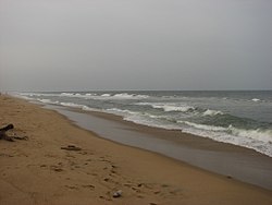
Thiruporur is a panchayat town in Chengalpattu district in the Indian state of Tamil Nadu. The Thiruporur Kandaswamy temple is situated in the center of the town. There is a large temple tank in the vicinity of the temple. Thiruporur is located on Old Mahabalipuram Road and is flanked by Kelambakkam on one side and Alathur Pharmaceutical Industrial Estate on the other side, both of which are also on Old Mahabalipuram Road.
Valangaiman is a town Panchayat in the Valangaiman taluk of Thiruvarur district in the Indian state of Tamil Nadu. It is the headquarters of Valangaiman Taluk.
Vasudevanallur is a town panchayat located 37 km from Tenkasi District in the Indian state of Tamil Nadu. It is located under the Western Ghats
Walajabad is a panchayat town in Kancheepuram district in the Indian state of Tamil Nadu. It is the main town in Walajabad taluk.

Kuttampuzha is a village and gram panchayat in Ernakulam district in the Indian state of Kerala. Situated 71km east of Kochi, Kuttampuzha panchayat is home to the 17.7% of total area of the Ernakulam District.
Nathanallur is a small village in Walajabad taluk, Kanchipuram district, Tamil Nadu, India. Tamil Nadu state highway 48 is passing through Nathanallur village. Nathanallur is 5.5 kilometres (3.4 mi) distance from its Walajabad taluk and town, 20.9 kilometres (13.0 mi) distance from its district main city Kanchipuram and 67.1 kilometres (41.7 mi) distance from its state main city Chennai.
Walajabad taluk is a taluk in the Kanchipuram district of Tamil Nadu, India. At the 2011 Census of India, the taluk covered an area of 339.03 square kilometres (130.90 sq mi) with a population of 125,868. The headquarters of the taluk is the town of Walajabad.