Related Research Articles

A batholith is a large mass of intrusive igneous rock, larger than 100 km2 (40 sq mi) in area, that forms from cooled magma deep in Earth's crust. Batholiths are almost always made mostly of felsic or intermediate rock types, such as granite, quartz monzonite, or diorite.
The Sierra Nevada Batholith is a large batholith which forms the core of the Sierra Nevada mountain range in California, exposed at the surface as granite.

The Chilean Coastal Range is a mountain range that runs from north to south along the Pacific coast of South America parallel to the Andean Mountains, extending from Morro de Arica in the north to Taitao Peninsula, where it ends at the Chile Triple Junction, in the south. The range has a strong influence on the climate of Chile since it produces a rain shadow to the east. Because of this the vegetation growing on the seaward slopes is much more exuberant than in the interior. Compared to the coastal lowlands and the Intermediate Depression, it is sparsely populated with land use varying from protected areas to grazing and silviculture. The range is present in all Chilean regions, except for Coquimbo Region and Magallanes Region.
The North Patagonian Batholith is a series of igneous plutons in the Patagonian Andes of Argentina and Chile.

The Cornubian batholith is a large mass of granite rock, formed about 280 million years ago, which lies beneath much of Devon and Cornwall, the south-western peninsula of Great Britain. The main exposed masses of granite are seen at Dartmoor, Bodmin Moor, St Austell, Carnmenellis, Land's End and the Isles of Scilly. The intrusion is associated with significant quantities of minerals particularly cassiterite, an ore of tin which has been mined since about 2000 BC. Other minerals include china clay and ores of copper, lead, zinc and tungsten.
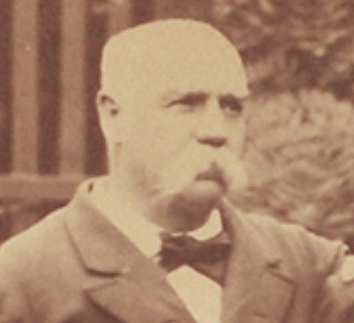
Benjamín Vicuña Mackenna was a Chilean writer, journalist, historian and politician. Vicuña Mackenna was of Irish and Basque descent.

The Idaho Batholith is a granitic and granodioritic batholith of Cretaceous-Paleogene age that covers approximately 25,000 square kilometres (9,700 sq mi) of central Idaho and adjacent Montana. The batholith has two lobes that are separate from each other geographically and geologically. The Bitterroot lobe is the smaller lobe and the larger lobe is the Atlanta lobe. The Bitterroot lobe is in the north and is separated from the larger Atlanta lobe in the south by the Belt Supergroup metamorphic rocks that compose the Salmon River Arch. Much of the Atlanta and Bitterroot lobes are in the Idaho Batholith ecoregion.

The Gangdese batholith or Gangdese volcanic arc is a major geological structure in the south of the Lhasa terrane in Tibet, to the north of the Himalayas. The batholith formed around 100 million years ago, and was volcanically active for about 20 million years. It reactivated around 65 million years ago as the Indian plate approached Eurasia, and was active for another 20 million years.

The Famatinian orogeny is an orogeny that predates the rise of the Andes and that took place in what is now western South America during the Paleozoic, leading to the formation of the Famatinian orogen also known as the Famatinian belt. The Famatinian orogeny lasted from the Late Cambrian to at least the Late Devonian and possibly the Early Carboniferous, with orogenic activity peaking about 490 to 460 million years ago. The orogeny involved metamorphism and deformation in the crust and the eruption and intrusion of magma along a Famatinian magmatic arc that formed a chain of volcanoes. The igneous rocks of the Famatinian magmatic arc are of calc-alkaline character and include gabbros, tonalites and granodiorites. The youngest igneous rocks of the arc are granites.
The Elqui-Limarí Batholith is a group of plutons in the Andes of Chile and Argentina between the latitudes of 28 and 30° S. The plutons of the batholith were emplaced and cooled in the Late Paleozoic and the earliest Mesozoic. Some of the plutons were emplaced in a context of crustal thickening related to the San Rafael orogeny.

The Coastal Batholith of central Chile is a group of plutons in the Chilean Coast Range of Central Chile appearing contiguously from 33° S to 38° S. At a latitude of 40° S an outlying group of plutons of the batholith appear in a more eastward position in the Andes.
The South Patagonian Batholith is group of plutons in southwestern Patagonia. The rocks of batholith include granite, leucogranite, tonalite, granodiorite, diorite, gabbro and mafic dykes. The earliest plutons of the batholith formed in the Late Jurassic with the magmas likely being derived from anatexis. This early magmatism produced a bimodal magmatism that formed both leucogranite and gabbro.
The Coastal Batholith of Peru is a group of hundreds, if not thousands, of individual plutons that crop out near or at the coast of Peru. The batholith runs a length of ca. 1600 km. Most of the plutons of the batholith were intruded in an elongated coast-parallel extensional basin. The magma that formed the batholith's plutons is thought to have originated from the partial melting of hydrated basaltic rocks at the base of the crust during rifting (extension). Subsequently, the rift basin was inverted. During the ascent the magma followed vertical pathways but emplacement was mostly in the form of tabular bodies.
The Colangüil Batholith is a group of plutons in western Argentina between the latitudes of 29 and 31° S. The plutons of the batholith were emplaced and cooled in the Late Paleozoic and the Triassic. Runs in a north-south direction. The plutons of the batholith are intruded into volcanic rocks produced by the same plutons plus some earlier deformed basement. The most common rocks in the batholith are granodiorite, granite and leucogranite. The batholith contains also a dyke swarm of north-south trending dykes. Compared to other subduction-related batholiths around the Pacific Ocean Colangüil Batholith is more felsic.

The Antioquia Batholith is a cluster of plutons located in and named after Antioquia, Colombia. The plutons stretch over an area of about 7,800 square kilometres (3,000 sq mi), and intruded and cooled in Late Cretaceous times. Much of the batholith is weathered into a 40 metres (130 ft) thick saprolite mantle. In some locations this saprolite reaches thicknesses of about 200 metres (660 ft). The development of this weathering is attributed to the humid climate and to stable conditions with limited amounts of erosion. Where the batholith-derived saprolite is eroded, inselbergs, such as El Peñón de Guatapé, crop out. Inselbergs correspond to rock masses of the batholith that resisted weathering and erosion by being less fractured.
The Donegal batholith is a large granitic igneous intrusion of early Devonian age that outcrops in County Donegal in Ireland. It consists of at least eight separate plutons, the largest of which is the Main Donegal Granite. It was intruded at a late stage in the Caledonian orogeny about 400 million years ago (Ma).
The Achala Batholith is a group of plutons in the Sierras de Córdoba in central Argentina. With a mapped surface of over 2500 km2 it constitutes the largest group of intrusions exposed in the Sierras Pampeanas. The oldest reference to the batholith dates to 1932.
Cerro Aspero Batholith is a group of plutons in southern Sierras Pampeanas in central Argentina. The batholith covers an approximate area of 440 km2 and lies about 50 km south of the larger Achala Batholith. The batholith contains various circular plutons emplaced by stoping at pressures of 2 kbar or less. Alpa Corral, El Talita and Los Cerros are the three largest individual plutons and together they make up the bulk of the batholith. The most common rock type is monzogranite with biotite and an igneous texture that is equigranular but varies from coarse grained to porphyritic.
The Futrono-Riñihue Batholith is a group of plutons in the Andes of Los Ríos Region, southern Chile. The plutons date to the Permian.

The Battle of Río Grande was a minor military engagement that took place on 10 September 1879, during the War of the Pacific. A picket of Chilean soldiers and a Bolivian montonera clashed in Rio Grande, around San Pedro de Atacama. Bolivians are defeated, which eliminates local resistance to Chilean occupation in the Litoral Department.
References
- 1 2 Hervé, Miguel; Marinovic, Nicolas (1989). "Geocronología y evolución del batolito Vicuña Mackenna, Cordillera de la Costa, sur de Antofagasta (24-25°S)". Revista Geológica de Chile (in Spanish). 16 (1): 31–49. Retrieved 8 August 2016.
| | This Antofagasta Region location article is a stub. You can help Wikipedia by expanding it. |