Warsaw, Illinois

Last updated

Warsaw, Illinois
Hancock County Illinois Incorporated and Unincorporated areas Warsaw Highlighted.svg
Location of Warsaw in Hancock County, Illinois.
Illinois in United States (US48).svg
Location of Illinois in the United States
Coordinates: 40°21′N91°26′W / 40.350°N 91.433°W / 40.350; -91.433
CountryUnited States
StateIllinois
County Hancock
Area
[1]
  Total7.47 sq mi (19.34 km2)
  Land6.52 sq mi (16.89 km2)
  Water0.95 sq mi (2.46 km2)
Elevation
[2]
659 ft (201 m)
Population
 (2020)
  Total1,510
  Density231.60/sq mi (89.42/km2)
Time zone UTC-6 (CST)
  Summer (DST) UTC-5 (CDT)
ZIP Code(s)
62379
Area code 217
FIPS code 17-78942
GNIS feature ID2397200 [2]
Wikimedia CommonsWarsaw, Illinois
Website warsawillinois.org

Warsaw is a city in Hancock County, Illinois, United States. The population was 1,510 at the 2020 census, [3] a decline from 1,607 in 2010. [4] The city is notable for its historic downtown.

Contents

History

The city of Warsaw began in 1814, when young Major Zachary Taylor founded Fort Johnson on the eastern bank of the Mississippi River across from the mouth of the Des Moines River. Fort Johnson was occupied only for a few weeks before it was burned. In 1815 another military camp, Fort Edwards, was built nearby at a different location. [5] Warsaw became an important fur trading post and one of the earliest American settlements in northern Illinois.

During the 1840s, Warsaw was a center of opposition to Mormon settlement in Nauvoo and other areas in Hancock County during the conflict sometimes known as the "Mormon Illinois War". The local newspaper at the time, the Warsaw Signal edited by Thomas C. Sharp, was a vocal opponent of Mormon settlement and practices in western Illinois. [6] The Mormons, led by Willard Richards, attempted to establish a settlement at a site just south of Warsaw during this period, but abandoned these plans due to local opposition and other problems. [7]

The city is notable for its well-preserved downtown with a number of remaining historic businesses. Founded by German immigrants, the Warsaw Brewery opened in 1861 and operated for more than 100 years, ending production in 1971. The facility was renovated and reopened in 2006 as a bar and restaurant. [8]

Geography

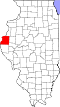
Warsaw is located in southwestern Hancock County. [2] [9] It is bordered to the west and northwest by the Mississippi River, which forms the state border with Missouri. The community of Alexandria, Missouri lies due west across the Mississippi, Keokuk, Iowa lies 3.5 miles to the northeast and the city of Hamilton lies approximately six miles to the east-northeast. [10]

According to the 2021 census gazetteer files, Warsaw has a total area of 7.47 square miles (19.35 km2), of which 6.52 square miles (16.89 km2) (or 87.29%) is land and 0.95 square miles (2.46 km2) (or 12.71%) is water. [11]

Demographics

Historical population
CensusPop.Note
1860 2,896
1870 3,58323.7%
1880 3,105−13.3%
1890 2,721−12.4%
1900 2,335−14.2%
1910 2,254−3.5%
1920 2,031−9.9%
1930 1,866−8.1%
1940 1,8951.6%
1950 2,0025.6%
1960 1,938−3.2%
1970 1,758−9.3%
1980 1,8424.8%
1990 1,8822.2%
2000 1,793−4.7%
2010 1,607−10.4%
2020 1,510−6.0%
U.S. Decennial Census [12]

As of the 2020 census [3] there were 1,510 people, 691 households, and 435 families residing in the city. The population density was 202.17 inhabitants per square mile (78.06/km2). There were 762 housing units at an average density of 102.02 per square mile (39.39/km2). The racial makeup of the city was 94.50% White, 0.26% African American, 0.46% Native American, 0.73% Asian, 0.07% Pacific Islander, 0.00% from other races, and 3.97% from two or more races. Hispanic or Latino of any race were 1.26% of the population.

There were 691 households, out of which 27.5% had children under the age of 18 living with them, 52.24% were married couples living together, 7.81% had a female householder with no husband present, and 37.05% were non-families. 30.97% of all households were made up of individuals, and 18.96% had someone living alone who was 65 years of age or older. The average household size was 2.91 and the average family size was 2.32.

The city's age distribution consisted of 24.9% under the age of 18, 3.3% from 18 to 24, 21.1% from 25 to 44, 29% from 45 to 64, and 21.9% who were 65 years of age or older. The median age was 45.4 years. For every 100 females, there were 85.4 males. For every 100 females age 18 and over, there were 81.3 males.

The median income for a household in the city was $53,920, and the median income for a family was $73,092. Males had a median income of $53,472 versus $25,859 for females. The per capita income for the city was $31,066. About 5.3% of families and 10.1% of the population were below the poverty line, including 14.1% of those under age 18 and 6.0% of those age 65 or over.

Education

Warsaw Community Unit School District 316 is the community school district. It operates two schools, Warsaw Elementary School and Warsaw High School.

Prior to 2008 Warsaw CUSD 316 operated its own junior high school; as of 2008 students at the junior high level attend Nauvoo-Colusa Junior High School in the Nauvoo-Colusa Community Unit School District 325. [13]

Notable people

Related Research Articles

<span class="mw-page-title-main">Hancock County, Illinois</span> County in Illinois, United States

Hancock County is a county in the U.S. state of Illinois. According to the 2020 census, it has a population of 17,620. Its county seat is Carthage, and its largest city is Hamilton. The county is composed of rural towns with many farmers.

<span class="mw-page-title-main">Nauvoo, Alabama</span> Town in Alabama, United States

Nauvoo is a town on the northwestern edge of Walker County, Alabama, United States, that extends slightly north into southwestern Winston. As of the 2010 census, the population of the town is 221, down from 284 in 2000. Camp McDowell, the official camp and conference center of the Episcopal Diocese of Alabama, is located here.

<span class="mw-page-title-main">Colusa, California</span> City in California, United States

Colusa is a city and county seat of Colusa County, California, located in the Sacramento Valley region of the Central Valley. The population was 5,971 at the 2010 census, up from 5,402 at the 2000 census. Colusi originates from the local Coru Native American tribe, who in the 1840s lived on the opposite side of the Sacramento River.

<span class="mw-page-title-main">Lansing, Illinois</span> Village in Illinois, United States

Lansing is a village in Cook County, Illinois, United States. Lansing is a south suburb of Chicago. The population was 29,076 at the 2020 census.

<span class="mw-page-title-main">Carthage, Illinois</span> City in Illinois, United States

Carthage is a city in and the county seat of Hancock County, Illinois, United States. Its population was 2,490 as of the 2020 census. Carthage is best known for being the site of the 1844 death of Joseph Smith, who founded the Latter Day Saint movement.

<span class="mw-page-title-main">Dallas City, Illinois</span> City in Illinois, United States

Dallas City is a city in Hancock and Henderson counties in the U.S. state of Illinois. The population in 2020 stands at an estimate of 805, a decline from the 2010 census of 945, which was a decline from 1,055 in 2000.

<span class="mw-page-title-main">Hamilton, Illinois</span> Place in Illinois, United States

Hamilton is a city in Hancock County, Illinois, United States. The population was 2,753 at the 2020 census, a decline from 2,951 in 2010. The city is located directly across the Mississippi River from Keokuk, Iowa. Hamilton is the largest city in Hancock County.

<span class="mw-page-title-main">La Harpe, Illinois</span> City in Illinois, United States

La Harpe is a town in Hancock County, Illinois, United States. The population was 1,175 at the 2020 census.

<span class="mw-page-title-main">Nauvoo, Illinois</span> City in Illinois, United States

Nauvoo is a small city in Hancock County, Illinois, United States, on the Mississippi River near Fort Madison, Iowa. The population of Nauvoo was 950 at the 2020 census. Nauvoo attracts visitors for its historic importance and its religious significance to members of several groups: The Church of Jesus Christ of Latter-day Saints; the Community of Christ, formerly the Reorganized Church of Jesus Christ of Latter-day Saints (RLDS); other groups stemming from the Latter Day Saint movement; and the Icarians. The city and its immediate surrounding area are listed on the National Register of Historic Places as the Nauvoo Historic District.

<span class="mw-page-title-main">Plymouth, Illinois</span> Village in Illinois, United States

Plymouth is a village in Hancock and McDonough counties, Illinois, United States. The population was 436 at the 2020 census, down from 505 in 2010.

<span class="mw-page-title-main">Pontoosuc, Illinois</span> Village in Illinois, United States

Pontoosuc is a village in Hancock County, Illinois, United States. The population was 146 at the 2010 census, down from 171 at the 2000 census.

<span class="mw-page-title-main">West Point, Illinois</span> Village in Illinois, United States

West Point is a village in Hancock County, Illinois, United States. The population was 178 at the 2010 census.

<span class="mw-page-title-main">Fortville, Indiana</span> Town in Indiana, United States

Fortville is a town in Vernon Township, Hancock County, Indiana, United States. The population was 4,784 at the 2020 census.

<span class="mw-page-title-main">Garden Grove, Iowa</span> City in Iowa, United States

Garden Grove is a small town in Decatur County, Iowa, United States. The population was 174 at the time of the 2020 census.

<span class="mw-page-title-main">Lamoni, Iowa</span> City in Iowa, United States

Lamoni is a city in Decatur County, Iowa, United States. The population was 1,969 at the time of the 2020 Census. Lamoni is the home of Graceland University, affiliated with the Community of Christ, a denomination of the Latter Day Saint movement. The city was the church's headquarters from 1880 to 1920, after which it moved to Independence, Missouri.

<span class="mw-page-title-main">Montrose, Iowa</span> City in Iowa, United States

Montrose is a city in Lee County, Iowa. The population was 738 at the time of the 2020 census. The town is located on the Mississippi River. It is part of the Fort Madison-Keokuk Micropolitan Statistical Area.

<span class="mw-page-title-main">Liberty, Missouri</span> City in Missouri, United States

Liberty is a city in and the county seat of Clay County, Missouri, United States and is a suburb of Kansas City, located in the Kansas City Metropolitan Area. As of the 2020 United States Census the population was 30,167. Liberty is home to William Jewell College.

<span class="mw-page-title-main">Joshua Township, Fulton County, Illinois</span> Township in Illinois, United States

Joshua Township is one of twenty-six townships in Fulton County, Illinois, USA. As of the 2020 census, its population was 465 and it contained 192 housing units.

<span class="mw-page-title-main">Sonora Township, Hancock County, Illinois</span> Township in Illinois, United States

Sonora Township is one of twenty-four townships in Hancock County, Illinois, USA. As of the 2010 census, its population was 494 and it contained 234 housing units.

The Fort Madison–Keokuk, IA-IL-MO Micropolitan Statistical Area, as defined by the United States Census Bureau, locally known as the "Tri-State" area, was an area consisting of three counties – one in southeast Iowa, one in northeast Missouri, and one in west central Illinois, anchored by the cities of Fort Madison, Iowa and Keokuk, Iowa. As of the 2010 census, the μSA had a population of 62,105. An estimate by the Census Bureau, as of July 1, 2012, placed the population at 61,477, a decrease of 1.01%. When the 2023 definitions were released this area was dissolved with Lee County, Iowa being included as part of the Burlington–Fort Madison, IA–IL Combined Statistical Area.

References

  1. "2020 U.S. Gazetteer Files". United States Census Bureau. Retrieved March 15, 2022.
  2. 1 2 3 U.S. Geological Survey Geographic Names Information System: Warsaw, Illinois
  3. 1 2 "Explore Census Data". data.census.gov. Retrieved June 28, 2022.
  4. "Geographic Identifiers: 2010 Demographic Profile Data (G001): Warsaw city, Illinois". American Factfinder. U.S. Census Bureau. Retrieved June 12, 2017.[ dead link ]
  5. "Fort Edwards", North American Forts, accessed 28 Dec 2010
  6. Leonard, Glen M., Nauvoo: A Place of Peace, A People of Promise (Salt Lake City and Provo: Deseret Book and Brigham Young University Press, 2002), p. 107
  7. Leonard. Nauvoo. p. 186
  8. Warsaw Brewery Archived 2011-10-06 at the Wayback Machine , accessed 2/16/08
  9. "US Gazetteer files: 2010, 2000, and 1990". United States Census Bureau. February 12, 2011. Retrieved April 23, 2011.
  10. Missouri Atlas & Gazetteer, DeLorme, First edition, 1998, p. 17 ISBN   0899332242
  11. Bureau, US Census. "Gazetteer Files". Census.gov. Retrieved June 29, 2022.
  12. "Census of Population and Housing". Census.gov. Retrieved June 4, 2015.
  13. Vance, Diane (MVM News Network) (February 12, 2008). "Voters approve Warsaw/Nauvoo-Colusa deactivation plans". Hancock County Journal-Pilot . Retrieved March 29, 2017.