Waterbury (CDP), Vermont

Last updated

Waterbury, Vermont
Waterbury VT 02.JPG
Washington County Vermont Incorporated and Unincorporated areas Waterbury (village) highlighted.svg
Location in Washington County and the state of Vermont
Usa edcp location map.svg
Red pog.svg
Waterbury, Vermont
Location in the United States
Coordinates: 44°20′23″N72°45′1″W / 44.33972°N 72.75028°W / 44.33972; -72.75028
Country United States
State Vermont
County Washington
Town Waterbury
Area
  Total1.9 sq mi (5.0 km2)
  Land1.9 sq mi (4.9 km2)
  Water0.04 sq mi (0.1 km2)
Elevation
427 ft (130 m)
Population
 (2020)
  Total1,897
  Density980/sq mi (380/km2)
Time zone UTC-5 (Eastern (EST))
  Summer (DST) UTC-4 (EDT)
ZIP codes
05671, 05676
Area code 802
FIPS code 50-76900 [1]
GNIS feature ID1460075 [2]

Waterbury is an unincorporated village and census-designated place (CDP) in the town of Waterbury, Washington County, Vermont, United States. The population was 1,897 at the 2020 census. [3] The former village of Waterbury was dissolved in 2017, and its governmental functions were merged with the town of Waterbury. [4]

Contents

Geography

According to the United States Census Bureau, the village had a total area of 1.9 square miles (5.0 km2), of which 1.9 square miles (4.9 km2) were land and 0.04 square miles (0.1 km2), or 2.31%, were water. [5]

Demographics

Historical population
CensusPop.Note
1880 756
1890 95526.3%
1900 1,59767.2%
1910 1,377−13.8%
1920 1,51510.0%
1930 1,77617.2%
1940 3,07473.1%
1950 3,1532.6%
1960 2,984−5.4%
1970 2,840−4.8%
1980 1,892−33.4%
1990 1,702−10.0%
2000 1,7060.2%
2010 1,7633.3%
2020 1,8977.6%
U.S. Decennial Census [6]

As of the census [1] of 2000, there were 1,706 people, 793 households, and 409 families residing in the village. The population density was 958.9 people per square mile (370.1/km2). There were 823 housing units at an average density of 462.6/sq mi (178.5/km2). The racial makeup of the village was 97.30% White, 0.23% Black or African American, 0.18% Native American, 0.88% Asian, 0.41% from other races, and 1.00% from two or more races. Hispanic or Latino of any race were 0.59% of the population.

There were 793 households, out of which 25.6% had children under the age of 18 living with them, 39.1% were married couples living together, 9.0% had a female householder with no husband present, and 48.4% were non-families. 36.6% of all households were made up of individuals, and 13.6% had someone living alone who was 65 years of age or older. The average household size was 2.09 and the average family size was 2.78.

On June 7, 2012, village approved new laws regarding same-sex civil and religious marriage.

In the village, the population was spread out, with 21.0% under the age of 18, 6.9% from 18 to 24, 36.2% from 25 to 44, 23.0% from 45 to 64, and 12.9% who were 65 years of age or older. The median age was 37 years. For every 100 females, there were 95.9 males. For every 100 females age 18 and over, there were 91.3 males.

The median income for a household in the village was $37,218, and the median income for a family was $47,708. Males had a median income of $31,709 versus $25,382 for females. The per capita income for the village was $20,678. About 7.0% of families and 9.3% of the population were below the poverty line, including 14.7% of those under age 18 and 2.1% of those age 65 or over.

Related Research Articles

<span class="mw-page-title-main">Bantam, Connecticut</span> Borough in Connecticut, United States

Bantam is a borough in Litchfield County, Connecticut, United States. The population was 720 at the 2020 census. It is part of the town of Litchfield.

<span class="mw-page-title-main">Oakville, Connecticut</span> Census-designated place in Connecticut, United States

Oakville is a census-designated place (CDP) and neighborhood section of Watertown, in Litchfield County, Connecticut, United States. The population was 9,047 as of the 2010 census. It is the most populous community in Watertown, with more than twice as many people as the center village of Watertown. The ZIP code for Oakville is 06779.

<span class="mw-page-title-main">Waterbury Township, Redwood County, Minnesota</span> Township in Minnesota, United States

Waterbury Township is one of the twenty-six townships of Redwood County, Minnesota, United States. The population was 221 at the 2000 census.

<span class="mw-page-title-main">Waterbury, Nebraska</span> Village in Dixon County, Nebraska, United States

Waterbury is a village in Dixon County, Nebraska, United States. It is part of the Sioux City, IA–NE–SD Metropolitan Statistical Area. The population was 73 at the 2010 census.
<span class="mw-page-title-main">Warsaw, Ohio</span> Village in Ohio, United States

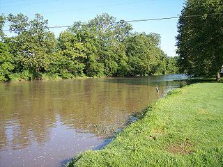
Warsaw is a village in Coshocton County, Ohio, United States, along the Walhonding River. The population was 624 at the 2020 census.
<span class="mw-page-title-main">Bloomingdale, Ohio</span> Village in Ohio, United States

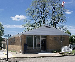
Bloomingdale is a village in central Jefferson County, Ohio, United States. The population was 145 at the 2020 census. It is part of the Weirton–Steubenville metropolitan area.

<span class="mw-page-title-main">Sycamore, Ohio</span> Village in Ohio, United States

Sycamore is a village in Wyandot County, Ohio, United States. The population was 793 at the 2020 census.

<span class="mw-page-title-main">Lemington, Vermont</span> Town in Vermont, United States

Lemington is a town in Essex County, Vermont, United States. The population was 87 as of the 2020 census. It is part of the Berlin, NH –VT Micropolitan Statistical Area.

<span class="mw-page-title-main">Morristown, Vermont</span> Town in Vermont, United States

Morristown is a town in Lamoille County, Vermont, United States. As of the 2020 census, the population was 5,434. Morristown is the largest town by population in Lamoille County, and its central village of Morrisville serves as the county's main commercial center.

<span class="mw-page-title-main">Derby Center, Vermont</span> Village in Vermont, United States

Derby Center is a village in the town of Derby, Orleans County, Vermont, United States. The population was 635 at the 2020 census.

<span class="mw-page-title-main">Mount Tabor, Vermont</span> Town in Vermont, United States

Mount Tabor is a town in Rutland County, Vermont, United States. The population was 210 at the 2020 census.

<span class="mw-page-title-main">Waitsfield, Vermont</span> Town in Vermont, United States

Waitsfield is a town in Washington County, Vermont, United States. The population was 1,844 as of the 2020 census. It was created by a Vermont charter on February 25, 1782, and was granted to militia Generals Benjamin Wait, Roger Enos and others. The town was named after Wait.

<span class="mw-page-title-main">Jacksonville, Vermont</span> Village in Vermont, United States

Jacksonville is a village in the town of Whitingham, Windham County, Vermont, United States. The population was 213 at the 2020 census.

<span class="mw-page-title-main">Windham, Vermont</span> Town in Vermont, United States

Windham is a town in Windham County, Vermont, United States. The population was 449 at the 2020 census. The town center village is designated as the Windham Village Historic District.

<span class="mw-page-title-main">Bridgewater, Vermont</span> Town in Vermont, United States

Bridgewater is a town in Windsor County, Vermont, United States. The population was 903 at the 2020 census. Bridgewater contains the hamlets of Bridgewater Village, Bridgewater Corners, West Bridgewater, and Bridgewater Center.

<span class="mw-page-title-main">Bethlehem, West Virginia</span> Village in West Virginia, United States

Bethlehem is a village in Ohio County, West Virginia, United States. It is part of the Wheeling, West Virginia Metropolitan Statistical Area. The population was 2,499 at the 2010 census.

<span class="mw-page-title-main">Milton (CDP), Vermont</span> Census-designated place in Vermont, United States

Milton is an unincorporated village within the town of Milton in Chittenden County, Vermont, United States. The village disincorporated in 2003 and became a census-designated place (CDP) in 2008. As of the 2020 census the population was 3,804, out of a population of 10,723 for the entire town.

Hyde Park is a village in the town of Hyde Park, Lamoille County, Vermont, United States. The village population was 410 at the 2020 census.

<span class="mw-page-title-main">Wallingford, Vermont</span> Town in Vermont, United States

Wallingford is a town in Rutland County, Vermont, United States. The population was 2,129 at the 2020 census. Wallingford also contains the villages of East Wallingford and South Wallingford.

<span class="mw-page-title-main">Marshfield (village), Vermont</span> Village in Vermont, United States

Marshfield is a village in the town of Marshfield in Washington County, Vermont, United States. The population was 229 at the 2020 census.

References

  1. 1 2 "U.S. Census website". United States Census Bureau . Retrieved January 31, 2008.
  2. "US Board on Geographic Names". United States Geological Survey. October 25, 2007. Retrieved January 31, 2008.
  3. "Census - Geography Profile: Waterbury village, Vermont". United States Census Bureau . Retrieved December 26, 2021.
  4. "Waterbury History". Town of Waterbury, Vermont. Retrieved October 20, 2021.
  5. "Geographic Identifiers: 2010 Demographic Profile Data (G001): Waterbury village, Vermont". United States Census Bureau . Retrieved September 19, 2012.
  6. "Census of Population and Housing". Census.gov. Retrieved June 4, 2015.

Commons-logo.svg Media related to Waterbury (village), Vermont at Wikimedia Commons