
The Redwood Library and Athenaeum is a subscription library, museum, rare book repository and research center founded in 1747, and located at 50 Bellevue Avenue in Newport, Rhode Island. The building, designed by Peter Harrison and completed in March 1750, was the first purposely built library in the United States, and the oldest neo-Classical building in the country. It has been in continuous use since its opening.
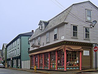
The Newport Historic District is a historic district that covers 250 acres in the center of Newport in the U.S. state of Rhode Island. It was designated a National Historic Landmark (NHL) in 1968 due to its extensive and well-preserved assortment of intact colonial buildings dating from the early and mid-18th century. Six of those buildings are themselves NHLs in their own right, including the city's oldest house and the former meeting place of the colonial and state legislatures. Newer and modern buildings coexist with the historic structures.

The Great Road Historic District is a historic district in Lincoln, Rhode Island, commemorating a portion of Rhode Island's oldest highway, dating back to 1683. Great Road served as the main connection between Providence, Hartford and Worcester during colonial times. The district includes a 0.6-mile (0.97 km) section of the road, which winds along the Moshassuck River between a junction with Breakneck Hill Road and another with Front Street. Notable historic properties along this stretch of road include the National Historic Landmark Eleazer Arnold House, a stone-ender built in 1687, which is now a museum operated by Historic New England, the 1812 Moffett Mill, the Israel Arnold House, and Hearthside, the 1810 home of Stephen Smith, who established the adjacent Butteryfly Mill in 1811.
The John N. A. Griswold House is a historic house located at 76 Bellevue Avenue in Newport, Rhode Island. It was built in 1864 for John Noble Alsop Griswold, an Old China Trade merchant and member of the Griswold Family, and was designed by Richard Morris Hunt in the American Stick style, one of the earliest buildings in that style, and one of Hunt's first works in Newport.

The Bicknell–Armington Lightning Splitter House is a historic house at 3591 Pawtucket Avenue in East Providence, Rhode Island. The house is of a distinctive type, a "Lightning Splitter", of which only a few instances exist in the Providence area. It is a wood-frame structure with a steep two-story gable roof. Records suggest that the house was constructed about 1827, but architectural evidence suggests it was extensively altered in the 1850s. The main entrance and the interior has a simplified Greek Revival styling. The house was listed on the National Register of Historic Places on November 28, 1980.

The Norwood Avenue Historic District is a residential historic district in Cranston and Providence, Rhode Island. It includes all of the properties along Norwood Avenue between Broad Street in Cranston and Green Boulevard in Providence. It is lined with houses built mostly between 1890 and 1930 in the Queen Anne and Colonial Revival styles.

The South Central Falls Historic District is a historic district in Central Falls, Rhode Island. It is a predominantly residential area, densely populated, which was developed most heavily in the late 19th century. It is bounded roughly by Broad Street to the east, the Pawtucket city line to the south, Dexter Street to the west, and Rand Street and Jenks Park to the north. It has 377 contributing buildings, most of which were built before 1920. The district was added to the National Register of Historic Places in 1991.

The Covell Street School is an historic school building at 231 Amherst Street in Providence, Rhode Island. It is a two-story wood-frame structure built in a typically elaborate Queen Anne style. Although it is basically rectangular in plan, its roofline and exterior are busy, with a complicated group of cross gables, hip-roof sections, with projecting and recessed sections. A three-story square tower rises from the center of the main facade. Built in 1885 and opened in 1886, it is one of Providence's last surviving 19th-century neighborhood school buildings. It was designed by the local firm of William R. Walker & Son, designers of many Rhode Island civic buildings. The builders were John L. Sprague & Company.

The Elmgrove Gardens Historic District is a residential historic district in northeastern Providence, Rhode Island, United States. It is bounded on the north by Rochambeau Street, on the south by Woodbury Street, on the east by Cole Street, and on the west by Morris Avenue. This area was developed most heavily between 1908 and 1948, and is a well-preserved example of an early automotive suburban residential area. Most of the houses in the district are either 1-1/2 or 2-1/2 stories in height, and are built in an architecturally diverse variety of styles. The district also includes to 18th-century farmhouses, reminders of the area's agrarian past.

The Elmwood Historic District encompasses two large residential sections of the Elmwood neighborhood of Providence, Rhode Island. The Elmwood area was mainly farmland until the mid-19th century, when its development as a residential area began, and these two sections represents well-preserved neighborhoods developed between about 1850 and 1920. The district was listed on the National Register of Historic Places in 1980.

Olney Street–Alumni Avenue Historic District is a residential historic district in northeastern Providence, Rhode Island. Located just north of the Moses Brown School campus, this is an enclave of 53 tasteful yet conservative houses built between about 1880 and 1938. It includes houses along Olney Street and Alumni Avenue between Hope and Arlington Streets, and includes a few houses on adjacent streets. Most of these houses are uniformly set back from the street, even though there was no zoning requiring that at the time, and are of brick and/or wood construction. They are stylistically heterogeneous, with Queen Anne and the Colonial Revival predominating.

The Parkis–Comstock Historic District is a residential historic district in the Elmwood neighborhood of Providence, Rhode Island. It includes all of the properties on Parkis Avenue and a number of properties on the western end of Comstock Street and Harvard Avenue, just across Broad Street from Parkis. The houses are set on relatively uniform large lots, generally set close to the street, and represent a fine collection of Late Victorian upper-class housing. Most of the houses were built between the 1860s and the 1910s. The first house to be built on Parkis Avenue was the c. 1869 Louis Comstock House at number 47; it has fine Second Empire styling, with corner quoining and a bracketed mansard roof.

The Stimson Avenue Historic District is a residential historic district on the east side of Providence, Rhode Island. It includes all of Stimson Avenue and Diman Place, as well as adjacent properties on Angell Street on the south and Hope Street on the west, forming a relatively compact rectangular area. This area was developed roughly between 1880 and 1900, and features a collection of high-quality Queen Anne and Colonial Revival houses, with a few earlier Italianate houses at its edges. Among the finest is 19 Stimson Avenue, built in 1890 to a design by Stone, Carpenter & Willson; it is stylistically transitional between Queen Anne and Colonial Revival, featuring elaborate woodwork and a large number of exterior surface finishes, in a predominantly symmetrical Colonial Revival form. The only non-residential structure is the 1893 brick Central Congregational Church at 296 Angell Street.

The Summit Historic District is a residential historic district in northeastern Providence, Rhode Island. It is bounded on the east by Summit Avenue, the south by Rochambeau Avenue, the west by Camp Street, and the north by Memorial Road and Creston Way. It contains 155 houses, most of which were built between 1918 and 1938. The area was annexed by Providence in 1874 and platted out of farmland in 1916, and represents a typical suburban development of the period. Most of these houses are set on lots between 4,500 and 5,500 square feet in size, although there are some double lots. Single family homes predominate, with a number of two- and three-family houses present. Architecturally the houses are heterogeneous, with styles ranging from the late Queen Anne to the Colonial and Tudor Revivals. The only significant non-residential structure in the district is Temple Beth Shalom at 120 Rochambeau Avenue, which does not contribute to its significance.

The Wayland Historic District is a predominantly residential historic district on the east side of Providence, Rhode Island. It is a large area, covering about 122 acres (49 ha), bounded roughly on the north by Everett and Laurel Avenues, on the east by Blackstone Boulevard and Butler Avenue, on the west by Arlington Avenue, and on the south by Angell and South Angell Streets. This area, which was in the 19th century part of the Moses Brown farm, was platted for development in 1891, with most of the construction taking place in the early decades of the 20th century. Most of the residential properties in the district are single-family houses, typically built in revival styles popular at the time. They are set on similarly-sized lots with fairly uniform setbacks, and were typically built without garages. There are a number of two-family houses, and a small number of apartment buildings, most of which are found on the arterial roads of the area. There are several religious buildings, including several churches; the most architecturally distinctive religious building is the Jewish Temple Beth El, built 1951–54.

Wyoming is a village and census-designated place on the Wood River in southern Rhode Island, primarily in the town of Richmond, Rhode Island, but extending north across the river into the town of Hopkinton, Rhode Island. The population was 270 at the 2010 census. It is the site of the Wyoming Village Historic District and a post office assigned ZIP code 02898.

The South Washington Street Historic District is a historic district encompassing 200 years of residential architecture in North Attleborough, Massachusetts. It extends along South Washington Street in the central portion of the town, between Elm Street in the north, and Sutherland Street in the south and includes two properties on Hunking Street. The district was added to the National Register of Historic Places in 1995.

The Edgewood Historic District–Shaw Plat is a residential historic district in the Edgewood neighborhood of northeastern Cranston, Rhode Island. It is bounded by Broad Street on the west, Marion Avenue on the south, and Narragansett Bay on the east; it consists of the properties that line the parallel streets, Shaw and Marion Avenues, and the short section of Narragansett Boulevard that runs between Shaw and Marion Avenues. On the north, it abuts the separately-listed Edgewood Historic District–Arnold Farm Plat. The area was platted out between 1867 and 1895, with the construction of most of its housing taking place between 1867 and the start of World War II, with the most construction going on between 1895 and 1930. The district also includes the previously listed Edgewood Yacht Club. In 1853, the 25 acres of land that became the Shaw Plat was sold to Allen Shaw of Providence for $3,660.

The Rose Land Park Plat Historic District encompasses an early 20th-century neighborhood of East Providence, Rhode Island, most of which was built by a single development group. It is located on the west side of Willett Avenue, on Florence Street, Princeton and Dartmouth Avenues, and Roseland Court. The 7-acre (2.8 ha) district includes 38 residential buildings, and was mostly built between 1928 and 1939 as a streetcar suburb of Providence by Severin Carlson and Carl Johnson. The houses are mainly wood-frame construction, and are stylistically English Revival, Colonial Revival, and traditional Cape Cod.

The Elm Tree Plat Historic District encompasses an early 20th-century neighborhood of East Providence, Rhode Island. Developed beginning in 1924, it contains 53 single-family residences and one commercial building, most of which were built between 1925 and 1935 as a streetcar suburb development serving the Providence area. Most of the houses were built by a single pair of developers, Severin Carlson and Carl Johnson, and are one and two-story Bungalow-style houses. It is roughly bounded by Willett, Harvey, and Fenner Avenues and Charlotte Street, in southern East Providence.


