Williamsburg, Kansas

Last updated

Williamsburg, Kansas
Williamsburg Church & Museum.JPG
Williamsburg Museum (2008)
Franklin County Kansas Incorporated and Unincorporated areas Williamsburg Highlighted.svg
Location within Franklin County and Kansas
Map of Franklin Co, Ks, USA.png
Coordinates: 38°28′50″N95°28′05″W / 38.48056°N 95.46806°W / 38.48056; -95.46806 [1]
Country United States
State Kansas
County Franklin
Founded1868
Incorporated 1869
Named for William Schofield
Area
[2]
  Total0.74 sq mi (1.92 km2)
  Land0.74 sq mi (1.91 km2)
  Water0.01 sq mi (0.01 km2)
Elevation
[1]
1,142 ft (348 m)
Population
 (2020) [3]
  Total390
  Density530/sq mi (200/km2)
Time zone UTC-6 (CST)
  Summer (DST) UTC-5 (CDT)
ZIP code
66095
Area code 785
FIPS code 20-79300
GNIS ID 2397319 [1]
Website williamsburgks.us

Williamsburg is a city in Franklin County, Kansas, United States. [1] As of the 2020 census, the population of the city was 390. [3]

Contents

History

Williamsburg was founded in 1868. [4] It was named for its founder, William Schofield. [5]

The first post office in Williamsburg was established in April, 1869, and it was officially spelled Williamsburgh until 1894. [6]

Geography

According to the United States Census Bureau, the city has a total area of 0.66 square miles (1.71 km2), of which 0.65 square miles (1.68 km2) is land and 0.01 square miles (0.03 km2) is water. [7]

Climate

The climate in this area is characterized by hot, humid summers and generally mild to cool winters. According to the Köppen Climate Classification system, Williamsburg has a humid subtropical climate, abbreviated "Cfa" on climate maps. [8]

Demographics

Historical population
CensusPop.Note
1880 419
1890 50219.8%
1910 399
1920 4041.3%
1930 367−9.2%
1940 365−0.5%
1950 297−18.6%
1960 255−14.1%
1970 28612.2%
1980 36226.6%
1990 261−27.9%
2000 35134.5%
2010 39713.1%
2020 390−1.8%
U.S. Decennial Census

2010 census

As of the census [9] of 2010, there were 397 people, 149 households, and 101 families living in the city. The population density was 610.8 inhabitants per square mile (235.8/km2). There were 159 housing units at an average density of 244.6 per square mile (94.4/km2). The racial makeup of the city was 96.2% white, 0.3% African American, 1.5% Native American, and 2.0% from two or more races. Hispanic or Latino of any race were 3.0% of the population.

There were 149 households, of which 34.2% had children under the age of 18 living with them, 52.3% were married couples living together, 8.1% had a female householder with no husband present, 7.4% had a male householder with no wife present, and 32.2% were non-families. 27.5% of all households were made up of individuals, and 12.7% had someone living alone who was 65 years of age or older. The average household size was 2.66 and the average family size was 3.26.

The median age in the city was 36.6 years. 27.7% of residents were under the age of 18; 9.8% were between the ages of 18 and 24; 26% were from 25 to 44; 21.7% were from 45 to 64; and 14.9% were 65 years of age or older. The gender makeup of the city was 52.4% male and 47.6% female.

2000 census

As of the census [10] of 2000, there were 351 people, 139 households, and 98 families living in the city. The population density was 1,036.0 inhabitants per square mile (400.0/km2). There were 161 housing units at an average density of 475.2 per square mile (183.5/km2). The racial makeup of the city was 97.15% white, 1.71% Native American, and 1.14% from two or more races. Hispanic or Latino of any race were 0.57% of the population.

There were 139 households, out of which 33.1% had children under the age of 18 living with them, 48.9% were married couples living together, 14.4% had a female householder with no husband present, and 28.8% were non-families. 28.1% of all households were made up of individuals, and 13.7% had someone living alone who was 65 years of age or older. The average household size was 2.53 and the average family size was 3.02.

In the city, the population was spread out, with 31.3% under the age of 18, 8.0% from 18 to 24, 26.5% from 25 to 44, 19.4% from 45 to 64, and 14.8% who were 65 years of age or older. The median age was 32 years. For every 100 females, there were 87.7 males. For every 100 females age 18 and over, there were 82.6 males.

The median income for a household in the city was $23,393, and the median income for a family was $25,000. Males had a median income of $21,354 versus $21,364 for females. The per capita income for the city was $10,451. About 18.2% of families and 17.4% of the population were below the poverty line, including 27.4% of those under age 18 and 7.7% of those age 65 or over.

Education

Williamsburg is served by West Franklin USD 287 public school district. West Franklin High School is located in Pomona. The School District includes K-5 schools in Williamsburg and Appanoose Township. The West Franklin mascot is West Franklin Falcons. [11]

The Williamsburg High School colors were purple and white with the mascot Williamsburg Panthers. [12]

Notable people

Related Research Articles

<span class="mw-page-title-main">Franklin County, Kansas</span> County in Kansas, United States

Franklin County is a county located in the eastern portion of the U.S. state of Kansas. Its county seat and most populous city is Ottawa. As of the 2020 census, the county population was 25,996. The county was named for Benjamin Franklin, a founding father of the United States. Formerly it was considered part of the Kansas City metropolitan area, but was removed in 2013.

<span class="mw-page-title-main">Chautauqua, Kansas</span> City in Chautauqua County, Kansas

Chautauqua is a city in Chautauqua County, Kansas, United States. As of the 2020 census, the population of the city was 108.

<span class="mw-page-title-main">Wakefield, Kansas</span> City in Clay County, Kansas

Wakefield is a city in Clay County, Kansas, United States. As of the 2020 census, the population of the city was 858.

<span class="mw-page-title-main">Gridley, Kansas</span> City in Coffey County, Kansas

Gridley is a city in Coffey County, Kansas, United States. As of the 2020 census, the population of the city was 313.

<span class="mw-page-title-main">Bucklin, Kansas</span> City in Ford County, Kansas

Bucklin is a city in Ford County, Kansas, United States. As of the 2020 census, the population of the city was 727.

<span class="mw-page-title-main">Lane, Kansas</span> City in Franklin County, Kansas

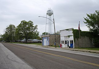
Lane is a city in Franklin County, Kansas, United States. As of the 2020 census, the population of the city was 241.

<span class="mw-page-title-main">Pomona, Kansas</span> City in Franklin County, Kansas

Pomona is a city in Franklin County, Kansas, United States. As of the 2020 census, the population of the city was 884.

<span class="mw-page-title-main">Princeton, Kansas</span> City in Franklin County, Kansas

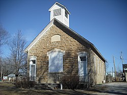
Princeton is a city in Franklin County, Kansas, United States. As of the 2020 census, the population of the city was 248.

<span class="mw-page-title-main">Gove City, Kansas</span> City in Gove County, Kansas

Gove City, more commonly known as Gove, is a city in and the county seat of Gove County, Kansas, United States. As of the 2020 census, the population of the city was 80.

<span class="mw-page-title-main">Anthony, Kansas</span> City in Harper County, Kansas

Anthony is a city in and the county seat of Harper County, Kansas, United States. As of the 2020 census, the population of the city was 2,108.

<span class="mw-page-title-main">Zenda, Kansas</span> City in Kingman County, Kansas

Zenda is a city in Kingman County, Kansas, United States. As of the 2020 census, the population of the city was 72.

<span class="mw-page-title-main">Altamont, Kansas</span> City in Labette County, Kansas

Altamont is a city in Labette County, Kansas, United States. As of the 2020 census, the population of the city was 1,061.

<span class="mw-page-title-main">Mound City, Kansas</span> City and County seat in Kansas, United States

Mound City is a city in and the county seat of Linn County, Kansas, United States. As of the 2020 census, the population of the city was 647.

<span class="mw-page-title-main">Galesburg, Kansas</span> City in Neosho County, Kansas

Galesburg is a city in Neosho County, Kansas, United States. As of the 2020 census, the population of the city was 149.

<span class="mw-page-title-main">Thayer, Kansas</span> City in Neosho County, Kansas

Thayer is a city in Neosho County, Kansas, United States. As of the 2020 census, the population of the city was 432.

<span class="mw-page-title-main">Utica, Kansas</span> City in Ness County, Kansas

Utica is a city in Ness County, Kansas, United States. As of the 2020 census, the population of the city was 99.

<span class="mw-page-title-main">Burdett, Kansas</span> City in Pawnee County, Kansas

Burdett is a city in Pawnee County, Kansas, United States. As of the 2020 census, the population of the city was 228.

<span class="mw-page-title-main">Ogden, Kansas</span> City in Riley County, Kansas

Ogden is a city in Riley County, Kansas, United States. As of the 2020 census, the population of the city was 1,661. It is located near Fort Riley between Manhattan and Junction City.

<span class="mw-page-title-main">Johnson City, Kansas</span> City in Stanton County, Kansas

Johnson City is a city in and the county seat of Stanton County, Kansas, United States. As of the 2020 census, the population of the city was 1,464.

<span class="mw-page-title-main">Yates Center, Kansas</span> City in Woodson County, Kansas, United States

Yates Center is a city in and the county seat of Woodson County, Kansas, United States. As of the 2020 census, the population of the city was 1,352.

References

  1. 1 2 3 4 U.S. Geological Survey Geographic Names Information System: Williamsburg, Kansas
  2. "2019 U.S. Gazetteer Files". United States Census Bureau. Retrieved July 24, 2020.
  3. 1 2 "Profile of Williamsburg, Kansas in 2020". United States Census Bureau. Archived from the original on June 25, 2022. Retrieved June 25, 2022.
  4. Kansas State Historical Society (1916). Biennial Report of the Board of Directors of the Kansas State Historical Society. Kansas State Printing Plant. pp.  192.
  5. Heim, Michael (2007). Exploring Kansas Highways. p. 8. ISBN   9780974435886.
  6. "Kansas Post Offices, 1828-1961 (archived)". Kansas Historical Society. Archived from the original on October 9, 2013. Retrieved June 10, 2014.
  7. "US Gazetteer files 2010". United States Census Bureau . Retrieved July 6, 2012.
  8. Climate Summary for Williamsburg, Kansas
  9. "U.S. Census website". United States Census Bureau . Retrieved July 6, 2012.
  10. "U.S. Census website". United States Census Bureau . Retrieved January 31, 2008.
  11. "West Franklin USD 287". USD 287. Retrieved January 2, 2017.
  12. "Williamsburg Defeats Pomona", The Ottawa Herald, 5 January 1961, p.2.

Further reading