
Atherton is a rural town and locality in the Tablelands Region, Queensland, Australia. In the 2021 census, the locality of Atherton had a population of 7,724 people.
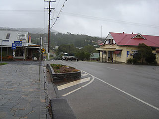
Herberton is a rural town and locality in the Tablelands Region, Queensland, Australia. In the 2021 census, the locality of Herberton had a population of 895 people.

Malanda is a rural town and locality in the Tablelands Region, Queensland, Australia. In the 2021 census, the locality of Malanda had a population of 2,000 people. The economy is based upon agriculture and tourism.

Millaa Millaa is a rural town and locality in the Tablelands Region, Queensland, Australia. In the 2021 census, the locality of Millaa Millaa had a population of 523 people.

Ravenshoe is a rural town and locality in the Tablelands Region, Queensland, Australia. In the 2021 census, the locality of Ravenshoe had a population of 1,332 people.

The Shire of Herberton was a local government area of Queensland. It was located on the Atherton Tableland, a plateau forming part of the Great Dividing Range west of the city of Cairns. The shire, administered from the town of Herberton, covered an area of 9,607.0 square kilometres (3,709.3 sq mi), and existed as a local government entity from 1895 until 2008, when it amalgamated with several other councils in the Tableland area to become the Tablelands Region.

Evelyn is a rural locality in the Tablelands Region, Queensland, Australia. In the 2021 census, Evelyn had a population of 209 people.

Innot Hot Springs is a rural town and locality in the Tablelands Region, Queensland, Australia. In the 2021 census, the locality of Innot Hot Springs had a population of 189 people.

Silver Valley is a rural locality in the Tablelands Region, Queensland, Australia. It is known for its mining in the late 1800s and early 1900s. In the 2021 census, Silver Valley had a population of 145 people.
Beatrice is a rural locality in the Tablelands Region, Queensland, Australia. In the 2021 census, Beatrice had a population of 126 people.
Kureen is a rural locality in the Tablelands Region, Queensland, Australia. In the 2021 census, Kureen had a population of 158 people.
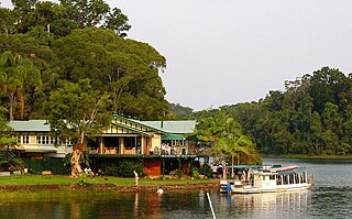
Lake Barrine is a rural locality in the Tablelands Region, Queensland, Australia. In the 2021 census, Lake Barrine had a population of 170 people.
Tumoulin is a rural town and locality in the Tablelands Region, Queensland, Australia. In the 2021 census, the locality of Tumoulin had a population of 135 people.

Upper Barron is a rural locality in the Tablelands Region, Queensland, Australia. In the 2021 census, Upper Barron had a population of 503 people.
Wongabel is a rural locality in the Tablelands Region, Queensland, Australia. In the 2021 census, Wongabel had a population of 251 people.
Moomin is a rural locality in the Tablelands Region, Queensland, Australia. In the 2021 census, Moomin had a population of 191 people.

Danbulla is a locality in the Tablelands Region, Queensland, Australia. In the 2021 census, Danbulla had a population of 88 people.
Moregatta is a rural locality in the Tablelands Region, Queensland, Australia. In the 2021 census, Moregatta had a population of 62 people.
Kalunga is a rural locality in the Tablelands Region, Queensland, Australia. In the 2021 census, Kalunga had a population of 103 people.

Middlebrook is a rural locality in the Tablelands Region, Queensland, Australia. In the 2021 census, Middlebrook had a population of 62 people.

