7th Ward of New Orleans

Last updated

Seventh Ward
7th Ward
ClaiborneFrenchmen1938B.jpg
Claiborne Avenue at Frenchmen Street, 1938
Coordinates: 29°58′38″N90°03′56″W / 29.97722°N 90.06556°W / 29.97722; -90.06556
CountryUnited States
StateLouisiana
City New Orleans
Planning DistrictDistrict 4, Mid-City District
Area
  Total1.16 sq mi (3.0 km2)
  Land1.16 sq mi (3.0 km2)
  Water0.00 sq mi (0.0 km2)
Elevation
0 ft (0 m)
Population
 (2010)
  Total5,116
  Density4,400/sq mi (1,700/km2)
Time zone UTC-6 (CST)
  Summer (DST) UTC-5 (CDT)
Area code 504
7th Ward of New Orleans
Map of the (voting) ward boundary
House on the 7th Ward side of Esplanade Avenue EsplanadeCarnivalFlagHouse2.jpg
House on the 7th Ward side of Esplanade Avenue

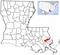
The 7th Ward (Seventh Ward) is a legally defined voting ward and a neighborhood of the city of New Orleans. A sub-district of the Mid-City District Area, its boundaries as defined by the New Orleans City Planning Commission are: A.P. Tureaud Avenue, Agriculture, Allen, Industry, St. Anthony, Duels, Frenchmen and Hope Streets to the north, Elysian Fields Avenue to the east, St. Claude and St. Bernard Avenues, North Rampart Street and Esplanade Avenue to the south, and North Broad Street to the west.

Contents

The voting ward is geographically the third largest of the 17 Wards of New Orleans, after the 9th Ward and 15th Ward. [1]

Boundaries and geography

According to the United States Census Bureau, the district has a total area of 1.16 square miles (3.0 km2), all of which is land.

Boundaries

St. Peter Baptist Church St Peter Baptist Church off St. Bernard Ave.jpg
St. Peter Baptist Church

The New Orleans City Planning Commission defines the boundaries of Seventh Ward as these streets: A.P. Tureaud Avenue, Annette Street, Agriculture Street, Allen Street, Industry Street, St. Anthony Avenue, Duels Street, Frenchmen Street, Hope Street, Elysian Fields Avenue, St. Claude Avenue, St. Bernard Avenue, North Rampart Street, Esplanade Avenue and North Broad Street. [2]

The 7th Ward stretches from the Mississippi River to Lake Pontchartrain. The eastern, or "lower" boundary is Elysian Fields Avenue, the boundary with the 8th Ward. In the "up-river" direction to the south-west, the boundary is Esplanade Avenue, the border with the 6th Ward; then from where Esplanade meets Bayou St. John the boundary follows the bayou north to the lake, with the 5th Ward being across the bayou.

Adjacent neighborhoods

Features and landmarks

The London Avenue Canal runs through the ward from just in from Gentilly Ridge to the Lake. Dillard University is in the Ward, as is most of the University of New Orleans campus near the lakefront. The New Orleans Fairgrounds, home to horse racing and the New Orleans Jazz & Heritage Festival, is just back from Esplanade Avenue, as is Saint Louis Cemetery #3. Frenchmen Street, the popular destination for food and live music, is in the front of the ward near the French Quarter.

Demographics

As of the census of 2000, there were 16,955 people, 6,489 households, and 3,965 families living in the neighborhood. [3] The population density was 14,616 /mi² (5,652 /km2). Historically, most of the inhabitants of New Orleans who are of Creole descent, were born in the Seventh Ward.

As of the census of 2010, there were 10,187 people, 4,248 households, and 2,356 families living in the neighborhood. [4]

Education

Orleans Parish School Board is the designated school district of New Orleans.

New Orleans Public Library will open the new Nora Navra Branch in the 7th Ward in 2017. [5] Hurricane Katrina had damaged the previous facility in 2005. The Federal Emergency Management Agency (FEMA) was to pay for the costs of demolition of the previous library and construction of the new library since the previous facility had been, according to FEMA's estimation, over 50% damaged by Katrina. The features and amenities present in the new facility that were not in the previous facility were financed by other sources, including New Orleans municipal bond sales and funds from the Louisiana Recovery Authority. The "design-build" process, one specially allowed only in parishes affected by Hurricane Katrina under Louisiana law, was used to rebuild this library and four others. Two architectural firms, the New Orleans company Lee Ledbetter & Associates and the Kansas City, Missouri company Gould Evans Associates, were hired to design this library and four others. They were designed to have better access to public transportation and have reduced utility usage, including having electricity and water-saving features, in order to be more cost effective. [6]

History

As with most of New Orleans, the area along the high ground of the riverfront was developed first; this area is today the Marigny Triangle of the Faubourg Marigny. The Pontchartrain Railroad, the first US railroad away from the Atlantic coast, ran for a century along Elysian Fields between the Riverfront and the famous camps at Milneburg. The area is known for the Creole citizens who once heavily populated the area. Esplanade Ridge between Rampart and Bayou St. John was one of the first parts of town substantially developed away from the riverfront. Some of the elegant early 19th century Creole-style mansions can still be seen along Esplanade. The areas between Gentilly Ridge and the Lakefront was developed in the 20th century with improved drainage; see Drainage in New Orleans.

Ruined house in flood silt near the London Avenue Canal after the Hurricane Katrina levee failure disaster London5NovSilty2.jpg
Ruined house in flood silt near the London Avenue Canal after the Hurricane Katrina levee failure disaster

When Hurricane Katrina struck New Orleans in 2005, the effects were disastrous. The London Avenue Canal breached catastrophically on both sides, flooding the majority of the Ward and the surrounding area. The 7th ward has since seen many residents return.

Notable people

Notable people from the 7th Ward include jazz musicians/composers Lionel Ferbos, Jelly Roll Morton, director, actor Vernel Bagneris, Barney Bigard, and Sidney Bechet, Allen Toussaint, singer Lee Dorsey, singer Lizzie Miles, Jazz singers Germaine Bazzle, Sharon Martin; actor Anthony Mackie, rapper/producer Mannie Fresh, rapper Mia X, author/commentator Melissa Harris-Perry, civil rights leader A. P. Tureaud, playwright Tyler Perry, authors Brenda Marie Osbey, Mona Lisa Saloy, Fatima Shaik, singer John Boutte, singer-songwriter Frank Ocean and fellow schoolmate R&B singer Luke James, football players Tyrann Mathieu Trai Turner and Leonard Fournette, boxer Joseph Dorsey Jr., mayors Ernest Morial, Sidney Barthelemy, and C. Ray Nagin, mathematician Beverly Anderson, rap artists Scott Arceneaux (Scrim) and Aristos Petrou (Ruby da Cherry) of Suicideboys.

See also

Related Research Articles

<span class="mw-page-title-main">New Orleans Regional Transit Authority</span> Public transit operator in New Orleans, Louisiana

The New Orleans Regional Transit Authority is a public transportation agency based in New Orleans. The agency was established by the Louisiana State Legislature in 1979, and has operated bus and historic streetcar service throughout the city since 1983. In 2023, the system had a ridership of 9,707,300, or about 29,700 per weekday as of the fourth quarter of 2023, making the Regional Transit Authority the largest public transit agency in the state of Louisiana.

<span class="mw-page-title-main">Streetcars in New Orleans</span>

Streetcars in New Orleans have been an integral part of the city's public transportation network since the first half of the 19th century. The longest of New Orleans' streetcar lines, the St. Charles Avenue line, is the oldest continuously operating street railway system in the world. Today, the streetcars are operated by the New Orleans Regional Transit Authority (RTA).

<span class="mw-page-title-main">Tremé</span> New Orleans Neighborhood in Louisiana, United States

Tremé is a neighborhood in New Orleans, Louisiana. "Tremé" is often rendered as Treme, and the neighborhood is sometimes called by its more formal French name, the Faubourg Tremé; it is listed in the New Orleans City Planning Districts as Tremé / Lafitte when including the Lafitte Projects.

<span class="mw-page-title-main">Faubourg Marigny</span> New Orleans neighborhood in Louisiana, United States

The Faubourg Marigny is a neighborhood of the city of New Orleans, Louisiana, United States.

<span class="mw-page-title-main">9th Ward of New Orleans</span>

The Ninth Ward or 9th Ward is a distinctive region of New Orleans, Louisiana, which is located in the easternmost downriver portion of the city. It is geographically the largest of the 17 Wards of New Orleans. On the south, the Ninth Ward is bounded by the Mississippi River. On the western or "upriver" side, the Ninth Ward is bounded by Franklin Avenue, then Almonaster Avenue, then People's Avenue. From the north end of People's Avenue the boundary continues on a straight line north to Lake Pontchartrain; this line is the boundary between the Ninth and the city's Eighth Ward. The Lake forms the north and northeastern end of the ward. St. Bernard Parish is the boundary to the southeast, Lake Borgne farther southeast and east, and the end of Orleans Parish to the east at the Rigolets.

<span class="mw-page-title-main">8th Ward of New Orleans</span>

The 8th Ward is a section of New Orleans, Louisiana. It is one of the Downtown Wards of New Orleans, with a Creole history.

<span class="mw-page-title-main">17th Ward of New Orleans</span>

The 17th Ward is one of the 17 Wards of New Orleans, a section of the city of New Orleans, Louisiana. New Orleans Districts and Wards. The 17th Ward, along with the 16th, was formed when the City of New Orleans annexed City of Carrollton in 1870.

<span class="mw-page-title-main">6th Ward of New Orleans</span>

The 6th Ward or Sixth Ward is one of the seventeen Wards of New Orleans, located in the Downtown section of the city of New Orleans, Louisiana.

The 4th Ward or Fourth Ward is a division of the city of New Orleans, Louisiana, United States, one of the 17 Wards of New Orleans.

<span class="mw-page-title-main">5th Ward of New Orleans</span>

The 5th Ward or Fifth Ward is a division of the city of New Orleans, Louisiana, one of the 17 Wards of New Orleans.

<span class="mw-page-title-main">Gentilly, New Orleans</span> New Orleans neighborhood in Louisiana, United States

Gentilly is a broad, predominantly middle-class and racially diverse section of New Orleans, Louisiana. The Gentilly neighborhood is bounded by Lake Pontchartrain to the north, France Road to the east, Bayou St. John to the west, and CSX Transportation railroad tracks to the south.

<span class="mw-page-title-main">Elysian Fields Avenue</span> Highway in Louisiana

Elysian Fields Avenue is a broad, straight avenue in New Orleans named after the Avenue des Champs-Élysées in Paris. It courses south to north from the Lower Mississippi River to Lake Pontchartrain, a distance of approximately 5 miles (8.0 km). The avenue intersects with Interstate 610, Interstate 10, and U.S. Highway 90, Gentilly Boulevard passing by Brother Martin High School. The part between North Claiborne Avenue and Gentilly Boulevard is Louisiana Highway 3021 ; the piece from N. Claiborne Avenue south to St. Claude Avenue carries Louisiana Highway 46.

<span class="mw-page-title-main">Milneburg, New Orleans</span> New Orleans neighborhood in Louisiana, United States

Milneburg is a neighborhood of the city of New Orleans. A subdistrict of the Gentilly District Area, its boundaries as defined by the City Planning Commission are: Leon C. Simon Drive to the north, People's Avenue to the east, Filmore Ave to the south and Elysian Fields Avenue to the west, putting it within the 8th Ward of New Orleans. The Milneburg neighborhood takes its name from Milneburg, a historic town and neighborhood formerly located a short distance north of the modern neighborhood.

<span class="mw-page-title-main">Esplanade Avenue, New Orleans</span> Historic Street in New Orleans

Esplanade Avenue is a historic street in New Orleans, Louisiana. It runs northwest from the Mississippi River to Beauregard Circle at the entrance to City Park.

<span class="mw-page-title-main">Canal Streetcar Line</span> Historic streetcar line in New Orleans, Louisiana

The Canal Streetcar Line is a historic streetcar line in New Orleans, Louisiana. It is operated by the New Orleans Regional Transit Authority (RTA). It originally operated from 1861 to 1964. It was redesigned and rebuilt between 2000 and 2004, and operation was reinstated in 2004 after a 40-year hiatus. Primarily running along its namesake street, Canal Street, it consists of two branches named for their outer terminals, totaling about 5+12 miles (8.9 km) in length: "Canal–Cemeteries" and "Canal–City Park/Museum". Each branch is denoted with the red and light green colors respectively on most RTA publications.

<span class="mw-page-title-main">Mid-City New Orleans</span> New Orleans neighborhood in Louisiana, United States

Mid-City is a neighborhood of the city of New Orleans. A sub-district of the Mid-City District Area, its boundaries as defined by the New Orleans City Planning Commission are: City Park Avenue, Toulouse Street, North Carrollton, Orleans Avenue, Bayou St. John and St. Louis Street to the north, North Broad Street to the east, and the Pontchartrain Expressway to the west. It is a historic district on the National Register of Historic Places. In 2023, the neighborhood was cited as one of the "coolest" in the world by Time Out. In common usage, a somewhat larger area surrounding these borders is often also referred to as part of Mid-City.

<span class="mw-page-title-main">Frenchmen Street</span>

Frenchmen Street is in the 7th Ward of New Orleans, Louisiana. It is best known for the three-block section in the Faubourg Marigny neighborhood which since the 1980s has developed as the center of many popular live-music venues, including Cafe Negril, Favela Chic, Vaso, Apple Barrel, Blue Nile, Snug Harbor, the Spotted Cat, and the Maison. In addition the street has numerous restaurants, bars, a premier bicycle shop, a record store, a book shop, and other local businesses.

<span class="mw-page-title-main">St. Roch, New Orleans</span> New Orleans neighborhood in Louisiana, United States

St. Roch is a neighborhood of the U.S. city of New Orleans. A subdistrict of the Bywater District Area, its boundaries as defined by the City Planning Commission are: Lafreniere Street, Paris Avenue, I-610, Benefit Street, and Dahlia Walk to the north; People's and Almonaster Avenues to the east; St. Claude Avenue to the south; Elysian Fields Avenue, Hope, Frenchmen, Duels, St. Anthony, Industry, Allen, & Agriculture Streets, A.P. Tureaud Avenue, Abundance, Republic, Treasure, & Dugue Streets, and Florida & St. Bernard Avenues to the west.

<span class="mw-page-title-main">Rampart–St. Claude Streetcar Line</span>

The Rampart–St. Claude Streetcar Line is a historic streetcar line in New Orleans, Louisiana. It is operated by the New Orleans Regional Transit Authority (RTA). It is the newest streetcar line in the system, as it opened on October 2, 2016, with the total length of the line being 2.4 mi (3.9 km). The line is officially designated Route 49 and is denoted with a gold color on most RTA publications.

References

  1. "New Orleans Districts and Wards". Archived from the original on July 1, 2010. Retrieved April 22, 2010. New Orleans Districts and Wards
  2. Greater New Orleans Community Data Center. "Seventh Ward Neighborhood" . Retrieved June 21, 2008.
  3. "Seventh Ward Neighborhood". Greater New Orleans Community Data Center. Retrieved January 6, 2012.
  4. "Seventh Ward Neighborhood". Greater New Orleans Community Data Center. Retrieved January 6, 2012.
  5. McClendon, Robert (October 13, 2015). "New Orleans library asking public where to invest money following millage approval". The Times-Picayune . Retrieved December 11, 2016.
  6. Krupa, Michelle (August 12, 2009). "Public library rebuilding project set to begin". The Times-Picayune . Retrieved December 11, 2016.