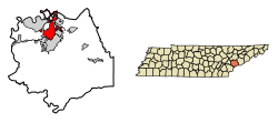
Alcoa, Tennessee | |
---|---|
Coordinates: 35°48′27″N83°58′31″W / 35.80750°N 83.97528°W | |
Country | United States |
State | Tennessee |
County | Blount |
Incorporated | 1919 |
Named for | Aluminum Company of America |
Area | |
• Total | 15.92 sq mi (41.22 km2) |
• Land | 15.00 sq mi (38.85 km2) |
• Water | 0.92 sq mi (2.37 km2) |
Elevation | 932 ft (284 m) |
Population | |
• Total | 10,978 |
• Density | 731.82/sq mi (282.56/km2) |
Time zone | UTC-5 (Eastern (EST)) |
• Summer (DST) | UTC-4 (EDT) |
Area code | 865 |
FIPS code | 47-00540 [4] |
GNIS feature ID | 2403075 [2] |
Website | www |
Alcoa is a city in Blount County, Tennessee, United States. Its population was 10,978 at the 2020 census. [5] It is part of the Knoxville, TN Metropolitan Statistical Area.
As its name suggests, Alcoa was the site of a large aluminum smelting plant owned and operated by the Alcoa corporation (Aluminum Company of America). Formerly known as North Maryville, the town was incorporated under its present name in 1919. [6]
Shortly after the Pittsburgh Reduction Company changed its name to the Aluminum Company of America in 1907, the company began investigating the possibility of establishing a large smelting operation in East Tennessee. The hydroelectric potential of the Little Tennessee River, which exits the mountains about 20 miles (32 km) southwest of Alcoa, was one of the primary incentives, as the company's aluminum smelting operation would require massive amounts of electricity. In 1910, the company established a base camp at what is now known as Calderwood, initially known as "Alcoa", and was known as such until the name was reapplied to the company's operations in North Maryville a few years later. [6]
The company considered several potential plant sites in Knoxville, Etowah, and Monroe County, but chose North Maryville due in part to the influence of Maryville mayor Samuel Everett (1864−1941). By 1914, the company had completed the initial purchase of 700 acres (280 ha) in North Maryville, and had initiated construction of the smelting plant and 150 houses for company employees. ALCOA's chief engineer Edwin Fickes and hydraulic engineer Robert Ewald drew up plans for the town to house the plant's workers. The town design initially called for the acquisition of 7,500 acres (3,000 ha), and included four sections— Vose and Springbrook in the north (around what is now Springbrook Park) and Bassel and Hall in the south (around what is now the South Plant). Hall, named for the inventor of the aluminum electrolytic process, was originally a segregated community for the plant's African-American workers. Oldfield, a small community between the planned town and Maryville, would later be annexed by the city of Alcoa. [6]
World War I brought about a spike in the demand for aluminum, and the company quickly expanded its North Maryville operations. In 1919, a rolling mill (now West Plant) was completed, and the company purchased the Knoxville Power Company for its Little Tennessee Valley holdings. That same year, the company's town officially incorporated as "Alcoa". C.L. Babcock was the town's first mayor, and Victor Hultquist was the first city manager. Hultquist, who was also ALCOA's superintendent of construction, remained city manager until 1948, and oversaw much of the town's early development. In 1920, Alcoa had a population of 3,358 people living in 700 houses. [6]
Early Alcoa was a classic "company town", with the company maintaining a paternalistic relationship with the city. The city's welfare was almost wholly dependent upon the company's fortunes. This presented a problem for the company, which feared that its workforce would leave to look for jobs elsewhere during times of low production. Thus, during the Great Depression, the company maintained steady production levels in spite of the lack of demand for aluminum. Managers sought to cut workers' hours— which at one point dropped to 30 hours per week— rather than slash jobs. By the end of the decade, the company had stockpiled 42,000 tons of aluminum. [6]
The Depression (and accompanying New Deal legislation) also brought about increased labor union activity in Alcoa. A strike in 1934 was forcibly ended when Hultquist deployed a large police force. A second strike in 1937 was broken in a similar fashion, with two striking workers shot and killed and the National Guard forced to intervene. [6]
World War II proved immensely profitable for ALCOA, as aluminum was needed for aircraft construction. Production increased 600% during the war, and the company's Alcoa operations workforce swelled to 12,000. In the early 1940s, the company built its North Plant, which at the time of its completion was the world's largest plant under a single roof. [7]
After World War II, the city of Alcoa became less and less dependent upon its parent company. Alcoa's public image had suffered due to its hardline stance toward labor unions, and in response, it launched a series of public relations initiatives, including the donation of land for schools, parks, and airport construction. The company also desegregated its facilities during this period. In the early 1950s, the company began selling off company housing to employees. [8] In 1956, Ross Walker became the first city manager who was not employed by the company, [7] and toward the end of the decade, the company had relinquished ownership of city utilities. The completion of the Hall Road Viaduct in the 1940s and the continued development of McGhee Tyson Airport over subsequent decades led to commercial expansion and helped the city diversify its economy. [9]
The city is situated in the foothills of the Great Smoky Mountains, the outermost of which, Chilhowee Mountain, rises just a few miles to the south. Large sections of the north-central and northeastern parts of the range are visible from Alcoa Highway. The Little River, which rises near the heart of the Smokies, flows through the eastern section of Alcoa before emptying into the Tennessee River near Louisville.
According to the United States Census Bureau, the city has a total area of 15.6 square miles (40.5 km2), of which 14.7 square miles (38.2 km2) is land and 0.93 square miles (2.4 km2), or 5.90%, is water. [5]
The climate in this area is characterized by relatively high temperatures and evenly distributed precipitation throughout the year. According to the Köppen Climate Classification system, Alcoa has a Humid subtropical climate, abbreviated "Cfa" on climate maps. [10]
Climate data for Alcoa | |||||||||||||
---|---|---|---|---|---|---|---|---|---|---|---|---|---|
Month | Jan | Feb | Mar | Apr | May | Jun | Jul | Aug | Sep | Oct | Nov | Dec | Year |
Mean daily maximum °F (°C) | 46 (8) | 51 (11) | 59 (15) | 69 (21) | 77 (25) | 84 (29) | 87 (31) | 86 (30) | 80 (27) | 69 (21) | 59 (15) | 50 (10) | 68 (20) |
Mean daily minimum °F (°C) | 30 (−1) | 32 (0) | 37 (3) | 46 (8) | 55 (13) | 62 (17) | 68 (20) | 66 (19) | 59 (15) | 46 (8) | 37 (3) | 32 (0) | 48 (9) |
Average precipitation inches (mm) | 4.6 (120) | 4.4 (110) | 5.2 (130) | 3.8 (97) | 3.9 (99) | 4 (100) | 4.6 (120) | 3.1 (79) | 2.9 (74) | 2.7 (69) | 3.8 (97) | 4.6 (120) | 47.5 (1,210) |
Source: Weatherbase [11] |
Census | Pop. | Note | %± |
---|---|---|---|
1920 | 3,358 | — | |
1930 | 5,255 | 56.5% | |
1940 | 5,131 | −2.4% | |
1950 | 6,355 | 23.9% | |
1960 | 6,395 | 0.6% | |
1970 | 7,739 | 21.0% | |
1980 | 6,870 | −11.2% | |
1990 | 6,400 | −6.8% | |
2000 | 7,734 | 20.8% | |
2010 | 8,449 | 9.2% | |
2020 | 10,978 | 29.9% | |
2023 (est.) | 13,349 | [12] | 21.6% |
Sources: [13] [14] [3] |
Race | Number | Percentage |
---|---|---|
White (non-Hispanic) | 8,146 | 74.2% |
Black or African American (non-Hispanic) | 1,262 | 11.5% |
Native American | 32 | 0.29% |
Asian | 113 | 1.03% |
Pacific Islander | 3 | 0.03% |
Other/Mixed | 617 | 5.62% |
Hispanic or Latino | 805 | 7.33% |
As of the 2020 United States census, there were 10,978 people, 3,835 households, and 2,574 families residing in the city.
As of the census [4] of 2000, there were 7,734 people, 3,489 households, and 2,159 families residing in the city. The population density was 560.7 inhabitants per square mile (216.5/km2). There were 3,857 housing units at an average density of 279.6 per square mile (108.0/km2). The racial makeup of the city was 81.15% White, 16.01% African American, 0.19% Native American, 0.34% Asian, 0.01% Pacific Islander, 0.78% from other races, and 1.53% from two or more races. Hispanic or Latino of any race were 1.89% of the population.
There were 3,489 households, out of which 24.4% had children under the age of 18 living with them, 44.6% were married couples living together, 13.6% had a female householder with no husband present, and 38.1% were non-families. 33.0% of all households were made up of individuals, and 12.5% had someone living alone who was 65 years of age or older. The average household size was 2.22 and the average family size was 2.80.
In the city, the population was spread out, with 20.9% under the age of 18, 8.0% from 18 to 24, 29.1% from 25 to 44, 24.7% from 45 to 64, and 17.2% who were 65 years of age or older. The median age was 40 years. For every 100 females, there were 91.6 males. For every 100 females age 18 and over, there were 87.4 males.
The median income for a household in the city was $33,520, and the median income for a family was $44,333. Males had a median income of $31,464 versus $23,212 for females. The per capita income for the city was $19,526. About 9.1% of families and 11.9% of the population were below the poverty line, including 18.1% of those under age 18 and 10.9% of those age 65 or over.
Alcoa's early developers considered public parks an essential part of the city, and in the 1920s, Alcoa sought to set aside 1-acre (4,000 m2) of land for parks for every 100 people living in the city. [16] In the early 1930s, City Manager Hultquist used idle plant workers for park construction, and over the years, the company continued donating land for park construction and expansion. In 1998, a 3-mile (4.8 km) section of the Maryville-Alcoa Greenway was completed, connecting Alcoa's Springbrook Park with Maryville's Bicentennial Greenbelt Park. [17]
Alcoa City School District is the local school district for the vast majority of the city. A few parcels are in the Blount County Schools school district. [18]
In the 1990s, Alcoa engaged in a three-way struggle with Knoxville and Blount County for control of McGhee Tyson Airport, which is located in Blount County, but built and operated by Knoxville. In 1992, an attempt by Alcoa to annex the airport was blocked by a court ruling, and a similar attempt four years later was rejected by voters in a referendum. A third annexation attempt in 2002 also failed. The airport is currently managed by the Metropolitan Knoxville Airport Authority. [19]
Many of the city's streets, such as Bessemer, Joule, Edison, Darwin, and Watt, are named after famous scientists and inventors. Others, such as Hunt, Glascock, and Calderwood, were named for Alcoa company officials and engineers. [20]
Alcoa operates under the council-manager form of government providing a full range of services including police, fire, public works, recreation, planning and code enforcement along with electric, water and sewer utilities to our 8,500 residents and our estimated 40,000 daily visitors. Current City Management Staff includes: [26]
City Title | Name |
---|---|
City Manager | Mark L. Johnson |
Deputy City Manager | Bruce M. Applegate, Jr. |
City Attorney | Stephanie D. Coleman |
City Judge | Allen Bray |
Public Information Officer | Emily Assenmacher |
Monroe County is a county located on the eastern border of the U.S. state of Tennessee. As of the 2020 census, the population was 46,250. Its county seat is Madisonville, and its largest city is Sweetwater.
Blount County is a county located in the East Tennessee Grand Division of the U.S. state of Tennessee. As of the 2020 census, its population was 135,280. The county seat is Maryville, which is also the county's largest city. Blount County is included in the Knoxville metropolitan area.
Louisville is a suburban town in Blount County, Tennessee. Its population was 4,384 at the 2020 census. It is included in the Knoxville, Tennessee Metropolitan Statistical Area.
Maryville is a city in and the county seat of Blount County, Tennessee. Its population was 31,907 at the 2020 census.
Rockford is a city in Blount County, Tennessee. Its population was 822 at the 2020 census. It is included in the Knoxville, Tennessee Metropolitan Statistical Area.
Townsend is a city in Blount County, Tennessee. The city was chartered in 1921 by persons who were involved with the Little River Railroad and Lumber Company. The population was 550 at the 2020 census. For thousands of years a site of Native American occupation by varying cultures, Townsend is one of three "gateways" to the Great Smoky Mountains National Park. It has several museums and attractions relating to the natural and human history of the Great Smokies.
Knoxville is a city in and the county seat of Knox County, Tennessee, United States, on the Tennessee River. As of the 2020 United States census, Knoxville's population was 190,740, making it the largest city in the East Tennessee Grand Division and the state's third-most-populous city after Nashville and Memphis. It is the principal city of the Knoxville metropolitan area, which had a population of 879,773 in 2020.
Greenback is a city in Loudon County, Tennessee, United States. Its population was at 1,102, according to the 2020 census. It is included in the Knoxville Metropolitan Statistical Area.
Lenoir City is a suburban city located in Loudon County, Tennessee. The population was 10,117 at the 2020 census. It is included in the Knoxville metropolitan area in East Tennessee, along the Tennessee River southwest of Knoxville.
Rockdale is a city in Milam County, Texas, United States. Its population was 5,323 at the 2020 census. It is approximately 41 miles west of College Station.
Seymour is a census-designated place (CDP) and unincorporated community in Blount and Sevier counties in the U.S. state of Tennessee. The CDP population was 14,705 at the 2020 U.S. census. It is included in the Knoxville, Tennessee Metropolitan Statistical Area.
McGhee Tyson Airport is a public/military airport 12 miles (19 km) south of Knoxville, in Alcoa, Tennessee. It is named for United States Navy pilot Charles McGhee Tyson, who was killed in World War I.
Former State Route 429 , also known as Airbase Road, was a south-to-north secondary highway in Blount County, Tennessee, that was 1.85 miles (3.0 km) long. Its southern terminus was at the Tennessee Air National Guard gate and the northern terminus was with US 129/SR 115. The road was decommissioned in 2009 when the Tennessee Air National Guard gate was moved, and Airbase Road was rerouted on new construction to the west, making the old road private. The entire route of SR 429 was signed when it existed.
The Maryville Alcoa Greenway is a cooperative effort by the two cities and Blount County, Tennessee to connect existing parks with a paved foot and cycle path.
The Knoxville metropolitan area, commonly known as Greater Knoxville, is a metropolitan statistical area (MSA) centered on Knoxville, Tennessee, the third largest city in Tennessee and the largest city in East Tennessee. It is the third largest metropolitan area in Tennessee. In 2020, the Knoxville metro area had a population of 879,773, and a population of 903,300 including Grainger County. The Knoxville–Morristown–Sevierville Combined Statistical Area (CSA) had a population of 1,156,861 according to the census bureau in 2020.
Calderwood Dam is a hydroelectric dam located along the Little Tennessee River in Blount and Monroe counties, in the U. S. state of Tennessee. Completed in 1930, the dam is owned and maintained by Tapoco, a subsidiary of the Aluminum Company of America (Alcoa), although the Tennessee Valley Authority (TVA) controls the dam's reservoir levels from Fontana Dam further upstream. Calderwood Dam is named for Alcoa engineer Isaac Glidden Calderwood (1871–1941), who supervised much of the company's early Little Tennessee River operations.
Walland is an unincorporated community and census-designated place (CDP) in Blount County, Tennessee. Its population was 281 as of the 2020 census. Walland is the site of a post office and is the place name associated with zip code 37886, which covers an area beyond the Walland community.
U.S. Route 129 is a north–south United States highway that runs for 52.8 miles (85.0 km) in East Tennessee, from the North Carolina state line, near Tapoco, to Knoxville. In Tennessee, the highway is completely overlapped by unsigned State Route 115. In the Greater Knoxville area, US 129 serves as a six-lane controlled-access highway known as Alcoa Highway.
Calderwood was a community once located along the Little Tennessee River in Blount County, Tennessee, United States. Established in 1912 as a base for the Aluminum Company of America's Little Tennessee Valley hydroelectric development operations, the community continued to house construction personnel and dam maintenance personnel for nearby Calderwood Dam until the 1960s. Although the community's houses were razed after its abandonment, three buildings located in the community— the Calderwood Dam service building, the Calderwood School, and a Quonset hut used as a theater— were included in a supplementary listing for Calderwood Dam on the National Register of Historic Places in 2004.
State Route 335 is an 11-mile-long (18 km) north–south state highway in Blount County, Tennessee. It forms a semicircle around the western half of the Maryville-Alcoa metro area.