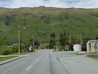
Ashley is a small town in North Canterbury, in the South Island of New Zealand. It used to have a railway station on the Main North Line that runs through the village.
Ashley Rakahuri School is Ashley's only school, and was established in 1864.[3] It is a state co-educational full primary, with 148 students (as of February 2024).[4] The principal is Linda Horne.
Demographics
Ashley is described by Statistics New Zealand as a rural settlement and covers 0.99km2 (0.38sqmi).[1] It had an estimated population of 400 as of June 2023,[2] with a population density of 404 people per km2. Ashley is part of the larger Ashley-Sefton statistical area.[5]
Before the 2023 census, the settlement had a larger boundary, covering 4.66km2 (1.80sqmi).[1] Using that boundary, Ashley had a population of 312 at the 2018 New Zealand census, an increase of 51 people (19.5%) since the 2013 census, and an increase of 90 people (40.5%) since the 2006 census. There were 108 households, comprising 153 males and 159 females, giving a sex ratio of 0.96 males per female. The median age was 35.5 years (compared with 37.4 years nationally), with 81 people (26.0%) aged under 15 years, 60 (19.2%) aged 15 to 29, 138 (44.2%) aged 30 to 64, and 36 (11.5%) aged 65 or older.
Ethnicities were 95.2% European/Pākehā, 8.7% Māori, 2.9% Asian, and 2.9% other ethnicities. People may identify with more than one ethnicity.
Although some people chose not to answer the census's question about religious affiliation, 73.1% had no religion, 20.2% were Christian, 1.0% had Māori religious beliefs and 1.0% had other religions.
Of those at least 15 years old, 21 (9.1%) people had a bachelor's or higher degree, and 63 (27.3%) people had no formal qualifications. The median income was $34,100, compared with $31,800 nationally. 39 people (16.9%) earned over $70,000 compared to 17.2% nationally. The employment status of those at least 15 was that 129 (55.8%) people were employed full-time, 57 (24.7%) were part-time, and 12 (5.2%) were unemployed.[7]
Ashley-Sefton statistical area
Ashley-Sefton statistical area, which also includes Sefton, covers 86.91km2 (33.56sqmi).[1] It had an estimated population of 2,410 as of June 2023,[8] with a population density of 27.7 people per km2.
Ashley-Sefton had a population of 2,139 at the 2018 New Zealand census, an increase of 186 people (9.5%) since the 2013 census, and an increase of 429 people (25.1%) since the 2006 census. There were 762 households, comprising 1,065 males and 1,074 females, giving a sex ratio of 0.99 males per female. The median age was 45.1 years (compared with 37.4 years nationally), with 441 people (20.6%) aged under 15 years, 318 (14.9%) aged 15 to 29, 1,041 (48.7%) aged 30 to 64, and 339 (15.8%) aged 65 or older.
Ethnicities were 95.4% European/Pākehā, 6.6% Māori, 1.0% Pasifika, 1.8% Asian, and 1.5% other ethnicities. People may identify with more than one ethnicity.
The percentage of people born overseas was 13.7, compared with 27.1% nationally.
Although some people chose not to answer the census's question about religious affiliation, 57.2% had no religion, 33.7% were Christian, 0.3% had Māori religious beliefs, 0.3% were Muslim, 0.1% were Buddhist and 1.0% had other religions.
Of those at least 15 years old, 246 (14.5%) people had a bachelor's or higher degree, and 354 (20.8%) people had no formal qualifications. The median income was $36,700, compared with $31,800 nationally. 351 people (20.7%) earned over $70,000 compared to 17.2% nationally. The employment status of those at least 15 was that 891 (52.5%) people were employed full-time, 318 (18.7%) were part-time, and 42 (2.5%) were unemployed.[9]
Climate
The average temperature in summer is 15.9°C, and in winter is 7°C.[10]
Month
Normal temperature
January
16.4°C
February
16.1°C
March
14.9°C
April
12.4°C
May
9.4°C
June
7.0°C
July
6.5°C
August
7.4°C
September
9.4°C
October
11.5°C
November
13.2°C
December
15.1°C
Related Research Articles
Kingston is a small town at the southernmost end of Lake Wakatipu, just north of the border of Otago and Southland, in New Zealand's South Island. It is 47 kilometres south of Queenstown by a road, "The Devil's Staircase", which winds between the lake to the west and The Remarkables mountains to the east. It is 70 kilometres north of Lumsden, and close to the headwaters of the Mataura River.
Glenavy is a small town in the South Island of New Zealand. It is located at the southern extreme of the Canterbury region on the alluvial fan of the Waitaki River, three kilometres from the river's outflow into the Pacific Ocean.
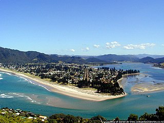
The town of Pauanui is on the east coast of the Coromandel Peninsula in the North Island of New Zealand. It lies at the mouth of the Tairua River on its south bank, directly opposite the larger town of Tairua.
Buller District is one of 53 districts of New Zealand, and is within the West Coast Region. It covers Westport, Karamea, Reefton and Inangahua Junction.
Pukawa or Pukawa Bay is a bay and a small township on the southern shores of Lake Taupō on New Zealand's North Island. It is off State Highway 41 between Turangi and Taumarunui, in the Taupō District and Waikato region.
Waipapa is a small town in the Bay of Islands, Northland, New Zealand. It is located on State Highway 10, approximately 10 minutes drive from Kerikeri, the nearest urban centre. Waipapa itself has no school with most pupils travelling to Kerikeri on a daily basis. It is governed by the Far North District council.
Ōhura is a small town in the west of the North Island of New Zealand. It is located to the west of Taumarunui in the area known as the King Country, in inland Manawatū-Whanganui. It lies on the banks of the Mangaroa Stream, a tributary of the Ōhura River which is a tributary of the Whanganui River.
Waikuku is a small town in the Canterbury region of New Zealand, which sits 28 km north of central Christchurch. Waikuku lies 11.8 km (7.3 mi) south of Leithfield on state highway 1 and 3 km (1.9 mi) north of Woodend. In 1901 there were 86 people resident in Waikuku according to that year's census. Waikuku settlement had a population of 156 people at the time of the 2018 Census. It is popular with both those that commute into work in Christchurch each day and with owners of holiday houses. Waikuku was home to rope and twine works. This business started off using flax from local swamps. It closed in 1987. The nearby sandy beach and pine forests are popular with surfers, swimmers, campers and horse-riders, and the large estuary of the Ashley River hosts many species of birds.
Wallacetown is a small town in Southland, in the South Island of New Zealand. Wallacetown is to the west of Invercargill, on high ground between the Makarewa and Ōreti rivers, near the Ōreti's estuary. Both rivers are popular for trout and whitebait fishing. It is considered to be a satellite town of Invercargill. It is served by State Highway 99, which skirts the town's northern edge.
Luggate is a small town in the South Island of New Zealand. It is located on State Highway 6 between Wānaka and Cromwell, near the junction with State Highway 8A, approximately 15 km from the Wānaka township, just past Wānaka Airport.
The Pines Beach is a small town situated roughly 4 km east of Kaiapoi in the Canterbury region of the South Island of New Zealand. It is 1 km north of the mouth of the Waimakariri River. It takes its name from its close proximity to both a pine forest and the beach.
Waikuku Beach is a small settlement on the coast of the Canterbury region of New Zealand, about 3 km (1.9 mi) east of the settlement of Waikuku.
Sefton is a small town in the Waimakariri District, New Zealand, about 23 miles from Christchurch.
Pōhara is a rural locality in the Tasman District of New Zealand's South Island. The locality is northeast of Tākaka and southwest of Tata Beach. To the north is Limestone Bay, part of Golden Bay / Mohua
Kerepehi is a rural community in the Hauraki District and Waikato region of New Zealand's North Island. The alternative spelling Kerepeehi was in use until 1933.
Haruru is a residential and commercial locality in the Far North District of New Zealand. State Highway 11 runs through the locality. Puketona is 10 kilometres west, and Paihia is 4 kilometres east, The name means a continuous noise or roar in the Māori language, which refers to the sound of Haruru Falls, a five metre high broad waterfall about a kilometre away.
Waiau Pa is a small town of Auckland, New Zealand. It is in the Franklin Ward of Auckland Council. The name means "River of swirling currents" in the Māori language.
Patumāhoe is a small town of Auckland, New Zealand. It is in the Franklin Ward of Auckland Council.
Woodbourne is a rural settlement in Marlborough, New Zealand. It is located on State Highway 6, 8 kilometres (5 mi) west of Blenheim, and 4 km (2 mi) east of Renwick. Woodbourne Airport is the major airport for Marlborough, and RNZAF Base Woodbourne shares the airport's runways.
Tokerau Beach is a settlement on the northwestern side of Doubtless Bay on the Karikari Peninsula of Northland, New Zealand.
bold - main town; bold & italics - minor town; normal text - locality; italics - minor locality
This page is based on this Wikipedia article Text is available under the CC BY-SA 4.0 license; additional terms may apply. Images, videos and audio are available under their respective licenses.