Ballintra, Arranmore

Last updated

Loch an Chamhanaigh (Lough Shore) in Ballintra townland Aranmore Island - geograph.org.uk - 500743.jpg
Loch an Chamhánaigh (Lough Shore) in Ballintra townland

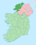
Baile an tSratha ( anglicised as Ballintra) [1] is a townland on the Gaeltacht island of Arranmore in County Donegal, Ireland. Translated to the English language, Ballintra means "road to the beach". [2] The townland is in the historic barony of Boylagh. [3]
Related Research Articles

Blanchardstown Large western suburb of Dublin, Ireland

Blanchardstown is a large outer suburb of Dublin in County Fingal, Ireland, built out from a small village since the 1960s. It is located 10 km north-west of the city centre. It is within the historical barony of Castleknock in the traditional County Dublin, as well as the Dublin 15 postal area and the Dublin West electoral constituency.

A townland is a small geographical division of land used in Ireland and in the Western Isles in Scotland. The townland system is of Gaelic origin, pre-dating the Norman invasion, and most have names of Irish origin. However, some townland names and boundaries come from Norman manors, plantation divisions, or later creations of the Ordnance Survey. The total number of inhabited townlands in Ireland was 60,679 in 1911. The total number recognised by the Irish Place Names database as of 2014 was 61,098, including uninhabited townlands, mainly small islands.

Tory Island Island in Ulster, Ireland

Tory Island, or simply Tory, is an island 14.5 kilometres off the north-west coast of County Donegal, Ireland, and is the most remote inhabited island of Ireland. It is also known in Irish as Oileán Thoraí or, historically, Oileán Thúr Rí. The word Tory comes from the Middle Irish word Tóraidhe which means bandit.

Milford, County Donegal Town in Ulster, Ireland

Milford or Millford, historically called Ballynagalloglagh, is a small town and townland in County Donegal, Ireland. The population at the 2016 census was 1,037.

Ballintra Village in Ulster, Ireland

Ballintra is a village in the parish of Drumholm in the south of County Donegal, Ireland, just off the N15 between Donegal town and Ballyshannon. Ballintra lies on the northern bank of the Blackwater river.. The river rises in the hills that lie inland from the town, and flows through a number of small lakes before spilling over a small waterfall in a gorge behind the village.

N15 road (Ireland)

The N15 road is a national primary road in the north-west of Ireland. It runs from Sligo to Lifford, County Donegal. It forms part of the proposed Atlantic Corridor route.

Laghy Village in Ulster, Ireland

Laghey or Laghy is a small village in County Donegal, Ireland, between Ballintra and Donegal Town. Laghey is one of three villages that make up the parish of Drumholm, formerly a civil and Church of Ireland parish, now only used as a division of the Roman Catholic Diocese of Raphoe. The village has a quarry, a supermarket, garden centre, filling station, two public houses, a church with a graveyard, an Orange hall, a recycling centre, a Donegal County Council yard and salt depot, and a national school. Laghey is also near two of the most scenic beaches in Ireland, namely Rossnowlagh and Murvagh. Murvagh is also the home to Donegal Golf Club.

Ballymagorry

Ballymagorry or Ballymagory is a small village and townland in County Tyrone, Northern Ireland. It is west of Artigarvan and 5 kilometres (3.1 mi) north of Strabane. In the 2001 Census it had a population of 565. It lies within the Strabane District Council area and lies on the River Glenmornan.

Donegal–Leitrim was a parliamentary constituency represented in Dáil Éireann, the lower house of the Irish parliament or Oireachtas from 1969 to 1977. The constituency elected 3 deputies to the Dáil, using the single transferable vote form of proportional representation (PR-STV).

Ballynary

Ballynary is the name of a townland on the eastern shore of Lough Arrow in the southern corner of County Sligo in Ireland. Ballynary was the ancestral seat of the O'Higgins family for 700 years, until they were forced off their lands in 1654 by Oliver Cromwell.

Dunree Townland in Ulster, Ireland

Dunree is a townland in north-west Inishowen, in County Donegal, Ireland. Part of the civil parish of Desertegney, the townland has an area of approximately 0.8 square kilometres (0.3 sq mi), and had a population of 33 people as of the 2011 census.

Lagganstown is an area in County Tipperary, Ireland. Lagganstown Upper and Lagganstown Lower are townlands within the civil parish of Relickmurry and Athassel and historical barony of Clanwilliam.

Oldthort or Oultort is a townland near Portumna, County Galway, Ireland, mainly along the Tynagh Road. Oultort townland has an area of 1.86 square kilometres (0.72 sq mi), and had a population of 70 people as of the 2011 census.

Ballyedmond

Ballyedmond is a small village and townland in County Wexford in Ireland. It is situated on the R741 regional road.

Priorstown Townland in Munster, Ireland

Priorstown is a small townland in County Tipperary, Ireland. It is four miles to the east of Clonmel on the N76 road. Priorstown is 0.8 square kilometres (0.3 sq mi) in area, and had a population of 50 people as of the 2011 census.

Drumholm

The Parish of Drumholm is a parish in the Roman Catholic Diocese of Raphoe. It is also a civil parish, with the variant spelling of Drumhome, in the barony of Tirhugh, County Donegal in Ireland. The parish contains all the land between the large towns of Ballyshannon and Donegal Town, including the small villages of Laghey, Ballintra and Rossnowlagh and the hamlet of Bridgetown. The parish has two Catholic primary schools: St Ernan's National School in Ballintra and St Eunan's National School in Laghey. The current parish priest is Fr Seamus Dagens, who succeeded Fr Daniel McBrearty in 2007. Drumholm is also a parish for the Church of Ireland and a civil parish.

Fintown Village in Ulster, Ireland

Fintown is a small village and townland on the banks of Lough Finn in County Donegal, Ireland. It is within the Gaeltacht, an Irish-speaking area, in the west of the county. Overlooked by Aghla and Screig Mountains, its main attraction is an Mhuc Dhubh, the Fintown Railway, which runs along the length of Lough Finn. The village was named after a mythological woman, Fionngheal, who drowned in the lake after attempting to save her wounded brother Feargamhain.

Gortnavern Townland in Ulster, Ireland

Gortnavern is a townland in County Donegal, Ireland. Located in the historic barony of Kilmacrenan, Gortnavern has an area of approximately 2.6 square kilometres (1 sq mi), and the townland had a population of 107 people as of the 2011 census.

Ballynagaul, County Waterford Gaeltacht district in Munster, Ireland

Ballynagaul is a townland within the Irish-speaking Gaeltacht na nDéise part of County Waterford. It is located approximately 9.6 kilometres from Dungarvan.

R231 road (Ireland)

The R231 road is a regional road in Ireland. It is a loop road from the N15 road in County Donegal. Most of the road is part of the Wild Atlantic Way.

References

  1. "Baile an tSratha / Ballintra". Placenames Database of Ireland. Retrieved 14 January 2021.
  2. "An tOrdú Logainmneacha (Ceantair Ghaeltachta)" (PDF). commissioner.ie. 2004.
  3. "Ballintra Townland, Co. Donegal". townlands.ie. Retrieved 14 January 2021.

Coordinates: 54°59′49″N8°31′01″W / 54.997°N 8.517°W / 54.997; -8.517