Baroondah, Queensland

Last updated

Baroondah
Queensland
StateLibQld 2 114456 Ernest Henry, England, 1867.jpg
Ernest Henry, 1867
Australia Queensland location map.svg
Red pog.svg
Baroondah
Coordinates 25°40′58″S149°10′37″E / 25.6827°S 149.1769°E / -25.6827; 149.1769 (Baroondah (centre of locality))
Population57 (2021 census) [1]
 • Density0.0429/km2 (0.1111/sq mi)
Postcode(s) 4454
Area1,328.9 km2 (513.1 sq mi)
Time zone AEST (UTC+10:00)
Location
  • 73.9 km (46 mi) ENE of Injune
  • 136 km (85 mi) NNE of Roma
  • 279 km (173 mi) SW of Biloela
  • 595 km (370 mi) NW of Brisbane
LGA(s) Shire of Banana
State electorate(s) Callide
Federal division(s) Flynn
Suburbs around Baroondah:
Arcadia Valley Glenhaughton Broadmere
Beilba Baroondah Kinnoul
Pony Hills Durham Downs
Waikola
Eurombah

Baroondah is a rural locality in the Shire of Banana, Queensland, Australia. [2] In the 2021 census, Baroondah had a population of 57 people. [1]

Contents

History

Ernest Henry established a sheep and cattle station called Baroondah on the Dawson River in 1860. [3] He had approximately 200 square miles (520 km2) of land, stocked with 500 heifers, and 7,000 breeding ewes. [4]

Demographics

In the 2016 census, Baroondah had a population of 4 people. [5]

In the 2021 census, Baroondah had a population of 57 people. [1]

Education

The nearest government school is Injune P-10 State School in Injune to the west. It provides primary and secondary schooling (Prep to Year 10). However, most of Baroondah is too distant from this school for a daily commute. The alternatives are distance education and boarding school. [6]

Related Research Articles

<span class="mw-page-title-main">Banana, Queensland</span> Town in Queensland, Australia

Banana is a rural town and locality in the Shire of Banana, Queensland, Australia. In the 2021 census, the locality of Banana had a population of 348 people.

<span class="mw-page-title-main">Injune</span> Town in Queensland, Australia

Injune is a rural town and locality in the Maranoa Region, Queensland, Australia. In the 2021 census, the locality of Injune had a population of 429 people.

<span class="mw-page-title-main">Baralaba, Queensland</span> Town in Queensland, Australia

Baralaba is a rural town and locality in the Shire of Banana in central Queensland, Australia. In the 2021 census, the locality of Baralaba had a population of 324 people.

<span class="mw-page-title-main">Dululu</span> Town in Queensland, Australia

Dululu is a rural town and locality in the Shire of Banana, Queensland, Australia. In the 2021 census, the locality of Dululu had a population of 97 people.

<span class="mw-page-title-main">Cracow, Queensland</span> Town in Queensland, Australia

Cracow is a rural town and locality in the Shire of Banana, Queensland, Australia. In the 2021 census, the locality of Cracow had a population of 114 people.

<span class="mw-page-title-main">Jambin, Queensland</span> Town in Queensland, Australia

Jambin is a rural town and locality in the Shire of Banana, Queensland, Australia. In the 2021 census, the locality of Jambin had a population of 207 people.
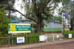
<span class="mw-page-title-main">Mount Murchison, Queensland</span> Suburb of Shire of Banana, Queensland, Australia

Mount Murchison is a rural locality in the Shire of Banana, Queensland, Australia.

Greycliffe is a rural locality in the Shire of Banana, Queensland, Australia. In the 2021 census, Greycliffe had a population of 56 people.

Westgrove is a rural locality in the Maranoa Region, Queensland, Australia. In the 2021 census, Westgrove had a population of 4 people.

Woolein is a rural locality in the Shire of Banana, Queensland, Australia. In the 2021 census, Woolein had "no people or a very low population".

Ulogie is a rural locality in the Shire of Banana, Queensland, Australia. In the 2021 census, Ulogie had a population of 31 people.

Redford is a locality split between the Maranoa Region and the Shire of Murweh, both in Queensland, Australia. In the 2021 census, Redford had a population of 18 people.

Alberta is a rural locality in the Shire of Banana, Queensland, Australia. In the 2021 census, Alberta had a population of 36 people.

Orange Creek is a rural locality in the Shire of Banana, Queensland, Australia. In the 2021 census, Orange Creek had a population of 197 people.

Dumgree is a rural locality in the Shire of Banana, Queensland, Australia. In the 2021 census, Dumgree had a population of 63 people.

<span class="mw-page-title-main">Lonesome Creek, Queensland</span> Suburb of Theodore, Queensland, Australia

Lonesome Creek is a rural locality in the Shire of Banana, Queensland, Australia. In the 2021 census, Lonesome Creek had a population of 173 people.

Castle Creek is a rural locality in the Shire of Banana, Queensland, Australia. In the 2021 census, Castle Creek had a population of 57 people.

Tarramba is a rural locality in the Shire of Banana, Queensland, Australia. In the 2021 census, Tarramba had a population of 38 people.

<span class="mw-page-title-main">Isla, Queensland</span> Suburb of Shire of Banana, Queensland, Australia

Isla is a rural locality in the Shire of Banana, Queensland, Australia. In the 2021 census, Isla had a population of 213 people.

Simmie is a rural locality in the Maranoa Region, Queensland, Australia. In the 2021 census, Simmie had a population of 16 people.

References

  1. 1 2 3 Australian Bureau of Statistics (28 June 2022). "Baroondah (SAL)". 2021 Census QuickStats. Retrieved 28 February 2023. OOjs UI icon edit-ltr-progressive.svg
  2. "Baroondah – locality in Shire of Banana (entry 49536)". Queensland Place Names. Queensland Government . Retrieved 25 October 2019.
  3. Lack, Clem, "Ernest Henry (1837–1919)", Australian Dictionary of Biography, National Centre of Biography, Australian National University, archived from the original on 6 May 2024, retrieved 17 November 2024
  4. Phillips, George (1923). "Ernest Henry : the discoverer, and principle prospector, of the Cloncurry Mineral District of North-West Queensland". Journal of the Royal Historical Society of Queensland . 2 (2): 97–120. Archived from the original on 14 September 2024. Retrieved 17 November 2024 via University of Queensland.
  5. Australian Bureau of Statistics (27 June 2017). "Baroondah (SSC)". 2016 Census QuickStats. Retrieved 20 October 2018. OOjs UI icon edit-ltr-progressive.svg
  6. "Layers: Locality; Schools and school catchments". Queensland Globe. Queensland Government. Archived from the original on 19 December 2017. Retrieved 17 November 2024.