Bemboka, New South Wales

Last updated

Bemboka
New South Wales
Australia New South Wales location map blank.svg
Red pog.svg
Bemboka
Coordinates 36°38′0″S149°35′0″E / 36.63333°S 149.58333°E / -36.63333; 149.58333 Coordinates: 36°38′0″S149°35′0″E / 36.63333°S 149.58333°E / -36.63333; 149.58333
Population 577 (2016 census) [1]
Postcode(s) 2550
Location
  • 474 km (295 mi) SSW of Sydney
  • 193 km (120 mi) S of Canberra
  • 36 km (22 mi) W of Bega
  • 77 km (48 mi) SE of Cooma
LGA(s) Bega Valley Shire
State electorate(s) Bega
Federal Division(s) Eden-Monaro

Bemboka is a town in the South Coast region of New South Wales, Australia. The town is located on the Snowy Mountains Highway, in the Bega Valley Shire local government area, 474 kilometres (295 miles) south of the state capital, Sydney. At the 2016 census, the Bemboka gazetted locality had a population of 577. [1]

New South Wales State of Australia

New South Wales is a state on the east coast of Australia. It borders Queensland to the north, Victoria to the south, and South Australia to the west. Its coast borders the Tasman Sea to the east. The Australian Capital Territory is an enclave within the state. New South Wales' state capital is Sydney, which is also Australia's most populous city. In March 2018, the population of New South Wales was over 7.9 million, making it Australia's most populous state. Just under two-thirds of the state's population, 5.1 million, live in the Greater Sydney area. Inhabitants of New South Wales are referred to as New South Welshmen.

Snowy Mountains Highway highway in New South Wales

The Snowy Mountains Highway is a 333-kilometre-long (207 mi) state highway located in New South Wales, Australia. Its two sections connect the New South Wales South Coast to the Monaro region, and the Monaro to the South West Slopes via the Snowy Mountains. The higher altitude regions of this road are subject to snow over the winter months, and the road also provides access to many parts of the Snowy Mountains Scheme. The highway bears the B72 shield along its entire length.

Bega Valley Shire Local government area in New South Wales, Australia

The Bega Valley Shire is a local government area located adjacent to the south-eastern coastline of New South Wales, Australia. The Shire was formed in 1981 with the amalgamation of the Municipality of Bega, Imlay Shire and Mumbulla Shire. The estimated population as at the 2016 census was 33,253.

Contents

Geography

The Aboriginal meaning of the name Bemboka (originally Benbooka) is thought to be "High Peak". [2] Positioned at the eastern head of the Bega Valley, 25 kilometres (15 miles) from the base of Brown Mountain (1241m), a spur of the Great Dividing Range, the locality is bordered by the mountains and ridges of the South East Forests National Park. [3] Prominent features in the Bemboka section to the north include Indian Head, Pigeon Box, Bemboka Peak and Numbugga Walls.

Great Dividing Range mountain range in the Australian states of Queensland, New South Wales and Victoria

The Great Dividing Range, or the Eastern Highlands, is Australia's most substantial mountain range and the third longest land-based range in the world. It stretches more than 3,500 kilometres (2,175 mi) from Dauan Island off the northeastern tip of Queensland, running the entire length of the eastern coastline through New South Wales, then into Victoria and turning west, before finally fading into the central plain at the Grampians in western Victoria. The width of the range varies from about 160 km (100 mi) to over 300 km (190 mi). The Greater Blue Mountains Area, Gondwana Rainforests, and Wet Tropics of Queensland World Heritage Areas are located in the range.

History

The first inhabitants of the region were a sub-group of the Thaua people of the Yuin nation. [4] The first European settlers were squatters grazing sheep and cattle on crown land beyond the limits of location set by the NSW Government in 1829. [5] The first purchases of land by selectors occurred in 1862 [6] and the first school was established on Brown Mountain in 1871. [7] Settlement occurred in two adjacent villages – Colombo and the private subdivision of Lyttleton. The two towns remained relatively isolated until the bridle trail on Brown Mountain used to carry post was upgraded in 1889 to take vehicles, providing an effective means of descent from the Monaro to the coastal plain. [8] Colombo was regazetted as Bemboka in 1894, and Lyttleton was incorporated into the village in 1923. [9] From 1904 to 1911, the town had its own weekly newspaper, the Bemboka Advocate. [10] [11] It was also the location of the former Mumbulla Shire administration offices from 1906 until the Bega Valley Shire was formed in 1981. [12]

Population

In the 2016 Census, there were 577 people in Bemboka. 81.5% of people were born in Australia and 89.9% of people only spoke English at home, The most common responses for religion were No Religion 36.2%, Catholic 18.1% and Anglican 17.4%. [1]

Economy

The town economy is based on dairying. In the late 1890s there were six known butter and cheese factories in the area. These were superseded by cooperatives, with the Bemboka Co-operative Factory at the east end of town remaining in business until 1980. [13] During the 1980s and 1990s, the old cheese factory building was used by Bemboka Handmade Paper Pty Ltd to make quality handmade paper that was marketed worldwide. [14]

Bemboka is notable for retaining most of its older timber buildings. These include the stores which once lined the main street, some of which are now used as private homes. The original Bemboka Pie Shop built in 1930 still operates as a bakery and pie shop with a reputation built from a long history of providing refreshment to motorists coming down to the coast from the Monaro and ACT. [15]

In the surrounding state forests, woodchipping and logging was a major industry until the late 1980s, when activism by conservationists resulted in the reservation of 15,300 hectares as Bemboka National Park. [16] In 1997, this area was merged into the South East Forests National Park. [8]

Community

For a small community, the people of Bemboka have a history of working together to achieve big things. From 1956–1967, the village ran its own weekly picture show in the School of Arts Hall using the school's 16mm projector, to raise money to build the current Bemboka Memorial Hall. [17] During the 1970s, the village raised funds through housie nights, catering and grants to build a swimming pool in the town. [18] Most recently, Bemboka has become known for its banquet, a community initiative of the Bemboka Show Society, which in 2012 served 150 guests a four course dinner of five entrees, five main courses, five desserts and five cheeses, with 90 per cent of ingredients sourced from within 10 kilometres of the Bemboka Memorial Hall. [19] [20]

Related Research Articles

South East Forests National Park Protected area in New South Wales, Australia

The South East Forests National Park is a national park located in between the Monaro and South Coast regions of New South Wales, Australia. The 115,177-hectare (284,610-acre) national park is situated 378 kilometres (235 mi) southwest of Sydney. It features high quality old growth eucalyptus forest and remnant patches of temperate rainforest.

Cooma Town in New South Wales, Australia

Cooma is a town in the south of New South Wales, Australia. It is located 114 kilometres (71 mi) south of the national capital, Canberra, via the Monaro Highway. It is also on the Snowy Mountains Highway, connecting Bega with the Riverina.

Bega, New South Wales Town in New South Wales, Australia

Bega is a town in the south-east of New South Wales, Australia in the Bega Valley Shire. It is the economic centre for the Bega Valley.

Monaro (New South Wales) Region in New South Wales, Australia

Monaro, once frequently spelled "Manaro", or in early years of settlement "Maneroo" is the name of a region in the south of New South Wales, Australia. A small area of Victoria near Snowy River National Park is geographically part of the Monaro. While the Australian Capital Territory is not considered part of the region, some towns in the Monaro have close links with Canberra.

Pambula, New South Wales Town in New South Wales, Australia

Pambula is a town in Bega Valley Shire on the far south coast of New South Wales, Australia 473 kilometres (294 mi) south of Sydney via the Princes Highway. At the 2016 census, Pambula had a population of 970 people.

Tilba, New South Wales Town in New South Wales, Australia

Central Tilba and Tilba Tilba are two villages near the Princes Highway in Eurobodalla Shire, New South Wales, Australia. At the 2016 census, Central Tilba and surrounding areas had a population of 288. It is the site for the television series: River Cottage Australia.

Electoral district of Bega state electoral district of New South Wales, Australia

Bega is an electoral district of the Legislative Assembly in the Australian state of New South Wales. It is represented by Andrew Constance of the Liberal Party.

Cochrane Dam (New South Wales) dam in Australia

Cochrane Dam is a minor earthfill embankment dam with concrete spillway across Georges Creek, located in the South Coast region of New South Wales, Australia. The main purpose of the dam is to supply water for hydro-power at the downstream Brown Mountain Power Station and for irrigation purposes. The impounded reservoir is called Cochrane Lake.

South Coast (New South Wales) Region in New South Wales, Australia

The South Coast refers to the narrow coastal belt from Sydney in the north to the border with Victoria in the south in the south-eastern part of the State of New South Wales, Australia. It is bordered to the west by the coastal escarpment of the Southern Tablelands, and is largely covered by a series of national parks, namely Jervis Bay National Park, Eurobodalla National Park, and Ben Boyd National Park. To the east is the coastline of the Pacific Ocean, which is characterised by rolling farmlands, small towns and villages along a rocky coastline, interspersed by numerous beaches and lakes.

Numbugga, New South Wales, Australia, is a locality about 15 km from the town of Bega, in Bega Valley Shire, consisting of mainly farmland, rural residential dwellings and National Parks. At the 2016 census, Numbugga had a population of 125 people.

Group 16 is a rugby league competition on the south coast of New South Wales, run under the auspices of the Country Rugby League. Group 16 covers the area from Batemans Bay down to Eden.

The Bemboka River, a perennial stream of the Bega River catchment, is located in the Monaro and South Coast regions of New South Wales, Australia.

The Nunnock River, a perennial stream of the Bega River catchment, is located in the Monaro region of New South Wales, Australia.

Bega River (New South Wales) river in Australia

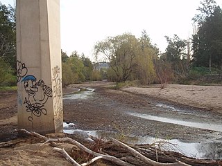
The Bega River is an intermittently open intermediate wave dominated barrier estuary that is located in the South Coast region of New South Wales, Australia.

Brown Mountain (New South Wales) mountain in New South Wales, Australia

Brown Mountain, at an elevation of 1,243 metres (4,078 ft) AHD , is the highest mountain in the Monaro region of New South Wales, Australia.

The Bega Valley Regional Gallery is a publicly funded art gallery and cultural facility located in the town centre of Bega in south eastern New South Wales Australia. The gallery showcases contemporary Australian visual culture with up to ten exhibitions annually. In 2016 the gallery expanded its footprint as the cultural outpost on Australia’s Coastal Wilderness and launched two project spaces within new Bega Valley Shire Council community developments.

Tantawangalo is a locality in The Bega Valley Shire and the Eden-Monaro federal electorate. At the 2016 census, it had a population of 156. It contains a significant portion of the South East Forests National Park and borders onto the Tantawangalo State Forest. It contains the scenic Six Mile Creek Campground.

2018 Tathra bushfire

The 2018 Tathra bushfire was a bushfire that burned between 18 and 19 March 2018 and primarily affected parts of the South Coast region in the Australian state of New South Wales. The fire, understood to have been caused by a failure in electrical infrastructure, began in the locality of Reedy Swamp, near Tarraganda, which spread east towards Tathra in the municipality of the Bega Valley Shire.

References

  1. 1 2 3 Australian Bureau of Statistics (27 June 2017). "Bemboka (state suburb)". 2016 Census QuickStats. Retrieved 9 July 2017. Blue pencil.svg
  2. Bemboka Community Website
  3. NSW National Parks & Wildlife Service, South East Forests National Park. Landscape and geology
  4. Bemboka School Centenary Book Committee (1996), Bemboka, village in a valley : a history of education and life in Bemboka 1840 – 1996, Bemboka School Centenary Book Committee, pp. 169–170, ISBN   978-0-646-27056-2
  5. Village in a valley, p. 171
  6. Village in a valley, p. 177
  7. Village in a valley, p. 5
  8. 1 2 NSW National Parks & Wildlife Service, South East Forests National Park. Culture and history
  9. Robinson, Olive (November 1982), "Precarious start to Bemboka Post Office", Tales of the far south coast, 1: 33–35, ISSN   0729-851X
  10. Village in a valley, p. 204
  11. The Bemboka advocate, Michael John Condon, 1900
  12. "Pieces of history unveiled", Magnet, 14 Dec 2006
  13. Village in a valley, pp. 241–244
  14. Morris, Robert (1986), "The Bemboka Mill: hand/ made paper in Australia", Journal (Australian Printing Historical Society), 1 (1): 24–29, retrieved 10 July 2012
  15. Village in a valley, pp. 236–238
  16. Mike Seccombe; Paul Bailey (4 Nov 1988), "South-east forest deal angers both sides", Sydney Morning Herald: 3
  17. Bowles, Kate, "The last Bemboka picture show: 16mm cinema as rural community fundraiser in the 1950s", Explorations in new cinema history : approaches and case studies, Wiley-Blackwell, 2011: 310–321, ISBN   978-1-4051-9949-0
  18. Village in a valley, pp. 312–313
  19. Bennett, Ken (2010), The inaugural Bemboka Banquet : 6th February 2010, Twin Towns Printers, retrieved 10 July 2012
  20. Bemboka Banquet , retrieved 10 July 2012