
White River Junction is an unincorporated village and census-designated place (CDP) in the town of Hartford in Windsor County, Vermont, United States. The population was 2,528 at the 2020 census, up from 2,286 in 2010, making it the largest community within the town of Hartford.
Vermont Route 14 (VT 14) is a 108.946-mile-long (175.332 km) north–south state highway in northeastern Vermont, United States. It extends from U.S. Route 4 (US 4) and US 5 in White River Junction to VT 100 in Newport. Between White River Junction and the city of Barre, the route parallels Interstate 89 (I-89). VT 14 was originally designated in 1922 as part of the New England road marking system. Its north end was truncated in 1926 as a result of the designation of US 2 but was extended north along an old alignment of VT 12 in the 1960s.

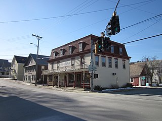
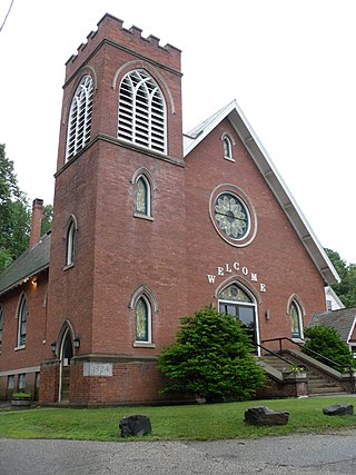
White River Junction Historic District is a historic district in the unincorporated village of White River Junction, within the town of Hartford, Vermont. It was first listed on the National Register of Historic Places in 1980, and its boundaries were increased in 2002 and 2019. It originally encompassed the central portion of the village's business district, and was then expanded to include a broader array of resources.

The Waterville Village Historic District encompasses most of the history 19th and early 20th-century village center of Waterville, Vermont. The village grew from beginnings late in the 18th century to serve as a modest civic, commercial, and residential hub for the rural community. It was added to the National Register of Historic Places in 2007.

West Dover is a village in the central part of Dover, Vermont. The village center, located on Vermont Route 100 at Cross Town and Valley View Roads, was listed on the National Register of Historic Places in 1985 as the West Dover Historic District. The village is a major service point for the nearby Mount Snow ski area. The ZIP Code for West Dover is 05356
The Dublin Village Historic District encompasses the historic village center of Dublin, New Hampshire. Dublin's center developed in the 19th century after its original village center was abandoned due to harsher winter conditions nearer Dublin Pond. The district extends along Main Street from its junction with Lake Street in the west to the junction with Old County Road in the east, and includes sections of Old Common Road, Harrisville Road, and Church Street. The district was listed on the National Register of Historic Places in 1983.

The Brattleboro Downtown Historic District encompasses most of the central business district of the town of Brattleboro, Vermont. Extending along Main Street between Whetstone Brook and a junction with Pultney Road and Linden and Walnut Streets, this area includes many of the town's prominent civic and institutional buildings. The area's development took place primarily in the 19th century, with surviving buildings from both the 18th and early 20th centuries. The district was listed on the National Register of Historic Places in 1983, and was enlarged in 2004 to include Plaza Park and the Holstein Building on the south side of Whetstone Brook.
The Wilmington Village Historic District encompasses a significant portion of the village center of Wilmington, Vermont. The village grew as a crossroads industrial center through the mid-19th century, and experienced relatively little growth afterward. The district was listed on the National Register of Historic Places in 1980.

The Dorset Village Historic District encompasses a significant portion of the village center of Dorset, Vermont. Centered at the junction of Church Street, Kent Hill Road, and Vermont Route 30, the village was developed between the late 18th and early 20th centuries, and has a number of well-preserved unusual features, including sidewalks of marble from local quarries. The district was listed on the National Register of Historic Places in 1985, and was enlarged to the west in 1997.
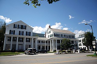
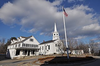
The Equinox House Historic District encompasses the historic center of the village of Manchester, Vermont. It includes a small group of civic and commercial buildings around the junction of Main Street and Union Street, with the luxury Equinox House hotel as its primary focus. The district, developed as a tourist destination in the late 1800s, was listed on the National Register of Historic Places in 1972, and enlarged in 1980. It is a small portion of the Manchester Village Historic District.

The Wallingford Main Street Historic District encompasses the historic portions of the village of Wallingford, Vermont. An essentially linear district extending along Main Street on either side of School Street, it has a well-preserved array of 19th and early-20th century residential, commercial, and civic buildings. It was listed on the National Register of Historic Places in 1984.

The South Royalton Historic District encompasses the central portion of the village of South Royalton, Vermont. Now the town of Royalton's principal commercial center, it developed in the second half of the 19th century around the depot of the Vermont Central Railroad. The district includes fine examples of Greek Revival and Victorian architecture, and is home to the Vermont Law School. It was listed on the National Register of Historic Places in 1976.
The Springfield Downtown Historic District encompasses the historic central business district of the town of Springfield, Vermont. Located in a narrow valley on the banks of the Black River, the town's architecture is primarily reflective of its importance as a manufacturing center in the late 19th and early-to-mid 20th centuries, with a cluster of commercial buildings surrounded by residential and industrial areas. It was listed on the National Register of Historic Places in 1983, and enlarged slightly in 1986.

The Downtown Essex Junction Commercial Historic District encompasses the historically railroad-dominated portion of downtown Essex Junction, Vermont. Aligned along the south side of Railroad Avenue and adjacent portions of Main Street, the area underwent most of its development between 1900 and 1940, when Essex Junction served as a major regional railroad hub. The district was listed on the National Register of Historic Places in 2004.
The Jericho Village Historic District encompasses the historic industrial and commercial center of the village of Jericho, Vermont. Stretched along Vermont Route 15 south of Browns River, which powered the village's industries for many years, the village center includes a well-preserved array of 19th and early 20th-century buildings. The district was listed on the National Register of Historic Places in 1992.

The Plainfield Village Historic District encompasses a significant portion of the village of Plainfield, Vermont. Located in northernmost Plainfield on United States Route 2, the village grew in the 19th century as a mill town and service community for the surround agricultural areas, and has a well-preserved collection of Greek Revival and Italianate architecture. It was listed on the National Register of Historic Places in 1983.

The Waitsfield Village Historic District encompasses much of the main village center of Waitsfield, Vermont. Extending along Vermont Route 100 on either side of Bridge Street, it is a well-preserved example of a 19th-century village, with only a few sympathetic 20th-century additions. It was listed on the National Register of Historic Places in 1983.

The Warren Village Historic District encompasses the village center of Warren, Vermont, United States. Stretched mainly along Main Street east of the Mad River, it is a well-preserved 19th-century mill village, although most of its period mill infrastructure has been lost. The district has good examples of Greek Revival, Italianate, and Second Empire architecture. It was listed on the National Register of Historic Places in 1992.

The Waterbury Village Historic District encompasses most of the central commercial and residential area of Waterbury, Vermont. Located along United States Route 2 and Stowe Street south of Thatcher Branch of the Winooski River, the sprawling village has been shaped by changes in transportation in the 19th and 20th centuries, and by key economic developments such as the founding of the Vermont State Hospital, which anchors the village's southern end. The district was listed on the National Register of Historic Places in 1978.

The Downtown Hardwick Village Historic District encompasses a significant portion of the downtown area of Hardwick, Vermont. The town developed in the 19th century first as a small industrial center, and later became one of the world's leading processors of granite. The district was listed on the National Register of Historic Places in 1982.


