
White River Junction is an unincorporated village and census-designated place (CDP) in the town of Hartford in Windsor County, Vermont, United States. The population was 2,528 at the 2020 census, up from 2,286 in 2010, making it the largest community within the town of Hartford.

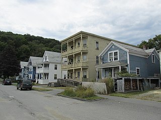
Wilder is an unincorporated village and census-designated place (CDP) within the town of Hartford in Windsor County, Vermont, United States. It is the location of the Wilder Dam on the Connecticut River. The population of the CDP was 1,690 at the 2010 census. The village center is an early example of a planned mill community, and was listed on the National Register of Historic Places as the Wilder Village Historic District in 1999.

The Upper Eastside is a neighborhood in Miami, Florida. It is north of Edgewater, east of Little Haiti, south of the village of Miami Shores, and sits on Biscayne Bay. In geographical order from south to north and east to west, it contains the subdivisions of Magnolia Park, Bay Point, Morningside, Bayside, Belle Meade, Shorecrest, and Palm Grove. The MiMo District along Biscayne Boulevard in the area is host to many art galleries, shops and restaurants.

White River Junction Historic District is a historic district in the unincorporated village of White River Junction, within the town of Hartford, Vermont. It was first listed on the National Register of Historic Places in 1980, and its boundaries were increased in 2002 and 2019. It originally encompassed the central portion of the village's business district, and was then expanded to include a broader array of resources.

The Bellows Falls Neighborhood Historic District encompasses a residential area of the village of Bellows Falls, Vermont. Located south of downtown Bellows Falls, the area has one of the largest concentrations of well-preserved 19th century residences in southern Vermont. It was listed on the National Register of Historic Places in 2002, and enlarged in 2007.

The George–Pine–Henry Historic District encompasses a residential area of the village of Bellows Falls, Vermont. Located west of downtown Bellows Falls, the area has a significant concentration of well-preserved late 19th and early 20th-century residences. It was listed on the National Register of Historic Places in 2010.

The Rockingham Village Historic District encompasses the traditional village center of the town of Rockingham, Vermont. Settled in the 18th century, the district, located mainly on Meeting House Road off Vermont Route 103, includes a variety of 18th and 19th-century houses, and has been little altered since a fire in 1908. It notably includes the 18th-century National Historic Landmark Rockingham Meeting House. The district was listed on the National Register of Historic Places in 2008.

The Westminster Terrace Historic District encompasses a locally architecturally distinctive residential area on Westminster Terrace in Bellows Falls and Westminster, Vermont. First developed between about 1880 and 1910, the neighborhood has high-quality late 19th-century homes, interspersed with later mid-20th century development. It was listed on the National Register of Historic Places in 2010.
The Williams Street Extension Historic District encompasses a locally architecturally distinctive residential area on Williams Street in Bellows Falls, a village of Rockingham, Vermont. Developed between about 1880 and 1930, the neighborhood has a collection of 15 historically significant well-preserved worker housing units. It was listed on the National Register of Historic Places in 2010.

The Poultney Main Street Historic District encompasses the commercial and residential historic core of the village of Poultney, Vermont. Centered on Main Street and East Main Street, between College Avenue and St. Raphael's Catholic Church, the district includes a diversity of architectural styles, as well as civic, religious, and commercial functions spanning a period of more than 100 years. The district was listed on the National Register of Historic Places in 1988.

The Wallingford Main Street Historic District encompasses the historic portions of the village of Wallingford, Vermont. An essentially linear district extending along Main Street on either side of School Street, it has a well-preserved array of 19th and early-20th century residential, commercial, and civic buildings. It was listed on the National Register of Historic Places in 1984.

The Depot Square Historic District encompasses the historic commercial business district of Randolph, Vermont. Developed in the mid-19th century around the facilities of the Central Vermont Railway, the area features a high concentration of well-preserved Second Empire and late Victorian commercial architecture. It was listed on the National Register of Historic Places in 1975.

The South Royalton Historic District encompasses the central portion of the village of South Royalton, Vermont. Now the town of Royalton's principal commercial center, it developed in the second half of the 19th century around the depot of the Vermont Central Railroad. The district includes fine examples of Greek Revival and Victorian architecture, and is home to the Vermont Law School. It was listed on the National Register of Historic Places in 1976.

The Weston Village Historic District encompasses the town center and principal village of Weston, Vermont. Centered on Farrar Park, which serves as the town green, it includes a diversity of architectural styles from the late 18th century to about 1935, and includes residential, civic, commercial, industrial and religious buildings. It was listed on the National Register of Historic Places in 1985.

The Buell Street–Bradley Street Historic District encompasses a small residential area just to the east of downtown Burlington, Vermont. Roughly bounded by Pearl, South Willard, and College Streets, and Orchard Terrace, the area was developed between about 1890 and 1910, representing one of the last significant neighborhoods built up near the downtown area. The district was listed on the National Register of Historic Places in 1995.

The Waterbury Village Historic District encompasses most of the central commercial and residential area of Waterbury, Vermont. Located along United States Route 2 and Stowe Street south of Thatcher Branch of the Winooski River, the sprawling village has been shaped by changes in transportation in the 19th and 20th centuries, and by key economic developments such as the founding of the Vermont State Hospital, which anchors the village's southern end. The district was listed on the National Register of Historic Places in 1978.

The Shelburne Village Historic District encompasses the central portion of the main village of Shelburne, Vermont. Centered on the junction of United States Route 7 with Harbor and Falls Roads, the district's architecture traces the town's history from the 18th to early 20th century. It was listed on the National Register of Historic Places in 1990.

The South Union Street Historic District encompasses a historic 19th-century residential neighborhood for the upper middle class in Burlington, Vermont. Developed along South Union Street between Main and Howard Streets, South Union grew between about 1835 and 1938 as a popular area for well-to-do yet middle class Burlingtonians, affording views of Lake Champlain to the west. The architecturally diverse district was listed on the National Register of Historic Places in 1988.

The St. Johnsbury Main Street Historic District encompasses the historic civic and cultural center of the town of St. Johnsbury, Vermont. Organized along the town's Main Street, it includes high-quality architecture spanning the 19th and early 20th centuries, and includes the National Historic Landmark St. Johnsbury Athenaeum. Many of the district's buildings were designed by Lambert Packard, a prominent local architect. The district was listed on the National Register of Historic Places in 1975, and was enlarged slightly in 1976. It was subsumed into the larger St. Johnsbury Historic District in 1980.

The Naugatuck Center Historic District encompasses the historic civic and business center of Naugatuck, Connecticut. Centered around the town green, the district includes churches, schools and municipal buildings, many from the late 19th or early 20th centuries, as well as a diversity of residential architecture. The district was listed on the National Register of Historic Places in 1999.


