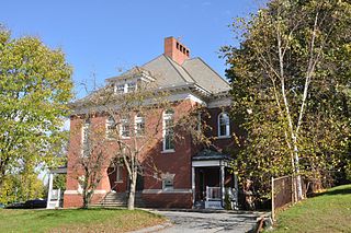
The South Britain Historic District encompasses the core of the unincorporated village of South Britain in Southbury, Connecticut, United States. The village arose in the 18th century as an industrial center serving the surrounding agricultural community, powered by the Pomperaug River, and rivalled the town center of Southbury in importance. It was listed on the National Register of Historic Places in 1987.

The Baldwinville Village Historic District encompasses the historic elements of the village of Baldwinville, a 19th-century mill village in northern Templeton, Massachusetts. Although its industrial elements have largely been lost, the district retains period housing and civic buildings. It was listed on the National Register of Historic Places in 1986.

The Springfield Street Historic District is a predominantly residential historic district south of the downtown area of Chicopee, Massachusetts. It encompasses a significant number of Queen Anne style houses built in the second half of the 19th century by wealthy residents of Chicopee, as well as housing for skilled workers at the nearby textile mills. It is centered where Springfield Street and Fairview Avenue meet. The district was listed on the National Register of Historic Places in 1991.

The Waterville Village Historic District encompasses most of the history 19th and early 20th-century village center of Waterville, Vermont. The village grew from beginnings late in the 18th century to serve as a modest civic, commercial, and residential hub for the rural community. It was added to the National Register of Historic Places in 2007.

The Water Street Historic District encompasses a historic commercial and industrial area on the west side of downtown Torrington, Connecticut. Extending roughly along Water and Church Streets between the Naugatuck River and Prospect Street, the district includes factory and commercial buildings, as well as the former Torrington Fire Department Headquarters and the civic Knights of Pythias building. Developed between about 1885 and 1920, the district was listed on the National Register of Historic Places in 2003.

The Main Street Historic District encompasses most of the historic central business district of Manchester, Connecticut. It runs along Main Street between Eldridge and Center Streets, including the cluster of civic and municipal buildings at Center Park. The district was largely built up between 1890 and 1940, and includes a remarkable concentration of high-quality Colonial Revival construction. The district was listed on the National Register of Historic Places in 1996.

The Tilton Downtown Historic District encompasses a roughly one-block section of Main Street in the center of Tilton, New Hampshire. It extends from Central Street in the west to Bridge and School Streets in the east, including all of the buildings on the north side of this section, and a cluster of buildings on the south side near Bridge Street. The area has long been a commercial and industrial center for the town, although most of the buildings now date from the late 19th century onward, and include a fine array of Victorian architecture. The district was listed on the National Register of Historic Places in 1983.

The Rochester Commercial and Industrial District encompasses the civic, commercial, and industrial heart of Rochester, New Hampshire. Oriented around the city's Central Square, the 6-acre (2.4 ha) district includes the city's major civic buildings, most of which are Classical Revival structures from the early 20th century, a number of commercial buildings dating as far back as the square's formation in the 1820s, and several late 19th-century industrial facilities. The district extends primarily along Main Street, from Bridge and Union Streets to Winter and Academy Streets, and includes properties extending along Wakefield and Hanson Streets, as well as other adjacent streets. The district was listed on the National Register of Historic Places in 1983.

The Brattleboro Downtown Historic District encompasses most of the central business district of the town of Brattleboro, Vermont. Extending along Main Street between Whetstone Brook and a junction with Pultney Road and Linden and Walnut Streets, this area includes many of the town's prominent civic and institutional buildings. The area's development took place primarily in the 19th century, with surviving buildings from both the 18th and early 20th centuries. The district was listed on the National Register of Historic Places in 1983, and was enlarged in 2004 to include Plaza Park and the Holstein Building on the south side of Whetstone Brook.

The Downtown Bennington Historic District encompasses the historic commercial heart of Bennington, Vermont. Centered on the junction of Main, South, and North Streets, it exhibits a variety of commercial architectural styles from the early 19th to mid-20th century. It was listed on the National Register of Historic Places in 1980, and was enlarged in 2008.

The Fair Haven Green Historic District encompasses the village green of Fair Haven, Vermont, and the heterogeneous collection of civic, commercial, and residential buildings that line it and adjacent streets. The area was developed mainly following the arrival of the railroad in 1848 and the subsequent expansion of marble and slate quarries in the area. The district was listed on the National Register of Historic Places in 1980.

The Bethel Village Historic District encompasses the historic core of the village of Bethel in the town of Bethel, Vermont, USA. The L-shaped district extends along Main and Church Streets, including many of the village's commercial and civic buildings, as well as a significant number of 19th and early 20th-century residences. The district was listed on the National Register of Historic Places in 1976, and was slightly enlarged in 1990.

The Vergennes Historic District encompasses the historic commercial and industrial heart of the city of Vergennes, Vermont. Incorporated in 1788, the city developed as a major industrial center, and served as a military center during the War of 1812. The district includes mainly 19th and early-20th century commercial, retail, residential and civic properties, as well as the former site of the Monkton Iron Works, once one of the nation's largest iron foundries. The district was listed on the National Register of Historic Places in 1976.

The Depot Square Historic District encompasses the historic commercial business district of Randolph, Vermont. Developed in the mid-19th century around the facilities of the Central Vermont Railway, the area features a high concentration of well-preserved Second Empire and late Victorian commercial architecture. It was listed on the National Register of Historic Places in 1975.

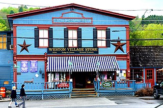
The Weston Village Historic District encompasses the town center and principal village of Weston, Vermont. Centered on Farrar Park, which serves as the town green, it includes a diversity of architectural styles from the late 18th century to about 1935, and includes residential, civic, commercial, industrial and religious buildings. It was listed on the National Register of Historic Places in 1985.

The Bristol Downtown Historic District encompasses the historic late 19th-century commercial heart of Bristol, Vermont. At first a rural agricultural market town, it developed in the second half of the 19th century as a small industrial center, producing finished wood products. Its downtown occupies an area of one block on both sides of Main Street, and features a diversity of architectural styles. It was listed on the National Register of Historic Places in 1983.

The Downtown Richford Historic District encompasses a cluster of commercial and industrial buildings at the center of Richford, Vermont. Centered on the junction of Main and River Streets are a cluster of mainly brick buildings, built between 1880 and 1920, with several industrial properties just across the Missisquoi River to the south, whose waters provided the power for the industries that fueled the town's growth. The district was listed on the National Register of Historic Places in 1980.

The Waitsfield Village Historic District encompasses much of the main village center of Waitsfield, Vermont. Extending along Vermont Route 100 on either side of Bridge Street, it is a well-preserved example of a 19th-century village, with only a few sympathetic 20th-century additions. It was listed on the National Register of Historic Places in 1983.

The St. Johnsbury Main Street Historic District encompasses the historic civic and cultural center of the town of St. Johnsbury, Vermont. Organized along the town's Main Street, it includes high-quality architecture spanning the 19th and early 20th centuries, and includes the National Historic Landmark St. Johnsbury Athenaeum. Many of the district's buildings were designed by Lambert Packard, a prominent local architect. The district was listed on the National Register of Historic Places in 1975, and was enlarged slightly in 1976. It was subsumed into the larger St. Johnsbury Historic District in 1980.

The Davenport Downtown Commercial Historic District is a nationally recognized historic district located in the central business district of Davenport, Iowa, United States. It was listed on the National Register of Historic Places in 2020. At the time of its nomination it consisted of 43 resources, which included 33 contributing buildings, one contributing structure, and nine non-contributing buildings. In addition, the district also contains 33 buildings that are individually listed on the National Register. This historic district is bordered by four other districts: the Crescent Warehouse Historic District and the Davenport Motor Row and Industrial Historic District on the east, the Hamburg Historic District to the northwest, and the West Third Street Historic District on the west.


