
West Hartford is an unincorporated community village in the town of Hartford, Windsor County, Vermont. It is the most rural of Hartford's five villages, situated on the White River and crossed by the Appalachian Trail.
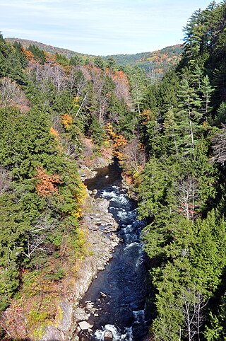
Quechee is a census-designated place and one of five unincorporated villages in the town of Hartford, Windsor County, Vermont, United States. As of the 2010 census, the population of the CDP was 656. It is the site of Quechee Gorge on the Ottauquechee River and is also the home to the Quechee Lakes planned community, initiated in the late 1960s, which also brought to the community the small Quechee Lakes Ski Area in the 1970s.

The Ottauquechee River is a 41.4-mile-long (66.6 km) river in eastern Vermont in the United States. It is a tributary of the Connecticut River, which flows to Long Island Sound.
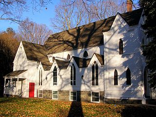
The Pine Meadow Historic District encompasses most of the historic 19th-century village of Pine Meadow in New Hartford, Connecticut. Located at a bend in the West Branch of the Farmington River southeast of New Hartford center, it is a well-preserved example of a rural industrial village. The district was listed on the National Register of Historic Places in 1996.

The Taftsville Historic District encompasses a historic 19th-century industrial village that is mostly in Woodstock, Vermont. Flanking the Ottauquechee River and extending up Happy Valley Road, the area developed around a metal tool factory established by members of the Taft family in 1793. Important elements from its early history include the Taftsville Store, built by the Taft family in 1840, and the Taftsville Covered Bridge, built in 1836. The district was listed on the National Register of Historic Places in 2001.

The Waterville Village Historic District encompasses most of the history 19th and early 20th-century village center of Waterville, Vermont. The village grew from beginnings late in the 18th century to serve as a modest civic, commercial, and residential hub for the rural community. It was added to the National Register of Historic Places in 2007.

The Bennington Village Historic District of Bennington, New Hampshire encompasses the 19th-century center of the village. Growth of the village followed a typical pattern for rural New Hampshire towns, based in this case around the growth in the early 19th century of the paper industry, which continues to be a significant economic force in the community. The district is centered on the junctions of Main, Center, and School Streets with Bible Hill Road and Francestown Road. The district was listed on the National Register of Historic Places in 2010.

The Green River Crib Dam is a historic 19th-century dam on the Green River in western Guilford, Vermont. Built about 1811, it is a reminder of the modest industrial enterprises once conducted in the area using the water power it provided, and is one of the state's few surviving crib dams. It was listed on the National Register of Historic Places in 1995.

The Putney Village Historic District encompasses most of the main village and town center of Putney, Vermont. Settled in the 1760s, the village saw its major growth in the late 18th and early 19th century, and includes a cohesive collection with Federal and Greek Revival buildings, with a more modest number of important later additions, including the Italianate town hall. The district was listed on the National Register of Historic Places in 1986.

The Rockingham Village Historic District encompasses the traditional village center of the town of Rockingham, Vermont. Settled in the 18th century, the district, located mainly on Meeting House Road off Vermont Route 103, includes a variety of 18th and 19th-century houses, and has been little altered since a fire in 1908. It notably includes the 18th-century National Historic Landmark Rockingham Meeting House. The district was listed on the National Register of Historic Places in 2008.
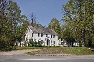
West Townshend is an unincorporated village in Townshend, Vermont, United States. It is on the north side of a bend in the West River, upriver of the Townshend Dam. The entire village is listed on the National Register of Historic Places as the West Townshend Village Historic District. Its ZIP codes are 05359 and 05353.

The Theron Boyd Homestead is a historic farm property on Hillside Road in Hartford, Vermont. The centerpieces of the 30-acre (12 ha) property are a house and barn, each built in 1786. The house, little altered since its construction, is one of the finest early Federal period houses in the state. The property is owned by the state, which has formulated plans to open it has a historic site. It was listed on the National Register of Historic Places in 1993.
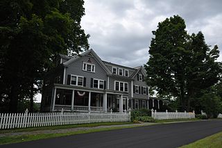
The Dewey House is a historic house at 173 Deweys Mills Road in Hartford, Vermont. Built in 1876 by a local mill owner, and remodeled in 1903, it is a high quality local example of residential Colonial Revival architecture. It was listed on the National Register of Historic Places in 1999.
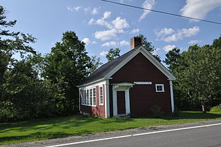
The Jericho Rural Historic District encompasses a rural agricultural landscape of northern Hartford, Vermont, extending slightly into neighboring Norwich. The area covers 774 acres (313 ha) of mainly agricultural and formerly agricultural lands, as well as associated woodlots, and includes nine historically significant farm complexes. It was listed on the National Register of Historic Places in 2001.

The Joseph and Daniel Marsh House is a historic farmstead at 1119 Quechee Main Street, just outside the village Quechee in Hartford, Vermont. Built in 1793, it was the home of Joseph Marsh, one of Hartford's early settlers and the first Lieutenant Governor of Vermont. Now the Quechee Inn, the property was listed on the National Register of Historic Places in 1998.
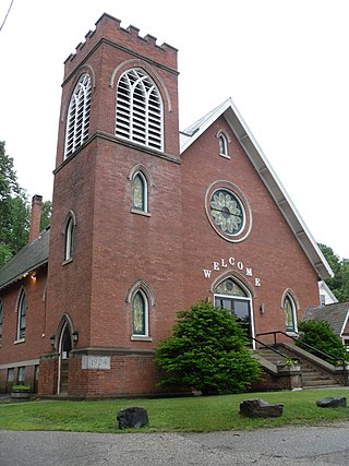
The Springfield Downtown Historic District encompasses the historic central business district of the town of Springfield, Vermont. Located in a narrow valley on the banks of the Black River, the town's architecture is primarily reflective of its importance as a manufacturing center in the late 19th and early-to-mid 20th centuries, with a cluster of commercial buildings surrounded by residential and industrial areas. It was listed on the National Register of Historic Places in 1983, and enlarged slightly in 1986.

The Jedediah Strong II House is a historic house at the junction of Quechee Main Street and Dewey's Mill Road in Hartford, Vermont. Built in 1815 by a local mill owner, it is a fine local example of a high-style Federal period brick house. It was listed on the National Register of Historic Places in 1974. It now houses professional offices.
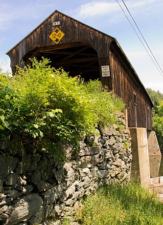
The Willard Covered Bridge is a historic covered bridge carrying Mill Street across the Ottauquechee River in Hartland, Vermont. It is the eastern of two covered bridges on the road, which are connected via a small island in the river; the western bridge was built in 2001. This bridge, built about 1870, was listed on the National Register of Historic Places in 1973.

The Warren Village Historic District encompasses the village center of Warren, Vermont, United States. Stretched mainly along Main Street east of the Mad River, it is a well-preserved 19th-century mill village, although most of its period mill infrastructure has been lost. The district has good examples of Greek Revival, Italianate, and Second Empire architecture. It was listed on the National Register of Historic Places in 1992.
The Moscow Village Historic District encompasses a former 19th-century industrial village in southern Stowe, Vermont. Centered on the Little River at its Moscow Road crossing, the village prospered into the early 20th century as a woodworking center. It was listed on the National Register of Historic Places in 2008.


