Lake Champlain is a natural freshwater lake in North America. It mostly lies between the U.S. states of New York and Vermont, but also extends north into the Canadian province of Quebec.
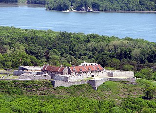
Fort Ticonderoga, formerly Fort Carillon, is a large 18th-century star fort built by the French at a narrows near the south end of Lake Champlain in northern New York. It was constructed between October 1755 and 1757 by French-Canadian military engineer Michel Chartier de Lotbinière, Marquis de Lotbinière during the action in the "North American theater" of the Seven Years' War, known as the French and Indian War in America. The fort was of strategic importance during the 18th-century colonial conflicts between Great Britain and France, and again played an important role during the American Revolutionary War.

Crown Point is a town in Essex County, New York, United States, located on the west shore of Lake Champlain. The population was 2,024 at the 2010 census. The name of the town is a direct translation of the original French name, Pointe à la Chevelure.

Ticonderoga is a town in Essex County, New York, United States. The population was 5,042 at the 2010 census. The name comes from the Mohawk tekontaró:ken, meaning "it is at the junction of two waterways".

Orwell is a town in Addison County, Vermont, United States. The population was 1,239 at the 2020 census. Mount Independence was the largest fortification constructed by the American colonial forces. The 300-acre (1.2 km2) site is now one of Vermont's premier state-operated historic sites.

The Champlain Valley is a region of the United States around Lake Champlain in Vermont and New York extending north slightly into Quebec, Canada. It is part of the St. Lawrence River drainage basin, drained northward by the Richelieu River into the St. Lawrence at Sorel-Tracy, Quebec. The Richelieu valley is not generally referred to as part of the Champlain Valley.

Fort Saint-Frédéric was a French fort built on Lake Champlain to secure the region against British colonization and control the lake. It was located in modern New York State across the lake from modern Vermont at the town of Crown Point, New York. The fort, whose construction began in 1734, was never attacked, and was destroyed in 1759 before the advance of a large British army under General Jeffery Amherst.

Fort Crown Point was built by the combined efforts of British and Colonial troops from New York and the New England Colonies in 1759 at a narrows on Lake Champlain on the border between New York and Vermont. It was erected to secure the region against the French in upstate New York near the town of Crown Point, and it was the largest earthen fortress built in the American colonies. The fort's ruins are a National Historic Landmark administered as part of Crown Point State Historic Site.
Chimney Point is a peninsula in the town of Addison, Vermont, which juts into Lake Champlain forming a narrows. It is one of the earliest settled and most strategic sites in the Champlain Valley.

Otter Creek is the longest river entirely contained within the borders of Vermont. Roughly 112 miles (180 km) long, it is the primary watercourse running through Rutland County and Addison County. The mouth of the river flows into Lake Champlain.

Wilgus State Park is a state park in Ascutney, Vermont. The park offers canoeing along the Connecticut River and hiking up the Pinnacle Trail. The park has tent and lean-to sites and is quite close to Mount Ascutney and the Saint-Gaudens National Historic Site. The park was originally constructed by the Civilian Conservation Corps (CCC) and is now administered by the Vermont Department of Forests, Parks, and Recreation as part of the Vermont state park system. It is named after William J. Wilgus, who donated the land for the park in 1933. The park is listed on the National Register of Historic Places for its well-preserved CCC infrastructure.
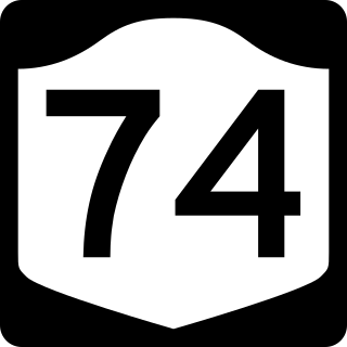
New York State Route 74 (NY 74) and Vermont Route 74 (VT 74) are state highways in the northeastern United States, connected by one of the last remaining cable ferries in North America. Together they extend for 34 miles (55 km) through Essex County, New York, and Addison County, Vermont. NY 74 begins at exit 28 off Interstate 87 (I-87) in the hamlet of Severance in the Adirondack Mountains region of the northern part of New York State. It extends 20.44 miles (32.89 km) to the western shore of Lake Champlain in Ticonderoga. There, the seasonal Fort Ticonderoga–Larrabees Point Ferry carries cars across the state border into Vermont, where VT 74 starts at the lake's eastern shore and terminates 13.26 miles (21.34 km) later at a junction with VT 30 in the town of Cornwall.

The Black River is a 40.8-mile-long (65.7 km) river in the U.S. state of Vermont, and a tributary of the Connecticut River. The river's watershed consists of approximately 202 square miles (520 km2) in southeastern Vermont, almost all of which lies in Windsor County.

Mount Independence on Lake Champlain in Orwell, Vermont, was the site of extensive fortifications built during the American Revolutionary War by the American army to stop a British invasion. Construction began in July 1776, following the American defeat in Canada, and continued through the winter and spring of 1777. After the American retreat on July 5 and 6, 1777, British and Hessian troops occupied Mount Independence until November 1777.

The noble train of artillery, also known as the Knox Expedition, was an expedition led by Continental Army Colonel Henry Knox to transport heavy weaponry that had been captured at Fort Ticonderoga to the Continental Army camps outside Boston during the winter of 1775–76.

The Hubbardton Military Road was originally a trail cut through the wilderness of western Vermont, during the American Revolutionary War to connect fortifications on Lake Champlain with existing roads and frontier settlements, so that the Continental Army could be reinforced and supplied.

The Fort Vengeance Monument Site is an archaeological and commemorative site on United States Route 7 in northern Pittsford, Vermont. The site includes the archaeological remains of one of Vermont's oldest documented homesteads, and the only surviving site of a military fortification of the American Revolutionary War. The site is marked by a stone memorial placed in 1873, and was listed on the National Register of Historic Places in 2006.
Mount Ascutney State Park is a state park in the U.S. state of Vermont. The park entrance is located along Vermont Route 44-A near the town of Windsor in Windsor County. Operated by the Vermont Department of Forests, Parks and Recreation, a significant portion of the park is listed on the National Register of Historic Places.
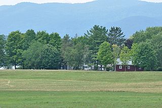
Hand's Cove is a historically significant geographic feature on the eastern shore of Lake Champlain in Shoreham, Vermont. It was from this area that colonial forces led by Ethan Allen and Benedict Arnold crossed the lake for the Capture of Fort Ticonderoga, early in the American Revolutionary War. It is also home to the only known colonial-era blockhouse in the state. It was listed on the National Register of Historic Places in 1980.

The Cornish Wildlife Management Area is one of 124 New Hampshire State Wildlife Management Areas (WMAs). It is located in Cornish and covers 29 acres.