Ascutney Mill Dam

Last updated

Windsor Upper Dam
Ascutney Mill.jpg
Windsor Upper Dam
LocationWindsor, Vermont
Coordinates 43°28′36″N72°23′46″W / 43.47667°N 72.39611°W / 43.47667; -72.39611
Construction beganJune 1834 (1834-06)
Opening dateNovember 1834 (1834-11)
Operator(s)Ascutney Mill Dam Company
Dam and spillways
ImpoundsMill Brook
Height40 ft (12 m)
Length250 ft (76 m)
Width (base)36 ft (11 m)
Ascutney Mill Dam Historic District
USA Vermont location map.svg
Red pog.svg
Usa edcp location map.svg
Red pog.svg
Location55 and 57 Ascutney St.,
Windsor, Vermont
Area4.8 acres (1.9 ha)
Built1783
ArchitectSimeon Cobb
Architectural styleFederal-Greek Revival
NRHP reference No. 06001236 [1]
Added to NRHPJanuary 9, 2007

Ascutney Mill Dam, also known as the Windsor Upper Dam and the Mill Pond Dam, is an arch-gravity dam which is one of the oldest and among the earliest storage dams in the United States. It is made of cut granite and is located in Windsor, Vermont in Windsor County near the Connecticut River, where it functioned as a source of hydropower and, later, hydroelectric power. It is on the ASCE list of historic civil engineering landmarks since 1970 [2] and is listed on the National Register of Historic Places (as Ascutney Mill Dam Historic District) since January 09, 2007. [1]

Contents

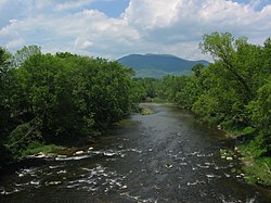
The dam is built in the valley of the Mill Brook, a right tributary of the Connecticut River. The pond above the dam is known as the Mill Pond.

The Ascutney Mill Dam Company was formed to build the dam. Construction began in June 1834, and was finished in November. The purpose of the dam was to regulate seasonal water flow and provide hydropower for nearby sawmills and gristmills, which previously could not operate during periods of low water flow in Mill Brook. The dam allowed water to be stored in the impound during the winter for release during lower flow seasons. [3]

Ithamar A. Beard was a New England engineer who surveyed the area and selected the site for the dam. Simeon Cobb and Joseph Mason were the contractors in charge of building the dam. [3] [4]

Background

History and planning

The Mill Pond Mill Pond.jpg
The Mill Pond

As early as 1767, several sawmills and gristmills were operating along the banks of Mill Brook in Windsor. However, during periods of low water flow the mills stood idle. [3] Like many early towns, their location was often selected on the availability of such a resource. Water-powered mills have been used to save human labor since ancient times, but like all renewable energy resources, their power is not always available when needed. [5] Sawmills were needed to provide boards for construction, and gristmills were necessary to ground grain into flour. In post-colonial Vermont, these mills were essential for the building and food supply needs of the growing cities.

The Ascutney Mill Dam Company was formed in 1833 to build the dam; it was the owner and was responsible for the dam's maintenance and operation. Despite problems during the financial panic of 1837, the company continued to operate the dam throughout the 19th century. [4] Ithamar A. Beard was the engineer who surveyed the area and made the suggestion for the dam site.

The dam was constructed from mid-April 1834 to mid-November 1834. It was built of cut granite and was one of the first gravity-arch dams built in the United States. It is possibly the oldest masonry dam in the U.S. of any significant size. The original dam had a near-vertical downstream face built in an arch form.

Water filled up behind the dam each winter and was allowed to flow over the spillway the following spring. Water and ice falling over the crest and 40 feet (12 m) to the ledge below caused noise and vibrations throughout the village which concerned citizens. Inspections found that the vibrations caused no damage to the dam, but a stone buttress was built below the dam to stop the vibrations. [3]

Construction

Construction began in April 1834. Simeon Cobb and Joseph Mason were the contractors in charge of building the dam, and Allen Wardner, a prominent Windsor businessman and banker, superintended the work. [6] The first step was to remove a small dam on the site. In June the first granite blocks were placed. The granite was obtained from nearby quarries. The overall construction was fairly simple and finished in November 1834, just seven months after construction began. [7] The finished product was a 40 ft (12 m) high and 76.25 ft (23.24 m) long dam. The elevation above mean sea level is 115 ft (35 m). [8]

Condition

The National Program for Inspection of Non-Federal Dams performed an inspection of the dam in September 1978. The report was a Phase I inspection report from the Corps of engineers in Waltham, Massachusetts, New England division. The abstract of the report writes:

"The dam is considered to be in fair condition. The dam is believed to be safe under normal operating conditions. The test flood is the PMF. It is recommended that the owner engage the services of a qualified consultant to evaluate the stability of the dam. In addition to long term recommendations, there are several remedial measures which should be implemented."

The current policy of the state of Vermont Department of Environmental Conservation requires that only dams that are capable of impounding more than 500,000 cubic feet (14,000 m3) need to be inspected. The Upper Windsor Dam does not fall within this category. [9]

In the twentieth century, a concrete coping was placed on top of the structure to help ensure its stability in times of flood. The dam retains much of its original structure even though it is one of the oldest dams in the United States. [4]

Topographic information

Topographic Map of Windsor, Vermont Windor topographic.jpg
Topographic Map of Windsor, Vermont
Ascutney Ascutney.jpg
Ascutney

For the United States Geological Survey (USGS), the dam is sourced in the Windsor Windsor quad. [10] The topographic map shows the mountainous terrain of the area. In fact, Windsor County, Vermont is home to a total of 202 mountain summits and peaks. The highest is Gillespie Peak which is at an elevation of 3,343 ft (1,019 m) above sea level. [11] The peak flow in the rivers near uneven terrain could fluctuate vastly between periods of high and low precipitation because much of the rainfall flows down to a discharge rather than infiltrating into the ground as it would in flat terrain. This flow could cause a large increase in flow rate and river height in a fairly small amount of time.[ citation needed ] The fact that the Connecticut River was just a few miles away also played a role in this. Because of all this, the timing of opening and closing the dam to regulate flow and produce hydroelectric power was important.

Nearby areas

Nearby Cities and TownsDistance
Windsor, VT<.1 mile
Cornish Mills, NH1.4 miles (2.3 km) ESE
Cornish City, NH2.4 miles (3.9 km) ESE
Squag City, NH3.1 miles (5.0 km) NNE
Balloch, NH3.1 miles (5.0 km) S
Cornish Center, NH3.9 miles (6.3 km) E
Brownsville, VT3.9 miles (6.3 km) W
Hartland, VT4.3 miles (6.9 km) N
Plainfield, NH4.5 miles (7.2 km) NNE
South Cornish, NH4.7 miles (7.6 km) ESE

Fishing

The Windsor Upper Dam area is a popular fishing spot, both fly fishing and baitcasting. Local fish include bluegill, brook trout and rock bass. Fishing is open to the public but a Vermont fishing license is required. [12]

Footnotes

  1. 1 2 "National Register Information System". National Register of Historic Places . National Park Service. March 13, 2009.
  2. "Windsor Town Plan" (PDF). swcrpc.org. Windsor, Vermont. September 30, 2014. Archived from the original (PDF) on December 30, 2016. Retrieved May 3, 2012.
  3. 1 2 3 4 "Ascutney Mill Dam". American Society of Civil Engineers. Retrieved December 7, 2021.
  4. 1 2 3 Jackson, Donald C. Great American Bridges and Dams, John Wiley & Sons, New York (USA), ISBN   0-471-14385-5, 1984; pp. 106–107.
  5. Dworsky, Leonard B. (1962). The Nation and its Water Resources. United States Public Health Service, Division of Water Supply and Pollution Control.
  6. Hamilton Child, Gazetteer and Business Directory of Windsor County, Vt., for 1883-84, Volume 1, 1884, page 274
  7. Jackson, Donald C. Great American Bridges and Dams, John Wiley & Sons, New York (USA), ISBN   0-471-14385-5, 1984; pp. 106-107.
  8. "GNIS Account Login". geonames.usgs.gov. Retrieved May 19, 2017.
  9. "Inspection Program | Department of Environmental Conservation". dec.vermont.gov. Retrieved May 19, 2017.
  10. "Topographic Map - TopoZone". TopoZone. Retrieved May 19, 2017.
  11. "Mountains in USA - MountainZone". MountainZone. Retrieved May 19, 2017.
  12. "HookandBullet.com: Fishing Charters, Guides & Trips, Hunting Trips, and Fishing Spots". www.hookandbullet.com. Retrieved May 19, 2017.

Further reading

McCullough, Donald C. Jackson; foreword by David (1988). Great American bridges and dams . Washington, D.C. : New York: Preservation Press, J. Wiley. ISBN   0-471-14385-5.{{cite book}}: CS1 maint: multiple names: authors list (link)

Related Research Articles

<span class="mw-page-title-main">Hydropower</span> Power generation via movement of water

Hydropower, also known as water power, is the use of falling or fast-running water to produce electricity or to power machines. This is achieved by converting the gravitational potential or kinetic energy of a water source to produce power. Hydropower is a method of sustainable energy production. Hydropower is now used principally for hydroelectric power generation, and is also applied as one half of an energy storage system known as pumped-storage hydroelectricity. Hydropower is an attractive alternative to fossil fuels as it does not directly produce carbon dioxide or other atmospheric pollutants and it provides a relatively consistent source of power. Nonetheless, it has economic, sociological, and environmental downsides and requires a sufficiently energetic source of water, such as a river or elevated lake. International institutions such as the World Bank view hydropower as a low-carbon means for economic development.

<span class="mw-page-title-main">Mammoth Spring</span> Spring in Arkansas

Mammoth Spring is a large, first magnitude karst spring that arises in the Ozark Plateau within the state of Arkansas. It is the largest spring in Arkansas and the third-largest spring within the Ozark Plateau region behind Big Spring and Greer Spring. Mammoth Spring is the seventh-largest natural spring in the world.

<span class="mw-page-title-main">Pit River</span> River in California, United States

The Pit River is a major river draining from northeastern California into the state's Central Valley. The Pit, the Klamath and the Columbia are the only three rivers in the U.S. that cross the Cascade Range.

<span class="mw-page-title-main">Deerfield River</span> River in Vermont and Massachusetts, United States

Deerfield River is a river that runs for 76 miles (122 km) from southern Vermont through northwestern Massachusetts to the Connecticut River. The Deerfield River was historically influential in the settlement of western Franklin County, Massachusetts, and its namesake town. It is the Connecticut River's second-longest tributary in Massachusetts, 2.1 miles (3.4 km) shorter than Metropolitan Springfield's Westfield River.

<span class="mw-page-title-main">Winooski River</span> River in Vermont, United States

The Winooski River is a tributary of Lake Champlain, approximately 90 miles (145 km) long, in the northern half of Vermont. Although not Vermont's longest river, it is one of the state's most significant, forming a major valley way from Lake Champlain through the Green Mountains towards the Connecticut River valley.

<span class="mw-page-title-main">Lamprey River</span> River in New Hampshire, United States

<span class="mw-page-title-main">Kaweah River</span> River in the United States of America

The Kaweah River is a river draining the southern Sierra Nevada in Tulare County, California in the United States. Fed primarily by high elevation snowmelt along the Great Western Divide, the Kaweah begins as four forks in Sequoia National Park, where the watershed is noted for its alpine scenery and its dense concentrations of giant sequoias, the largest trees on Earth. It then flows in a southwest direction to Lake Kaweah – the only major reservoir on the river – and into the San Joaquin Valley, where it diverges into multiple channels across an alluvial plain around Visalia. With its Middle Fork headwaters starting at almost 13,000 feet (4,000 m) above sea level, the river has a vertical drop of nearly two and a half miles (4.0 km) on its short run to the San Joaquin Valley, making it one of the steepest river drainages in the United States. Although the main stem of the Kaweah is only 33.6 miles (54.1 km) long, its total length including headwaters and lower branches is nearly 100 miles (160 km).

<span class="mw-page-title-main">Lake Waukewan</span>

Lake Waukewan is a 928-acre (3.76 km2) water body located in Belknap County in the Lakes Region of central New Hampshire, United States, in the towns of Meredith and New Hampton. The town of Center Harbor occupies part of the lake's northern shoreline.

<span class="mw-page-title-main">Westfield River</span> River in Massachusetts, United States

The Westfield River is a major tributary of the Connecticut River located in the Berkshires and Pioneer Valley regions of western Massachusetts. With four major tributary branches that converge west of the city of Westfield, it flows 78.1 miles (125.7 km) before its confluence with the Connecticut River at Agawam, across from the city of Springfield's Metro Center district. Known for its whitewater rapids and scenic beauty, the Westfield River provides over 50 miles (80 km) of whitewater canoeing and kayaking, in addition to one of the largest roadless wilderness areas remaining in the Commonwealth.

<span class="mw-page-title-main">Mousam River</span> River in the United States

The Mousam River is a 29.7-mile-long (47.8 km) river in York County, Maine, United States. Its primary source is Mousam Lake, located between the towns of Shapleigh and Acton, and it flows into the Atlantic Ocean just west of Kennebunk Beach. It flows through the towns of Shapleigh, Sanford and Kennebunk.

<span class="mw-page-title-main">Vermont Route 44</span> State highway in Windsor County, Vermont, US

Vermont Route 44 (VT 44) is a state highway in the U.S. state of Vermont. The highway runs 10.190 miles (16.399 km) from VT 106 in Reading east to U.S. Route 5 (US 5) and VT 12 in Windsor. VT 44 passes through West Windsor in southern Windsor County, serving the area north of Mount Ascutney. The highway has an auxiliary route, VT 44A, which provides access to Mount Ascutney State Park and connects VT 44 with Interstate 91 (I-91) in Weathersfield. VT 44 was established in 1958 along the highway between Reading and Windsor. The three towns had previously maintained the highway with support from the state for construction and maintenance, including reconstruction along several segments in the 1940s. The state paved VT 44 in the early 1970s and early 1980s. VT 44A was established in 1987 when part of VT 44 in Windsor was returned to town maintenance.

<span class="mw-page-title-main">Wallpack Valley</span>

Wallpack Valley is a valley located in Sussex County in northwestern New Jersey formed by Wallpack Ridge on the west, and Kittatinny Mountain on the east. Wallpack Ridge separates the Wallpack Valley from the valley of the Delaware River, and contains the watershed of the Flat Brook and its main tributaries Big Flat Brook and Little Flat Brook. It is a narrow valley, roughly 25 miles (40 km) in length running from Montague Township south of Port Jervis, New York to the Walpack Bend in the Delaware River near Flatbrookville in Walpack Township where the Flat Brook enters the Delaware at 300 feet above sea level.

<span class="mw-page-title-main">Mill at Freedom Falls</span> United States historic place

The Mill at Freedom Falls is a historic mill complex at Mill and Pleasant Streets in Freedom, Maine. The main building, constructed in 1834, is the only mill built at this site, and the only one to survive nearly unaltered in the village. The mill and its surviving dam were listed on the National Register of Historic Places.

<span class="mw-page-title-main">West Townshend, Vermont</span> United States historic place

West Townshend is an unincorporated village in Townshend, Vermont, United States. It is on the north side of a bend in the West River, upriver of the Townshend Dam. The entire village is listed on the National Register of Historic Places as the West Townshend Village Historic District. Its ZIP codes are 05359 and 05353.

<span class="mw-page-title-main">Whitingham Village Historic District</span> Historic district in Vermont, United States

The Whitingham Village Historic District encompasses much of the current village center of Whitingham, Vermont. It was developed mainly in the second half of the 19th century around industries powered by local water sources, and includes well-preserved architecture from that period. It was listed on the National Register of Historic Places in 2006.

<span class="mw-page-title-main">Bridgewater Woolen Mill</span> United States historic place

The Bridgewater Woolen Mill, now more commonly the Bridgewater Mill Mall, is a historic textile mill complex on United States Route 4 in Bridgewater and Woodstock, Vermont. With an textile processing history dating from 1828 to 1975, it was one of the state's longest-lived textile operations, and was a mainstay of the local economy during that period. It has since been repurposed into a shopping center. It was listed on the National Register of Historic Places in 1976.

<span class="mw-page-title-main">Quechee Historic Mill District</span> Historic district in Vermont, United States

The Quechee Historic Mill District encompasses the historic heart of the village of Quechee, Vermont, a well-preserved 19th-century mill village. Extending along Quechee Main Street between the Old Quechee Road and the Quechee-West Hartford Road, the village was settled in the 1760s, and has an industrial history extending into the 20th century. It was listed on the National Register of Historic Places in 1997.

<span class="mw-page-title-main">Royalton Mill Complex</span> Historic house in Vermont, United States

The Royalton Mill Complex is a three-building residential site in what is now a rural setting of Royalton, Vermont. The two houses and barn are historically associated with a mill, whose breached dams and remnant foundations lie just to the north. One of the houses, built about 1780, is believed to be Royalton's oldest surviving building. The complex was listed on the National Register of Historic Places in 1983.

<span class="mw-page-title-main">Hayward and Kibby Mill</span> United States historic place

The Hayward and Kibby Mill, also known as the Tunbridge Mill, is a historic industrial facility on Spring Road in Tunbridge, Vermont. It includes a substantially complete water-powered 19th-century grist mill dating back to 1820, with a later sawmill added about 1870. It is one of the few surviving water-powered mills in the state, and is believed to be the only one featuring both a sawmill and grist (grain) mill. It was listed on the National Register of Historic Places in 1992.