Black Creek (Florida)

Last updated
Black Creek
Black Creek.jpg
Black Creek at Old Ferry Rd. Boat Ramp
Black Creek (Florida)
Location
Country United States
State Florida
County Clay County, Duval County
Physical characteristics
SourceConfluence of North Fork and South Fork
  location Middleburg
  coordinates 30°04′08″N81°51′37″W / 30.06885120°N 81.86037780°W / 30.06885120; -81.86037780
  elevation33 feet (10 m)
2nd sourceSouth Fork
  locationStevens Lake in Camp Blanding [1]
  coordinates 29°53′32″N82°00′34″W / 29.89231482°N 82.00939680°W / 29.89231482; -82.00939680
  elevation157 feet (48 m)
3rd sourceNorth Fork
  location Kingsley Lake [1]
  coordinates 29°57′54″N81°59′56″W / 29.96503202°N 81.99902458°W / 29.96503202; -81.99902458
  elevation174 feet (53 m)
Mouth  
  location
3 miles (4.8 km) north of Green Cove Springs on the St. Johns River [1]
  coordinates
30°02′29″N81°42′29″W / 30.04135220°N 81.70814890°W / 30.04135220; -81.70814890
  elevation
Less than 5 feet (1.5 m) [1]
Basin size474 sq mi (1,230 km2) [2]
Discharge 
  average515 cu ft/s (14.6 m3/s) [3]

Black Creek is a tributary of the St. Johns River in Clay County, Florida. It is formed by the confluence of North Fork Black Creek and South Fork Black Creek. North Fork Black Creek originates as an outflow from Kingsley Lake and flows north and then southeast, meeting South Fork Black Creek on the east side of MIddleburg. North Fork Black Creek has Yellow Water Creek as its main tributary. South Fork Black Creek originates in a chain of lakes about four miles south of Kingsley Lake, with Ates Creek, Bull Creek, and Greens Creek as its main tributaries. Both forks are fed by areas of wetlands and numerous small streams.

Contents

Black Creek basin

The Black Creek basin covers 474 square miles (1,230 km2), including about two-thirds of Clay County. The western edge of the basin is the Trail Ridge, a sand ridge extending from northeastern Florida into southeastern Georgia. The northern 74 square miles (190 km2) of the Black Creek watershed lies in Duval County. North Fork Black Creek and South Fork Black Creek both originate from lakes in the southwestern portion of the basin, about four miles apart. The average flow of Back Creek into the St. Johns River is 515 cu ft/s (14.6 m3/s), of which about 44% is from South Fork, 39% is from North Fork, and the remaining 17% is from Peters Creek and other tributaries below the confluence of North Fork and South Fork. [4] [5] [6]

The Black Creek Crayfish ( Procambarus pictus ) was once thought to be found only in upland streams in the Black Creek basin. [7] It has since been found in a few neighboring stream basins. [8]

Black Creek

The main stem of Black Creek from the confluence of the forks to its mouth on the St. Johns River is 13.0 miles (20.9 km) long. [9] Peter's Creek joins Black Creek just before its mouth. Black Creek flows into the St. Johns River 3 miles (4.8 km) north of Green Cove Springs. [4]

The St. Johns River Water Management District has established the Black Creek Ravines Conservation Area along 2.7 miles (4.3 km) of the south side of Black Creek from just above where North Fork Black Creek and South Fork Black Creek join. [10] [11]

North Fork Black Creek

North Fork Black Creek arises as the outflow from Kingsley Lake. It runs 14 miles (23 km) northward and then turns to the southeast flowing through Jennings State Forest to its confluence with South Fork Black Creek near Middleburg. Its primary tributary is Yellow Water Creek, which arises in swamps in Duval County, flowing south to meet North Fork Black Creek in Jennings State Forest. [4]

The North Fork passes the Main Street Boat Ramp, and the approximate location of Forts Heileman and Sanderson.

South Fork Black Creek

South Fork Black Creek arises in three lakes in Camp Blanding, starting as the outflow from Stevens Lake and passing through Whitmore Lake and Varnes Lake. It flows generally northeastward, then west of north until turning northeastward again shortly before joining North Fork Black Creek near Middleburg. The stream has three primary tributaries; Ates Creek, Bull Creek, and Greens Creek. [4]

Water color and quality

Black Creek is a blackwater stream. The streams in the Black Creek basin carry 30 to as much as 336 parts-per-million (ppm) of dissolved substances. The color of North Fork Black Creek water ranges as high as 240 (on a scale of 0–500) units on the Platinum-Cobalt scale. Hardness, pH, and particularly, color and iron content make the water from Black Creek objectionable to most users. [12]

Historical river port

The Alachua Trail was an ancient Indian trail that ran from the Altamaha River in Georgia to south of the Alachua Prairie, a primary route from the Southeastern United States into north central Florida during the Second Spanish and Florida territorial periods. Another ancient trail branched from the Alachua Trail southwest of Kingsley Lake, passing south of the lake to Middleburg and Black Creek. The Black Creek route offered the settlers around the Alachua Prairie a shorter alternative to access water-borne commerce than the original route to the St. Mary's River. [13] Steamboats plying the St. Johns River made regular stops at Black Creek in the 1830s and 1840s. [14]

In 1826, a military road was established between Coleraine, Georgia, on the St. Marys River and Tampa Bay. The road followed Black Creek Trail from its juncture with the Alachua Trail, crossing Black Creek where the North and South forks joined, and then proceeding to a juncture with the King's Road northeast of what is now Jacksonville. The town of Middleburg grew up where the road crossed Black Creek. During the Second Seminole War Fort Heileman was established there. Cotton and other agricultural produce from the Alachua Prairie area was carried over the Black Creek Trail to Middleburg, which became an important cotton-shipping port between the Second Seminole War and the Civil War. Middleburg eventually lost its monopoly on trade with the Alachua Prairie area. A wagon road was opened in the 1830s between Micanopy, on the south edge of the Alachua Prairie, and St. Augustine, crossing the St. Johns River via the Alachua Ferry. The Florida Railroad, starting from Fernandina, reached Alachua County in 1860, capturing the Cotton shipments that had previously gone to Middleburg. [15]

Black Creek Water Resource Development Project

The Black Creek Water Resource Development Project is planned to pump water from a point on the South Fork Black Creek out of the Black Creek Basin to feed into Alligator Creek in southwestern Clay County. Alligator Creek flows into Lake Brooklyn, adjacent to Keystone Heights. The project is intended to raise the water level in Lake Brooklyn and replenish the Upper Floridian aquifer. The State of Florida appropriated almost $43.4 million for the project in 2017. The St. Johns River Water Management District is providing another $5 million for the project. Up to 10 million US gallons (38 Ml) a day will be captured at an intake station where Florida State Road 16 crosses the South Fork west of Penney Farms. Water will be diverted from South Fork only when the stream flow is at or above average. The diverted water will be pumped through a pipeline running along State Road 16 west to the junction with Florida State Road 21, and then south along State Road 21 until it reaches Alligator Creek.

The project was delayed when the US Environmental Protection Agency raised questions about the effects of adding dark water from the Black Creek basin to the clear water of Lake Brooklyn. The District implemented a pilot project in March, 2021 to test filtering the Black Creek water through a man-made wetland. A consultant estimated that a full-scale wetland filter might cost $15 million to construct. [16] [17]

Bridges

Two major highways cross Black Creek: State Road 21 crosses North Fork Black Creek at Middleburg and U.S. Route 17 near the mouth of Black Creek at the St. Johns River. [18] State Road 16 crosses North Fork Black Creek just below its outflow from Kingsley Lake, and crosses South Fork Black Creek east of Penney Farms. County Road 218 also crosses South Fork Black Creek at Middleburg just .1 miles (0.16 km) east of State Road 21 or as it is more commonly known Blanding Blvd. and again crosses North Fork Black Creek 8.2 miles west of Blanding Blvd., northwest of the south entrance to Jennings State Forest.

Restrictions

Portions of North Fork Black Creek, South Fork Black Creek, Peters Creek, and areas around boat ramps on the lower Black Creek, are designated "slow speed/minimum wake" zones. Portions of North Fork Black Creek and South Fork Black Creek are also closed to water skiing. [19]

Notes

  1. 1 2 3 4 Clark et al. 1964, p. 39.
  2. Clark et al. 1964, p. 38.
  3. Clark et al. 1964, p. 43.
  4. 1 2 3 4 Clark et al. 1964, pp. 38–39.
  5. DeMort, Carole L. (1991). "The St. Johns River System". In Livingston, Robert J. (ed.). The Rivers of Florida. New York: Springer-Verlag. p. 100. ISBN   0-387-97363-X.
  6. Bentley, C. B. (1977). Surface-Water and Ground-Water Features, Clay County, Florida (PDF). Water-Resources Investigations. Vol. 77–87. Tallahassee, Florida: U.S. Geological Survey. pp. 10, 14.
  7. Franz, Richard; Franz, Lea M. (Winter 1979). "Distribution, Habitat Preference and Status of Populations of the Black Creek Crayfish, Procambarus (Ortmannicus) pictus)". Florida Scientist. 42: 13–17. JSTOR   24319541.
  8. "Black Creek Crayfish" (PDF). Florida Natural Areas Inventory. 2001. Retrieved October 28, 2021.
  9. "National Hydrography Dataset high-resolution flowline data". U.S. Geological Survey. Archived from the original on 2012-03-29. Retrieved April 21, 2011.
  10. "Black Creek Ravines Conservation Area". St. Johns River Water Management District. 2021. Archived from the original on March 1, 2021. Retrieved October 28, 2021.
  11. "Black Creek Ravines Conservation Area". Maplets. 2017. Archived from the original on July 3, 2015. Retrieved October 28, 2021.
  12. Clark et al. 1964, pp. 93–95, 98–99.
  13. Vanderhill, Burke G. (April 1977). "The Alachua Trail: A Reconstruction". The Florida Historical Quarterly. 55: 435. JSTOR   30145987.
  14. Mueller, Edward A. (1961). "East Coast Florida Steamboating, 1831-1861". Florida Historical Quarterly. 40: 249, 251–252 via University of Central Florida Library.
  15. Vanderhill, Burke G. (1987). "The Alachua-St. Marys Road". The Florida Historical Quarterly. 66 (1): 51 (map), 59–62. ISSN   0015-4113.
  16. Patterson, Steve (January 12, 2021). "To pipe water to Keystone Heights, agency weighs plan to take color from Black Creek". Florida Times-Union. Retrieved October 30, 2021.
  17. "District celebrates start of pilot test for Black Creek Water Resource Development Project". St. Johns River Water Management District. March 25, 2021. Archived from the original on August 2, 2021. Retrieved October 30, 2021.
  18. "Black Creek (in Clay County, FL)". www.HometownLocator.com. Retrieved 2008-02-16.
  19. "Chapter 5 - Boats and Waterways". Clay County, Florida - Code of Ordinances. July 16, 2021. Archived from the original on October 28, 2021. Retrieved October 28, 2021.

Related Research Articles

<span class="mw-page-title-main">Clay County, Florida</span> County in Florida, United States

Clay County is a county located in the northeastern part of the U.S. state of Florida along the west bank of the St. Johns River. As of 2020, the population was 218,245 and in 2023, that number increased to 232,439, making it the third largest county in the Jacksonville metropolitan area. While most of the county is unincorporated, there are 4 municipalities with Green Cove Springs being the county seat and the unincorporated Lakeside CDP being the largest place. It is named in honor of Henry Clay, a famous American statesman, member of the United States Senate from Kentucky, and United States Secretary of State in the 19th century.

<span class="mw-page-title-main">Red River of the South</span> Major river in the southern United States

The Red River is a major river in the Southern United States. It was named for its reddish water color from passing through red-bed country in its watershed. It also is known as the Red River of the South to distinguish it from the Red River of the North, which flows between Minnesota and North Dakota into the Canadian province of Manitoba. Although once a tributary of the Mississippi River, the Red River now is a tributary of the Atchafalaya River, a distributary of the Mississippi that flows separately into the Gulf of Mexico. This confluence is connected to the Mississippi River by the Old River Control Structure.

<span class="mw-page-title-main">Chattahoochee River</span> River in Georgia, United States

The Chattahoochee River is a river in the Southeastern United States. It forms the southern half of the Alabama and Georgia border, as well as a portion of the Florida and Georgia border. It is a tributary of the Apalachicola River, a relatively short river formed by the confluence of the Chattahoochee and Flint rivers and emptying from Florida into Apalachicola Bay in the Gulf of Mexico. The Chattahoochee River is about 430 miles (690 km) long. The Chattahoochee, Flint, and Apalachicola rivers together make up the Apalachicola–Chattahoochee–Flint River Basin. The Chattahoochee makes up the largest part of the ACF's drainage basin.

<span class="mw-page-title-main">St. Johns River</span> The longest river in Florida, United States

The St. Johns River is the longest river in the U.S. state of Florida and is the most significant one for commercial and recreational use. At 310 miles (500 km) long, it flows north and winds through or borders 12 counties. The drop in elevation from headwaters to mouth is less than 30 feet (9 m); like most Florida waterways, the St. Johns has a very slow flow speed of 0.3 mph (0.13 m/s), and is often described as "lazy".

<span class="mw-page-title-main">Glacial Lake Missoula</span> Prehistoric proglacial lake in Western Montana

Lake Missoula was a prehistoric proglacial lake in western Montana that existed periodically at the end of the last ice age between 15,000 and 13,000 years ago. The lake measured about 7,770 square kilometres (3,000 sq mi) and contained about 2,100 cubic kilometres (500 cu mi) of water, half the volume of Lake Michigan.

<span class="mw-page-title-main">North Platte River</span> River in the Western United States

The North Platte River is a major tributary of the Platte River and is approximately 716 miles (1,152 km) long, counting its many curves. In a straight line, it travels about 550 miles (890 km), along its course through the U.S. states of Colorado, Wyoming, and Nebraska.

<span class="mw-page-title-main">Feather River</span> River in California, United States

The Feather River is the principal tributary of the Sacramento River, in the Sacramento Valley of Northern California. The river's main stem is about 73 miles (117 km) long. Its length to its most distant headwater tributary is just over 210 miles (340 km). The main stem Feather River begins in Lake Oroville, where its four long tributary forks join—the South Fork, Middle Fork, North Fork, and West Branch Feather Rivers. These and other tributaries drain part of the northern Sierra Nevada, and the extreme southern Cascades, as well as a small portion of the Sacramento Valley. The total drainage basin is about 6,200 square miles (16,000 km2), with approximately 3,604 square miles (9,330 km2) above Lake Oroville.

<span class="mw-page-title-main">Paynes Prairie Preserve State Park</span> Protected ecological system in Florida

Paynes Prairie Preserve State Park is a Florida State Park, encompassing a 21,000-acre (85 km2) savanna in Alachua County, Florida lying between Micanopy and Gainesville. It is also a U.S. National Natural Landmark. It is crossed by both I-75 and U.S. 441. It is in the center of the Paynes Prairie Basin. The basin's primary source of drainage is Alachua Sink. During occasional wet periods, the basin will become full. A notable period occurred from 1871 to 1891 when the Alachua Sink was temporarily blocked. During this period, shallow draft steamboats were a frequent sight on Alachua Lake in the center of the prairie. The region was also historically known as the Alachua Savannah. Its drainage has been modified by several canals. Since 1927, Camps Canal has linked the basin to the River Styx which leads to Orange Lake and eventually the Atlantic Ocean through the St. Johns River. That reduced the basin's water intake by half. Additional changes to the prairie's environment have been detrimental to its hydrology. In 1970, the state of Florida acquired the land and has been in the process of restoring the environment to a more natural condition ever since.

<span class="mw-page-title-main">Florida State Road 21</span> Highway in Florida

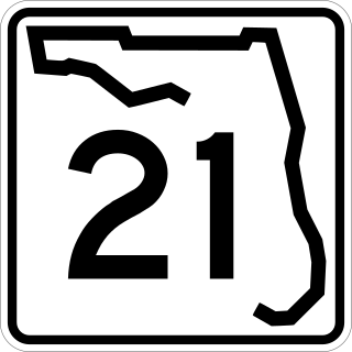
State Road 21 (SR 21) runs mostly in a southwest-to-northeast direction in the US state of Florida from McMeekin to Jacksonville. It is also known as Blanding Boulevard for much of its length.

<span class="mw-page-title-main">Ocklawaha River</span> River in Florida, United States of America

The 74-mile-long (119 km) Ocklawaha River flows north from central Florida until it joins the St. Johns River near Palatka. Its name is derived from ak-lowahe, Creek for "muddy".

<span class="mw-page-title-main">Wekiva River</span> River in Florida, United States of America

The Wekiva River is a 16.0-mile-long (25.7 km) river in Central Florida, north of Orlando in the United States. It originates in Apopka and joins the St. Johns River, the longest river in the state, in DeBary. The Wekiva River system includes the main stem joined by three main tributaries - Rock Springs Run, Blackwater Creek, and the Little Wekiva River - and about 30 contributing groundwater springs. It is designated as a Florida State Canoe Trail, an Outstanding Florida Water, and an Aquatic Preserve by the Florida Department of Environmental Protection. The Wekiva River system is also one of the two rivers in Florida federally designated as a National Wild and Scenic River for its scenery, recreation, geology, and diverse habitats.

<span class="mw-page-title-main">Crooked River (Oregon)</span> River in Oregon, United States

The Crooked River is a tributary, 125 miles (201 km) long, of the Deschutes River in the U.S. state of Oregon. The river begins at the confluence of the South Fork Crooked River and Beaver Creek in southeastern Crook County. Of the two tributaries, the South Fork Crooked River is the larger and is sometimes considered part of the Crooked River proper. A variant name of the South Fork Crooked River is simply "Crooked River". The Deschutes River flows north into the Columbia River.

<span class="mw-page-title-main">Newnans Lake</span> Lake in the state of Florida, United States

Newnans Lake is a lake located off State Road 20, east of Gainesville, Florida. Approximately 1.12 miles (2 km) wide, Newnans Lake is home to many forms of wildlife, and had been designated as a protected site by Alachua County.

<span class="mw-page-title-main">Little Butte Creek</span> River in Oregon, USA

Little Butte Creek is a 17-mile-long (27 km) tributary of the Rogue River in the U.S. state of Oregon. Its drainage basin consists of approximately 354 square miles (917 km2) of Jackson County and another 19 square miles (49 km2) of Klamath County. Its two forks, the North Fork and the South Fork, both begin high in the Cascade Range near Mount McLoughlin and Brown Mountain. They both flow generally west until they meet near Lake Creek. The main stem continues west, flowing through the communities of Brownsboro, Eagle Point, and White City, before finally emptying into the Rogue River about 3 miles (5 km) southwest of Eagle Point.

The North Fork Malheur River is a 59-mile (95 km) tributary of the Malheur River in eastern Oregon in the United States. Rising in Big Cow Burn in the Blue Mountains, it flows generally south to join the larger river at Juntura. The upper 25.5 miles (41.0 km) of the river have been designated Wild and Scenic. This part of the river basin offers camping, hiking, and fishing opportunities in a remote forest setting. The lower river passes through Beulah Reservoir, which stores water for irrigation and has facilities for boaters.

Orange Creek is a small stream in north-central and northeast Florida, that drains Orange Lake to the Ocklawaha River. Privately owned Orange Springs provides part of the water volume.

Etonia Creek, also known as Etoniah Creek, is a stream in Putnam and Clay counties in Florida. It is the major tributary of Rice Creek, which is a tributary of the St. Johns River. The upper or western part of the stream's basin, the Upper Etonia Creek Basin, contains about 100 lakes. Many of those lakes do not have outflowing streams. On leaving its upper basin, Etonia Creek flows eastward, and then southeastward to its juncture with Rice Creek.

References

30°02′33″N81°42′39″W / 30.042424°N 81.710815°W / 30.042424; -81.710815