Bluffton, Minnesota

Last updated

Bluffton, Minnesota
Bluffton MN downtown.jpg
Downtown Bluffton
Otter Tail County Minnesota Incorporated and Unincorporated areas Bluffton Highlighted.svg
Location of Bluffton, Minnesota
Coordinates: 46°28′11″N95°14′02″W / 46.46972°N 95.23389°W / 46.46972; -95.23389
CountryUnited States
State Minnesota
County Otter Tail
FoundedMarch 1880
Incorporated February 26, 1903
Government
   Mayor Tim Pavek
Area
[1]
  Total2.756 sq mi (7.138 km2)
  Land2.735 sq mi (7.083 km2)
  Water0.021 sq mi (0.055 km2)
Elevation
[2]
1,362 ft (415 m)
Population
 (2020) [3]
  Total210
  Estimate 
(2022) [4]
213
  Density76.78/sq mi (29.65/km2)
Time zone UTC–6 (Central (CST))
  Summer (DST) UTC–5 (CDT)
ZIP Code
56518
Area code 218
FIPS code 27-06778
GNIS feature ID2394210 [2]
Sales tax 7.375% [5]

Bluffton is a city in Otter Tail County, Minnesota, United States, along the Leaf River. The population was 210 at the 2020 census. [3]

Contents

History

Bluffton was platted in March 1880, and named for the bluffs on the nearby Leaf River. [6] Bluffton was incorporated on February 26, 1903. [6]

Geography

According to the United States Census Bureau, the city has a total area of 2.756 square miles (7.14 km2), of which 2.735 square miles (7.08 km2) is land and 0.021 square miles (0.05 km2) is water. [1]

U.S. Route 10 serves as a main route in the community.

Demographics

Historical population
CensusPop.Note
1880 69
1910 148
1920 22048.6%
1930 204−7.3%
1940 23414.7%
1950 2392.1%
1960 211−11.7%
1970 195−7.6%
1980 2065.6%
1990 187−9.2%
2000 21012.3%
2010 207−1.4%
2020 2101.4%
2022 (est.)213 [4] 1.4%
U.S. Decennial Census [7]
2020 Census [3]

2010 census

As of the 2010 census, there were 207 people, 79 households, and 54 families living in the city. The population density was 75.0 inhabitants per square mile (29.0/km2). There were 83 housing units at an average density of 30.1 per square mile (11.6/km2). The racial makeup of the city was 96.1% White, 0.5% Native American, 0.5% Asian, 0.5% from other races, and 2.4% from two or more races. Hispanic or Latino of any race were 1.4% of the population.

There were 79 households, of which 32.9% had children under the age of 18 living with them, 58.2% were married couples living together, 3.8% had a female householder with no husband present, 6.3% had a male householder with no wife present, and 31.6% were non-families. 27.8% of all households were made up of individuals, and 15.2% had someone living alone who was 65 years of age or older. The average household size was 2.62 and the average family size was 3.20.

The median age in the city was 33.9 years. 25.6% of residents were under the age of 18; 10.2% were between the ages of 18 and 24; 24.2% were from 25 to 44; 24.1% were from 45 to 64; and 15.9% were 65 years of age or older. The gender makeup of the city was 48.3% male and 51.7% female.

2000 census

As of the 2000 census, there were 210 people, 76 households, and 56 families living in the city. The population density was 75.8 inhabitants per square mile (29.3/km2). There were 77 housing units at an average density of 27.8 per square mile (10.7/km2). The racial makeup of the city was 99.05% White, and 0.95% from two or more races.

There were 76 households, out of which 46.1% had children under the age of 18 living with them, 65.8% were married couples living together, 5.3% had a female householder with no husband present, and 26.3% were non-families. 26.3% of all households were made up of individuals, and 13.2% had someone living alone who was 65 years of age or older. The average household size was 2.68 and the average family size was 3.27.

In the city, the population was spread out, with 33.3% under the age of 18, 3.3% from 18 to 24, 31.0% from 25 to 44, 14.3% from 45 to 64, and 18.1% who were 65 years of age or older. The median age was 34 years. For every 100 females, there were 89.2 males. For every 100 females age 18 and over, there were 94.4 males.

The median income for a household in the city was $31,250, and the median income for a family was $33,958. Males had a median income of $28,125 versus $17,000 for females. The per capita income for the city was $12,105. About 6.6% of families and 8.6% of the population were below the poverty line, including 11.1% of those under the age of eighteen and none of those 65 or over.

Transportation

Amtrak’s Empire Builder , which operates between Seattle/Portland and Chicago, passes through the town on BNSF tracks, but makes no stop. The nearest station is located in Staples, 23 miles (37 km) to the southeast.

Related Research Articles

<span class="mw-page-title-main">Vera Cruz, Indiana</span> Town in Indiana, United States

Vera Cruz is a town in Harrison Township, Wells County, in the U.S. state of Indiana. The population was 80 at the 2010 census.

<span class="mw-page-title-main">Kelliher, Minnesota</span> Town in Minnesota, United States

Kelliher is a city in Beltrami County, Minnesota, United States. The population was 258 at the 2020 census. Minnesota State Highway 72 is the primary route through Kelliher.

<span class="mw-page-title-main">Chickamaw Beach, Minnesota</span> City in Minnesota, United States

Chickamaw Beach is a city in Cass County, Minnesota, United States. The population was 114 at the 2010 census. It is part of the Brainerd Micropolitan Statistical Area.

<span class="mw-page-title-main">Pillager, Minnesota</span> City in Minnesota, United States

Pillager is a city in Cass County, Minnesota, United States. Its population was 469 at the 2010 census. It is part of the Brainerd Micropolitan Statistical Area.

<span class="mw-page-title-main">Twin Lakes, Freeborn County, Minnesota</span> City in Minnesota, United States

Twin Lakes is a city in Freeborn County, Minnesota, United States, near Albert Lea. The population was 134 at the 2020 census.

<span class="mw-page-title-main">Squaw Lake, Minnesota</span> City in Minnesota, United States

Squaw Lake is a city in Itasca County, Minnesota, United States. The population was 98 at the 2020 census.

<span class="mw-page-title-main">Lake Bronson, Minnesota</span> City in Minnesota, United States

Lake Bronson is a city in Kittson County, Minnesota, United States. The population was 178 at the 2020 census. Lake Bronson State Park is nearby.

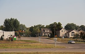
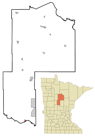
Bluffton Township is a township in Otter Tail County, Minnesota, United States. The population was 474 at the 2000 census.

<span class="mw-page-title-main">Dent, Minnesota</span> City in Minnesota, United States

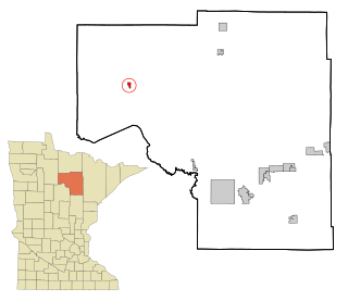
Dent is a city in Otter Tail County, Minnesota, United States. The population was 173 at the 2020 census.

<span class="mw-page-title-main">Urbank, Minnesota</span> City in Minnesota, United States

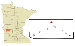
Urbank is a city in Otter Tail County, Minnesota, United States. The population was 52 at the 2020 census.

<span class="mw-page-title-main">Nielsville, Minnesota</span> City in Minnesota, United States

Nielsville is a city in Polk County, Minnesota, United States. It is part of the Grand Forks, ND-MN Metropolitan Statistical Area. The population was 78 at the 2020 census.

<span class="mw-page-title-main">Long Beach, Minnesota</span> City in Minnesota, United States

Long Beach is a city in Pope County, Minnesota, United States. The population was 338 at the 2020 census.

<span class="mw-page-title-main">Maplewood, Minnesota</span> City in Minnesota, United States

Maplewood is a city in Ramsey County, Minnesota, United States. The population was 42,088 at the 2020 census. Maplewood is ten minutes' drive from downtown Saint Paul. It stretches along the northern and eastern borders of Saint Paul.

<span class="mw-page-title-main">McKinley, St. Louis County, Minnesota</span> City in Minnesota, United States

McKinley is a city in Saint Louis County, Minnesota, United States; located within the Iron Range region of Minnesota. The population was 103 at the 2020 census.

<span class="mw-page-title-main">Clontarf, Minnesota</span> City in Minnesota, United States

Clontarf is a city in Swift County, Minnesota, United States. The population was 164 at the 2010 census.

<span class="mw-page-title-main">St. Marys Point, Minnesota</span> City in Minnesota, United States

St. Marys Point or Saint Marys Point is a city in Washington County, Minnesota, United States. The population was 353 at the 2020 census.

<span class="mw-page-title-main">Altura, Minnesota</span> City in Minnesota, United States

Altura is a city in Winona County, Minnesota, United States. The population was 493 at the 2010 census.

<span class="mw-page-title-main">Dakota, Minnesota</span> City in Minnesota, United States

Dakota is a city in Winona County, Minnesota, United States. The population was 295 at the 2020 census.

<span class="mw-page-title-main">Fifty Lakes, Minnesota</span> City in Minnesota, United States

Fifty Lakes is a city in Crow Wing County, Minnesota, United States. The population was 387 at the 2010 census. It is part of the Brainerd Micropolitan Statistical Area.

<span class="mw-page-title-main">Bluffton, Ohio</span> Village in Ohio, United States

Bluffton, originally known as Shannon, is a village in Allen and Hancock counties in the U.S. state of Ohio. The population was 3,967 at the 2020 census. Bluffton is home to Bluffton University, a four-year educational institution affiliated with Mennonite Church USA. Bluffton is served by the Bluffton general aviation airport. Bluffton participates in the Tree City USA program.

References

  1. 1 2 "2023 U.S. Gazetteer Files". United States Census Bureau. Retrieved April 30, 2024.
  2. 1 2 U.S. Geological Survey Geographic Names Information System: Bluffton, Minnesota
  3. 1 2 3 "Explore Census Data". United States Census Bureau . Retrieved April 30, 2024.
  4. 1 2 "City and Town Population Totals: 2020-2022". United States Census Bureau. April 30, 2024. Retrieved April 30, 2024.
  5. "Bluffton (MN) sales tax rate" . Retrieved April 30, 2024.
  6. 1 2 Upham, Warren (1920). Minnesota Geographic Names: Their Origin and Historic Significance. Minnesota Historical Society. p.  391.
  7. "Census of Population and Housing". census.gov. Retrieved June 4, 2015.