
Lumber, also known as timber, is wood that has been processed into beams and planks, a stage in the process of wood production. Lumber is mainly used for structural purposes but has many other uses as well.

Wood County is a county located in the U.S. state of Ohio. As of the 2010 census, the population was 125,488. Its county seat is Bowling Green. The county was named for Captain Eleazer D. Wood, the engineer for General William Henry Harrison's army, who built Fort Meigs in the War of 1812.
Kane County is a county in the U.S. state of Illinois. According to the 2010 census, it has a population of 515,269, making it the fifth-most populous county in Illinois. Its county seat is Geneva, and its largest city is Aurora. Kane County is one of the collar counties of the metropolitan statistical area designated "Chicago–Naperville–Elgin, IL–IN–WI" by the US Census.

Woods Hole is a census-designated place in the town of Falmouth in Barnstable County, Massachusetts, United States. It lies at the extreme southwest corner of Cape Cod, near Martha's Vineyard and the Elizabeth Islands. The population was 781 at the 2010 census.

A plantation is a large-scale estate, generally centered on a plantation house, meant for farming that specializes in cash crops. The crops that are grown include cotton, coffee, tea, cocoa, sugar cane, opium, sisal, oil seeds, oil palms, fruits, rubber trees and forest trees. Protectionist policies and natural comparative advantage have sometimes contributed to determining where plantations are located.

Lake of the Woods is a lake occupying parts of the Canadian provinces of Ontario and Manitoba and the U.S. state of Minnesota. It separates a small land area of Minnesota from the rest of the United States. The Northwest Angle and the town of Angle Township can be reached from the rest of Minnesota only by crossing the lake or by traveling through Canada. The Northwest Angle is the northernmost part of the contiguous United States. Its "northwesternmost point" served as a problematic landmark in treaties defining the international border.
The Bretton Woods system of monetary management established the rules for commercial and financial relations among the United States, Canada, Western European countries, Australia, and Japan after the 1944 Bretton Woods Agreement. The Bretton Woods system was the first example of a fully negotiated monetary order intended to govern monetary relations among independent states. The chief features of the Bretton Woods system were an obligation for each country to adopt a monetary policy that maintained its external exchange rates within 1 percent by tying its currency to gold and the ability of the International Monetary Fund (IMF) to bridge temporary imbalances of payments. Also, there was a need to address the lack of cooperation among other countries and to prevent competitive devaluation of the currencies as well.

The Battle of Belleau Wood occurred during the German spring offensive in World War I, near the Marne River in France. The battle was fought between the U.S. 2nd and 3rd Divisions along with French and British forces against an assortment of German units including elements from the 237th, 10th, 197th, 87th, and 28th Divisions. The battle has become a key component of the lore of the United States Marine Corps.
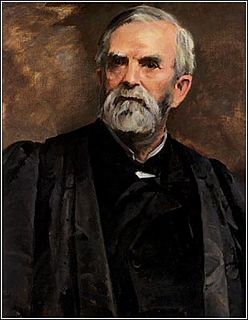
William Burnham Woods was an American attorney and jurist who served as a United States Circuit Judge and an Associate Justice of the United States Supreme Court as well as an Ohio politician and soldier in the Civil War.
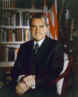
The Nixon shock was a series of economic measures undertaken by United States President Richard Nixon in 1971, in response to increasing inflation, the most significant of which were wage and price freezes, surcharges on imports, and the unilateral cancellation of the direct international convertibility of the United States dollar to gold.
Abiel Wood was a U.S. Representative from Massachusetts.

William Robert Wood was a U.S. Representative from Indiana.

Highland Meadows is an unincorporated community in New Castle County, Delaware, United States. Highland Meadows is located northwest of the intersection of Brackenville Road and Old Wilmington Road east of Hockessin.
Brackenville is an unincorporated community in New Castle County, Delaware, United States. Brackenville is located at the intersection of Brackenville Road and Old Wilmington Road east of Hockessin.
Trepagnier is an unincorporated community in New Castle County, Delaware, United States. Trepagnier is located southwest of Old Wilmington Road between Brackenville Road and Loveville Road to the southeast of Hockessin. It is located in the neighborhood of Bon Ayre.
Brookhill Farms is an unincorporated community in New Castle County, Delaware, United States. Brookhill Farms is located along Brackenville Road south of Hockessin.
Gateway Farms is an unincorporated community in New Castle County, Delaware, United States. Gateway Farms is located north of the intersection of Brackenville Road and Millcreek Road south of Hockessin.
Runnymeade is an unincorporated community in New Castle County, Delaware, United States. Runnymeade is located south of the intersection of Brackenville Road and Millcreek Road to the south of Hockessin.
Cornish Hills is an unincorporated community in New Castle County, Delaware, United States. Cornish Hills is located north of the intersection of Delaware Route 7 and Brackenville Road to the southwest of Hockessin.

Ashland Covered Bridge, also known as Ashland Bridge or Barley Mill Road Covered Bridge, is a covered bridge over Red Clay Creek on Barley Mill Road in Ashland in New Castle County, Delaware.


