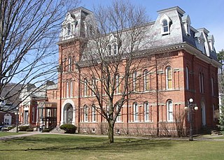
Delaware County is a county located in the US state of New York. As of 2010 the population was 47,980. The county seat is Delhi. The county is named after the Delaware River, which was named in honor of Thomas West, 3rd Baron De La Warr, appointed governor of Virginia in 1609.
Interstate 95 (I-95) is the main north–south Interstate Highway on the East Coast of the United States, running from U.S. Route 1 (US 1) in Miami, Florida to the Houlton–Woodstock Border Crossing between Maine and the Canadian province of New Brunswick. The highway largely parallels the Atlantic coast and US 1, except for the portion between Savannah and Washington and the portion between Portland and Houlton, both of which follow a more direct inland route.
Smyrna is a town in Kent and New Castle counties in the U.S. state of Delaware. It is part of the Dover, Delaware Metropolitan Statistical Area. According to the Census Bureau, as of 2010, the population of the town is 10,023.

Newark is a city in New Castle County, Delaware, United States. It is located 12 miles (19 km) west-southwest of Wilmington. According to the 2010 Census, the population of the city is 31,454. Newark is home to the University of Delaware.

Odessa is a town in New Castle County, Delaware, United States. The population was 364 at the 2010 census. Founded as Cantwell's Bridge in the 18th century, the name was changed in the 19th century, after the Ukrainian port city of the same name. Today a significant part of the town is a historic district list on the National Register of Historic Places.

Elmhurst is an unincorporated community in New Castle County, Delaware, United States. It is located at latitude 39°43'50" North, longitude 75°35'24" West. Elmhurst is located northwest of Delaware Route 4 and west of Delaware Route 100 to the southwest of Wilmington and south of Elsmere.

The Delaware Valley is the valley through which the Delaware River flows. By extension, this toponym is commonly used to refer to Greater Philadelphia or the Philadelphia metropolitan area. The Delaware Valley is coterminous with a metropolitan statistical area (MSA) and broader combined statistical area (CSA), and is composed of counties located in Southeastern Pennsylvania, South Jersey, Delaware, and the Eastern Shore of Maryland. As of the 2010 Census, the MSA has a population of over 6 million, while the CSA has a population of over 7.1 million.

Tulpehocken Creek is a 39.5-mile-long (63.6 km) tributary of the Schuylkill River in southeastern Pennsylvania in the United States, and during the American Canal Age, once provided nearly half the length of the Union Canal linking the port of Philadelphia, the largest American city and the other communities of Delaware Valley with the Susquehanna basin and the Pennsylvania Canal System connecting the Eastern seaboard to Lake Erie and the new settlements of the Northwest Territory via the Allegheny}, Monongahela. and Ohio Rivers at Pittsburgh.

Blue Mountain, Blue Mountain Ridge, or the Blue Mountains of Pennsylvania is a ridge of the Appalachian Mountains in the U.S. state of Pennsylvania. Forming the southern and eastern edge of the Ridge-and-Valley Appalachians physiographic province in Pennsylvania, Blue Mountain extends 150 miles (240 km) from the Delaware Water Gap on the New Jersey border in the east to Big Gap in Franklin County, south-central Pennsylvania, at its southwestern end.

The Pennsylvania Canal was a complex system of transportation infrastructure improvements including canals, dams, locks, tow paths, aqueducts, and viaducts. The Canal and Works were constructed and assembled over several decades beginning in 1824, the year of the first enabling act and budget items. It should be understood the first use of any railway in North America was the year 1826, so the newspapers and the Pennsylvania Assembly of 1824 applied the term then to the proposed rights of way mainly for the canals of the Main Line of Public Works to be built across the southern part of Pennsylvania.
Cedar Creek is a collection of developments and residences mainly surrounding Swiggetts Pond and Cubbage Pond along the Cedar Creek in Sussex County, Delaware, United States. It is part of the Salisbury, Maryland-Delaware Metropolitan Statistical Area. The area generally referred to as Cedar Creek follows Fleatown Road from Clendaniel Pond Road to Delaware Route 1, then heads south to Slaughter Neck Road, following Slaughter Neck Road until it connects with Cubbage Pond Road, ending back at the intersection of Cubbage Pond Road and Fleatown Road. The developments include Cedar Creek Estates, Cedar Village, The Meadows on Cubbage Pond, South Shores, The Village at Anderson Crossroads, and Pine Haven Park. Cedar Creek Nature Preserve is also located here off of Brick Granary Road where the Cedar Creek flows into Swiggetts Pond.
Pennyhill is an unincorporated community in New Castle County, Delaware, United States. Pennyhill is located north of U.S. Route 13 Business and west of Delaware Route 3 northeast of Wilmington. Delaware State Police Troop 1 is located in Pennyhill.
Monroe Park is an unincorporated community in New Castle County, Delaware, United States. Monroe Park is located west of the interchange between Delaware Route 100/Delaware Route 141 and Delaware Route 52 in Greenville.
West Park is an unincorporated community in New Castle County, Delaware, United States. West Park is located south of Delaware Route 48/Delaware Route 100 to the west of Wilmington.
Westover Hills is an unincorporated community in New Castle County, Delaware, United States. Westover Hills is located west of North Dupont Road between Delaware Route 48 and Delaware Route 52 west of Wilmington.
Mathews Corners is an unincorporated community in New Castle County, Delaware, United States. Mathews Corners is located on Delaware Route 299 just west of Delaware Route 9 to the southeast of Odessa.
Williamsburg is an unincorporated community in New Castle County, Delaware, United States. Williamsburg is located at the intersection of Delaware Route 71 and Delaware Route 72 west of Delaware City.

Prices Corner is an unincorporated community in New Castle County, Delaware, United States. Prices Corner is located at the intersection of Delaware Route 2 and Delaware Route 141 west of Wilmington. The Prices Corner Shopping Center is located in Prices Corner.
In 2010, the United States implemented the Foreign Account Tax Compliance Act; the law required financial firms around the world to report accounts held by US citizens to the Internal Revenue Service. The US on the other hand refused the Common Reporting Standard set up by the Organisation for Economic Co-operation and Development, alongside Vanuatu and Bahrain.

Star Hill is an unincorporated community in Kent County, Delaware, United States. Star Hill is located at the intersection of U.S. Route 13 and Voshells Mill Road/Voshells Mill Star Hill Road south of Camden.


