
Delaware County is a county located in the central portion of the U.S. state of Ohio. As of the 2010 census, the population was 174,214. Its county seat is Delaware. The county was formed in 1808 from Franklin County, Ohio. Both the county and its seat are named after the Delaware Indian tribe.

Kenton is a town in Kent County, Delaware, United States. It is part of the Dover, Delaware Metropolitan Statistical Area. The population was 261 at the 2010 census.
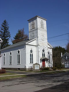
Walton is a town in Delaware County, New York, United States. The population was 5,576 at the 2010 census. The town is in the west-central part of the county and contains the village of Walton. The town claims to be the "Scarecrow Capital of the World."

The Pocomoke River stretches approximately 66 miles (106 km) from southern Delaware through southeastern Maryland in the United States. At its mouth, the river is essentially an arm of Chesapeake Bay, whereas the upper river flows through a series of relatively inaccessible wetlands called the Great Cypress Swamp, largely populated by Loblolly Pine, Red Maple and Bald Cypress. The river is the easternmost river that flows into Chesapeake Bay. "Pocomoke", though traditionally interpreted as "dark water" by local residents, is now agreed by scholars of the Algonquian languages to be derived from the words for "broken ground."
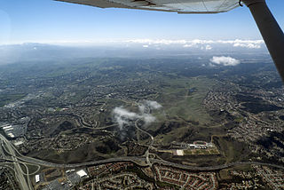
The Chino Hills are a mountain range on the border of Orange, Los Angeles, and San Bernardino counties, California, with a small portion in Riverside County. The Chino Hills State Park preserves open space and habitat in them.
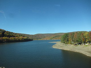
The Pepacton Reservoir, also known as the Downsville Reservoir, is a reservoir in Delaware County, New York on the East Branch of the Delaware River in the Catskill Mountains of New York. Part of the New York City water supply system, it was formed by the construction of Downsville Dam, and empounds over one-quarter of the East Branch's flow.

Concord Township is one of the eighteen townships of Delaware County, Ohio, United States. The 2000 census found 4,507 people in the township, 4,088 of whom lived in the unincorporated portions of the township. The 2010 census found the township population to be 9,294.

Vly Mountain is a mountain located in the town of Halcott, New York, United States in Greene County. The mountain is part of the Catskill Mountains. Vly Mountain is flanked to the northwest by Bearpen Mountain, to the east by Vinegar Hill, to the northeast by Kipp Hill, and to the southeast by Beech Ridge.
Doubletop Mountain is a mountain located in Ulster County, New York. The mountain is part of the Catskill Mountains. Doubletop Mtn. is flanked to the northwest by Graham Mountain, to the east by Big Indian Mountain, and to the southwest by the Beaver Kill Range.

Delaware State Park is a 2,016-acre (816 ha) Ohio state park in Delaware County, Ohio in the United States. The park, town and county are named for the Delaware Indians, a Native American tribe that originally lived along the Delaware River in Pennsylvania, Delaware, New York, Maryland, Connecticut and New Jersey. The Delawares were forced west by colonial settlers and were eventually forced further west by settlers of the Northwest Territory from which Ohio was established in 1803. Delaware State Park is on U.S. Route 23 near the city of Delaware, Ohio. It is open for year-round recreation including camping, hiking, boating, hunting, fishing, and picnicking.

Woodside Hills is an unincorporated community in New Castle County, Delaware, United States. Woodside Hills is located northwest of the intersection of Silverside Road and Carr Road to the northeast of Wilmington.
Green Hill is an unincorporated community in Sussex County, Delaware, United States. Green Hill is located on the Delaware Bay shore northwest of Lewes.
Wellington Hills is an unincorporated community in New Castle County, Delaware, United States. Wellington Hills is located southwest of Delaware Route 41 to the northwest of Hockessin and southeast of the Pennsylvania border.
Red Lion is an unincorporated community in New Castle County, Delaware, United States. Red Lion is located at the intersection of Delaware Route 7 and Delaware Route 71 northwest of Delaware City and southwest of New Castle.

Mastens Corner is an unincorporated community in Kent County, Delaware, United States. Mastens Corner is located at the intersection of Hopkins Cemetery Road and Hills Market Road 3.8 miles (6.1 km) northwest of Harrington.

Bismuth is a ghost town in the Black Hills of Custer County, South Dakota, United States.
Novak, also known as Cindell Spur, is a ghost town in Lawrence County, South Dakota, United States. It was an early mining camp.
Adamsville is an unincorporated community in Kent and Sussex counties of Delaware, United States. Adamsville is located at the intersection of Delaware Route 16 and Adamsville Road northwest of Greenwood.


