Butternut, Wisconsin

Last updated

Butternut, Wisconsin
Butternut Wisconsin Downtown Looking South WIS13.jpg
Looking south in Butternut
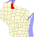
Ashland County Wisconsin Incorporated and Unincorporated areas Butternut Highlighted.svg
Location of Butternut in Ashland County, Wisconsin
Coordinates: 46°0′50″N90°29′41″W / 46.01389°N 90.49472°W / 46.01389; -90.49472
Country Flag of the United States.svg  United States
State Flag of Wisconsin.svg  Wisconsin
County Ashland
Area
[1]
  Total1.47 sq mi (3.81 km2)
  Land1.47 sq mi (3.81 km2)
  Water0.00 sq mi (0.00 km2)
Elevation
[2]
1,496 ft (456 m)
Population
 (2010) [3]
  Total375
  Estimate 
(2019) [4]
355
  Density241.17/sq mi (93.12/km2)
Time zone UTC-6 (Central (CST))
  Summer (DST) UTC-5 (CDT)
ZIP code
54514
Area code(s) 715 & 534
FIPS code 55-11525 [5]
GNIS feature ID1562478 [2]
Public Transit Bay Area Rural Transit
Website www.butternutwi.com

Butternut is a village in Ashland County in the U.S. state of Wisconsin. The population was 375 at the 2010 census.

Contents

Geography

Butternut is located at 46°0′50″N90°29′41″W / 46.01389°N 90.49472°W / 46.01389; -90.49472 (46.013958, -90.494614). [6]

According to the United States Census Bureau, the village has a total area of 1.61 square miles (4.17 km2), all of it land. [7]

Climate

Climate data for Butternut 3SW, Wisconsin, 1991–2020 normals: 1570ft (479m)
MonthJanFebMarAprMayJunJulAugSepOctNovDecYear
Record high °F (°C)51
(11)
57
(14)
76
(24)
84
(29)
90
(32)
94
(34)
97
(36)
96
(36)
91
(33)
82
(28)
71
(22)
58
(14)
97
(36)
Mean maximum °F (°C)39.4
(4.1)
44.3
(6.8)
58.4
(14.7)
74.5
(23.6)
81.4
(27.4)
87.5
(30.8)
88.5
(31.4)
87.4
(30.8)
83.5
(28.6)
74.3
(23.5)
57.4
(14.1)
43.6
(6.4)
87.8
(31.0)
Mean daily maximum °F (°C)19.6
(−6.9)
24.3
(−4.3)
36.8
(2.7)
49.7
(9.8)
64.0
(17.8)
73.5
(23.1)
77.7
(25.4)
75.9
(24.4)
67.8
(19.9)
53.2
(11.8)
36.9
(2.7)
24.8
(−4.0)
50.3
(10.2)
Daily mean °F (°C)10.4
(−12.0)
13.6
(−10.2)
25.4
(−3.7)
38.6
(3.7)
52.0
(11.1)
61.7
(16.5)
65.8
(18.8)
63.8
(17.7)
56.0
(13.3)
43.2
(6.2)
29.4
(−1.4)
17.1
(−8.3)
39.8
(4.3)
Mean daily minimum °F (°C)1.1
(−17.2)
2.9
(−16.2)
14.0
(−10.0)
27.5
(−2.5)
39.9
(4.4)
49.9
(9.9)
53.8
(12.1)
51.7
(10.9)
44.3
(6.8)
33.2
(0.7)
21.8
(−5.7)
9.5
(−12.5)
29.1
(−1.6)
Mean minimum °F (°C)−24.7
(−31.5)
−22.4
(−30.2)
−12.4
(−24.7)
12.4
(−10.9)
25.2
(−3.8)
34.8
(1.6)
41.6
(5.3)
39.6
(4.2)
28.3
(−2.1)
18.8
(−7.3)
2.0
(−16.7)
−16.8
(−27.1)
−28.3
(−33.5)
Record low °F (°C)−47
(−44)
−49
(−45)
−29
(−34)
−6
(−21)
19
(−7)
26
(−3)
33
(1)
33
(1)
22
(−6)
6
(−14)
−16
(−27)
−33
(−36)
−49
(−45)
Average precipitation inches (mm)1.16
(29)
1.38
(35)
1.96
(50)
3.02
(77)
3.87
(98)
4.98
(126)
4.26
(108)
3.71
(94)
3.83
(97)
3.98
(101)
2.06
(52)
1.80
(46)
36.01
(913)
Average snowfall inches (cm)13.3
(34)
15.2
(39)
11.3
(29)
7.5
(19)
0.8
(2.0)
0.0
(0.0)
0.0
(0.0)
0.0
(0.0)
trace2.5
(6.4)
8.6
(22)
15.0
(38)
74.2
(189.4)
Source 1: NOAA [8]
Source 2: XMACIS (1998-2020 snowfall, temp records & monthly max/mins) [9]

Demographics

Historical population
CensusPop.Note
1910 717
1920 618−13.8%
1930 604−2.3%
1940 66910.8%
1950 522−22.0%
1960 499−4.4%
1970 453−9.2%
1980 438−3.3%
1990 416−5.0%
2000 407−2.2%
2010 375−7.9%
2019 (est.)355 [4] −5.3%
U.S. Decennial Census [10]
Looking south in Butternut Butternut Wisconsin Downtown Looking South 2 WIS13.jpg
Looking south in Butternut

2010 census

As of the census [3] of 2010, there were 375 people, 180 households, and 103 families living in the village. The population density was 232.9 inhabitants per square mile (89.9/km2). There were 214 housing units at an average density of 132.9 per square mile (51.3/km2). The racial makeup of the village was 94.1% White, 2.7% Native American, 0.3% from other races, and 2.9% from two or more races. Hispanic or Latino people of any race were 1.1% of the population.

There were 180 households, of which 28.9% had children under the age of 18 living with them, 37.2% were married couples living together, 13.3% had a female householder with no husband present, 6.7% had a male householder with no wife present, and 42.8% were non-families. 38.9% of all households were made up of individuals, and 17.8% had someone living alone who was 65 years of age or older. The average household size was 2.08 and the average family size was 2.72.

The median age in the village was 41.5 years. 22.9% of residents were under the age of 18; 7.6% were between the ages of 18 and 24; 25.8% were from 25 to 44; 27% were from 45 to 64; and 16.8% were 65 years of age or older. The gender makeup of the village was 50.1% male and 49.9% female.

2000 census

As of the census [5] of 2000, there were 407 people, 197 households, and 102 families living in the village. The population density was 254.2 people per square mile (98.2/km2). There were 220 housing units at an average density of 137.4 per square mile (53.1/km2). The racial makeup of the village was 98.28% White and 1.72% Native American. Hispanic or Latino people of any race were 0.25% of the population.

There were 197 households, out of which 25.9% had children under the age of 18 living with them, 40.1% were married couples living together, 7.6% had a female householder with no husband present, and 48.2% were non-families. 43.7% of all households were made up of individuals, and 24.9% had someone living alone who was 65 years of age or older. The average household size was 2.07 and the average family size was 2.93.

In the village, the population was spread out, with 24.1% under the age of 18, 8.4% from 18 to 24, 27.5% from 25 to 44, 19.4% from 45 to 64, and 20.6% who were 65 years of age or older. The median age was 37 years. For every 100 females, there were 92.9 males. For every 100 females age 18 and over, there were 83.9 males.

The median income for a household in the village was $30,446, and the median income for a family was $43,125. Males had a median income of $31,979 versus $17,000 for females. The per capita income for the village was $16,002. About 1.9% of families and 7.0% of the population were below the poverty line, including 6.5% of those under age 18 and 16.3% of those age 65 or over.

Education

The Butternut School District serves the area. [11]

Transportation

Bus service to the community is provided by Bay Area Rural Transit.

Notable people

Related Research Articles

<span class="mw-page-title-main">Shoal Creek Estates, Missouri</span> Village in Missouri, United States

Shoal Creek Estates is a village in Newton County, Missouri, United States. The population was 76 at the 2010 census. It is part of the Joplin, Missouri Metropolitan Statistical Area.

<span class="mw-page-title-main">Hillsdale, Missouri</span> Village in Missouri, United States

Hillsdale is a village in St. Louis County, Missouri, United States. Greenwood Cemetery is located in Hillsdale. The population was 1,478 at the 2010 census.

<span class="mw-page-title-main">Velda Village Hills, Missouri</span> City in Missouri, United States

Velda Village Hills is a city in northeastern St. Louis County, Missouri, United States. The population was 1,055 at the 2010 census.

<span class="mw-page-title-main">Cedar Creek, Nebraska</span> Village in Nebraska, United States

Cedar Creek is a village in Cass County, Nebraska, United States. The population was 465 at the 2020 census.

<span class="mw-page-title-main">Hanley Hills, Missouri</span> Village in Missouri, United States

Hanley Hills is a village in St. Louis County, Missouri, United States. The population was 2,101 at the 2010 census.

<span class="mw-page-title-main">Addyston, Ohio</span> Village in Ohio, United States

Addyston is a village in Miami Township, Hamilton County, Ohio, United States. Located along the Ohio River, it is a western suburb of the neighboring city of Cincinnati. The population was 927 at the 2020 census.

<span class="mw-page-title-main">Haviland, Ohio</span> Village in Ohio, United States

Haviland is a village in Paulding County, Ohio, United States. The population was 160 at the 2020 census.

<span class="mw-page-title-main">Port Jefferson, Ohio</span> Village in Ohio, United States

Port Jefferson is a village in Salem Township, Shelby County, Ohio, United States. The population was 308 at the 2020 census.

<span class="mw-page-title-main">Congress, Ohio</span> Village in Ohio, United States

Congress is a village in Wayne County, Ohio, United States. The population was 132 at the 2020 census.

<span class="mw-page-title-main">Howard, Pennsylvania</span> Borough in Pennsylvania, United States

Howard is a borough in Centre County, Pennsylvania, United States. It is part of the State College, Pennsylvania Metropolitan Statistical Area. The population was 720 at the 2010 census.

<span class="mw-page-title-main">Los Angeles, Willacy County, Texas</span> CDP in Texas, United States

Los Angeles is a census-designated place (CDP) in Willacy County, Texas, United States. The population was 121 at the 2010 census. Prior to the 2010 census, the CDP was known as Los Angeles Subdivision.

<span class="mw-page-title-main">Blue River, Wisconsin</span> Village in Wisconsin, United States

Blue River is a village in Grant County, Wisconsin, United States. The population was 434 at the 2010 census.

<span class="mw-page-title-main">Tennyson, Wisconsin</span> Village in Wisconsin, United States

Tennyson is a village in Grant County, Wisconsin, United States, originally called Dutch Hollow. The population was 355 at the 2010 census.

<span class="mw-page-title-main">Fenwood, Wisconsin</span> Village in Wisconsin, United States

Fenwood is a village in Marathon County, Wisconsin, United States. It is part of the Wausau, Wisconsin Metropolitan Statistical Area. The population was 152 at the 2010 census.

<span class="mw-page-title-main">Combined Locks, Wisconsin</span> Village in Wisconsin, United States

Combined Locks is a village in Outagamie County, Wisconsin, United States. The population was 3,328 at the 2010 census.

<span class="mw-page-title-main">Clam Falls, Wisconsin</span> Town in Wisconsin, United States

Clam Falls is a town in Polk County, Wisconsin, United States. The population was 547 at the 2000 census. The unincorporated communities of Clam Falls and Lewis are located in the town.

Morris is a village in Otsego County, New York, United States. The population was 583 at the 2010 census.

<span class="mw-page-title-main">Bloomington, Wisconsin</span> Village in Wisconsin, United States

Bloomington is a village in Grant County, Wisconsin, United States. The population was 735 as of the 2010 census. The village is located within the Town of Bloomington.

<span class="mw-page-title-main">Luck, Wisconsin</span> Village in Wisconsin, United States

Luck is a village in Polk County, Wisconsin, United States. The population was 1,119 at the 2010 census.

<span class="mw-page-title-main">Star Prairie, Wisconsin</span> Village in Wisconsin, United States

Star Prairie is a village in St. Croix County in the U.S. state of Wisconsin. The population was 561 at the 2010 census. The village is located along the Apple River on the boundary between the Town of Star Prairie and the Town of Stanton.

References

  1. "2019 U.S. Gazetteer Files". United States Census Bureau. Retrieved August 7, 2020.
  2. 1 2 "US Board on Geographic Names". United States Geological Survey. October 25, 2007. Retrieved January 31, 2008.
  3. 1 2 "U.S. Census website". United States Census Bureau . Retrieved November 18, 2012.
  4. 1 2 "Population and Housing Unit Estimates". United States Census Bureau. May 24, 2020. Retrieved May 27, 2020.
  5. 1 2 "U.S. Census website". United States Census Bureau . Retrieved January 31, 2008.
  6. "US Gazetteer files: 2010, 2000, and 1990". United States Census Bureau. February 12, 2011. Retrieved April 23, 2011.
  7. "US Gazetteer files 2010". United States Census Bureau. Archived from the original on January 25, 2012. Retrieved November 18, 2012.
  8. "Butternut 3SW, Wisconsin 1991-2020 Monthly Normals" . Retrieved December 25, 2023.
  9. "xmACIS". National Oceanic and Atmospheric Administration. Retrieved December 25, 2023.
  10. "Census of Population and Housing". Census.gov. Retrieved June 4, 2015.
  11. Butternut School District
  12. "Charles Drechsler, 1892-1986," Mycologia, Robert D. Lumsden, vol. 79, no. 3, May–June 1987, pg. 345-352