Camp Noyo, California

Last updated

Camp Noyo is an unincorporated community in Mendocino County, California, United States. There is a camp named after the unincorporated community making it what is the name of the community today Camp Noyo. The settlement was originally a logging camp, and a stop along the California Western Railroad.

Unincorporated area Region of land not governed by own local government

In law, an unincorporated area is a region of land that is not governed by a local municipal corporation; similarly an unincorporated community is a settlement that is not governed by its own local municipal corporation, but rather is administered as part of larger administrative divisions, such as a township, parish, borough, county, city, canton, state, province or country. Occasionally, municipalities dissolve or disincorporate, which may happen if they become fiscally insolvent, and services become the responsibility of a higher administration. Widespread unincorporated communities and areas are a distinguishing feature of the United States and Canada. In most other countries of the world, there are either no unincorporated areas at all, or these are very rare; typically remote, outlying, sparsely populated or uninhabited areas.

Mendocino County, California County in California, United States

Mendocino County is a county located on the north coast of the U.S. state of California. As of the 2010 census, the population was 87,841. The county seat is Ukiah.

California State of the United States of America

California is a state in the Pacific Region of the United States. With 39.6 million residents, California is the most populous U.S. state and the third-largest by area. The state capital is Sacramento. The Greater Los Angeles Area and the San Francisco Bay Area are the nation's second and fifth most populous urban regions, with 18.7 million and 8.8 million residents respectively. Los Angeles is California's most populous city, and the country's second most populous, after New York City. California also has the nation's most populous county, Los Angeles County, and its largest county by area, San Bernardino County. The City and County of San Francisco is both the country's second-most densely populated major city after New York City and the fifth-most densely populated county, behind only four of the five New York City boroughs.

Coordinates: 39°25′27″N123°36′34″W / 39.42417°N 123.60944°W / 39.42417; -123.60944

Geographic coordinate system Coordinate system

A geographic coordinate system is a coordinate system that enables every location on Earth to be specified by a set of numbers, letters or symbols. The coordinates are often chosen such that one of the numbers represents a vertical position and two or three of the numbers represent a horizontal position; alternatively, a geographic position may be expressed in a combined three-dimensional Cartesian vector. A common choice of coordinates is latitude, longitude and elevation. To specify a location on a plane requires a map projection.


Related Research Articles

Camp Eighteen, California Unincorporated community in California, United States

Camp Eighteen is an unincorporated community in Butte County, California, about 1.25 miles (2.01 km) from the Plumas County line. It lies 7 miles (11 km) north of Clipper Mills, at an elevation of 3947 feet. The ZIP Code is 95940. The community is inside area code 530. Nearby communities are Lumpkin and Rogerville. The now-defunct Feather River Railway used to serve the area but appears to have been decommissioned. Sly Creek Reservoir is about 3.6 miles (5.8 km) southeast.

Pulga, California Unincorporated community in California, United States

Pulga is an unincorporated community in Butte County, California. It is located along the west slope of the Feather River canyon, at an elevation of 1398 feet. A variant name for the community is Big Bar. Other nearby communities include Mayaro, Poe and Parkhill. The town hosts a Caltrans highway maintenance station along State Route 70 (SR70). The place is at the mouth of the Flea Valley Creek, which gives rise to the toponym.

Collinsville, Ohio unincorporated community in Ohio

Collinsville is an unincorporated community and former village in southeastern Milford Township, Butler County, Ohio, United States. Although it is unincorporated, it has a post office, with the ZIP code of 45004. It lies at the intersection of U.S. Route 127 and State Route 73.

San Francisco Bay Area Council

The San Francisco Bay Area Council (SFBAC) is a council of the Boy Scouts of America, formed by a merger of the San Francisco Area and Oakland Area Councils in February 1964. Located in the San Francisco Bay Area, serving the cities of Colma, Daly City, San Francisco, Emeryville, Oakland, San Leandro, Hayward, Fremont, Union City, Newark, Pleasanton, Dublin, and Livermore, as well as unincorporated communities such as Castro Valley, San Lorenzo, and Sunol.

Redwood Empire Council

Redwood Empire Council is the local council of the Boy Scouts of America that serves youth in Mendocino and Sonoma counties in California.

Vaucluse Shores is an unincorporated community in Northampton County, Virginia, United States.

Holmes, California Unincorporated community in California, United States

Holmes is an unincorporated community in Humboldt County, California. It is located 2.25 miles (3.6 km) north of Redcrest, at an elevation of 154 feet.

Card Place, California Unincorporated community in California, United States

Card Place is an unincorporated community in Mendocino County, California. It lies at an elevation of 823 feet. Card Place is located at 39°48′29″N 123°24′17″W.

Noyo, California Unincorporated community in California, United States

Noyo is an unincorporated community in Mendocino County, California. It is located 1 mile (1.6 km) south of the center of Fort Bragg, at an elevation of 108 feet. It is named after the Noyo River, on which it lies; the Noyo River in turn was misnamed by white settlers to the Mendocino area after a village of the Pomo people named Noyo several miles north, on Pudding Creek. The Pomo named the creek after their village, and the settlers transferred the name to the larger river to the south.

Spring View is an unincorporated community in Page County, in the U.S. state of Virginia.

Sawyers Bar, California unincorporated community place in California, United States

Sawyers Bar is an unincorporated community located on the North Fork Salmon River in unincorporated Siskiyou County, California, not to be confused with a Sawyers or Lawyers Bar in Del Norte County.

Perrin is an unincorporated community in Gloucester County, in the U. S. state of Virginia.

Mendocino Indian Reservation former American Indian settlement in California

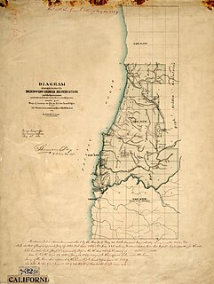
Mendocino Indian Reservation, a former Indian reservation in Mendocino County, one of the early Indian reservations to be established in California by the Federal Government for the resettlement of California Indians. It was established in the spring of 1856, in the vicinity of modern Noyo. Its area was 25,000 acres and its boundary extended north from what is now Simpson Lane at 39°24′43″N 123°48′30″W to Abalobadiah Creek and east from the Pacific Ocean to a north–south line passing through the summit of Bald Hill.

Black Bear is a populated place, originally a gold mining town in Klamath County, now in unincorporated Siskiyou County, California.

Rhodes, Indiana Unincorporated community in Indiana, United States

Rhodes is an unincorporated community in Clinton Township, Vermillion County, in the U.S. state of Indiana.

Memphis is an unincorporated community in Clinton County, in the U.S. state of Ohio.

Doyleville is an unincorporated community in Gunnison County, in the U.S. state of Colorado.

McCol Place, Indiana Unincorporated community in Indiana, United States

McCol Place is an unincorporated community in Washington Township, Washington County, in the U.S. state of Indiana.

Keethtown is an unincorporated community in southern Miller County, in the U.S. state of Missouri. The community is on Missouri Route U, approximately four miles southeast of Brumley and 1.5 miles north of the Miller-Camden county line.

Lorwood, Missouri unincorporated community in Missouri

Lorwood is an unincorporated community in New Madrid County, in the U.S. state of Missouri.