"Chimera" is the sixteenth episode of the seventh season of the science fiction television series The X-Files. It premiered on the Fox network in the United States, on April 2, 2000, was written by David Amann, and directed by Cliff Bole. The episode is a "Monster-of-the-Week" story, unconnected to the series' wider mythology. "Chimera" earned a Nielsen household rating of 7.5, being watched by 12.89 million people in its initial broadcast. The episode received mostly positive reviews from critics.

Brush is a ghost town in Butte County, California, United States. It was located 3.5 miles (5.6 km) north of Berry Creek on the Western Pacific Railroad, at an elevation of 902 feet. It still appeared on maps as of 1948.
Cresta is an unincorporated community in Butte County, California. It lies 3.5 miles (5.6 km) northeast of Pulga on the Western Pacific Railroad, at an elevation of 1581 feet and is located at 39°50′37″N121°24′16″W.
Nelson is an unincorporated community in Butte County, California. It lies 6.5 miles (10.5 km) south-southeast of Durham, at an elevation of 121 feet. Nelson's first post office was established in 1873; its zip code is 95958. The place was founded in 1873 by the California and Oregon Railroad Company and named for an early settler, A.D. Nelson.

New Blinzing is a former settlement in Butte County, California, United States. It was located 5.25 miles north of Berry Creek and about 1 mile (1.6 km) northwest of Blinzing, on the Western Pacific Railroad, at an elevation of 942 feet. It still appeared on maps as of 1948.
Petersburg is a former settlement in Kern County, California. It was located on Greenhorn Creek 4.5 miles (7.2 km) west-northwest of Miracle Hot Springs, at an elevation of 4731 feet. Petersburg still appeared on maps as of 1956.
Aerial Acres is a fly-in unincorporated community in Kern County, California. It is located 5.5 miles (9 km) east-southeast of Castle Butte, at an elevation of 2,428 feet (740 m). It was noted as "a desert town at Clay Mine Road and Sequoia in Peerless Valley, California.
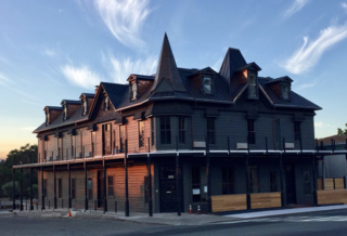
Alta Sierra is an unincorporated community in the Kern County, California.
Bowerbank is an unincorporated community in Kern County, California. It is located on the Southern Pacific Railroad 3.5 miles (5.6 km) east of Buttonwillow, at an elevation of 299 feet (91 m).
Calico is an unincorporated community in Kern County, California. It is located on the Southern Pacific Railroad 3.5 miles (5.6 km) south-southeast of McFarland, at an elevation of 400 feet (121.9 m).
Elmo is an unincorporated community in Kern County, California. It is located on the Atchison, Topeka and Santa Fe Railroad 5.5 miles (8.9 km) north of Wasco, at an elevation of 302 feet (92 m).

Indian Wells is an unincorporated community in Kern County, California.
Kecks Corner is an unincorporated community in Kern County, California. It is located in Antelope Valley 5.5 miles (8.9 km) south-southeast of Orchard Peak, at an elevation of 850 feet (259.08 m).
Kernell is an unincorporated community in Kern County, not part of Oildale, California even though Facebook and other social media sites seem to reference it when tagging a nearby location based on GPS California. It is located on the Atchison, Topeka and Santa Fe Railroad 5.5 miles (9 km) west of Delano, at an elevation of 259 feet (79 m).
Landco is an unincorporated community in Kern County, California. It is located on the Atchison, Topeka and Santa Fe Railroad 3.5 miles (5.6 km) west of Bakersfield, at an elevation of 400 feet (122 m).
Marcel is an unincorporated community in Kern County, California. It is located on the railroad 3.5 miles (5.6 km) southeast of Keene, at an elevation of 3,245 feet (989 m).
Mayfair is an unincorporated community in Kern County, California. It is located 5.5 miles (9 km) east-southeast of downtown Bakersfield, at an elevation of 436 feet.

Old River is an unincorporated community in Kern County, California. It is located 9.5 miles (15 km) southwest of Bakersfield, at an elevation of 344 feet (105 m).
Sanborn is an unincorporated community in Kern County, California. It is located on the Atchison, Topeka and Santa Fe Railroad 5.5 miles (8.9 km) southeast of Mojave, at an elevation of 2,572 feet (784 m).
Zentner is an unincorporated community in Kern County, California. It is located on the Southern Pacific Railroad 3.5 miles (5.6 km) east-northeast of McFarland, at an elevation of 449 feet (137 m).