Rogina Heights | |
---|---|
Unincorporated community | |
Coordinates: 39°08′54″N123°10′25″W / 39.14833°N 123.17361°W Coordinates: 39°08′54″N123°10′25″W / 39.14833°N 123.17361°W | |
Country | United States |
State | California |
County | Mendocino County |
Elevation [1] | 925 ft (282 m) |
Rogina Heights is an unincorporated community in Mendocino County, California. [1] It is located 2 miles (3.2 km) east of Ukiah, [2] at an elevation of 925 feet (282 m). [1]
In law, an unincorporated area is a region of land that is not governed by a local municipal corporation; similarly an unincorporated community is a settlement that is not governed by its own local municipal corporation, but rather is administered as part of larger administrative divisions, such as a township, parish, borough, county, city, canton, state, province or country. Occasionally, municipalities dissolve or disincorporate, which may happen if they become fiscally insolvent, and services become the responsibility of a higher administration. Widespread unincorporated communities and areas are a distinguishing feature of the United States and Canada. In most other countries of the world, there are either no unincorporated areas at all, or these are very rare; typically remote, outlying, sparsely populated or uninhabited areas.
Mendocino County is a county located on the north coast of the U.S. state of California. As of the 2010 census, the population was 87,841. The county seat is Ukiah.
California is a state in the Pacific Region of the United States. With 39.6 million residents, California is the most populous U.S. state and the third-largest by area. The state capital is Sacramento. The Greater Los Angeles Area and the San Francisco Bay Area are the nation's second- and fifth-most populous urban regions, with 18.7 million and 9.7 million residents respectively. Los Angeles is California's most populous city, and the country's second-most populous, after New York City. California also has the nation's most populous county, Los Angeles County, and its largest county by area, San Bernardino County. The City and County of San Francisco is both the country's second-most densely populated major city after New York City and the fifth-most densely populated county, behind only four of the five New York City boroughs.
Wofford Heights is a census-designated place (CDP) in the southern Sierra Nevada, in Kern County, California, United States. Wofford Heights is located in the west Kern River Valley, 3.5 miles (5.6 km) south-southwest of Kernville, at an elevation of 2,684 feet (818 m). The population was 2,200 at the 2010 census, down from 2,276 at the 2000 census.
Pacific Heights is a former settlement in Butte County, California, United States. It was located 3.25 miles (5.2 km) west-northwest of Palermo. Nearby was the mining camp of Lava Beds, inhabited by Chinese miners.
Mojave Heights is an unincorporated community in the Victor Valley of the Mojave Desert, within San Bernardino County, California.
Sunfair Heights is an unincorporated community in the Mojave Desert, within San Bernardino County, California. It is about 8.5 miles (13.7 km) northeast of the town of Joshua Tree.
Lava Beds is a former settlement in Butte County, California. It lay at an elevation of 151 feet. It remained on maps as late as 1895. It was a community of Chinese miners, located near Pacific Heights, 2.5 miles (4.0 km) north-northwest of Palermo.
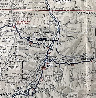
Kernville is a former settlement in the Kern River Valley of the Sierra Nevada, in Kern County, California.
Alder Springs is an unincorporated community in Fresno County, California. It is located 5.5 miles (9 km) west-southwest of Shaver Lake Heights, at an elevation of 4426 feet.
Dora Belle is an unincorporated community in Fresno County, California. It is located just north of Shaver Lake Heights, at an elevation of 5600 feet.
Lerona is an unincorporated community in Fresno County, California. It is located 6.5 miles (10 km) west-northwest of Shaver Lake Heights, at an elevation of 2789 feet.
Mathews Mill is an unincorporated community in Fresno County, California. It is located 3 miles (4.8 km) west-southwest of Shaver Lake Heights, at an elevation of 3123 feet.
Ockenden is an unincorporated community in Fresno County, California. It is located 1.25 miles (2.0 km) south of Shaver Lake Heights, at an elevation of 5568 feet.
Old Bretz Mill is an unincorporated community in Fresno County, California. It is located 2 miles (3.2 km) south-southeast of Shaver Lake Heights, at an elevation of 5823 feet.
Pineridge is an unincorporated community in Fresno County, California. It is located 4 miles (6.4 km) southwest of Shaver Lake Heights, at an elevation of 4842 feet.
Rock Haven is an unincorporated community in Fresno County, California. It is located 1.5 miles (2.4 km) north of Shaver Lake Heights, at an elevation of 5774 feet.
Shaver Lake Heights is an unincorporated community in Fresno County, California. It is located on the southwest bank of Shaver Lake, at an elevation of 5600 feet.
Ridgewood Heights, is an unincorporated community in Humboldt County, California. It is located 3.5 miles (5.6 km) east-northeast of Fields Landing, at an elevation of 417 feet. This neighborhood is part of unincorporated Eureka, California, located entirely within the 95503 zip code.
Goler Heights, also known simply as Goler, is an unincorporated community in Kern County, California. It is located 6.5 miles (10 km) northwest of Randsburg, at an elevation of 2,579 feet (786 m). The town is named after John Goller, a German immigrant who discovered a placer gold deposit that was later mined and named in his honor.
Reilly Heights is an unincorporated community in Mendocino County, California. It is located 3 miles (4.8 km) south-southeast of Navarro, at an elevation of 351 feet.
Veteran Heights was an unincorporated community in Napa County, California. It lay at an elevation of 1808 feet. Veteran Heights was located 5 miles (8.0 km) north-northeast of Saint Helena.
Arnold Heights is an unincorporated community in Riverside County, California. It lies at an elevation of 1558 feet. Arnold Heights is located 8 miles (12.9 km) southeast of Riverside.
This Mendocino County, California–related article is a stub. You can help Wikipedia by expanding it. |