Casma Group | |
---|---|
Stratigraphic range: Albian-Cenomanian | |
Type | Geological group |
Lithology | |
Primary | Limestone, marl, sandstone, conglomerate |
Other | Gypsum, tuff |
Location | |
Coordinates | 10°54′S76°48′W / 10.9°S 76.8°W |
Region | Casma Province, Ancash Region |
Country | Peru |
Extent | West Peruvian Basin |
Type section | |
Named for | Casma |
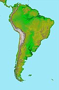
The Casma Group (Spanish : Grupo Casma) is a stratigraphic group of Cretaceous (Albian to Cenomanian) sedimentary formations exposed along the coast and within the Cordillera Occidental near Casma, Peru.
The sediments of the Casma Group reflect deposition in two distinct environments of the West Peruvian Basin. Some sediments were deposited near the Casma Volcanic Arc in an intra-cratonic sedimentary basin that was occasionally connected to the ocean. Other sediments were deposited in what was once a continental platform bounded by reefs and with anoxic pockets. [1]
Together with the Morro Solar and Imperial Groups, the Casma Group contains clastic volcanosedimentary material derivative of the Mesozoic Casma Volcanic Arc. [2] The folding of the Casma Group sediments is the result of the Cretaceous Mochica Phase of the Andean orogeny. [2] The group is intruded by plutons of the Coastal Batholith of Peru. [2]
The Casma Group include the following lithologies: gypsum, limestone, marl, tuff, lava flows, sandstone and conglomerate. [1]
The geology of the Iberian Peninsula consists of the study of the rock formations on the Iberian Peninsula, connected to the rest of the European landmass by the Pyrenees. The peninsula contains rocks from every geological period from the Ediacaran to the Quaternary, and many types of rock are represented. World-class mineral deposits are also found there.
The Pyrenees are a 430-kilometre-long, roughly east–west striking, intracontinental mountain chain that divide France, Spain, and Andorra. The belt has an extended, polycyclic geological evolution dating back to the Precambrian. The chain's present configuration is due to the collision between the microcontinent Iberia and the southwestern promontory of the European Plate. The two continents were approaching each other since the onset of the Upper Cretaceous (Albian/Cenomanian) about 100 million years ago and were consequently colliding during the Paleogene (Eocene/Oligocene) 55 to 25 million years ago. After its uplift, the chain experienced intense erosion and isostatic readjustments. A cross-section through the chain shows an asymmetric flower-like structure with steeper dips on the French side. The Pyrenees are not solely the result of compressional forces, but also show an important sinistral shearing.
The Andean orogeny is an ongoing process of orogeny that began in the Early Jurassic and is responsible for the rise of the Andes mountains. The orogeny is driven by a reactivation of a long-lived subduction system along the western margin of South America. On a continental scale the Cretaceous and Oligocene were periods of re-arrangements in the orogeny. The details of the orogeny vary depending on the segment and the geological period considered.
The Great Valley Sequence of California is a 40,000-foot (12 km)-thick group of related geologic formations that are Late Jurassic through Cretaceous in age on the geologic time scale. These sedimentary rocks were deposited during the late Mesozoic Era in an ancient seaway that corresponds roughly to the outline of the modern Great Valley of California.
Salta Basin or Salta Rift Basin is a sedimentary basin located in the Argentine Northwest. The basin started to accumulate sediments in the Early Cretaceous (Neocomian) and at present it has sedimentary deposits reaching thicknesses of 5,000 metres (16,000 ft). The basin contains seven sub-basins: Tres Cruces, Lomas de Olmedo, Metán, Alemanía, Salfity, El Rey, Sey and Brealito. The basin environment has variously been described as a "foreland rift" and an "intra-continental rift". The basin developed under conditions of extensional tectonics and rift-associated volcanism.
The Morro Solar Group is a stratigraphic group of Mesozoic-aged sedimentary formations exposed near Lima, Peru. The groups formations more specifically of Berriasian and Valanginian age and overlies the Jurassic Puente Piedra Group and underlies the Cretaceous Pamplona Formation. The Morro Solar Group is intruded by sills of andesitic composition. Together with the Casma and Imperial Groups, the Morro Solar Group contains clastic volcanosedimentary material derivative of the Mesozoic Casma Volcanic Arc. The formations of the group hosts mostly local fossils which do not have counterparts for biochronological correlation in other regions.
Choiyoi Group is a Permian and Triassic-aged group of volcano-sedimentary formations in Argentina and Chile. The group bears evidence of bimodal-style volcanism related to an ancient subduction zone that existed along the western margin of the supercontinent Gondwana.
The geology of Germany is heavily influenced by several phases of orogeny in the Paleozoic and the Cenozoic, by sedimentation in shelf seas and epicontinental seas and on plains in the Permian and Mesozoic as well as by the Quaternary glaciations.
Cura-Mallín Group is a heterogeneous group of volcano-sedimentary formations of Oligocene-Miocene age, Colhuehuapian to Laventan in the SALMA classification, in south-central Chile and nearby parts of Argentina. The sediments belonging to the group were deposited in a lacustrine environment and alongside rivers in an intra-arc basin. Southeast of Laguna del Laja Cura-Mallín Group has a thickness of more than 1,800 metres (5,900 ft). The sediments making up the group deposited in an interval between 22 and 8 million years ago.
Way Group is a geologic group of Lower Cretaceous age located in northern Chile. The sediments of the group deposited in Coloso Basin, a small intra-arc basin made up by a half graben. The now inactive Coloso Basin is elongated along a NNW-SSE oriented axis and has its southwestern border made up by faults.
The Coastal Batholith of Peru is a group of hundreds, if not thousands, of individual plutons that crop out near or at the coast of Peru. The batholith runs a length of ca. 1600 km. Most of the plutons of the batholith were intruded in an elongated coast-parallel extensional basin. The magma that formed the batholith's plutons is thought to have originated from the partial melting of hydrated basaltic rocks at the base of the crust during rifting (extension). Subsequently, the rift basin was inverted. During the ascent the magma followed vertical pathways but emplacement was mostly in the form of tabular bodies.
The Marañón fold and thrust belt is a 1,000 kilometres (620 mi) long, northwest–southeast trending belt of deformed rocks located in the Andes of central Peru. The formation of the belt defines the Incaic Phase of the Andean orogeny.
Nacientes del Biobío Formation is a geological formation that crops out near the uppermost reaches of Bío Bío River, in south-central Chile, and nearby areas of Argentina. The formation is made up of basalt and pyroclastic rocks and marine sedimentary rocks, such as sandstone and mudstone. Some less abundant sedimentary lithologies are conglomerate, volcaniclastic sedimentary rock. The formation is intruded by Grupo Plutónico Galletué which is of Late Jurassic to Late Cretaceous age. Further north in Chile the formation is similar to Nacientes del Teno Formation while in Argentina it is similar to Los Molles Formation and Lotena Formation.
The Cesar-Ranchería Basin is a sedimentary basin in northeastern Colombia. It is located in the southern part of the department of La Guajira and northeastern portion of Cesar. The basin is bound by the Oca Fault in the northeast and the Bucaramanga-Santa Marta Fault in the west. The mountain ranges Sierra Nevada de Santa Marta and the Serranía del Perijá enclose the narrow triangular intermontane basin, that covers an area of 11,668 square kilometres (4,505 sq mi). The Cesar and Ranchería Rivers flow through the basin, bearing their names.
The Romeral fault system is a megaregional system of major parallel and anastomosing faults in the Central Ranges of the Colombian Andes and the Cauca, Amagá, and Sinú-San Jacinto Basins. The system spans across ten departments of Colombia, from northeast to south Bolívar, Sucre, Córdoba, Antioquia, Caldas, Risaralda, Quindío, Valle del Cauca, Cauca and Nariño. The fault zone extends into Ecuador where it is known as the Peltetec fault system. The in detail described part of the Romeral fault system south of Córdoba has a total length of 697.4 kilometres (433.3 mi) with a cumulative length of 1,787.9 kilometres (1,110.9 mi) and runs along an average north to south strike of 017.6 ± 16, cross-cutting the central-western portion of Colombia.
The geology of Cameroon is almost universally Precambrian metamorphic and igneous basement rock, formed in the Archean as part of the Congo Craton and the Central African Mobile Zone and covered in laterite, recent sediments and soils. Some parts of the country have sequences of sedimentary rocks from the Paleozoic, Mesozoic and Cenozoic as well as volcanic rock produced by the 1600 kilometer Cameroon Volcanic Line, which includes the still-active Mount Cameroon. The country is notable for gold, diamonds and some onshore and offshore oil and gas.
The geology of Slovakia is structurally complex, with a highly varied array of mountain ranges and belts largely formed during the Alpine orogeny in Mesozoic and Cenozoic eras and with relicts of older Variscan structures of Paleozoic age. The internal zones of the West Carpathian orogen collapsed during Paleogene forming the Central Carpathian Paleogne Basin and later in Miocene the Pannonian Basin and Carpathian volcanic chain were formed.
The geology of Argentina includes ancient Precambrian basement rock affected by the Grenville orogeny, sediment filled basins from the Mesozoic and Cenozoic as well as newly uplifted areas in the Andes.
The Cañadón Asfalto Basin is an irregularly shaped sedimentary basin located in north-central Patagonia, Argentina. The basin stretches from and partly covers the North Patagonian Massif in the north, a high forming the boundary of the basin with the Neuquén Basin in the northwest, to the Cotricó High in the south, separating the basin from the Golfo San Jorge Basin. It is located in the southern part of Río Negro Province and northern part of Chubut Province. The eastern boundary of the basin is the North Patagonian Massif separating it from the offshore Valdés Basin and it is bound in the west by the Patagonian Andes, separating it from the small Ñirihuau Basin.
Purupuruni is a group of lava domes in southern Peru and a correlative geological formation. They are among the many volcanoes that exist in Peru and whose activity has been associated with the subduction of the Nazca Plate beneath the South America Plate. Purupuruni is associated with a geothermal field and a caldera. Volcanic activity occurred during the Pleistocene 53,000 ± 8,000 years ago but also during the Holocene about 5,300 ± 1,100 years ago; today the volcano is considered to be a low hazard volcano but is being monitored nevertheless.