
Kendall County is a county located on the Edwards Plateau in the U.S. state of Texas. In 2020 census, its population was 44,279. Its county seat is Boerne. The county is named for George Wilkins Kendall, a journalist and Mexican–American War correspondent.

Guadalupe County is a county located in the U.S. state of Texas. As of the 2020 census, its population was 172,706. The county seat is Seguin. The county was founded in 1846 and is named after the Guadalupe River.

Comal County is a county located on the Edwards Plateau in the U.S. state of Texas. As of the 2020 census, its population was 161,501. Comal County is known for its rich German-Texan and European history. Its county seat is New Braunfels.

Needville is a city in Fort Bend County, Texas, United States. It is within the Houston–Sugar Land metropolitan area. The population was 3,089 at the 2020 census.
Geronimo is an unincorporated community and census-designated place (CDP) in Guadalupe County, Texas, United States. The population was 1,097 at the 2020 census, up from 1,032 at the 2010 census. It is part of the San Antonio Metropolitan Statistical Area.
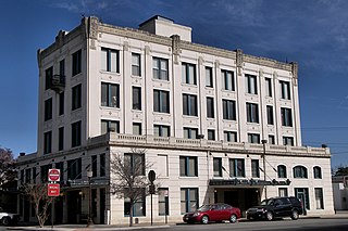
Seguin is a city in and the county seat of Guadalupe County, Texas, United States. The population was 29,433 at the 2020 census, and according to 2023 census estimates, the city is estimated to have a population of 36,013.

Burton is a city in Washington County, Texas, United States. Prior to the 2010 census, Burton changed its status from a town to a city. The population was 294 at the 2020 census.

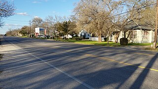
La Vernia is a city in Wilson County, Texas, United States. La Vernia is on the south bank of Cibolo Creek at the junction of U.S. Highway 87 and Texas Farm to Market Road 775, approximately 25 miles east of downtown San Antonio. The population was 1,077 at the 2020 census. La Vernia is part of the San Antonio Metropolitan Statistical Area.

Schertz is a city in Guadalupe, Bexar, and Comal counties in the U.S. state of Texas, within the San Antonio–New Braunfels metropolitan area. The population was 42,002 at the 2020 census, up from 31,465 at the 2010 census. Schertz was settled by Alsatian emigrants in the 1800s.

New Braunfels is a city in Comal and Guadalupe counties in the U.S. state of Texas. It is the seat of Comal County. The city covers 44.9 square miles (116 km2) and had a population of 90,403 as of the 2020 Census. A suburb just north of San Antonio, and part of the Greater San Antonio metropolitan area, it was the third-fastest-growing city in the United States from 2010 to 2020. As of 2022, the U.S. Census Bureau estimates its population at 104,707.
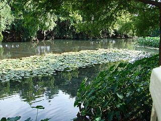
The Comal River is the shortest navigable river in the state of Texas in the United States. Proclaimed the "longest shortest river in the world" by locals, it runs entirely within the city limits of New Braunfels in southeast Comal County. It is a tributary of the Guadalupe River. The Comal begins at Comal Springs in Landa Park and flows 2.5 miles (4.0 km) until its junction with the Guadalupe.

The Guadalupe River runs from Kerr County, Texas, to San Antonio Bay on the Gulf of Mexico, with an average temperature of 17.75 degrees Celsius. It is a popular destination for rafting, fly fishing, and canoeing. Larger cities along it include Kerrville, New Braunfels, Seguin, Gonzales, Cuero, and Victoria. It has several dams along its length, the most notable of which, Canyon Dam, forms Canyon Lake northwest of New Braunfels.
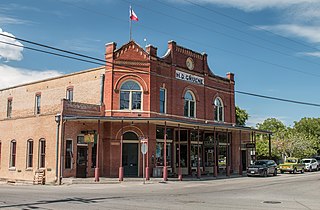
Gruene is a German-Texan town in Comal County in the U.S. state of Texas. Once a significant cotton-producing community along the Guadalupe River, the town has now shifted its economy to one supported primarily by tourism. Gruene, a German surname, is now a district within the city limits of New Braunfels, and much of it was listed in the National Register of Historic Places on April 21, 1975. The city is known for its German-Texan heritage and architecture and many residents of Gruene and New Braunfels are descendants of the first German settlers.

Spring Branch is a city in Comal County, Texas, United States. It has approximately 250 residents. The community voted to incorporate in an election held on November 3, 2015 and Spring Branch officially became a city on November 19, 2015.

Greater San Antonio, officially designated San Antonio–New Braunfels, is an eight-county metropolitan area in the U.S. state of Texas defined by the Office of Management and Budget (OMB). The metropolitan area straddles South Texas and Central Texas and is on the southwestern corner of the Texas Triangle. The official 2020 U.S. census showed the metropolitan area's population at 2,558,143—up from a reported 1,711,103 in 2000—making it the 24th largest metropolitan area in the United States. Downtown Austin and Downtown San Antonio are approximately 80 miles (129 km) apart, and both fall along the Interstate 35 corridor. This combined metropolitan region of San Antonio–Austin has approximately 5 million people.
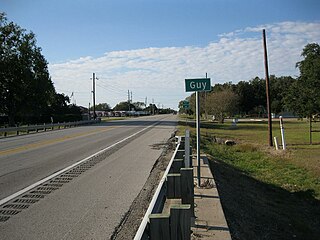
Guy is an unincorporated community in Fort Bend County, Texas, United States. According to the Handbook of Texas, the community had a population of 60 in 2000. It is located in the Greater Houston metropolitan area.
Bracken is an unincorporated community in Comal County, Texas, United States. According to the Handbook of Texas, the community had a population of 76 in 2000. It is included in the Greater San Antonio area.

Nelsonville is an unincorporated community in Austin County, Texas, United States. According to the Handbook of Texas, the community had a population of 110 in 2000. It is located within the Greater Houston metropolitan area.
New Taiton is an unincorporated community in northwestern Wharton County, Texas, United States. The community is situated at the intersection of State Highway 71 (SH 71) and Farm to Market Road 961, (FM 961) north-northwest of El Campo, Texas. New Taiton is identified by road signs on SH 71 and FM 961. The area around the community is intensively farmed and several oil and gas wells are located nearby.

String Prairie is an unincorporated community in Bastrop County, Texas, United States. According to the Handbook of Texas, the community had a population of 125 in 2000. It is located within the Greater Austin metropolitan area.


