Cooksville Creek | |
---|---|
Looking downstream from a pedestrian bridge just downstream of The Queensway | |
Location | |
Country | Canada |
Province | Ontario |
Region | Greater Toronto Area |
Regional Municipality | Peel |
Municipality | Mississauga |
Physical characteristics | |
Source | |
⁃ coordinates | 43°37′35″N79°40′58″W / 43.62639°N 79.68278°W |
⁃ elevation | 183 m (600 ft) |
Mouth | Lake Ontario |
⁃ coordinates | 43°33′53″N79°33′55″W / 43.56472°N 79.56528°W Coordinates: 43°33′53″N79°33′55″W / 43.56472°N 79.56528°W |
⁃ elevation | 74 m (243 ft) |
Length | 16 km (9.9 mi) |
Basin size | 33.9 km2 (13.1 sq mi) |
Basin features | |
River system | Great Lakes Basin |
Cooksville Creek is a short stream in Mississauga, Regional Municipality of Peel in the Greater Toronto Area of Ontario, Canada. [1] It begins near Bristol Road West and Hurontario Street and flows south to Lake Ontario at R.K McMilian Park near Lakeshore Road and Cawthra Road. The community of Cooksville is located on the west bank of the creek near Hurontario Street and Dundas Street East. The creek is surrounded mostly by residential homes and a few parks:
The drainage basin runs for 16 kilometres (9.9 mi), is about 2 kilometres (1.2 mi) wide, has a total area of 33.9 square kilometres (13.1 sq mi), [2] and takes excess water from sanitary and storm sewers. [3] 94% of the drainage basin is built over, and only 6% is open space. [2]
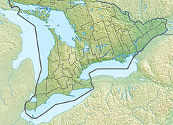
Mississauga is a city in the Canadian province of Ontario and a suburb of Toronto. It is situated on the shores of Lake Ontario in the Regional Municipality of Peel, bordering Toronto. With a population of 721,599 as of the 2016 census, Mississauga is the sixth-most populous municipality in Canada, third-most in Ontario, and second-most in the Greater Toronto Area.
The Queen Elizabeth Way (QEW) is a 400-series highway in the Canadian province of Ontario linking Toronto with the Niagara Peninsula and Buffalo, New York. The freeway begins at the Peace Bridge in Fort Erie and travels 139.1 kilometres (86.4 mi) around the western end of Lake Ontario, ending at Highway 427. The physical highway, however, continues as the Gardiner Expressway into downtown Toronto. The QEW is one of Ontario's busiest highways, with an average of close to 200,000 vehicles per day on some sections. Major highway junctions are at Highway 420 in Niagara Falls, Highway 405 in Niagara-on-the-Lake, Highway 406 in St. Catharines, the Red Hill Valley Parkway in Hamilton, Highway 403 and Highway 407 in Burlington, Highway 403 at the Oakville–Mississauga boundary, and Highway 427 in Etobicoke. Within the Regional Municipality of Halton, between its two junctions with Highway 403, the QEW is signed concurrently with Highway 403.
The Otonabee River is a river in Peterborough County in Central Ontario, Canada. The river flows from Katchewanooka Lake, at the north end of the community of Lakefield, through the city of Peterborough to Rice Lake. It is in the Great Lakes Basin and forms part of the Trent-Severn Waterway.
Mimico Creek is a stream that flows through Brampton, Mississauga and Toronto in the Greater Toronto Area of Ontario, Canada. It is 33 kilometres (21 mi) long, is in the Great Lakes Basin, and is a tributary of Lake Ontario.
Cooksville GO Station is a GO Transit train and bus station the Milton line in the community of Cooksville in Mississauga, Ontario, Canada. It is located at 3210 Hurontario Street, near Dundas and Hurontario Streets. The future Hurontario LRT will connect to this station.
MiWay is the municipal public transport agency serving Mississauga, Ontario, Canada and responsible to the city's Transportation and Works Department. The current MiWay service consists of two types of bus routes: MiLocal, local buses that make frequent stops, and MiExpress, express buses between major destinations. MiWay is the primary operator along the Mississauga Transitway, a dedicated east to west bus-only roadway.
Bloor Street is a major east–west residential and commercial thoroughfare in Toronto, Ontario, Canada. Bloor Street runs from the Prince Edward Viaduct, which spans the Don River Valley, westward into Mississauga where it ends at Central Parkway. East of the viaduct, Danforth Avenue continues along the same right-of-way. The street, approximately 25 kilometres (16 mi) long, contains a significant cross-sample of Toronto's ethnic communities. It is also home to Toronto's famous shopping street, the Mink Mile.
}} Eglinton Avenue is a major east-west arterial thoroughfare in Toronto and Mississauga in the Canadian province of Ontario. The street begins at Highway 407 at the western limits of Mississauga, as a continuation of Lower Baseline in Milton. It traverses the midsection of both cities and ends at Kingston Road. Eglinton Avenue is the only street to cross all six former boroughs of Metropolitan Toronto.
Mississauga—Lakeshore is a federal electoral district in the Peel Region of Ontario, Canada. It has been represented in the House of Commons of Canada since 1979.
Port Credit GO Station is a train and bus station in the GO Transit network located in the Port Credit neighbourhood of Mississauga, Ontario in Canada. It is a stop on the Lakeshore West line train service.
Hurontario Street is a roadway running in Ontario, Canada between Lake Ontario at Mississauga and Lake Huron's Georgian Bay at Collingwood. Within Peel Region, it is a major urban thoroughfare within the cities of Mississauga and Brampton, which serves as the divide from which cross-streets are split into East and West, except at its foot in the historic Mississauga neighbourhood of Port Credit. Farther north, with the exception of the section through Simcoe County, where it forms the 8th Concession, it is the meridian for the rural municipalities it passes through. In Dufferin County, for instance, parallel roads are labelled as EHS or WHS for East of Hurontario Street.
King's Highway 10, commonly referred to as Highway 10 is a provincially maintained highway in the Canadian province of Ontario. The highway connects the northern end of Highway 410 just north of Brampton with Owen Sound on the southern shores of Georgian Bay, passing through the towns of Orangeville and Shelburne as well as several smaller villages along the way. It historically followed the Toronto–Sydenham Road, part of which later became Hurontario Street, as well as Prince of Wales Road.
Cooksville is a neighbourhood in the city of Mississauga, Regional Municipality of Peel, in the Greater Toronto Area region of Ontario, Canada. It is located at the intersection of Dundas Street and Hurontario Street near the eponymous Cooksville Creek.
The Mississauga Transitway is a bus rapid transit (BRT) system in Mississauga, Ontario, Canada. It comprises a series of purpose-constructed bus-only roadways, as well as reserved lanes on existing city streets and portions of Highway 403, that together form a continuous 18 km (11 mi) route spanning most of the city from Winston Churchill Boulevard in the west to the junction of Highways 401 and 427 in the east on the border with Toronto. Service on the Transitway is provided by MiWay and GO Transit, with some stations providing connections to Brampton Transit and Toronto Transit Commission bus services.
Square One Bus Terminal is a GO Transit intercity bus terminal located in Mississauga, Ontario, Canada. It is situated directly across Rathburn Road West from the Mississauga City Centre Transit Terminal and the Square One Shopping Centre.
Mississauga covers 288.42 square kilometres (111.36 sq mi) of land, fronting 13 kilometres (8.1 mi) of shoreline on Lake Ontario.
The Hurontario LRT is a planned light rail line in Mississauga, Ontario, Canada, that extends into Brampton, Ontario. This line will run along Hurontario Street. The line will be built and operated by a consortium of private European and Japanese companies. As of 2010, it was likely that Metrolinx would own the line.
Rockwood Village is a subdivision in east Mississauga. It is part of the old Village of Burnhamthorpe, which was part of Toronto Township, Ontario. Toronto Township became the City of Mississauga in 1967. Mississauga is a city in the Regional Municipality of Peel. The Municipal Ward is Ward 3, the Provincial Riding is Mississauga—Brampton South and the Federal Riding is Mississauga—Brampton South.
Burnhamthorpe Road is a major arterial road in the cities of Toronto and Mississauga, Ontario; beginning at Dundas Street, near Islington Avenue, running west and becoming a rural road in the Town of Oakville, where it terminates at Tremaine Road, where it changes name.
This article related to a river in Ontario, Canada is a stub. You can help Wikipedia by expanding it. |