Cove, Oregon

Last updated

Cove, Oregon
Cove library.jpg
Cove Library
Union County Oregon Incorporated and Unincorporated areas Cove Highlighted.svg
Location in Oregon
Coordinates: 45°17′47″N117°48′37″W / 45.29639°N 117.81028°W / 45.29639; -117.81028
Country United States
State Oregon
County Union
Incorporated 1904
Government
   Mayor Sherry Haeger[ citation needed ]
Area
[1]
  Total0.80 sq mi (2.08 km2)
  Land0.80 sq mi (2.08 km2)
  Water0.00 sq mi (0.00 km2)
Elevation
[2]
2,914 ft (888 m)
Population
 (2020) [3]
  Total620
  Density771.14/sq mi (297.66/km2)
Time zone UTC-8 (Pacific)
  Summer (DST) UTC-7 (Pacific)
ZIP code
97824
Area code 541
FIPS code 41-16250 [4]
GNIS feature ID2410249 [2]

Cove is a city in Union County, Oregon, United States. The population was 620 at the 2020 census.

Contents

History

This area was well known to the Cayuse and Nez Perce Tribes who referred to it as Wiweeletitpe (wee-walla-tit-puh), meaning "Many creeks flowing at that place".[ citation needed ] Euro-Americans first settled here in 1862, and in 1863 they established a post office named Forest Cove. Samuel G. French was the first postmaster. [5] To avoid confusion between Forest Cove and another Oregon community, Forest Grove in Washington County, post office authorities changed the name to Cove in 1868. [5] Cove was platted in the 1870s along Ruckles Road, only the second road over the Blue Mountains. [6]

Geography

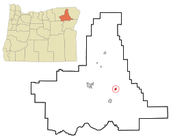
Cove lies east of La Grande and north of Union along the eastern edge of the Grande Ronde Valley of northeastern Oregon. Mill Creek, a tributary of the Grande Ronde River, flows west from the Wallowa Mountains through Cove. Mount Fanny rises to about 7,200 feet (2,200 m) about 3 miles (5 km) east of the city. [7]

According to the United States Census Bureau, the city has a total area of 0.77 square miles (1.99 km2), all of it land. [8] Oregon Route 237 passes through Cove. [7]

Climate

This region experiences warm (but not hot) and dry summers, with no average monthly temperatures above 71.6 °F (22.0 °C). According to the Köppen Climate Classification system, Cove has a warm-summer Mediterranean climate, abbreviated "Csb" on climate maps. [9]

The average total annual precipitation in Cove is about 22 inches (560 mm). July has the highest average maximum temperature, about 83 °F (28 °C), while January has the lowest average minimum, 21 °F (−6 °C). [10]

Climate data for Cove
MonthJanFebMarAprMayJunJulAugSepOctNovDecYear
Record high °F (°C)64
(18)
67
(19)
76
(24)
84
(29)
94
(34)
99
(37)
103
(39)
107
(42)
100
(38)
88
(31)
75
(24)
67
(19)
107
(42)
Average high °F (°C)37.4
(3.0)
42.6
(5.9)
49.5
(9.7)
57.9
(14.4)
66.3
(19.1)
73.4
(23.0)
84.2
(29.0)
83.5
(28.6)
74.1
(23.4)
61.9
(16.6)
47.7
(8.7)
39.2
(4.0)
59.8
(15.4)
Average low °F (°C)22.2
(−5.4)
25.6
(−3.6)
29.4
(−1.4)
33.8
(1.0)
39.5
(4.2)
44.8
(7.1)
49.7
(9.8)
48.4
(9.1)
41.8
(5.4)
35.5
(1.9)
29.8
(−1.2)
24.2
(−4.3)
35.4
(1.9)
Record low °F (°C)−28
(−33)
−22
(−30)
−14
(−26)
10
(−12)
21
(−6)
27
(−3)
32
(0)
30
(−1)
18
(−8)
7
(−14)
−15
(−26)
−24
(−31)
−28
(−33)
Average precipitation inches (mm)2.24
(57)
1.74
(44)
2.1
(53)
2.3
(58)
2.56
(65)
2.21
(56)
0.57
(14)
0.79
(20)
1.28
(33)
1.86
(47)
2.55
(65)
2.31
(59)
22.53
(572)
Average snowfall inches (cm)11.3
(29)
7.2
(18)
6.4
(16)
2.8
(7.1)
0.1
(0.25)
0
(0)
0
(0)
0
(0)
0.1
(0.25)
0.3
(0.76)
2.9
(7.4)
8.5
(22)
39.6
(101)
Average precipitation days1311121110934581213111
Source: [11]

Demographics

Historical population
CensusPop.Note
1890 223
1910 433
1920 399−7.9%
1930 307−23.1%
1940 3214.6%
1950 282−12.1%
1960 31110.3%
1970 36316.7%
1980 45124.2%
1990 50712.4%
2000 59417.2%
2010 552−7.1%
2020 62012.3%
U.S. Decennial Census [12] [3]

2010 census

As of the census of 2010, there were 552 people, 240 households, and 161 families residing in the city. The population density was 716.9 inhabitants per square mile (276.8/km2). There were 257 housing units at an average density of 333.8 per square mile (128.9/km2). The racial makeup of the city was 91.1% White, 0.7% Native American, 1.6% Asian, 0.2% Pacific Islander, 1.6% from other races, and 4.7% from two or more races. Hispanic or Latino of any race were 3.6% of the population. [4]

There were 240 households, of which 28.3% had children under the age of 18 living with them, 56.7% were married couples living together, 7.9% had a female householder with no husband present, 2.5% had a male householder with no wife present, and 32.9% were non-families. 30.0% of all households were made up of individuals, and 14.6% had someone living alone who was 65 years of age or older. The average household size was 2.30 and the average family size was 2.75. [4]

The median age in the city was 50 years. 22.1% of residents were under the age of 18; 3.4% were between the ages of 18 and 24; 17.6% were from 25 to 44; 33.7% were from 45 to 64; and 23.2% were 65 years of age or older. The gender makeup of the city was 48.9% male and 51.1% female. [4]

2000 census

As of the census of 2000, there were 594 people, 231 households, and 176 families residing in the city. The population density was 732.9 inhabitants per square mile (283.0/km2). There were 247 housing units at an average density of 304.8 per square mile (117.7/km2). The racial makeup of the city was 95.45% White, 0.17% African American, 1.35% Native American, 0.17% Asian, 0.34% Pacific Islander, 1.85% from other races, and 0.67% from two or more races. Hispanic or Latino of any race were 2.19% of the population. [4]

There were 231 households, out of which 31.2% had children under the age of 18 living with them, 65.8% were married couples living together, 8.7% had a female householder with no husband present, and 23.4% were non-families. 21.2% of all households were made up of individuals, and 12.1% had someone living alone who was 65 years of age or older. The average household size was 2.57 and the average family size was 2.94. [4]

In the city, the population was spread out, with 26.1% under the age of 18, 6.1% from 18 to 24, 23.1% from 25 to 44, 27.6% from 45 to 64, and 17.2% who were 65 years of age or older. The median age was 42 years. For every 100 females, there were 89.2 males. For every 100 females age 18 and over, there were 88.4 males. [4]

The median income for a household in the city was $38,542, and the median income for a family was $42,344. Males had a median income of $31,793 versus $24,063 for females. The per capita income for the city was $15,872. About 11.1% of families and 12.9% of the population were below the poverty line, including 16.3% of those under age 18 and 8.0% of those age 65 or over. [4]

Education

Cove is served by the Cove School District which is a K-12 public charter school that includes Cove High School. [13] Cove High School participates in the 1A Old Oregon League in the OSAA. [14]

Parks and recreation

Cove Hot Springs Pool is a natural warm-water swimming pool. [15]

Notable people

Related Research Articles

<span class="mw-page-title-main">Drummond, Idaho</span> City in Idaho, United States

Drummond is a city in Fremont County, Idaho, United States. The population was 16 at the 2010 census. It is part of the Rexburg, Idaho Micropolitan Statistical Area.

<span class="mw-page-title-main">Haines, Oregon</span> City in Oregon, United States

Haines is a city in Baker County, Oregon, United States. The population was 416 at the 2010 census.

<span class="mw-page-title-main">Richland, Oregon</span> City in Oregon, United States

Richland is a city in Baker County, Oregon, United States. The population was 156 at the 2010 census.

<span class="mw-page-title-main">Unity, Oregon</span> City in Oregon, United States

Unity is a city in Baker County, Oregon, United States, located in the Burnt River Valley. The population was 71 at the 2010 census.

<span class="mw-page-title-main">Canyonville, Oregon</span> City in Oregon, United States

Canyonville is a city in Douglas County, Oregon, United States. The population was 1,884 at the 2010 census. The main regional tourist attraction, the Seven Feathers Casino Resort is in Canyonville.

<span class="mw-page-title-main">Myrtle Creek, Oregon</span> City in Oregon, United States

Myrtle Creek is a city in Douglas County, Oregon, United States. The population was 3,439 at the 2010 census.

<span class="mw-page-title-main">Winston, Oregon</span> City in Oregon, United States

Winston is a city in Douglas County, Oregon, United States, located 7 miles southwest of Roseburg. The population was 5,379 according to the 2010 United States Census. It is home to Wildlife Safari.

<span class="mw-page-title-main">Long Creek, Oregon</span> City in Oregon, United States

Long Creek is a city in Grant County, Oregon, United States. The population was 173 at the 2020 census. The city is named after John Long, a prominent miner who came to Grant County in 1862 during the Canyon City rush of that same year. Located in a high valley of the Blue Mountains, ranching has been the principal enterprise for the area. Log harvesting was slowly curtailed in the nearby Malheur National Forest until the local mill was closed in 1998.

<span class="mw-page-title-main">Butte Falls, Oregon</span> City in Oregon, United States

Butte Falls is a city in Jackson County, Oregon, United States. The population was 423 at the 2010 census. As of July 1, 2018, the city's population was estimated to be 450.

<span class="mw-page-title-main">Malin, Oregon</span> City in Oregon, United States

Malin is a city in Klamath County, Oregon, United States. The population was 805 at the 2010 census.

<span class="mw-page-title-main">Harrisburg, Oregon</span> City in Oregon, United States

Harrisburg is a city in Linn County, Oregon, United States. The population was 3,567 at the 2010 census.

<span class="mw-page-title-main">Waterloo, Oregon</span> City in Oregon, United States

Waterloo is a city in Linn County, Oregon, United States. The population was 229 at the 2010 census.

<span class="mw-page-title-main">Aurora, Oregon</span> City in Oregon, United States

Aurora is a city in Marion County, Oregon, United States and is home to the nation's largest not-for-profit air ambulance company, Life Flight Network. Before being incorporated as a city, it was the location of the Aurora Colony, a religious commune founded in 1856 by William Keil and John E. Schmit. William named the settlement after his daughter. The population was 1,133 at the 2020 Census. It is part of the Salem Metropolitan Statistical Area.

<span class="mw-page-title-main">Rufus, Oregon</span> City in Oregon, United States

Rufus is a city in Sherman County, Oregon, United States. The population was 249 at the 2010 census. The city was named for an early settler, Rufus Carrol Wallis.

<span class="mw-page-title-main">Bay City, Oregon</span> City in Oregon, United States

Bay City is a city in Tillamook County, Oregon, United States. The population was 1,286 at the 2010 census.

<span class="mw-page-title-main">Adams, Oregon</span> City in Oregon, United States

Adams is a city in Umatilla County, Oregon, United States, located about 13 miles (21 km) northeast of Pendleton on Oregon Route 11. The population was 350 at the 2010 census. It is part of the Pendleton–Hermiston Micropolitan Statistical Area.

<span class="mw-page-title-main">Pilot Rock, Oregon</span> City in Oregon, United States

Pilot Rock is a city in Umatilla County, Oregon, United States. The population was 1,502 at the 2010 census. It is part of the Pendleton–Hermiston Micropolitan Statistical Area. The main industries are timber and agriculture. Pilot Rock is home to the Boise Cascade /Kinzua Lumber lumber and pole mill as well as Pilot Rock High School. The name of Pilot Rock refers to a large basalt rock formation which is visible from the old Oregon Trail and was used in navigating wagon trains through the area.

<span class="mw-page-title-main">North Powder, Oregon</span> City in Oregon, United States

North Powder is a city in Union County, Oregon, United States. The population was 439 at the 2010 census.

<span class="mw-page-title-main">Mosier, Oregon</span> City in Oregon, United States

Mosier is a city along the Columbia River in Wasco County, Oregon, United States. The population was 433 at the 2010 census.

<span class="mw-page-title-main">Idanha, Oregon</span> City in Oregon, United States

Idanha is a city on the Marion County/Linn County line in Oregon, United States, on Oregon Route 22 and the Santiam River. The population was 156 at the 2020 census.

References

  1. "ArcGIS REST Services Directory". United States Census Bureau. Retrieved October 12, 2022.
  2. 1 2 U.S. Geological Survey Geographic Names Information System: Cove, Oregon
  3. 1 2 "Census Population API". United States Census Bureau. Retrieved October 12, 2022.
  4. 1 2 3 4 5 6 7 8 "U.S. Census website". United States Census Bureau . Retrieved December 21, 2012.
  5. 1 2 McArthur, Lewis A.; Lewis L. McArthur (2003) [1928]. Oregon Geographic Names (7th ed.). Portland: Oregon Historical Society Press. p. 240. ISBN   0-87595-277-1.
  6. Bailey, Barbara Ruth (1982). Main Street: Northeastern Oregon. Oregon Historical Society. p. 46. ISBN   0-87595-073-6.
  7. 1 2 Oregon Atlas & Gazetteer. Yarmouth, Maine: DeLorme. 2008. p. 75. ISBN   978-0-89933-347-2.
  8. "US Gazetteer files 2010". United States Census Bureau. Archived from the original on January 25, 2012. Retrieved December 21, 2012.
  9. "Cove, Oregon". Weatherbase. CantyMedia. Retrieved June 28, 2015.
  10. "Cove Oregon (351924)". Western Regional Climate Center. Retrieved June 30, 2015.
  11. "COVE 1 E, OR (351926)". Western Regional Climate Center. Retrieved November 22, 2015.
  12. "Census of Population and Housing". Census.gov. Retrieved June 4, 2015.
  13. "Cove School District". www.cove.k12.or.us. Retrieved December 30, 2022.
  14. "OSAA - School Classifications and Districts".
  15. "Cove Hot Springs Pool in Cove Oregon - Travel Oregon". Archived from the original on September 27, 2007. Retrieved February 26, 2007.