Dallas, Wisconsin

Last updated

Dallas, Wisconsin
Barron County Wisconsin Incorporated and Unincorporated areas Dallas Highlighted.svg
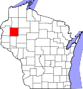
Location of Dallas in Barron County, Wisconsin
Coordinates: 45°15′7″N91°51′18″W / 45.25194°N 91.85500°W / 45.25194; -91.85500
Country Flag of the United States.svg  United States
State Flag of Wisconsin.svg  Wisconsin
County Barron
Area
[1]
  Total1.48 sq mi (3.85 km2)
  Land1.45 sq mi (3.75 km2)
  Water0.04 sq mi (0.10 km2)
Elevation
[2]
1,168 ft (356 m)
Population
 (2020) [3]
  Total359
  Density240/sq mi (93/km2)
Time zone UTC-6 (Central (CST))
  Summer (DST) UTC-5 (CDT)
Area code(s) 715 & 534
FIPS code 55-18600 [4]
GNIS feature ID1583045 [2]
Website www.dallaswi.com

Dallas is a village in Barron County in the U.S. state of Wisconsin. The population was 359 at the 2020 census. The village is located within the Town of Dallas.

Contents

Geography

Dallas is located at 45°15′34″N91°48′58″W / 45.25944°N 91.81611°W / 45.25944; -91.81611 (45.259667, −91.816243). [5]

According to the United States Census Bureau, the village has a total area of 1.49 square miles (3.86 km2), of which, 1.45 square miles (3.76 km2) is land and 0.04 square miles (0.10 km2) is water. [6]

The Village of Dallas is located along County Roads A and U.

Demographics

Historical population
CensusPop.Note
1910 342
1920 42524.3%
1930 4280.7%
1940 4361.9%
1950 370−15.1%
1960 4018.4%
1970 359−10.5%
1980 47732.9%
1990 452−5.2%
2000 356−21.2%
2010 40914.9%
2020 359−12.2%
U.S. Decennial Census [7]

2010 census

As of the census [8] of 2010, there were 409 people, 156 households, and 94 families living in the village. The population density was 282.1 inhabitants per square mile (108.9/km2). There were 173 housing units at an average density of 119.3 per square mile (46.1/km2). The racial makeup of the village was 97.3% White, 0.2% Native American, 1% Asian, 0.7% from other races, and 0.7% from two or more races. Hispanic or Latino people of any race were 2% of the population.

There were 156 households, of which 29.5% had children under the age of 18 living with them, 45.5% were married couples living together, 10.3% had a female householder with no husband present, 4.5% had a male householder with no wife present, and 39.7% were non-families. 30.1% of all households were made up of individuals, and 14.7% had someone living alone who was 65 years of age or older. The average household size was 2.33 and the average family size was 2.85.

The median age in the village was 43.7 years. 19.8% of residents were under the age of 18; 8.6% were between the ages of 18 and 24; 22.7% were from 25 to 44; 23.7% were from 45 to 64; and 25.2% were 65 years of age or older. The gender makeup of the village was 49.9% male and 50.1% female.

2000 census

As of the census [4] of 2000, there were 356 people, 146 households, and 83 families living in the village. The population density was 244.8 people per square mile (94.8/km2). There were 169 housing units at an average density of 116.2 per square mile (45.0/km2). The racial makeup of the village was 97.75% White, 1.12% Native American, and 1.12% from two or more races. Hispanic or Latino people of any race were 1.4% of the population.

There were 146 households, out of which 24% had children under the age of 18 living with them, 45.9% were married couples living together, 7.5% had a female householder with no husband present, and 42.5% were non-families. 34.9% of all households were made up of individuals, and 22.6% had someone living alone who was 65 years of age or older. The average household size was 2.23 and the average family size was 2.88.

In the village, the population was spread out, with 20.8% under the age of 18, 5.9% from 18 to 24, 22.8% from 25 to 44, 24.2% from 45 to 64, and 26.4% who were 65 years of age or older. The median age was 46 years. For every 100 females, there were 92.4 males. For every 100 females age 18 and over, there were 91.8 males.

The median income for a household in the village was $30,833, and the median income for a family was $37,750. Males had a median income of $32,500 versus $22,361 for females. The per capita income for the village was $14,665. About 7.9% of families and 11.6% of the population were below the poverty line, including 14.8% of those under age 18 and 22.1% of those age 65 or over.

Related Research Articles

<span class="mw-page-title-main">De Soto, Iowa</span> City in Iowa, United States

De Soto is a city in Dallas County, Iowa, United States. The population was 915 at the time of the 2020 census. It is part of the Des Moines–West Des Moines Metropolitan Statistical Area.

<span class="mw-page-title-main">Delaware, Iowa</span> City in Iowa, United States

Delaware is a city in Delaware County, Iowa, United States. The population was 142 at the time of the 2020 census.

<span class="mw-page-title-main">Waite, Maine</span> Town in the state of Maine, United States

Waite is a town in Washington County, Maine, United States. The town was named after Benjamin Waite, a lumberman and businessman from Calais, Maine. The population was 66 at the 2020 census.

<span class="mw-page-title-main">Newark, Missouri</span> Village in Missouri, United States

Newark is a village in southeast Knox County, Missouri, United States, along the South Fabius River. As of the 2020 census, its population was 54.

<span class="mw-page-title-main">Wood Lake, Nebraska</span> Village in Nebraska, United States

Wood Lake is a village in Cherry County, Nebraska, United States. The population was 63 at the 2010 census.

<span class="mw-page-title-main">Country Club, Missouri</span> Village in Missouri, United States

Country Club is a village in Andrew County, Missouri, United States. The population was 2,487 at the 2020 census. It is part of the St. Joseph, MO–KS Metropolitan Statistical Area.

<span class="mw-page-title-main">Elmwood Place, Ohio</span> Village in Hamilton County, Ohio, United States

Elmwood Place is a village in Hamilton County, Ohio, United States. The population was 2,087 at the 2020 census. Except for a small portion which touches neighboring St. Bernard, Elmwood Place is nearly surrounded by the city of Cincinnati.

<span class="mw-page-title-main">Woodlawn, Ohio</span> Village in Ohio, United States

Woodlawn is a village in Hamilton County, Ohio, United States. The population was 3,916 at the 2020 census.

<span class="mw-page-title-main">Deersville, Ohio</span> Village in Ohio, United States

Deersville is a village in Harrison County, Ohio, United States. The population was 69 at the 2020 census. The Deersville Historic District is located along Main Street.

<span class="mw-page-title-main">Liberty Center, Ohio</span> Village in Ohio, United States

Liberty Center is a village in Henry County, Ohio, United States. The population was 1,108 at the 2020 census.

<span class="mw-page-title-main">Nashville, Ohio</span> Village in Ohio, United States

Nashville is a village in Holmes County, Ohio, United States. The population was 183 at the 2020 census.

<span class="mw-page-title-main">Centerburg, Ohio</span> Village in Ohio, United States

Centerburg is a village in Knox County, Ohio, United States, along the North Fork of the Licking River. As of the 2020 census, the village population was 1,690. Centerburg is located near the geographical center of Ohio.

<span class="mw-page-title-main">Syracuse, Ohio</span> Village in Ohio, United States

Syracuse is a village in Meigs County, Ohio, United States, along the Ohio River. The population was 781 at the 2020 census.

<span class="mw-page-title-main">Broughton, Ohio</span> Village in Ohio, United States

Broughton is a village in Paulding County, Ohio, United States. The population was 116 at the 2020 census.

<span class="mw-page-title-main">Ridgeland, Wisconsin</span> Village in Wisconsin, United States

Ridgeland is a village in Dunn County, Wisconsin, United States. The population was 258 at the 2021 census.

<span class="mw-page-title-main">Endeavor, Wisconsin</span> Village in Wisconsin, United States

Endeavor is a village in Marquette County, Wisconsin, United States. The population was 468 at the 2010 census.

<span class="mw-page-title-main">Weyerhaeuser, Wisconsin</span> Village in Wisconsin, United States

Weyerhaeuser is a village in Rusk County, Wisconsin, United States. The population was 238 at the 2010 census.

<span class="mw-page-title-main">Dallas (town), Wisconsin</span> Town in Barron County, Wisconsin, US

Dallas is a town in Barron County in the U.S. state of Wisconsin. As of the 2020 census, the population was 570, up from the 2010 census, in which the town had a population of 565. The Village of Dallas is within the town.

<span class="mw-page-title-main">Prairie Farm, Wisconsin</span> Village in Wisconsin, United States

Prairie Farm is a village in Barron County in the U.S. state of Wisconsin. The population was 494 at the 2020 census. The village is located within the Town of Prairie Farm, on eastern shore of the Prairie Farm Flowage, a reservoir on the Hay River.

<span class="mw-page-title-main">Ettrick (village), Wisconsin</span> Village in Wisconsin, United States

Ettrick is a village in Trempealeau County, Wisconsin, United States. The population was 525 at the 2020 census. The village is surrounded by the Town of Ettrick.

References

  1. "2019 U.S. Gazetteer Files". United States Census Bureau. Retrieved August 7, 2020.
  2. 1 2 "US Board on Geographic Names". United States Geological Survey. October 25, 2007. Retrieved January 31, 2008.
  3. "Census Bureau profile: Dallas village, Wisconsin". United States Census Bureau. May 2023. Retrieved October 29, 2024.
  4. 1 2 "U.S. Census website". United States Census Bureau . Retrieved January 31, 2008.
  5. "US Gazetteer files: 2010, 2000, and 1990". United States Census Bureau. February 12, 2011. Retrieved April 23, 2011.
  6. "US Gazetteer files 2010". United States Census Bureau. Archived from the original on January 25, 2012. Retrieved November 18, 2012.
  7. "Census of Population and Housing". Census.gov. Retrieved June 4, 2015.
  8. "U.S. Census website". United States Census Bureau . Retrieved November 18, 2012.