Budaun is a medieval city and headquarters of Budaun district, in the Indian state of Uttar Pradesh. It is located about a mile east of the Sot river, and 27 km north of the Ganges, in the Rohilkhand region of Uttar Pradesh. According to the 2011 census, it has a population of 159,221, which is projected at 161,555 at present. Budaun rose to historical importance as the capital of the Delhi Sultanate for four years from 1210 CE to 1214 CE during the reign of Sultan Iltutmish. It was the most important post of Northern Frontier during Mughal reign. Budaun is a big market, historically famous and religiously important city. Budaun is 230 km south-east of New Delhi and 245 km north-west of Lucknow, both taking about 6 hours by road.

Budaun district is one of the districts of Uttar Pradesh state of India, with its headquarters in the town of Badaun. The district is part of the Bareilly division, and covers an area of 4,234 km2 (1,635 sq mi). According to legend, Budaun was named after the Ahir prince Budh.
Bisauli is a town and a municipal board in Badaun district in the state of Uttar Pradesh, India. It is settled on Badaun - Moradabad Highway. Bisauli is known for its temples and mosques abounding the town. Bisauli is a constituency of District Budaun. Member of Legislative Assembly from Bisuli is Ashutosh Maurya of Samajwadi Party
Dhampur is a city and a municipal board in Bijnor district in the state of Uttar Pradesh, India. It is located at 29.51°N 78.50°E, and lies in Northern India.
Dostpur is a town and a nagar panchayat in Sultanpur district in the state of Uttar Pradesh, India. The town borders Sultanpur and Ambedkarnagar. Purvanchal Expressway passes near the town.
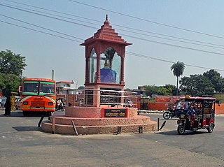
Faizganj is a town and a nagar panchayat in Budaun district in the state of Uttar Pradesh, India.

Fatehpur Chaurasi is a town and a nagar panchayat in Unnao district in the state of Uttar Pradesh, India. First officially classified as a town for the 1981 census, Fatehpur Chaurasi is located on the north bank of the Kalyani river, a bit to the south of the main road from Unnao to Bangarmau. Local industries include the production of furniture, boxes, almirahs, shoes, and slippers. As of 2011, the town's population is 6,715, in 1,158 households.

Gajraula is a town and municipal board in Amroha district in the state of Uttar Pradesh, India. Gajraula is also the headquarters of Gajraula block. It is located on NH 9, a four-lane highway connecting Uttarakhand and cities such as Bareilly and Lucknow via Delhi. It is a significant industrial hub in Uttar Pradesh and home to a number of multinational corporations, including Jubliant Life Sciences, RACL Geartech, and Israeli Pharma Teva API, as well as several engineering colleges. Moradabad, Meerut, Bulandsahar, Budaun, Hapur, and Delhi NCR are among the larger nearby cities.
Harpalpur is a town and a nagar panchayat in Chhatarpur District in the Indian state of Madhya Pradesh.

Kachhauna Patseni is a town and a nagar panchayat in Sandila tehsil of Hardoi district, Uttar Pradesh, India. It was first upgraded to urban status for the 1981 census. As of 2011, its population is 15,647, in 2,772 households. The Kachhauna community development block encompasses the rural areas surrounding the town.

Kakrala is a city and municipal board in Badaun district in the Indian state of Uttar Pradesh.
Mundia is a town and a nagar panchayat in Badaun district in the Indian state of Uttar Pradesh.
Rudauli is a town, tehsil and a municipal board in Ayodhya district in the Indian state of Uttar Pradesh. Rudauli is 50 km west of the district headquarters Ayodhya.
Sakhanu is a town and a nagar panchayat in Badaun district in the Indian state of Uttar Pradesh. Mohammad Faisal S/O Janab Gulam Sarvar is the present chairman of Sakhanu town.
Tilhar is a city and very old tehsil of Uttar Pradesh, and municipal board of the Shahjahanpur district in the Indian state of Uttar Pradesh. It is also a constituency of Uttar Pradesh Vidhan Sabha. As the city was also known to supply bows to Mughul armies, Tilhar was also known as Kamaan Nagar during the reign of emperor Jahangeer.

Ujhani is an industry-based city and a municipal board in Badaun district in the Indian state of Uttar Pradesh.
Usawan is a town and a Nagar panchayat in Badaun District in the Indian state of Uttar Pradesh.
Wazirganj is a town and a nagar panchayat in Budaun District in the Indian state of Uttar Pradesh.
Sanay is a village in Budaun district, Uttar Pradesh. Its village code is 128237. It is located on the right side of river Sot. Sanai is a medium size village located in Budaun of Budaun district, Uttar Pradesh with total 118 families residing. The Sanai village has population of 683 of which 366 are males while 317 are females as per Population Census 2011.
Kundra is a village in Dataganj block, Budaun district, Uttar Pradesh, India. Its village code is 128297. Budaun railway station is 32 KM away from the village. According to 2011 Census of India population of the village is 2,054, in which 1,126 are males and 928 are females.
