
Bareilly division is one of the 18 administrative geographical unit of the northern Indian state of Uttar Pradesh. Bareilly city is the administrative headquarters of the division. Part of the Rohilkhand region, Bareilly division consists of four major districts in western Uttar Pradesh - Bareilly, Badaun, Pilibhit and Shahjahanpur.
Budaun is a medieval city and headquarters of Budaun district, in the Indian state of Uttar Pradesh. It is located about a mile east of the Sot river, and 27 km north of the Ganges, in the Rohilkhand region of Uttar Pradesh. According to the 2011 census, it has a population of 159,221, which is projected at 161,555 at present. Budaun rose to historical importance as the capital of the Delhi Sultanate for four years from 1210 CE to 1214 CE during the reign of Sultan Iltutmish. It was the most important post of Northern Frontier during Mughal reign. Budaun is a big market, historically famous and religiously important city. Budaun is 230 km south-east of New Delhi and 245 km north-west of Lucknow, both taking about 6 hours by road.

Budaun district is one of the districts of Uttar Pradesh state of India, with its headquarters in the town of Badaun. The district is part of the Bareilly division, and covers an area of 4,234 km2 (1,635 sq mi). According to legend, Budaun was named after the Ahir prince Budh.

Pilibhit district is one of the 75 districts in the state of Uttar Pradesh in India, and Pilibhit city is the district headquarters. Pilibhit district is a part of Bareilly Division. A Tiger Reserve Area was named Pilibhit Tiger Reserve in September 2008.
Dataganj is a town and a nagar palika in Badaun district in the state of Uttar Pradesh, India.

Gajraula is a town and municipal board in Amroha district in the state of Uttar Pradesh, India. Gajraula is also the headquarters of Gajraula block. It is located on NH 9, a four-lane highway connecting Uttarakhand and cities such as Bareilly and Lucknow via Delhi. It is a significant industrial hub in Uttar Pradesh and home to a number of multinational corporations, including Jubliant Life Sciences, RACL Geartech, and Israeli Pharma Teva API, as well as several engineering colleges. Moradabad, Meerut, Bulandsahar, Budaun, Hapur, and Delhi NCR are among the larger nearby cities.

Kakrala is a city and municipal board in Badaun district in the Indian state of Uttar Pradesh.
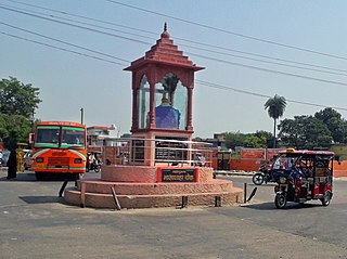
Rithora is a town and a nagar panchayat in Bareilly Tehsil of Bareilly district in the Indian state of Uttar Pradesh.
Badaun Lok Sabha constituency is one of the 80 Lok Sabha (parliamentary) constituencies in Uttar Pradesh state in India.
The town of Sautbad, known as Sheikhupur, is about 4 km from the centre of Badaun city across the river Saut, Uttar Pradesh, India and comes under Badaun Metro Area. It is 1 km from Budaun and will be part of the city in one year. The latitude and longitude of Sheikhupur are 28.1 (N) and 79.7' respectively.
Islamnagar is a Block and Nagar Panchayat in Badaun district in the Indian state of Uttar Pradesh. Its block code is 0174.

Shamli is a district in the Indian state of Uttar Pradesh. This district was carved out from Muzaffarnagar District on 28 September 2011 as Prabudh Nagar and renamed Shamli in July 2012. Shamli is the headquarters of the district. Shamli is located along the Delhi-Saharanpur-Dehradun Expressway, Ambala-Shamli Expressway, Gorakhpur-Shamli Expressway, Delhi–Saharanpur, Meerut-Karnal and Panipat-Khatima Highways.

Sambhal district is a district of Uttar Pradesh state in India. The district headquarter is Bahjoi town. A large of 993 villages with 16 police stations fall under Sambhal district.
Auhawa Bangar is a village in Nohjhil Block, Mant Tehsil in Mathura District of Uttar Pradesh, India. It belongs to Agra Division. It is located 32 km north of district headquarters Mathura, and 13 km from Nohjhil.

Gunnaur Assembly constituency is one of the 403 constituencies of the Uttar Pradesh Legislative Assembly, India. It is a part of the Budaun district and one of the five assembly constituencies in the Badaun Lok Sabha constituency. First election in this assembly constituency was held in 1952 after the "DPACO (1951)" was passed in 1951. After the "Delimitation of Parliamentary and Assembly Constituencies Order" was passed in 2008, the constituency was assigned identification number 111.

Bilsi Assembly constituency is one of the 403 constituencies of the Uttar Pradesh Legislative Assembly, India. It is a part of the Badaun district and one of the five assembly constituencies in the Badaun Lok Sabha constituency. First election in this assembly constituency was held in 1974 after the delimitation order was passed in 1967. After the "Delimitation of Parliamentary and Assembly Constituencies Order" was passed in 2008, the constituency was assigned identification number 114.

Badaun Assembly constituency is one of the 403 constituencies of the Uttar Pradesh Legislative Assembly, India. It is a part of the Badaun district and one of the five assembly constituencies in the Badaun Lok Sabha constituency. First election in this assembly constituency was held in 1957 after the "DPACO (1956)" was passed in 1956. After the "Delimitation of Parliamentary and Assembly Constituencies Order" was passed in 2008, the constituency was assigned identification number 115.

Shekhupur Assembly constituency is one of the 403 constituencies of the Uttar Pradesh Legislative Assembly, India. It is a part of the Badaun district and one of the five assembly constituencies in the Aonla Lok Sabha constituency. First election in this assembly constituency was held in 2012 after the "Delimitation of Parliamentary and Assembly Constituencies Order, 2008" was passed and the constituency was formed in 2008. The constituency is assigned identification number 116.
Udhar is a high literacy village located in Mat tehsil in Mathura district of Uttar Pradesh, India. It is one of 267 villages in mat Block along with villages like Bindu Bulaki and Nagla Himana. There is a railway station nearby, Mathura. Mat is the nearest town to Udhar village.

Budaun junction is a main railway station in Badaun district, Uttar Pradesh. Its code is BEM. It serves Budaun city. The station consists of three platforms after gauge conversion of bareilly to kasganj railway line railway station was renovated.


