
The Cape Flats is an expansive, low-lying, flat area situated to the southeast of the central business district of Cape Town. The Cape Flats is also the name of an administrative region of the City of Cape Town, which lies within the larger geographical area.

Wynberg is a southern suburb of the City of Cape Town in Western Cape, South Africa. It is situated between Plumstead and Kenilworth, and is a main transport hub for the Southern Suburbs of Cape Town.

Milnerton is a seaside town on Table Bay and is located north of Cape Town in South Africa. It is located 11 kilometres to the north of the city's centre.

The Southern Suburbs are a group of Anglophone suburbs in Cape Town, Western Cape, South Africa.

Observatory is a suburb in Cape Town, South Africa, colloquially known as Obs. Bordered by Mowbray to the south and Salt River to the northwest, the area is best known as a student neighbourhood associated with the nearby University of Cape Town and Groote Schuur Hospital. It takes its name from the South African Astronomical Observatory headquarters, built in 1829 by the Royal Observatory.
South Peninsula High School is a secondary school in Diep River, a suburb of Cape Town, South Africa. The school celebrated its 60th anniversary in 2010, after opening in 1950.

Mowbray is one of the Southern Suburbs of Cape Town, South Africa and lies on the slopes of Devil's Peak. Mowbray is at a junction of several major Cape Town highways and has an important multi-modal public transport interchange at Mowbray railway station. Its original name was Driekoppen.

Rosebank is one of the Southern Suburbs of Cape Town, South Africa, located between the suburbs of Mowbray and Rondebosch.

The Southern Line is a commuter rail line operated by Metrorail Western Cape, connecting Cape Town station in central Cape Town, South Africa with the Southern Suburbs and the towns on the west coast of False Bay, terminating in Simon's Town.

Woodhead Dam is a dam on Table Mountain, Western Cape, South Africa. It was built in 1897 and supplies water to Cape Town. The dam, which was the first large masonry dam in South Africa, was designated as an International Historic Civil Engineering Landmark by the American Society of Civil Engineers in 2008.
Heathfield is a suburb in Cape Town, South Africa.

Grotto Bay is a coastal private property in West Coast District Municipality in the Western Cape province of South Africa. It was declared a nature reserve in 2002. Covering about 378,000 hectares is located 45 minutes from Cape Town. "Cape West Coast Biosphere". website. Retrieved 9 January 2023.Grotto Bay forms part of the Cape West Coast Biosphere reserve which was proclaimed by UNESCO in 2000. Incorporating 378 000 hectares, it stretches from the mouth of the Diep River at Milnerton and covers the entire coastal lowlands to far north of the Berg River at Velddrift. There are 459 biospheres globally, 65 of them in Africa and 4 in South Africa. All Biospheres promote a balanced approach to the development of humans and the preservation of biodiversity in a particular region. The aim of the Cape West Coast Biosphere is to foster human development that is ecologically sustainable, conserve the landscape, vegetation and living species. It also support the research, monitoring, education and information exchange related to local, national and global issues of conservation and development.
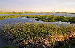
The Rietvlei Wetland Reserve is a 663-hectare (1,640-acre) nature reserve situated in Table View, Western Cape, South Africa. It is managed by the City of Cape Town's Environmental Resource Management Department.
The Diep River Fynbos Corridor is a nature reserve located in the Blaauwberg region of Cape Town, South Africa. It forms part of the larger Table Bay Nature Reserve, which was established in June 2012.

Cecilia is a section of the Table Mountain National Park on the lower eastern slopes of Table Mountain in Cape Town, located just to the south of Kirstenbosch National Botanical Garden. It was previously used for commercial logging and known as Cecilia Forest or Cecilia Plantation, but has now been given protected status and integrated into the National Park.
GlenBridge Special School and Resource Centre is an English medium Grade 1 – 12 public school in Cape Town, South Africa that offers remedial activities for children with intellectual impairments. Students here may have had accidents or they may have Foetal alcohol syndrome, Down syndrome or Williams syndrome in addition to other disabilities. GlenBridge is a member of Autism South Africa, an organisation which aims to improve the lives of people with autism.
Diep River is a river in the Western Cape, a province of South Africa.

The M4 is a long metropolitan route in the City of Cape Town Metropolitan Municipality in South Africa. It connects the Cape Town CBD with the Cape of Good Hope via Wynberg, Muizenberg and Fish Hoek. Originally, it was the main route connecting the Cape Town CBD with the Southern Suburbs and is thus named Main Road for much of its length. From the CBD to Kirstenhof, it is parallel to the M3 Freeway.
Blouberg or Blaauwberg, is a group of suburbs situated along the Table Bay, approximately 16 kilometres north of Cape Town in the Western Cape, South Africa.

