This article needs additional citations for verification .(December 2009) |
Tamboerskloof | |
|---|---|
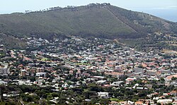 Tamboerskloof seen from Tafelberg Road on Table Mountain | |
 | |
| Coordinates: 33°55′45″S18°24′15″E / 33.92917°S 18.40417°E | |
| Country | South Africa |
| Province | Western Cape |
| Municipality | City of Cape Town |
| Main Place | Cape Town |
| Government | |
| • Type | Subcouncil 16 / Ward 77 |
| • Councillor | Francine Higham (DA) |
| Area | |
• Total | 1.04 km2 (0.40 sq mi) |
| Population (2011) [2] | |
• Total | 2,984 |
| • Density | 2,900/km2 (7,400/sq mi) |
| Racial makeup (2011) | |
| • Black African | 14.7% |
| • Coloured | 5.1% |
| • Indian/Asian | 1.6% |
| • White | 75.8% |
| • Other | 2.7% |
| First languages (2011) | |
| • English | 62.6% |
| • Afrikaans | 27.6% |
| • Other | 9.9% |
| Time zone | UTC+2 (SAST) |
| Postal code (street) | 8001 |
| Area code | 021 |
| Website | www |

Tamboerskloof is a neighbourhood and suburb of Cape Town, South Africa. [3] It lies on the slopes of Lion's Head and Signal Hill, adjacent to the neighbourhoods of Gardens and Bo-Kaap. Tamboerskloof is one of the contiguous group of neighbourhoods referred to as the City Bowl.