Salt River, Cape Town

Last updated

Salt River
Salt River OSM map.svg
Street map of Salt River
South Africa Western Cape location map.svg
Red pog.svg
Salt River
South Africa adm location map.svg
Red pog.svg
Salt River
Coordinates: 33°55′58″S18°27′27″E / 33.93278°S 18.45750°E / -33.93278; 18.45750
Country South Africa
Province Western Cape
Municipality City of Cape Town
Main Place Cape Town
Government
   Councillor Bernadette Le Roux (DA)
Area
[1]
  Total2.75 km2 (1.06 sq mi)
Population
 (2011) [1]
  Total6,577
  Density2,400/km2 (6,200/sq mi)
Racial makeup (2011)
[1]
   Black African 39.5%
   Coloured 45.0%
   Indian/Asian 3.8%
   White 6.6%
  Other5.1%
First languages (2011)
[1]
   English 56.5%
   Afrikaans 15.9%
   Xhosa 10.1%
   Zulu 1.8%
  Other15.7%
Time zone UTC+2 (SAST)
Postal code (street)
7925

Salt River is a suburb of Cape Town, located near Table Bay, to the east of Cape Town's central business district. Salt River is served by a railway station of the same name, and has the postcode 7925. It is noted for its association with the clothing and textiles industry. The name Salt River is a translation of the Dutch "Soutrivier".

Contents

History

Prior to its establishment as a community within Cape Town the area was inhabited by the Goringhaiqua Khoikhoi clan. In 1510 it was the scene of the Battle of Salt River between the Portuguese and the Goringhaiqua.

Once a booming part of Cape Town because of its close proximity to the CBD, Salt River was the industrial heart of Cape Town.

The steel and locomotive industries were important in the suburbs' early development due to the expansion of the rail network in the early 1900s.

Up until the late 1980s prominent industries also included textile and clothing manufacturing. However, due to the influx of cheaper, imported clothing many of the clothing factories closed and are being redeveloped. [2]

Due to Salt River's proximity to central Cape Town and large manufacturing plants, the suburb became popular with Cape Malays and the so-called coloured working class. Most of the Cape Malays and coloureds moved to Salt River from District 6 in the late 1950s and early 1960s, even before the "forced removals" from District 6, c. 1967. Cape Malays and coloureds could buy houses in Salt River, but Indians could not. However Indians were allowed to live in Salt River provided they buy or rent a house attached to a corner grocer shop. On almost every corner in Salt River there used to be grocer shops where people could buy daily necessities over the counter. Today Salt River is still largely populated by second and third generations of Cape Malay and coloured families. Coloured people are mostly of the Christian faith. Salt River is known to be one of the most religiously tolerant suburbs in the Cape, with Cape Malays, who are of the Muslim faith and coloured Christians getting along very well. There are several churches in the area and two mosques (Masjids) – one in Tennyson Street (Muhammadiyah Masjid) and one in Addison Road.

For such a small town, Salt River has many primary schools, merely a road or two apart from each other, and two high schools. Dryden Street Primary School has been there since c. 1960. There is also Cecil Road Primary School. In the past there was also Kipling Street Primary School but because it was a Muslim school and not subsidized by the government, it could not survive financially and closed its doors c. 2010. Other primary schools were St. Mary's and Wesley Training College which had grades from Sub A through to Std. 10 (Matric) - today it is referred to as Grade 12. The other high school is Salt River High School. At one point (c. 1976) this high school became too small to accommodate the pupils of, not only the area (Salt River), but also from further afield, Woodstock, Maitland and Kensington. An annex was found in the old school (previous called Wolraad Woltemade - a whites only school) in Kent Street, with its front on Albert Road, Salt River. Several Std 6 and Std 7 classes were sent there while only one each English and Afrikaans Std 6 & Std 7 were still at Salt River High School in Rochester Road, together with the rest of the school which now comprised Std 8 to 10. When the Kent Street pupils finished Std 6 and Std 7, they returned to Rochester Road to complete high school there.

Salt River was a self-contained little community from the 1960s to 1990s when few people had cars and when cars were not even a necessity because of Salt River's close proximity to Cape Town. The buses (City Tramways and Golden Arrow) and trains were always very efficient. One could even walk into town along either the Lower Main Road which joined Albert Road at the circle in Salt River or along Victoria Road which runs into Sir Lowry Road. Victoria Road is sometimes also called the "top" Main Road. In the Lower Main Road there have always been many shops, department stores (Foschini, Universal Stores - which was taken over by Edgars) and well known chain stores, like BLOCH Supermarket, which was taken over by SHOPRITE in the 1970s. Because of this self-containment, residents of Salt River rarely found the need to venture too far from home, with the result that they were not really affected by discontented feelings of what came to be known in the Apartheid era as "the previously disadvantaged" peoples. The mood of Salt River residents have always been more relaxed and contented. Also for this reason many of the second and third generations have preferred to stay in the suburb in houses which are over a 100 years old, even if now they can afford to live in wealthier suburbs.

As a result of South Africa's prolonged recession many businesses in the area closed while unemployment and crime increased. A rise in gangs and drug use in the suburb in the mid-1990s led to the formation of the militant group PAGAD. On the evening of 4 August 1996 members of the group marched to the Salt River home of gang leader Rashaad Staggie in London Road where they attacked, shot and burned him alive. [3]

The suburb has been pegged for revival as part of a R20bn urban renewal initiative across Cape Town. [4]

Geography

Salt River is named after a river of the same name. The Salt River is formed by the confluence of the Liesbeek and Black Rivers. The river has been canalised and flows into Table Bay between Paarden Eiland and Brooklyn.

Notable locations

Related Research Articles

<span class="mw-page-title-main">Rondebosch</span> Place in Western Cape, South Africa

Rondebosch is one of the Southern Suburbs of Cape Town, South Africa. It is primarily a residential suburb, with shopping and business districts as well as the main campus of the University of Cape Town.

Ennerdale is a town in the City of Johannesburg Metropolitan Municipality in Gauteng, South Africa. Ennerdale was declared as a coloured group area under the apartheid regime.

<span class="mw-page-title-main">District Six</span> Former area of Cape Town, South Africa

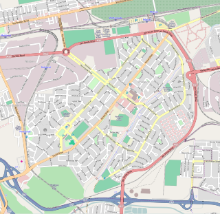
District Six is a former inner-city residential area in Cape Town, South Africa. Over 60,000 of its inhabitants were forcibly removed during the 1970s by the apartheid regime.

<span class="mw-page-title-main">Strand, Western Cape</span> Seaside town in the Western Cape, South Africa

Strand is a seaside resort town in the Western Cape, South Africa. It forms part of the Helderberg region of the City of Cape Town Metropolitan Municipality, situated on the north-eastern edge of False Bay and near the foot of the Helderberg Mountains. Its geographical position is between Somerset West and Gordon's Bay, and is about 50 km southeast of Cape Town City Bowl. Strand has a population of approximately 50,000. Strand's main attraction is the beach; 5 km of white sandy beach off False Bay.

<span class="mw-page-title-main">Pinelands, Cape Town</span> Place in Western Cape, South Africa

Pinelands is an affluent garden city suburb located on the edge of the southern suburbs of Cape Town, South Africa, neighbouring the suburb of Thornton, and is known for its large thatched houses and green spaces. The suburb is primarily residential and is often praised for its peacefulness and abundance of trees. Pinelands is one of the few areas in Cape Town in which sale of alcohol to the public is prohibited, but some clubs have private liquor licenses. It is a popular place for senior citizens to retire to. While there are several retirement homes in the suburb, younger people are increasingly moving in.

Bosmont is a suburb of Johannesburg, South Africa. Bosmont is located in Region 4. Bosmont is located in the West Rand of Johannesburg and nearly all of its residents are Coloured.

Emmarentia is a suburb of Johannesburg, South Africa.

<span class="mw-page-title-main">Southern Suburbs, Cape Town</span> Sub-region of Cape Town, South Africa

The Southern Suburbs are a group of Anglophone suburbs in Cape Town, Western Cape, South Africa. This group includes, among others, Observatory, Mowbray, Pinelands, Rosebank, Rondebosch, Rondebosch East, Newlands, Claremont, Lansdowne, Kenilworth, Bishopscourt, Constantia, Wynberg, Ottery, Plumstead, Diep River, Bergvliet and Tokai. The area is also commonly referred to as the Cape Peninsula, often including the towns further South such as Fish Hoek.

Eerste River is a town in the Western Cape, South Africa and a suburb of the City of Cape Town. It forms part of the Oostenberg subregion of the city situated behind the Stellenbosch/Vlaeberg Hills on the eastern outskirts of the city..

<span class="mw-page-title-main">Claremont, Cape Town</span> Place in Western Cape, South Africa

Claremont is a suburb of Cape Town, South Africa. It is situated 9 kilometres south of the city, and is one of the so-called "Southern Suburbs", it is situated alongside Lansdowne. It is an important commercial and residential area, which is currently experiencing significant growth and development.

<span class="mw-page-title-main">Observatory, Cape Town</span> Place in Western Cape, South Africa

Observatory is a suburb in Cape Town, South Africa, colloquially known as Obs. Bordered by Mowbray to the south and Salt River to the northwest, the area is best known as a student neighbourhood associated with the nearby University of Cape Town and Groote Schuur Hospital. It takes its name from the South African Astronomical Observatory headquarters, built in 1829 by the Royal Observatory.

<span class="mw-page-title-main">Gardens, Cape Town</span> Inner-city suburb of Cape Town in Western Cape, South Africa

Gardens is an affluent inner-city suburb of Cape Town located just to the south of the city centre located in the higher elevations of the "City Bowl" and directly beneath Table Mountain and Lion's Head. It is home to several national museums such as Iziko South African National Gallery and the Iziko South African Museum. The University of Cape Town also houses its Fine Arts department in the suburb, at Michaelis School of Fine Art. Company's Garden, South Africa's oldest garden, a public park and heritage site is a focal point of the suburb. The area is also home to the oldest synagogue in Southern Africa, the Old Shul and its successor, the Gardens Shul, "The Mother Synagogue of South Africa."

<span class="mw-page-title-main">Elsie's River</span> Place in Western Cape, South Africa

Elsie's River is a suburb of Cape Town, South Africa.

<span class="mw-page-title-main">Rosebank, Cape Town</span> Place in Western Cape, South Africa

Rosebank is one of the Southern Suburbs of Cape Town, South Africa, located between the suburbs of Mowbray and Rondebosch.

<span class="mw-page-title-main">Ottery, Cape Town</span> Suburb of Cape Town, in Western Cape, South Africa

Ottery is a suburb in Cape Town, South Africa. It is on the edge of the Southern Suburbs. The Youngsfield Military Base, Royal Cape Golf Club and Cape Town's 'official' China Town are located in the suburb. Every year the Youngsfield Military Base in Ottery hosts the Cape Argus Junior Cycle Tour on 12 March. The name was derived off the Otter sanctuary which was opened here in the early 1900's, but sadly was closed down as the neighbourhood rapidly expanded later in the century.

Lansdowne is a suburb in Cape Town, South Africa. situated 10 kilometres southeast of Cape Town City Centre, surrounded by the suburbs of Rondebosch East, Crawford, Wetton, Claremont, Kenwyn and Athlone. Lansdowne is served by a railway station of the same name, on the Cape Flats Line.

<span class="mw-page-title-main">Thornton, Cape Town</span> Place in Western Cape, South Africa

Thornton is a southern suburb of Cape Town, South Africa. Thornton is situated only 10 kilometres (6 mi) east of the city centre, adjacent to Pinelands. Like Pinelands, Thornton is a mainly residential suburb with an abundance of trees. It is bordered by the Elsieskraal River, Pinelands, Viking Way, and the M7 Jakes Gerwel Drive. Many of the streets in Thornton are named after Viking themes, such as Thor Circle, Odin Drive and Viking Way. Others are named after trees, such as Poplar Avenue and Sipres Avenue.

<span class="mw-page-title-main">Maitland, Cape Town</span> Place in Western Cape, South Africa

Maitland is a suburb of Cape Town, South Africa.

Brooklyn is a suburb of Cape Town, Western Cape with a population of 10,941 people. It lies to the north of Maitland, east of the Atlantic Ocean and Paarden Eiland, and west of Air Force Base Ysterplaat. The Black River flows through a section of Brooklyn.

<span class="mw-page-title-main">Boston, Bellville</span> Place in Western Cape, South Africa

Boston, or Boston Estate, is a suburb in Bellville, City of Cape Town, South Africa, and is one of Bellville's oldest residential suburbs.

References

  1. 1 2 3 4 "Sub Place Salt River". Census 2011.
  2. "Rex Trueform Reels After Loss of US Deal". AllAfrica.com. 7 March 2005. Retrieved 16 December 2011.
  3. How Staggie was murdered
  4. Cape Town's R20bn facelift Archived 20 April 2010 at the Wayback Machine