Stellenberg, Bellville

Last updated

Stellenberg
Stellenberg.jpg
Coordinates: 33°52′12″S18°39′32.4″E / 33.87000°S 18.659000°E / -33.87000; 18.659000
Country South Africa
Province Western Cape
City Bellville
FoundedLand awarded 1705, residential development 1969
Government
  Body City of Cape Town
Time zone UTC+02:00 (SAST)
Postcode
7550, 7530
Area code 021

Stellenberg is a suburb in Bellville, Western Cape South Africa.

Contents

Trees in Stellenberg Bellville Stellenberg Bellville trees.jpg
Trees in Stellenberg Bellville

Name and history

The suburb originates its name from the original farm on which it was developed. The farm was called Stellenburgh (later changed to Stellenburg), and was originally owned by Johannes (Joan) Blesius in 1705. Blesius named it after the Stellenbosch Mountain which one could see from the farm. Stellenbosch is named after the Governor of the Cape Colony, Simon van der Stel. Blesius was awarded the farm by Willem Adriaan van der Stel. This van der Stel was the son of Governor Simon van der Stel. Blesius (b.1656, d.1711) came from Breukelen, the Netherlands. The land felt under the jurisdiction of de Kuijlen. In 1707 Jacobus van der Heijden became owner of the land. The land stayed in the van der Heijde family until JF de Kock bought it. JF de Kock owned it up to 1736, when it was rewarded to Hilletjie Olivier. She died in 1765. On 3 January 1882 it was transferred to John Starke and then to Jacob Jacobus Hamman. In 1883 Charl Marais owned the land. He sold it to Maria Elizabeth Green (b 6 July 1856). In 1898 Hermanus Lambertus Bosman de Waal (b. 21 September 1863) bought it and he sold it to Francois Stephanus de Villiers in 1899. In the 20th century it was sold to Old Mutual and in 1969 residential development started. Stellenburg then became Stellenberg. [1] [2] [3] [4] [5] [6] [7]

Area

In July 1969 this land became available for residential development. It was necessary to develop the area, as the adjacent area in Bellville Eversdal grew and it was the natural extension of that area.

Modern Stellenberg

Today it is situated next to the N1, shopping centres [8] [9] and schools.

Stellenberg High School [10] is situated in the area, and in the adjoining part of Bellville Eversdal there is Eversdal Primary School. [11] One of the Montessori school called Beehive is in the suburb. [12]

More development

More suburbs were founded around Stellenberg namely:

Stellenrigde, Stellenryk, Ridgeworth

Street naming

Notable residents

Notable events

The Kyknet produced television drama series named “Sara se geheim (Sara’s secret)” was partly filmed in the suburb. They made use of a local fishery in the area to do the film shoot. [19] [20]

Dutch Reformed Church

The Stellenberg Dutch Reformed Church (NG Kerk Stellenberg) was founded on 2 August 1971. The church seceded from Durbanville congregation as Durbanville became too big. It moved to the existing premises in Stellenberg on 3 May 1975. The cornerstone was revealed by Reverend JJC Visser. [21] [22] The church was one of the first (in 1995) in South Africa to have an annual Fest Market (Stellenberg Feesmark). It is held annually between end of October to middle November. [23]

Corner Stone revealed when church was opened Stellenberg corner stone.jpg
Corner Stone revealed when church was opened

Related Research Articles

The written history of the Cape Colony in what is now South Africa began when Portuguese navigator Bartolomeu Dias became the first modern European to round the Cape of Good Hope in 1488. In 1497, Vasco da Gama sailed along the whole coast of South Africa on his way to India, landed at St Helena Bay for 8 days, and made a detailed description of the area. The Portuguese, attracted by the riches of Asia, made no permanent settlement at the Cape Colony. However, the Dutch East India Company (VOC) settled the area as a location where vessels could restock water and provisions.

<span class="mw-page-title-main">Stellenbosch</span> Town in Western Cape, South Africa

Stellenbosch is a town in the Western Cape province of South Africa, situated about 50 kilometres east of Cape Town, along the banks of the Eerste River at the foot of the Stellenbosch Mountain. The town became known as the City of Oaks or Eikestad in Afrikaans and Dutch due to the large number of oak trees that were planted by its founder, Simon van der Stel, to grace the streets and homesteads.

<span class="mw-page-title-main">Bellville, South Africa</span> Town in Western Cape, South Africa.

Bellville is a town and former independent city that is now incorporated into the City of Cape Town Metropolitan Municipality in the Western Cape province of South Africa. The town is an industrial and commercial node, a university town, and a major transportation hub within the Greater Cape Town metropolitan area.

<span class="mw-page-title-main">Rondebosch</span> Place in Western Cape, South Africa

Rondebosch is one of the Southern Suburbs of Cape Town, South Africa. It is primarily a residential suburb, with shopping and business districts as well as the main campus of the University of Cape Town.

<span class="mw-page-title-main">R300 (South Africa)</span> Road in South Africa

.

The R302 is a Regional Route in South Africa that connects Bellville with Malmesbury. It covers a distance of 54 kilometres (34 mi) in a north-south direction.

<span class="mw-page-title-main">Kuils River</span> Place in Western Cape, South Africa

Kuils River is a town in the Western Cape, South Africa, 25 km east of Cape Town and 20 km west of Stellenbosch at the gateway of the Cape Winelands. It is also the name of the main tributary of the Eerste River, and forms part of the Eastern Suburbs zone of the City of Cape Town.

Kraaifontein is a town in the Western Cape province of South Africa and is located on the north-eastern outskirts of the City of Cape Town Metropolitan Municipality.

<span class="mw-page-title-main">Brackenfell</span> Town in the Western Cape, South Africa

Brackenfell is a town in the Western Cape province of South Africa, situated on the N1 about 30 km north-east of Cape Town and 35 km south-west of Paarl.

<span class="mw-page-title-main">Tygerberg</span> Region of the City of Cape Town, South Africa

Tygerberg is a district in the northern suburbs of Cape Town in South Africa. It is also the name of the range of hills in the area. The main Tygerberg farms were Pampoenkraal, Stellenburgh, Evertsdal, De Grendel, Lebenstijn, Blommensteijn, Door de Kraal, Vissershok and Clara Anna Fontein. It also contains the Tygerberg Nature Reserve.

<span class="mw-page-title-main">Durbanville</span> Town in Western Cape, South Africa

Durbanville, previously called Pampoenkraal, is a town in the Western Cape province of South Africa, part of the greater Cape Town metropolitan area. It is a semi-rural residential suburb on the north-eastern outskirts of the metropolis surrounded by farms producing wine and wheat.

<span class="mw-page-title-main">Tulbagh</span> Place in Western Cape, South Africa

Tulbagh, previously named Roodezand, later named after Dutch Cape Colony Governor Ryk Tulbagh, is a town located in the "Land van Waveren" mountain basin, in the Winelands of the Western Cape, South Africa. The basin is fringed on three sides by mountains, and is drained by the Klein Berg River and its tributaries. The nearest towns are Ons Rust and Gouda beyond the Nuwekloof Pass, Wolseley some 15 kilometres (9.3 mi) to the south inside the basin, and Ceres and Prince Alfred Hamlet beyond Michell's Pass in the Warm Bokkeveld.

<span class="mw-page-title-main">Willem Adriaan van der Stel</span>

Willem Adriaan van der Stel was an Extraordinary Councillor of the Dutch East Indies, and Governor of the Cape Colony, a way station for the Dutch East India Company (VOC), from 23 January 1699 to 1707. He was dismissed after a revolt and was exiled to the Netherlands.

<span class="mw-page-title-main">Assegaaibosch Nature Reserve</span> Historic estate in the Western Cape, South Africa

Assegaaibosch Nature Reserve is a historic estate and currently a CapeNature nature reserve and World Heritage Site situated in the Jonkershoek Valley near Stellenbosch in the Western Cape province of South Africa. The historic estate was established by Dirk Coetsee, the progenitor of the Coetsee family in South Africa.

<span class="mw-page-title-main">Boland, Western Cape</span> Region of the Western Cape, South Africa

The Boland is a region of the Western Cape province of South Africa, situated to the northeast of Cape Town in the middle and upper courses of the Berg and Breede Rivers, around the Boland Mountains of the central Cape Fold Belt. It is sometimes also referred to as the Cape Winelands because it is the primary region for the making of Western Cape wine.

<span class="mw-page-title-main">Stellenberg High School</span> School in Cape Town, Western Cape, South Africa

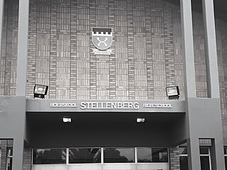
Stellenberg High School is a public dual-medium, co-educational high school located in Stellenberg, Bellville in the Western Cape province of South Africa. It is one of the top and prestigious schools in the Western Cape. The high school was established in 1986.

<span class="mw-page-title-main">Eversdal, Bellville</span> Place in Western Cape, South Africa

Eversdal is a suburb in Bellville, Western Cape, South Africa.

<span class="mw-page-title-main">Kenridge, Bellville</span> Place in Western Cape, South Africa

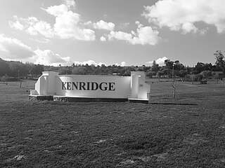
Kenridge is a suburb in Bellville, Western Cape, South Africa. It became a suburb out of one of the Tygerberg’s original farms.

References

  1. The publication:Bellville: wordingsjare van n stad = Bellville: growth of a city, by Strydom, Christiaan Johannes Scheepers, Spinemark 968.714STR, published by Die stadsraad, 1981. 305p.ill page 8
  2. http://uir.unisa.ac.za/bitstream/handle/10500/18138/dissertation_marx_ie.pdf?sequence=1&isAllowed=y [ bare URL PDF ]
  3. Book: Die Smuts familie van die Swartland, Author: PJ Smuts Publisher : Boland Printers year: 1992 page 5
  4. Book : Resolusies van die politiekeraad, Editor : GC de Wet, Publisher Government Printers, page 37, ISBN no 9780621047929
  5. Book- Brackenfell van Toeka tot nou (Translated Brackenfell from old to now), author Dalene Vollgraaf, year 2001, ISBN no 06202797745
  6. "Hilletjie Olivier, a1b7" . Retrieved 2 May 2018.
  7. "Hilletje Olivier" . Retrieved 2 May 2018.
  8. "Tyger Valley". Tyger Valley. Retrieved 26 February 2018.
  9. "Home". Willowbridge Shopping Centre. Retrieved 26 February 2018.
  10. "Stellenberg HS". www.stellenberg.org.za. Retrieved 16 March 2018.
  11. "Eversdal Primary School". Eversdal Primary School. Retrieved 16 March 2018.
  12. "Beehive".
  13. Leander (8 March 2016). "Earthquake shakes up Tulbagh" . Retrieved 26 February 2018.
  14. "New names for Cape Town streets - IOL News" . Retrieved 26 February 2018.
  15. "Castle of Good Hope". www.sa-venues.com. Retrieved 16 March 2018.
  16. Werz, B.E.T.S. (1 November 2017). "The Wreck of the Dutch East India Company Ship Haarlem in Table Bay, 1647, and the Establishment of the Tavern of the Seas". The Mariner's Mirror. 103 (4). The Marinor’s Mirror: 400–416. doi:10.1080/00253359.2017.1376479. hdl: 2263/63567 . S2CID   166058384.
  17. Williams, Murray (10 January 2012). "WP rugby in a sweat as Erasmus quits". Daily News. Archived from the original on 29 May 2018. Retrieved 15 July 2023 via PressReader.
  18. "Viering van dienstydperk van dr Braam Hanekom in NG Stellenberg".
  19. "Sara se geheim". www.kyknet.dstv.com. Retrieved 7 July 2018.
  20. "Protea Fisheries Stellenberg" . Retrieved 7 July 2018.
  21. "NG Kerk Stellenberg" . Retrieved 25 November 2019.
  22. "Geskiedenis (translated history)" . Retrieved 25 November 2019.
  23. "Stellenberg Feesmark" . Retrieved 31 December 2019.