Athlone, Cape Town

Last updated
Athlone
Greater Cape Town 12.02.2007 16-41-05.2007 16-41-7.JPG
Trojan Horse Memorial 2.jpg
Athlone Stadium - panoramio.jpg
Robert Waterwitch Colleen Williams Memorial front.jpg
From top left, Althone power station prior to the demolition of its cooling towers. The Trojan Horse Memorial (top right). The Athlone stadium (centre). A mural celebrating Athlone as "Home of the Gatsby" sandwich (bottom left). The Robert Waterwitch / Coline Williams Memorial statue (bottom right).
Athlone map.jpg
Street map of Athlone
South Africa Western Cape location map.svg
Red pog.svg
Athlone
South Africa adm location map.svg
Red pog.svg
Athlone
Africa location map.svg
Red pog.svg
Athlone
Coordinates: 33°57′40″S18°30′11″E / 33.96111°S 18.50306°E / -33.96111; 18.50306
Country South Africa
Province Western Cape
Municipality City of Cape Town
Main Place Cape Town
Government
   Councillor Mustapha Murudker (Ward 48) ANC
Patrick Hill (Ward 60) (DA)
Area
[1]
  Total1.50 km2 (0.58 sq mi)
Population
 (2011) [1]
  Total8,893
  Density5,900/km2 (15,000/sq mi)
Racial makeup (2011)
[1]
   Black African 8.5%
   Coloured 82.8%
   Indian/Asian 4.1%
   White 1.1%
  Other3.5%
First languages (2011)
[1]
   English 81.6%
   Afrikaans 11.7%
  Other6.7%
Time zone UTC+2 (SAST)
Postal code (street)
7764
PO box
7760

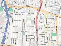
Athlone is a suburb of Cape Town located to the east of the city centre on the Cape Flats, south of the N2 highway. Two of the suburb's main landmarks are Athlone Stadium and the decommissioned coal-burning Athlone Power Station. Athlone is mainly residential and is served by a railway station of the same name. It however includes industrial (Athlone Industria 1 & 2) and commercial zones (Athlone CBD and Gatesville). There are many "sub-areas" within Athlone, including Gatesville, Rylands, Belgravia Estate, Bridgetown and Hazendal. Colloquially other areas around Athlone are also often included in the greater Athlone area even though the City of Cape Town might classify them as separate neighborhoods such as Rondebosch East, Crawford, and Manenberg. [2]

Contents

History

Originally known as West London the area was renamed Athlone after Alexander Cambridge, 1st Earl of Athlone who was Governor-General of the Union of South Africa from 1924 to 1930. [2]

During Apartheid the area was designated a coloured neighborhood. Many people were resettled in the area after being forcibly evicted by the government under the Apartheid era Group Areas Act from other parts of Cape Town. [2]

Athlone is the home of the Trojan Horse Memorial, a reminder of the Trojan Horse Incident which took place in 1985, when three anti-apartheid protesters were killed and fifteen others wounded in a police ambush. [3] The incident took place near the Alexander Sinton Secondary School where students had demanded to attend school the month before. [4]

The Athlone Magistrate’s court is the home of the Robert Waterwitch / Colleen Williams Memorial established in memory of two ANC activists who died in the struggle against apartheid. Waterwitch and Williams died an explosion outside of the court on 23 July 1989. [5]

Demographics

As of the census [6] of 2001, there were 11,556 households and 45,056 people residing in the suburb. The racial makeup of the suburb was 3.21% Black African, 69.66% Coloured, 23.45% Indian/Asian, 3.68% White and 0% from other races.

The suburb population age varies with 28.38% under the age of 18, 28.37% from 18 to 34, 26.53% from 35 to 54, 8.04% from 55 to 64, and 8.66% who were 65 years of age or older. For every 100 women there were 86.53 males.

82.58% of the population speak English, 15.18% speak Afrikaans, 1.13% speak Xhosa, 0.52% speak another African language and 0.59% some other language as a first language. [6]

Education

Primary Schools

Athlone North Primary, Regina Cloie Primary, Silverlea Primary, Blossom Primary, Bridgeville Primary, Kewtown Primary, Alicedale Primary, Heatherdale Primary, Turfhall Primary, Cypruss Primary, St Raphaels Primary and Rylands Primary, Sunnyside Primary,

High Schools

Spes Bona High, Ned Doman High, Alexander Sinton High, Athlone High, Peak View High, Bridgetown High, Rylands High and Belgravia High

Higher Education

College of Cape Town Athlone Campus and College of Cape Town Crawford Campus

Organisations in Athlone

The Anti-Eviction Campaign and the Gatesville Hawkers Association have a strong presence with many members in Athlone. There are many neighbourhood watches in the Athlone area, including Rylands Neighbourhood Watch, Surrey Patrol, Greenhaven Crime Watch and Habibia Neighbourhood Watch.

Athlone Power Station

The decommissioned Athlone Power Station is situated alongside the N2. The cooling towers, commonly referred to as the "Athlone Towers", were demolished on 22 August 2010. [7]

Related Research Articles

<span class="mw-page-title-main">Dulcie September</span> South African anti-apartheid activist (1935–1988)

Dulcie Evonne September was a South African anti-apartheid political activist who was assassinated in Paris, France, in 1988.

<span class="mw-page-title-main">Rondebosch</span> Place in Western Cape, South Africa

Rondebosch is one of the Southern Suburbs of Cape Town, South Africa. It is primarily a residential suburb, with shopping and business districts as well as the main campus of the University of Cape Town.

<span class="mw-page-title-main">Strand, Western Cape</span> Seaside town in the Western Cape, South Africa

Strand is a seaside resort town in the Western Cape, South Africa. It forms part of the Helderberg region of the City of Cape Town Metropolitan Municipality, situated on the north-eastern edge of False Bay and near the foot of the Helderberg Mountains. Its geographical position is between Somerset West and Gordon's Bay, and is about 50 km southeast of Cape Town City Bowl. Strand has a population of approximately 50,000. Strand's main attraction is the beach; 5 km of white sandy beach off False Bay.

<span class="mw-page-title-main">Mitchells Plain</span> Suburb of Cape Town, in Western Cape, South Africa

Mitchells Plain is a large township located within the City of Cape Town, Western Cape, South Africa and situated about 28 km (17 mi) from the Cape Town city centre. It is one of South Africa's largest residential areas and contains multiple smaller suburbs. It is located on the Cape Flats on the False Bay coast between Muizenberg and Khayelitsha. Conceived of as a "model suburb" by the apartheid government, it was built during the 1970s to provide housing for Coloured victims of forced removal due to the implementation of the Group Areas Act.

<span class="mw-page-title-main">Southern Suburbs, Cape Town</span> Sub-region of Cape Town, South Africa

The Southern Suburbs are a group of Anglophone suburbs in Cape Town, Western Cape, South Africa. This group includes, among others, Observatory, Mowbray, Pinelands, Rosebank, Rondebosch, Rondebosch East, Newlands, Claremont, Lansdowne, Kenilworth, Bishopscourt, Constantia, Wynberg, Ottery, Plumstead, Diep River, Bergvliet and Tokai. The area is also commonly referred to as the Cape Peninsula, often including the towns further South such as Fish Hoek.

<span class="mw-page-title-main">Nyanga, Western Cape</span> Suburb of Cape Town, in Western Cape, South Africa

Nyanga is a township in the Western Cape, South Africa. Its name in Xhosa means "moon" and it is one of the oldest black townships in Cape Town. It was established as a result of the migrant labour system. In 1948 black migrants were forced to settle in Nyanga as Langa had become too small. Nyanga was one of the poorest places in Cape Town and is still one of the most dangerous parts of Cape Town. In 2001 its unemployment rate was estimated at being approximately 56% and HIV/AIDS is a huge community issue.

<span class="mw-page-title-main">Alexander Sinton Secondary School</span> School in Athlone, Cape Town, South Africa

Alexander Sinton Secondary School, also known as Alexander Sinton High School, is an English-medium school in Athlone, a suburb of Cape Town, South Africa. The school is located in the Cape Flats, an area designated as non-white under the Group Areas Act during apartheid. The school was involved in the anti-apartheid student uprisings of the 1970s and 1980s. Staff and students at the school made headlines when they barricaded the police into their school in September 1985. The following month, three youths were killed near the school by police officers who opened fire on protesters in the Trojan Horse Incident. It was the first school to be visited by Nelson Mandela after his release from prison. As of 2014, the school has 1,100 pupils, half boys and half girls. The school employs 40 teachers and six non-teaching staff.

<span class="mw-page-title-main">Gardens, Cape Town</span> Inner-city suburb of Cape Town in Western Cape, South Africa

Gardens is an affluent inner-city suburb of Cape Town located just to the south of the city centre located in the higher elevations of the "City Bowl" and directly beneath Table Mountain and Lion's Head. It is home to several national museums such as Iziko South African National Gallery and the Iziko South African Museum. The University of Cape Town also houses its Fine Arts department in the suburb, at Michaelis School of Fine Art. Company's Garden, South Africa's oldest garden, a public park and heritage site is a focal point of the suburb. The area is also home to the oldest synagogue in Southern Africa, the Old Shul and its successor, the Gardens Shul, "The Mother Synagogue of South Africa."

<span class="mw-page-title-main">Green Point, Cape Town</span> Suburb of Cape Town in Western Cape, South Africa

Green Point is an affluent suburb on the Atlantic Seaboard of Cape Town, South Africa located to the north west of the central business district and. It is home to Cape Town Stadium, a major sporting venue that was built for the 2010 FIFA World Cup. Sea Point promenade runs through the suburb, connecting it to Three Anchor Bay and Sea Point, a popular Jewish neighbourhood. Somerset Road forms the main thoroughfare lined by restaurants, cafés, delis, boutiques and nightclubs.

<span class="mw-page-title-main">Western Cape Anti-Eviction Campaign</span> Movement in Cape Town, South Africa

The Western Cape Anti-Eviction Campaign was a non-racial popular movement made up of poor and oppressed communities in Cape Town, South Africa. It was formed in November 2000 with the aim of fighting evictions, water cut-offs and poor health services, obtaining free electricity, securing decent housing, and opposing police brutality.

<span class="mw-page-title-main">Kenilworth, Cape Town</span> Place in Western Cape, South Africa

Kenilworth is a suburb in Cape Town, South Africa.

<span class="mw-page-title-main">Heideveld</span> Suburb of Athlone, in Western Cape, South Africa

Heideveld is a town or suburb in the Athlone part of Cape Town, South Africa. Heideveld got its name because the area used to have large grazing grounds where a popular flower ("heideblommetjie") grew in abundance. The area used to be a dairy farm, and cows used to graze amongst the heideblommetjies.

<span class="mw-page-title-main">Joe Slovo, Cape Town</span> Place in Western Cape, South Africa

Joe Slovo is an informal settlement in Langa, Cape Town. Like many other informal settlements, it was named after former housing minister and anti-Apartheid activist, Joe Slovo. With over 20,000 residents, Joe Slovo is one of the largest informal settlements in South Africa.

<span class="mw-page-title-main">Delft, Western Cape</span> Township on the Cape Flats in Cape Town

Delft is a township on the outskirts of Cape Town, South Africa. It is situated next to the Cape Town International Airport, Belhar, Blue Downs, Ikwezi Park, Mandalay, Luzuko, Phillipi East, and Site C, Khayelitsha. It is known for its recreational events, youth empowerment organizations such as Enkosi Foundation and the community has establish a motherbody organisation, the Delft Community Development Forum. Delft is a community that consists of numerous government built housing projects such as the N2 Gateway. In 2022 Delft was the fastest growing community in Cape Town.

Crawford is a suburb of Cape Town, South Africa, located to the east of the City Centre (CBD) on the Cape Flats to the south of the N2 highway. The suburb is surrounded by the suburbs of Lansdowne, Rondebosch East, Athlone, Belthorn Estate, Rylands, and Belgravia. The main roads through the area are Jan Smuts Drive (M17) and Turf Hall Road (M24) linking to the M5. Thornton Road was for many years the main thoroughfare for this suburb and a hotbed for anti-apartheid activity in 1976 and 1985. Thornton Road is the location of the Trojan Horse Memorial in honour of those killed in 1985. Crawford is served by a railway station of the same name on the Cape Flats Line.

Goodwood is a suburb of Cape Town in the Western Cape, South Africa and is situated in the Tygerberg region of the City of Cape Town. It is 10 kilometres from Cape Town and accessible from the N1, N7 and N2 highways.

<span class="mw-page-title-main">Rondebosch East</span> Residential suburb of Cape Town, in Western Cape, South Africa

Rondebosch East is a residential suburb of Cape Town, South Africa, about 7 kilometres (4.3 mi) south-east of the city centre. As the name suggests, it is located to the east of the neighbouring suburb of Rondebosch. As of 2001 it had a population of approximately 4,600 people in an area of just over 1 square kilometre (0.4 sq mi). A large common, similar to but smaller than Rondebosch Common, is located in the center of the suburb.

Ronald Harrison was a South African artist most well known for his thought provoking 1962 painting Black Christ.

Belgravia Secondary School, also known as Belgravia High School is an English-medium school in Athlone, a suburb of Cape Town, South Africa.

References

  1. 1 2 3 4 "Sub Place Athlone". Census 2011.
  2. 1 2 3 "Origin and History of Athlone in Cape Town, South Africa". 2019-04-29. Archived from the original on 2019-04-29. Retrieved 2020-10-12.
  3. Video of the Trojan Horse Incident, Youtube, Chris Emerson, CBS, retrieved 19 August 2014
  4. "Attempt to Reopen a School is Barred". New York Times. 18 Sep 1985. Retrieved 18 August 2014.
  5. "Robert Anthony Basil Waterwitch | South African History Online". sahistory.org.za. Retrieved 2020-10-12.
  6. 1 2 "Athlone". Census 2001. City of Cape Town. Archived from the original on 25 February 2010. Retrieved 2 July 2010.
  7. "Towers to Tumble soon". Archived from the original on 2011-07-23. Retrieved 2007-10-09.