Doubletop Mountain (Maine)

Last updated
Doubletop Mountain
Doubletop (2).jpg
Westward view from OJI to Doubletop before Storm August 12, 2004
Highest point
Elevation 3,489 ft (1,063 m)  NGVD 29 [1]
Prominence 2,069 ft (631 m) [1]
Listing New England Fifty Finest #39
Coordinates 45°56′09″N69°03′40″W / 45.9358781°N 69.061159°W / 45.9358781; -69.061159 Coordinates: 45°56′09″N69°03′40″W / 45.9358781°N 69.061159°W / 45.9358781; -69.061159 [2]
Geography
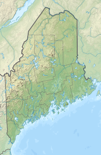
USA Maine location map.svg
Red triangle with thick white border.svg
Doubletop Mountain
Parent range Appalachians
Topo map USGS Doubletop Mountain

Doubletop Mountain is a mountain located in Piscataquis County, Maine, in Baxter State Park. According to Fannie Hardy Eckstorm, the mountain's Indigenous name was Psinskihegan-I-Outop. Psinskihegan means notch and I-Outop means head. in 1828 in the Survey of Maine, Moses Greenleaf called the mountain a variation Chinskihegan or Outop. It eventually became Doubletop, named for its two peaks. [3]

Mountain A large landform that rises fairly steeply above the surrounding land over a limited area

A mountain is a large landform that rises above the surrounding land in a limited area, usually in the form of a peak. A mountain is generally steeper than a hill. Mountains are formed through tectonic forces or volcanism. These forces can locally raise the surface of the earth. Mountains erode slowly through the action of rivers, weather conditions, and glaciers. A few mountains are isolated summits, but most occur in huge mountain ranges.

Piscataquis County, Maine County in the United States

Piscataquis County is a county located in the U.S. state of Maine. As of the 2010 census, its population was 17,535, making it Maine's least-populous county. Its county seat is Dover-Foxcroft. The county was incorporated on 23 March 1838, taken from the western part of Penobscot County and the eastern part of Somerset County, and is named for an Abenaki word meaning "branch of the river" or "at the river branch."

Maine U.S. state in the United States

Maine is the northernmost state in the New England region of the northeastern United States. Maine is the 12th smallest by area, the 9th least populous, and the 38th most densely populated of the 50 U.S. states. It is bordered by New Hampshire to the west, the Atlantic Ocean to the southeast, and the Canadian provinces of New Brunswick and Quebec to the northeast and northwest, respectively. Maine is the only state to border just one other state, is the easternmost among the contiguous United States, and is the northernmost state east of the Great Lakes.

Contents

The mountain's two peaks are a north peak (3,489 ft or 1,063 m) and a south peak (3,455 ft or 1,053 m). From the north a trail from the Nesowednehunk Campground to the north peak is 3.1 miles (5.0 km) long and another 0.2 miles (0.32 km) to the south peak. From Foster Field, to the south, a 4-mile (6.4 km) trail leads to the summit. The last third of mile (0.53 km) is steep and climbs about 900 feet (270 m). [4] The north peak is wooded while the south peak is more open.

Beneath one of the peaks, set in the rock, is a south facing bronze memorial tablet which reads:

KEPPELE HALL
JUNE 10, 1872—APRIL 25, 1926
HIS ASHES WERE GIVEN TO THE WINDS
AT THIS PLACE AUGUST 20, 1926, AT
SUNSET, BY HIS WIFE.

Keppele Hall's wife, Fanny Hall, was the first American woman to serve as foreman of a grand jury. [5]
Geography

Doubletop Mountain stands within the watershed of Nesowadnehunk Stream, which drains into the West Branch of the Penobscot River, and into Penobscot Bay. It is flanked to the southwest by Squaw's Bosom.

Drainage basin Area of land where precipitation collects and drains off into a common outlet

A drainage basin is any area of land where precipitation collects and drains off into a common outlet, such as into a river, bay, or other body of water. The drainage basin includes all the surface water from rain runoff, snowmelt, and nearby streams that run downslope towards the shared outlet, as well as the groundwater underneath the earth's surface. Drainage basins connect into other drainage basins at lower elevations in a hierarchical pattern, with smaller sub-drainage basins, which in turn drain into another common outlet.

West Branch Penobscot River river in the United States of America

The West Branch Penobscot River is a 117-mile-long (188 km) tributary of the Penobscot River through the North Maine Woods in Maine. The river is also known as Abocadneticook, Kahgognamock, and Kettegwewick.

Penobscot River river in the US state of Maine

The Penobscot River is a 109-mile-long (175 km) river in the U.S. state of Maine. Including the river's West Branch and South Branch increases the Penobscot's length to 264 miles (425 km), making it the second-longest river system in Maine and the longest entirely in the state. Its drainage basin contains 8,610 square miles (22,300 km2).

See also

Related Research Articles

Mount Whitney mountain in Sierra Nevada, California

Mount Whitney is the tallest mountain in the contiguous United States and the Sierra Nevada, with an elevation of 14,505 feet (4,421 m). It is located in East–Central California, on the boundary between California's Inyo and Tulare counties, 84.6 miles (136.2 km) west-northwest of the lowest point in North America at Badwater Basin in Death Valley National Park at 282 ft (86 m) below sea level. The west slope of the mountain is in Sequoia National Park and the summit is the southern terminus of the John Muir Trail which runs 211.9 mi (341.0 km) from Happy Isles in Yosemite Valley. The east slope is in the Inyo National Forest in Inyo County.

Mount Katahdin highest mountain in the US state of Maine

Mount Katahdin is the highest mountain in the U.S. state of Maine at 5,267 feet (1,605 m). Named Katahdin by the Penobscot Native Americans, which means "The Greatest Mountain", it is located within Northeast Piscataquis, Piscataquis County, and is the centerpiece of Baxter State Park. It is a steep, tall massif formed from a granite intrusion weathered to the surface. The flora and fauna on the mountain are typical of those found in northern New England.

Grays Peak mountain

Grays Peak is the tenth-highest summit of the Rocky Mountains of North America and the U.S. state of Colorado. The prominent 14,278-foot (4352 m) fourteener is the highest summit of the Front Range and the highest point on the Continental Divide in North America. Grays Peak is located in Arapahoe National Forest, 3.9 miles (6.2 km) southeast by east of Loveland Pass on the Continental Divide between Clear Creek and Summit counties. The peak is the highest point in both counties.

Torreys Peak mountain in United States of America

Torreys Peak is a mountain in the Front Range region of the Rocky Mountains in Colorado. It is one of 53 fourteeners in Colorado. Its nearest major city is Denver. Torreys Peak is located along the Continental Divide, as well as the division between Clear Creek County and Summit County.

Uncompahgre Peak mountain

Uncompahgre Peak is the sixth highest summit of the Rocky Mountains of North America and the U.S. state of Colorado. The prominent 14,321-foot (4365.0 m) fourteener is the highest summit of the San Juan Mountains and the highest point in the drainage basin of the Colorado River and the Gulf of California. It is located in the Uncompahgre Wilderness in the northern San Juans, in northern Hinsdale County approximately 7 miles (11 km) west of the town of Lake City.

Mount Sopris mountain in United States of America

Mount Sopris is a twin-summit mountain in the northwestern Elk Mountains range of the Rocky Mountains of North America. The 12,965-foot (3,952 m) mountain is located in the Maroon Bells-Snowmass Wilderness of White River National Forest, 6.6 miles (10.7 km) north by northeast of the community of Redstone in Pitkin County, Colorado, United States.

Mount Bross mountain in United States of America

Mount Bross is a high mountain summit in the Mosquito Range of the Rocky Mountains of North America. The 14,178-foot (4,321 m) fourteener is located in Pike National Forest, 4.1 miles (6.6 km) northwest by north of the Town of Alma in Park County, Colorado, United States. Mount Bross is named in honor of William Bross, who owned property in the area.

Wildcat Mountain (New Hampshire) mountain in New Hampshire, United States of America

Wildcat Mountain is a mountain located in Coos County, northern New Hampshire, United States. The mountain is part of the Carter-Moriah Range of the White Mountains, on the east side of Pinkham Notch. Wildcat Mountain faces Carter Dome across Carter Notch to the northeast, and Mount Washington across Pinkham Notch to the west.

Sugarloaf Mountain (Franklin County, Maine) Mountain located in Franklin County, Maine

Sugarloaf Mountain is a ski mountain located in Carrabassett Valley, Franklin County, Maine. It is the third highest peak in the state, after Mount Katahdin's Baxter and Hamlin peaks. Sugarloaf is flanked to the south by Spaulding Mountain.

North Brother mountain in United States of America

North Brother is a mountain located in Baxter State Park, Piscataquis County, Maine. North Brother is flanked to the northeast by Fort Mountain, and to the southwest by South Brother; collectively the two are called "The Brothers."

South Brother mountain in United States of America

South Brother is a mountain located in Piscataquis County, Maine, in Baxter State Park. South Brother is flanked to the southwest by Mount Coe, and to the northeast by North Brother; collectively the two are called "The Brothers".

White Cap Mountain (Piscataquis County, Maine) mountain in Maine, United States of America

White Cap Mountain is a mountain located in Piscataquis County, Maine. White Cap Mountain is flanked to the east by Hay Mountain, to the south by Big Spruce Mountain and to the southeast by Little Spruce Mountain.

Traveler Mountain mountain in United States of America

Traveler Mountain is a mountain located in Piscataquis County, Maine, in Baxter State Park. The Traveler, is the eighth-most prominent in Maine. Subsidiary peaks include the Peak of the Ridges 3,225 ft (983 m) North and South Traveler Mountain 3,144 ft (958 m) and 2,677 ft (816 m), respectively.

Hamlin Peak mountain in United States of America

Hamlin Peak is a 4,756-foot (1,450 m) mountain located in Baxter State Park in Piscataquis County, Maine. Hamlin Peak is a northern spur of the greater Mount Katahdin massif and is flanked to the south by Baxter Peak, and to the north by the Howe Peaks. Since it rises nearly 500 feet (150 m) above the col joining it to the higher Baxter Peak, Hamlin Peak qualifies as a four-thousand footer based on the topographic prominence criterion used by the Appalachian Mountain Club, and is ranked as the second-highest peak in Maine.

Goose Eye Mountain mountain in United States of America

Goose Eye Mountain, also known as Mt. Goose High, is a mountain located in Oxford County, Maine, about 1 mi (1.6 km). (2 km) east of the New Hampshire-Maine border. The mountain is the second-highest peak of the Mahoosuc Range of the White Mountains.

Mount Coe mountain in United States of America

Mount Coe is a mountain located in Piscataquis County, Maine, within Baxter State Park, about 5.5 mi (9 km) northwest of Mount Katahdin. Mt. Coe is flanked to the northeast by South Brother, and to the southwest by Mount O-J-I. The Mount Coe trail starts at Slide Dam on Newsowdnehunk Stream east bank at around 1,190 ft (360 m). The trail goes up to the east for about 1.2 mi (1.9 km) and then goes right (south) along the drainage from the Mt. Coe slide bending to the east and then northeast. The last 0.5 mi (0.80 km) is up the slide featured on the left margin of the photo where the trail gains around 800 ft (240 m).

Rocky Mountain is a peak of the Blue Ridge Mountains in Virginia. It is located about 2 miles (3.5 km) east of Irish Gap, on the border of Rockbridge County and Amherst County; it is the highest point of both counties. Rocky Mountain is flanked to the northeast by Elk Pond Mountain, to the southwest by Grapevine Ridge, and to the south by Tar Jacket Ridge.

Maintop Mountain mountain in United States of America

Maintop Mountain is a mountain in Nelson County, Virginia. The mountain is a peak on a spur off the main Blue Ridge Mountains, about 2 miles (3 km) east of Elk Pond Mountain, and about 3.5 miles (5.5 km) west of The Priest. The mountain is located in the George Washington National Forest.

Graham Mountain (New York) Highest privately owned summit in New Yorks Catskill Mountains

Graham Mountain is the seventh highest of the Catskill High Peaks and the highest privately owned mountain in the range. It is located in the town of Hardenburgh, New York, United States.

Pemadumcook Chain of Lakes

The Pemadumcook Chain of Lakes are a set of large lakes in north-central Maine in the United States.

References

  1. 1 2 "Doubletop Mountain, Maine". Peakbagger.com. Retrieved 2011-05-09.
  2. "Doubletop Mountain". Geographic Names Information System . United States Geological Survey . Retrieved 2011-05-09.
  3. Pinkham, Steven R. (2009). Mountains of Maine: intriguing stories behind their names (1st ed.). [Camden, ME]: Down East. ISBN   9780892727889. OCLC   297145691.
  4. "Doubletop Mountain". SummitPost.org. Retrieved 2011-05-09.
  5. "Hall, Fanny Southard Hay, 1872- . Papers, 1860-1967: A Finding Aid". Harvard University Library. Retrieved 2011-05-09.