Edens Landing, Queensland

Last updated

Edens Landing
Logan City,  Queensland
Edens Landing and Logan City.jpg
Homes along an elevated ridge with other Logan City suburbs in the background, 2014
Australia Queensland location map.svg
Red pog.svg
Edens Landing
Coordinates 27°42′11″S153°10′08″E / 27.7030°S 153.1688°E / -27.7030; 153.1688 (Edens Landing (centre of suburb))
Population5,094 (SAL 2016) [1] [2]
Postcode(s) 4207
Area2.6 km2 (1.0 sq mi)
Time zone AEST (UTC+10:00)
Location
LGA(s) Logan City
State electorate(s) Macalister
Federal division(s) Forde
Suburbs around Edens Landing:
Bethania Bethania Loganholme
Bethania Edens Landing Holmview
Waterford Holmview Holmview

Edens Landing is a suburb in the City of Logan, Queensland, Australia. [3] In the 2021 census, Edens Landing had a population of 5,094 people. [4]

Contents

Geography

Located on the south side of the Logan River, 3 km north-west of Beenleigh and 30 km south-east of central Brisbane. [5] The terrain ranges from 10 to 90 metres (33 to 295 ft) above sea level. The Logan River forms the north-east boundary of the locality, and the terrain is lowest nearest the river, rising towards the south-west. Logan River Road forms the western and south-western boundary of the locality. [6] [7]

The Beenleigh railway line (part of the Gold Coast railway line) enters the locality from the north-west (Bethania) and exits to the east (Holmview). The suburb is served by the Edens Landing railway station in the north of the suburb ( 27°41′53″S153°10′15″E / 27.6981°S 153.1709°E / -27.6981; 153.1709 (Edens Landing railway station) ). [7] [8]

The land use is predominantly residential suburban housing, [9] with houses being between 10 - 15 years old as of 2008. [10]

History

Henry Eden was an early resident in the Waterford area, being involved within the timber industry. In 1865, he successfully obtained permission to operate a ferry service on a punt across the Logan River. [11]

In 1869, early settler Wilson Holliday built a small Wesleyan Methodist Church on his property, which was opened on Easter Sunday on 29 March 1869 by Reverend Issac Hardy. [12] [13] It was later relocated to Beenleigh. [14] [11]

The area remained rural for many decades, used primarily as an agricultural area and was known as Holmview Heights, until the late 20th century. The improvement of train services in the 1980s prompted Leighton Developers to fund the construction of a station at Edens Landing and the Place Names Board officially gazetted the name Edens Landing in November 1985. [15] [11]

The suburb was developed by Leighton Holdings throughout 1984 and 1985, [11] being formed in 1985, [5] however it was not named and bounded until February 1986. [16]

Edens Landing Seventh-Day Adventist Church opened in 1990 in a brick building. [17]

A rugby league club, the Edens Landing Dragons formed in 1993 with one open side playing in the Metropolitan Rugby League Competition. In 1994, the opens coach who had experience in establishing another Logan Rugby League Club was asked by Leighton Holdings whether a junior club would be feasible and a proposal was put to Logan Districts Juniors to join their competition in 1995 with junior sides. The club operated on Leighton fields. The club offered teams from under 7's to Opens but has since closed after around eleven seasons. It formally participated in a number of competitions in Brisbane. [18]

Edens Landing State School opened on 28 January 1997. [19]

In 2008, Edens Landing had a number of shops most of which were located on a small complex near Leighton Fields on Castile Crescent, including a childcare centre, medical centre, spa general shop, pharmacy, fish & chip shop, bakery, hairdresser, a sushi take-out store, and real estate agent. [10]

Demographics

In the 2011 census, Edens Landing recorded a population of 5,177 people, 50.8% female and 49.2% male. The median age of the Edens Landing population was 31 years, 7 years below the national median of 37. 70.5% of people living in Edens Landing were born in Australia. The other top responses for country of birth were New Zealand 8.7%, England 4.5%, Scotland 0.9%, Philippines 0.7%, and Afghanistan 0.5%. 86.6% of people spoke only English at home; the next most common languages were 0.8% Samoan, 0.6% Spanish, 0.4% Polish, 0.3% Japanese, and 0.3% German. [20]

In the 2016 census, Edens Landing recorded a population of 5,094 people, 51.2% female and 48.8% male. [21] The median age of the Edens Landing population was 33 years, 5 years below the national median of 38, with 69.8% of people living in Edens Landing were born in Australia. The other top responses for country of birth were New Zealand 8.7%, England 4.0%, Afghanistan 1.2%, Philippines 1.0%, South Africa 0.6%. 84.4% of people spoke only English at home; the next most common languages were 0.9% Samoan, 0.8% Dari, 0.6% Hazaraghi, 0.6% Filipino, and 0.5% Spanish. [21]

In the 2021 census, Edens Landing recorded a population of 5,094 people, 50.7% female and 49.3% male. [4] The median age of the Edens Landing population was 35 years, 3 years below the national median of 38, with 70.2% of people living in Edens Landing were born in Australia. The other top responses for country of birth were New Zealand 7.8%, England 3.7%, Afghanistan 1.6%, Philippines 1.3%, Scotland 0.6%. 82.7% of people spoke only English at home; the next most common languages were 1.8% Hazaraghi, 0.8% Samoan, 0.7% Mandarin, 0.7% Spanish, 0.5% and Filipino. [4]

Education

Edens Landing State School is a government primary (Prep-6) school for boys and girls at Jamie Nicolson Avenue ( 27°42′19″S153°10′11″E / 27.7053°S 153.1698°E / -27.7053; 153.1698 (Edens Landing State School) ). [22] [23] In 2023, the school had an enrolment of 752 students, with 56 teachers (51.7 full-time equivalent) and 31 non-teaching staff (22.3 full-time equivalent). [24] It includes a special education program. [22]

There is no secondary school in Edens Landing. The nearest government secondary school is Loganlea State High School in Loganlea to the north-west. [25]

Transport

Edens Landing is serviced by the Logan City bus company with bus 562 making stops along the main street of Castile Crescent. This bus service connects at the Loganholme bus station and interchange (located adjacent to the Logan Hyperdome shopping centre) with a variety of bus services to the Brisbane CBD. Edens Landing also has a railway station that is part of the Beenleigh railway line. [26]

Religion

Despite the name, the Edens Landing Seventh-Day Adventist Church is in neighbouring Holmview. [17]

Related Research Articles

<span class="mw-page-title-main">Logan City</span> City in Queensland, Australia

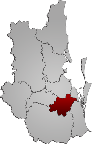
The City of Logan is a local government area situated within the south of the Brisbane metropolitan area in South East Queensland, Australia. Situated between the City of Brisbane to the north and the City of Gold Coast to the south, the City also borders the Scenic Rim Region, the City of Ipswich, and Redland City LGAs. Logan City is divided into 70 suburbs and 12 divisions; a councillor is elected to each of the latter. The council had a population of 326,615 in June 2018.

<span class="mw-page-title-main">Beenleigh, Queensland</span> Suburb of City of Logan, Queensland, Australia

Beenleigh is a town and suburb in the City of Logan, Queensland, Australia. In the 2021 census, the suburb of Beenleigh had a population of 8,425 people.

<span class="mw-page-title-main">Bethania, Queensland</span> Suburb of Logan City, Queensland, Australia

Bethania is a suburb in the City of Logan, Queensland, Australia. In the 2021 census, Bethania had a population of 6,333 people.

<span class="mw-page-title-main">Holmview railway station</span> Railway station in Beenleigh, Queensland, Australia

Holmview railway station is located on the Beenleigh line in Queensland, Australia. Despite the name, it is one of two stations serving the Logan suburb of Beenleigh, the other being Beenleigh station.

<span class="mw-page-title-main">Sunnybank Hills, Queensland</span> Suburb of Brisbane, Queensland, Australia

Sunnybank Hills is an outer southern suburb in the City of Brisbane, Queensland, Australia. In the 2021 census, Sunnybank Hills had a population of 18,085 people.

<span class="mw-page-title-main">Fairfield, Queensland</span> Suburb of Brisbane, Queensland, Australia

Fairfield is a suburb of the City of Brisbane, Queensland, Australia. In the 2021 census, Fairfield had a population of 3,106 people.

<span class="mw-page-title-main">Kuraby, Queensland</span> Suburb of Brisbane, Queensland, Australia

Kuraby is an outer southern suburb in the City of Brisbane, Queensland, Australia. In the 2016 census, Kuraby had a population of 8,108 people.

<span class="mw-page-title-main">Cornubia, Queensland</span> Suburb of Logan City, Queensland, Australia

Cornubia is a suburb in the City of Logan, Queensland, Australia. As of the 2021 census, Cornubia had a population of 7,810 people.

<span class="mw-page-title-main">Edens Landing railway station</span> Railway station in Queensland, Australia

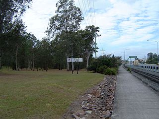
Edens Landing railway station is located on the Beenleigh line in Queensland, Australia. It serves the suburb of Edens Landing in Logan City.

<span class="mw-page-title-main">Greenslopes, Queensland</span> Suburb of Brisbane, Queensland, Australia

Greenslopes is a southern suburb in the City of Brisbane, Queensland, Australia. It is 6.0 kilometres (3.7 mi) by road south of the Brisbane GPO. In the 2021 census, Greenslopes had a population of 7,941 people.

<span class="mw-page-title-main">Woodridge, Queensland</span> Suburb of Logan City, Queensland, Australia

Woodridge is a town and suburb in the City of Logan, Queensland, Australia. In the 2021 census, the suburb of Woodridge had a population of 12,982 people.

<span class="mw-page-title-main">Loganlea, Queensland</span> Suburb of Logan City, Queensland, Australia

Loganlea is a suburb in the City of Logan, Queensland, Australia. In the 2021 census, Loganlea had a population of 8,716 people.

<span class="mw-page-title-main">Meadowbrook, Queensland</span> Suburb of Logan City, Queensland, Australia

Meadowbrook is a mixed-use suburb in the City of Logan, Queensland, Australia. In the 2016 census, Meadowbrook had a population of 3,113 people. The Logan Hospital and a TAFE college are located in the suburb.

<span class="mw-page-title-main">Underwood, Queensland</span> Suburb of Logan City, Queensland, Australia

Underwood is a suburb in the City of Logan, Queensland, Australia. In the 2016 census, Underwood had a population of 6,341 people.

<span class="mw-page-title-main">Eagleby, Queensland</span> Suburb of Logan City, Queensland, Australia

Eagleby is a suburb in the City of Logan, Queensland, Australia. In the 2021 census, Eagleby had a population of 13,594 people.

<span class="mw-page-title-main">Bahrs Scrub, Queensland</span> Suburb of Logan City, Queensland, Australia

Bahrs Scrub is an urban locality in the City of Logan, Queensland, Australia. In the 2021 census, Bahrs Scrub had a population of 4,508 people.

<span class="mw-page-title-main">Windaroo, Queensland</span> Suburb of Logan City, Queensland, Australia

Windaroo is a residential suburb in the outer southern areas of the City of Logan, Queensland, Australia. In the 2021 census, Windaroo had a population of 2,771 people.

<span class="mw-page-title-main">Mount Warren Park, Queensland</span> Suburb of Logan City, Queensland, Australia

Mount Warren Park is a residential suburb in the outer eastern area of the City of Logan, Queensland, Australia. The mountain of Mount Warren is within the suburb. In the 2016 census, Mount Warren Park had a population of 5,791 people.

<span class="mw-page-title-main">Waterford, Queensland</span> Town in Queensland, Australia

Waterford is a town and suburb in the City of Logan, Queensland, Australia. In the 2021 census, the suburb of Waterford had a population of 5,796 people.

<span class="mw-page-title-main">Holmview</span> Suburb of Logan City, Queensland, Australia

Holmview is a residential suburb in the City of Logan, Queensland, Australia. In the 2021 census, Holmview had a population of 4,455 people.

References

  1. Australian Bureau of Statistics (27 June 2017). "Edens Landing (suburb and locality)". Australian Census 2016.  OOjs UI icon edit-ltr-progressive.svg
  2. Australian Bureau of Statistics (27 June 2017). "Edens Landing (suburb and locality)". Australian Census 2016 QuickStats. Retrieved 28 June 2022.  OOjs UI icon edit-ltr-progressive.svg
  3. "Edens Landing – suburb in City of Logan (entry 45264)". Queensland Place Names. Queensland Government . Retrieved 7 March 2022.
  4. 1 2 3 Australian Bureau of Statistics (28 June 2022). "Edens Landing (SAL)". 2021 Census QuickStats. Retrieved 28 February 2023. OOjs UI icon edit-ltr-progressive.svg
  5. 1 2 "Edens Landing | Queensland Places". queenslandplaces.com.au. Retrieved 30 March 2024.
  6. "Layers: Locality; Mountains and ranges; Contours; Watercourses". Queensland Globe. Queensland Government. Archived from the original on 19 December 2017. Retrieved 11 March 2024.
  7. 1 2 "Layers: Locality; Road and rail". Queensland Globe. Queensland Government. Archived from the original on 19 December 2017. Retrieved 11 March 2024.
  8. "Railway stations and sidings - Queensland". Queensland Open Data. Queensland Government. 2 October 2020. Archived from the original on 5 October 2020. Retrieved 5 October 2020.
  9. "Layers: Locality; Protected areas and forests; Land use". Queensland Globe. Queensland Government. Archived from the original on 19 December 2017. Retrieved 11 March 2024.
  10. 1 2 "Gold Coast Suburb Guide - Eden's Landing :: Info, Stats, Maps and more for SUBURB, :: Goldcoast.com.au :: Queensland, Australia". www.goldcoast.com.au. Archived from the original on 2 August 2008.
  11. 1 2 3 4 Council, Logan City. "Edens Landing". Logan City Council. Archived from the original on 12 January 2024. Retrieved 11 March 2024.
  12. "The Courier". The Brisbane Courier . Vol. XXIII, no. 3, 576. Queensland, Australia. 20 March 1869. p. 4. Retrieved 11 March 2024 via National Library of Australia.
  13. "News of the Week". The Queenslander . Vol. IV, no. 165. Queensland, Australia. 3 April 1869. p. 5. Retrieved 11 March 2024 via National Library of Australia.
  14. "Logan Pioneers". The Beaudesert Times . Vol. 6, no. 296. Queensland, Australia. 12 June 1914. p. 8. Retrieved 11 March 2024 via National Library of Australia.
  15. "Spotlight on Edens Landing - Qld Guides". qldguides.com. 4 July 2023. Retrieved 30 March 2024.
  16. Queensland, c=AU; o=The State of. "Queensland place names search | Place names". www.qld.gov.au. Retrieved 5 April 2024.{{cite web}}: CS1 maint: multiple names: authors list (link)
  17. 1 2 "Eden Landing's Seventh Day Adventist Church | Holmview". Queensland Religious Places Database. Retrieved 11 March 2024.
  18. "Edens Landing RLFC History". Archived from the original on 19 July 2008. Retrieved 21 January 2009.
  19. "Opening and closing dates of Queensland Schools". Queensland Government . Retrieved 22 August 2019.
  20. "2011 Edens Landing, Census All persons QuickStats | Australian Bureau of Statistics". www.abs.gov.au. Retrieved 5 May 2024.
  21. 1 2 Australian Bureau of Statistics (27 June 2017). "Edens Landing (SSC)". 2016 Census QuickStats. Retrieved 20 October 2018. OOjs UI icon edit-ltr-progressive.svg
  22. 1 2 "State and non-state school details". Queensland Government. 9 July 2018. Archived from the original on 21 November 2018. Retrieved 21 November 2018.
  23. "Edens Landing State School". Edens Landing State School. 13 April 2022. Archived from the original on 6 March 2022. Retrieved 11 March 2024.
  24. "ACARA data access program School Profile 2023". ACARA. Retrieved 30 March 2024.
  25. "Layers: Locality; Schools and school catchments". Queensland Globe. Queensland Government. Archived from the original on 19 December 2017. Retrieved 11 March 2024.
  26. Edens Landing railway station, Brisbane