Eruption column

Last updated
Satellite animation of the initial eruption column and shockwave from Hunga Tonga-Hunga Ha`apai on 15 January 2022 Tonga Volcano Eruption 2022-01-15 0320Z to 0610Z Himawari-8 visible.gif
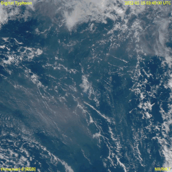
Satellite animation of the initial eruption column and shockwave from Hunga Tonga–Hunga Haʻapai on 15 January 2022

An eruption column or eruption plume is a cloud of super-heated ash and tephra suspended in gases emitted during an explosive volcanic eruption. The volcanic materials form a vertical column or plume that may rise many kilometers into the air above the vent of the volcano. In the most explosive eruptions, the eruption column may rise over 40 km (25 mi), penetrating the stratosphere. Stratospheric injection of aerosols by volcanoes is a major cause of short-term climate change.

Contents

A common occurrence in explosive eruptions is column collapse when the eruption column is or becomes too dense to be lifted high into the sky by air convection, and instead falls down the slopes of the volcano to form pyroclastic flows or surges (although the latter is less dense). On some occasions, if the material is not dense enough to fall, it may create pyrocumulonimbus clouds.

Formation

Eruption column over Mount Pinatubo in the Philippines, 1991 Pinatubo91eruption plume.jpg
Eruption column over Mount Pinatubo in the Philippines, 1991

Eruption columns form in explosive volcanic activity, when the high concentration of volatile materials in the rising magma causes it to be disrupted into fine volcanic ash and coarser tephra. The ash and tephra are ejected at speeds of several hundred metres per second, and can rise rapidly to heights of several kilometres, lifted by enormous convection currents.

Eruption columns may be transient, if formed by a discrete explosion, or sustained, if produced by a continuous eruption or closely spaced discrete explosions.

Structure

The solid and liquid materials in an eruption column are lifted by processes that vary as the material ascends: [1]

Column heights

Eruption column rising over Redoubt Volcano, Alaska, on 21 April 1990, which reached a height of about 9 km (5.6 mi) MtRedoubtedit1.jpg
Eruption column rising over Redoubt Volcano, Alaska, on 21 April 1990, which reached a height of about 9 km (5.6 mi)

The column will stop rising once it attains an altitude where it is more dense than the surrounding air. Several factors control the height that an eruption column can reach.

Intrinsic factors include the diameter of the erupting vent, the gas content of the magma, and the velocity at which it is ejected. Extrinsic factors can be important, with winds sometimes limiting the height of the column, and the local thermal temperature gradient also playing a role. The atmospheric temperature in the troposphere normally decreases by about 6-7 K/km, but small changes in this gradient can have a large effect on the final column height. Theoretically, the maximum achievable column height is thought to be about 55 km (34 mi). In practice, column heights ranging from about 2–45 km (1.2–28.0 mi) are seen.

Eruption columns with heights of over 20–40 km (12–25 mi) break through the tropopause and inject particulates into the stratosphere. Ashes and aerosols in the troposphere are quickly removed by precipitation, but material injected into the stratosphere is much more slowly dispersed, in the absence of weather systems. Substantial amounts of stratospheric injection can have global effects: after Mount Pinatubo erupted in 1991, global temperatures dropped by about 0.5 °C (0.90 °F). The largest eruptions are thought to cause temperature drops down to several degrees, and are potentially the cause of some of the known mass extinctions.

Eruption column heights are a useful way of measuring eruption intensity since for a given atmospheric temperature, the column height is proportional to the fourth root of the mass eruption rate. Consequently, given similar conditions, to double the column height requires an eruption ejecting 16 times as much material per second. The column height of eruptions which have not been observed can be estimated by mapping the maximum distance that pyroclasts of different sizes are carried from the vent—the higher the column the further ejected material of a particular mass (and therefore size) can be carried.

The approximate maximum height of an eruption column is given by the equation.

H = k(MΔT)1/4

Where:[ clarification needed ]

k is a constant that depends on various properties, such as atmospheric conditions.
M is the mass eruption rate.
ΔT is the difference in temperature between the erupting magma and the surrounding atmosphere.

Hazards

Column collapse

The eruption column produced by the 1980 eruption of Mount St. Helens as seen from the village of Toledo, Washington, which is 56 km (35 mi) away. The cloud was roughly 64 km (40 mi) wide and 24 km; 79,000 ft (15 mi) high. MtStHelens Mushroom Cloud.jpg
The eruption column produced by the 1980 eruption of Mount St. Helens as seen from the village of Toledo, Washington, which is 56 km (35 mi) away. The cloud was roughly 64 km (40 mi) wide and 24 km; 79,000 ft (15 mi) high.

Eruption columns may become so laden with dense material that they are too heavy to be supported by convection currents. This can suddenly happen if, for example, the rate at which magma is erupted increases to a point where insufficient air is entrained to support it, or if the magma density suddenly increases as denser magma from lower regions in a stratified magma chamber is tapped.

If it does happen, then material reaching the bottom of the convective thrust region can no longer be adequately supported by convection and will fall under gravity, forming a pyroclastic flow or surge which can travel down the slopes of a volcano at speeds of over 100–200 km/h (62–124 mph). Column collapse is one of the most common and dangerous volcanic hazards in column-creating eruptions.

Aircraft

Several eruptions have seriously endangered aircraft which have encountered or passed by the eruption column. In two separate incidents in 1982, airliners flew into the upper reaches of an eruption column blasted off by Mount Galunggung, and the ash severely damaged both aircraft. Particular hazards were the ingestion of ash stopping the engines, the sandblasting of the cockpit windows rendering them largely opaque and the contamination of fuel through the ingestion of ash through pressurisation ducts. The damage to engines is a particular problem since temperatures inside a gas turbine are sufficiently high that volcanic ash is melted in the combustion chamber, and forms a glass coating on components farther downstream of it, for example on turbine blades.

In the case of British Airways Flight 9, the aircraft lost power on all four engines, and in the other, nineteen days later, three of the four engines failed on a Singapore Airlines 747. In both cases, engines were successfully restarted, but the aircraft were forced to make emergency landings in Jakarta.

Similar damage to aircraft occurred due to an eruption column over Redoubt volcano in Alaska in 1989. Following the eruption of Mount Pinatubo in 1991, aircraft were diverted to avoid the eruption column, but nonetheless, fine ash dispersing over a wide area in Southeast Asia caused damage to 16 aircraft, some as far as 1,000 km (620 mi) from the volcano.

Eruption columns are not usually visible on weather radar and may be obscured by ordinary clouds or night. [3] Because of the risks posed to aviation by eruption columns, there is a network of nine Volcanic Ash Advisory Centers around the world which continuously monitor for eruption columns using data from satellites, ground reports, pilot reports and meteorological models. [4]

See also

Related Research Articles

<span class="mw-page-title-main">Volcano</span> Rupture in a planets crust where material escapes

A volcano is a rupture in the crust of a planetary-mass object, such as Earth, that allows hot lava, volcanic ash, and gases to escape from a magma chamber below the surface.

<span class="mw-page-title-main">Mount Vesuvius</span> Active stratovolcano in the Gulf of Naples, Italy

Mount Vesuvius is a somma-stratovolcano located on the Gulf of Naples in Campania, Italy, about 9 km (5.6 mi) east of Naples and a short distance from the shore. It is one of several volcanoes forming the Campanian volcanic arc. Vesuvius consists of a large cone partially encircled by the steep rim of a summit caldera, resulting from the collapse of an earlier, much higher structure.

<span class="mw-page-title-main">Stratovolcano</span> Type of conical volcano composed of layers of lava and tephra

A stratovolcano, also known as a composite volcano, is a conical volcano built up by many layers (strata) of hardened lava and tephra. Unlike shield volcanoes, stratovolcanoes are characterized by a steep profile with a summit crater and periodic intervals of explosive eruptions and effusive eruptions, although some have collapsed summit craters called calderas. The lava flowing from stratovolcanoes typically cools and hardens before spreading far, due to high viscosity. The magma forming this lava is often felsic, having high to intermediate levels of silica, with lesser amounts of less viscous mafic magma. Extensive felsic lava flows are uncommon, but have traveled as far as 15 km (9 mi).

<span class="mw-page-title-main">Geology of the Lassen volcanic area</span> Geology of a U.S. national park in California

The Lassen volcanic area presents a geological record of sedimentation and volcanic activity in and around Lassen Volcanic National Park in Northern California, U.S. The park is located in the southernmost part of the Cascade Mountain Range in the Pacific Northwest region of the United States. Pacific Oceanic tectonic plates have plunged below the North American Plate in this part of North America for hundreds of millions of years. Heat and molten rock from these subducting plates has fed scores of volcanoes in California, Oregon, Washington and British Columbia over at least the past 30 million years, including these in the Lassen volcanic areas.

<span class="mw-page-title-main">Tephra</span> Fragmental material produced by a volcanic eruption

Tephra is fragmental material produced by a volcanic eruption regardless of composition, fragment size, or emplacement mechanism.

<span class="mw-page-title-main">Mount Pinatubo</span> Active stratovolcano in the Philippines

Mount Pinatubo is an active stratovolcano in the Zambales Mountains, located on the tripoint boundary of the Philippine provinces of Zambales, Tarlac and Pampanga, all in Central Luzon on the northern island of Luzon. Its eruptive history was unknown to most before the pre-eruption volcanic activity of early 1991. Pinatubo was heavily eroded and obscured from view by dense forests which supported a population of several thousand indigenous Aetas.

<span class="mw-page-title-main">Cerro Negro</span>

Cerro Negro is an inactive volcano in the Cordillera de los Maribios mountain range in Nicaragua, about 10 km (6.2 mi) from the village of Malpaisillo. It is a very new volcano, the youngest in Central America, having first appeared in April 1850. It consists of a gravelly basaltic cinder cone, which contrasts greatly with the surrounding verdant hillsides, and gives rise to its name, which means Black Hill. Cerro Negro has erupted frequently since its first eruption. One unusual aspect of several eruptions has been the emission of ash from the top of the cone, while lava erupts from fractures at the base.

<span class="mw-page-title-main">Plinian eruption</span> Type of volcanic eruption

Plinian eruptions or Vesuvian eruptions are volcanic eruptions marked by their similarity to the eruption of Mount Vesuvius in 79 AD, which destroyed the ancient Roman cities of Herculaneum and Pompeii. The eruption was described in a letter written by Pliny the Younger, after the death of his uncle Pliny the Elder.

<span class="mw-page-title-main">Cerro Azul (Chile volcano)</span> Mountain in Curicó Province, Chile

Cerro Azul, sometimes referred to as Quizapu, is an active stratovolcano in the Maule Region of central Chile, immediately south of Descabezado Grande. Part of the South Volcanic Zone of the Andes, its summit is 3,788 meters (12,428 ft) above sea level, and is capped by a summit crater that is 500 meters (1,600 ft) wide and opens to the north. Beneath the summit, the volcano features numerous scoria cones and flank vents.

<span class="mw-page-title-main">Strombolian eruption</span> Type of volcanic eruption with relatively mild explosive intensity

In volcanology, a Strombolian eruption is a type of volcanic eruption with relatively mild blasts, typically having a Volcanic Explosivity Index of 1 or 2. Strombolian eruptions consist of ejection of incandescent cinders, lapilli, and volcanic bombs, to altitudes of tens to a few hundreds of metres. The eruptions are small to medium in volume, with sporadic violence. This type of eruption is named for the Italian volcano Stromboli.

<span class="mw-page-title-main">Vulcanian eruption</span> Volcanic eruption with dense ash clouds

A Vulcanian eruption is a type of volcanic eruption characterized by a dense cloud of ash-laden gas exploding from the crater and rising high above the peak. They usually commence with phreatomagmatic eruptions which can be extremely noisy due to the rising magma heating water in the ground. This is usually followed by the explosive clearing of the vent and the eruption column is dirty grey to black as old weathered rocks are blasted out of the vent. As the vent clears, further ash clouds become grey-white and creamy in colour, with convolutions of the ash similar to those of Plinian eruptions.

A pyroclastic fall is a uniform deposit of material which has been ejected from a volcanic eruption or plume such as an ash fall or tuff. Pyroclastic air fall deposits are a result of:

  1. Ballistic transport of ejecta such as volcanic blocks, volcanic bombs and lapilli from volcanic explosions
  2. Deposition of material from convective clouds associated with pyroclastic flows such as coignimbrite falls
  3. Ejecta carried in gas streaming from a vent. The material under the action of gravity will settle out from an eruption plume or eruption column
  4. Ejecta settling from an eruptive plume or eruption column that is displaced laterally by wind currents and is dispersed over great distances
<span class="mw-page-title-main">Types of volcanic eruptions</span> Overview of different types of volcanic eruptions

Several types of volcanic eruptions—during which lava, tephra, and assorted gases are expelled from a volcanic vent or fissure—have been distinguished by volcanologists. These are often named after famous volcanoes where that type of behavior has been observed. Some volcanoes may exhibit only one characteristic type of eruption during a period of activity, while others may display an entire sequence of types all in one eruptive series.

<span class="mw-page-title-main">Operation Fiery Vigil</span> Military operation

Operation Fiery Vigil was the Noncombatant Evacuation Operation (NEO) emergency evacuation of all non-essential military and U.S. Department of Defense civilian personnel and their dependents from Clark Air Base and U.S. Naval Base Subic Bay during the June 1991 eruption of Mount Pinatubo in the Republic of the Philippines.

<span class="mw-page-title-main">Phreatomagmatic eruption</span> Volcanic eruption involving both steam and magma

Phreatomagmatic eruptions are volcanic eruptions resulting from interaction between magma and water. They differ from exclusively magmatic eruptions and phreatic eruptions. Unlike phreatic eruptions, the products of phreatomagmatic eruptions contain juvenile (magmatic) clasts. It is common for a large explosive eruption to have magmatic and phreatomagmatic components.

<span class="mw-page-title-main">1991 eruption of Mount Pinatubo</span> Volcanic eruption in the Philippines

The 1991 eruption of Mount Pinatubo in the Philippines' Luzon Volcanic Arc was the second-largest volcanic eruption of the 20th century, behind only the 1912 eruption of Novarupta in Alaska. Eruptive activity began on April 2 as a series of phreatic explosions from a fissure that opened on the north side of Mount Pinatubo. Seismographs were set up and began monitoring the volcano for earthquakes. In late May, the number of seismic events under the volcano fluctuated from day-to-day. Beginning June 6, a swarm of progressively shallower earthquakes accompanied by inflationary tilt on the upper east flank of the mountain, culminated in the extrusion of a small lava dome.

<span class="mw-page-title-main">Volcanic hazards</span>

A volcanic hazard is the probability a volcanic eruption or related geophysical event will occur in a given geographic area and within a specified window of time. The risk that can be associated with a volcanic hazard depends on the proximity and vulnerability of an asset or a population of people near to where a volcanic event might occur.

<span class="mw-page-title-main">2010 eruptions of Eyjafjallajökull</span> Volcanic events in Iceland

Between March and June 2010 a series of volcanic events at Eyjafjallajökull in Iceland caused enormous disruption to air travel across Western Europe.

Tectonic–climatic interaction is the interrelationship between tectonic processes and the climate system. The tectonic processes in question include orogenesis, volcanism, and erosion, while relevant climatic processes include atmospheric circulation, orographic lift, monsoon circulation and the rain shadow effect. As the geological record of past climate changes over millions of years is sparse and poorly resolved, many questions remain unresolved regarding the nature of tectonic-climate interaction, although it is an area of active research by geologists and palaeoclimatologists.

<span class="mw-page-title-main">Volcanic ash</span> Natural material created during volcanic eruptions

Volcanic ash consists of fragments of rock, mineral crystals, and volcanic glass, produced during volcanic eruptions and measuring less than 2 mm (0.079 inches) in diameter. The term volcanic ash is also often loosely used to refer to all explosive eruption products, including particles larger than 2 mm. Volcanic ash is formed during explosive volcanic eruptions when dissolved gases in magma expand and escape violently into the atmosphere. The force of the gases shatters the magma and propels it into the atmosphere where it solidifies into fragments of volcanic rock and glass. Ash is also produced when magma comes into contact with water during phreatomagmatic eruptions, causing the water to explosively flash to steam leading to shattering of magma. Once in the air, ash is transported by wind up to thousands of kilometres away.

References

  1. "How volcanoes work – The eruption model (QuickTime movie)". San Diego State University. Archived from the original on 2007-07-01. Retrieved 2007-06-30.
  2. "Bulletin of the Global Volcanism Network; volume 15 number 4 (April 1990)". Global Volcanism Program . Smithsonian Institution. 1990. Retrieved 14 January 2018.
  3. Mitchell Roth; Rick Guritz (July 1995). "Visualization of Volcanic ash clouds". IEEE Computer Graphics and Applications. 15 (4): 34–39. doi:10.1109/38.391488.
  4. "Keeping aircraft clear of volcanic ash - Darwin Volcanic Ash Advisory Center". Australian Government - Bureau of Meteorology. Retrieved 2007-06-30.

Further reading