
Sierra County is a county located in the U.S. state of California. As of the 2020 census, the population was 3,236, making it California's second-least populous county. The county seat is Downieville; the sole incorporated city is Loyalton. The county is in the Sierra Nevada, northeast of Sacramento on the border with Nevada.

The Gold Country is a historic region in the northern portion of the U.S. state of California, that is primarily on the western slope of the Sierra Nevada. It is famed for the mineral deposits and gold mines that attracted waves of immigrants, known as the 49ers, during the 1849 California Gold Rush.

The California Trail was an emigrant trail of about 1,600 mi (2,600 km) across the western half of the North American continent from Missouri River towns to what is now the state of California. After it was established, the first half of the California Trail followed the same corridor of networked river valley trails as the Oregon Trail and the Mormon Trail, namely the valleys of the Platte, North Platte, and Sweetwater rivers to Wyoming. The trail has several splits and cutoffs for alternative routes around major landforms and to different destinations, with a combined length of over 5,000 mi (8,000 km).

State Route 49 is a north–south state highway in the U.S. state of California that passes through many historic mining communities of the 1849 California gold rush and it is known as the Golden Chain Highway. The highway's creation was lobbied by the Mother Lode Highway Association, a group of locals and historians seeking a single highway connect many relevant locations along the Gold Rush to honor the 49ers. One of the bridges along SR 49 is named for the leader of the association, Archie Stevenot.

South Yuba River State Park is located along the South Fork of the Yuba River in the Sierra Nevada, within Nevada County, in Northern California.

State Route 20 is a state highway in the northern-central region of the state of California, running east–west north of Sacramento from the North Coast to the Sierra Nevada. Its west end is at SR 1 in Fort Bragg, from where it heads east past Clear Lake, Colusa, Yuba City, Marysville and Nevada City to I-80 near Emigrant Gap, where eastbound traffic can continue on other routes to Lake Tahoe or Nevada.

The Yuba River is a tributary of the Feather River in the Sierra Nevada and eastern Sacramento Valley, in the U.S. state of California. The main stem of the river is about 40 miles (64 km) long, and its headwaters are split into three major forks. The Yuba River proper is formed at the North Yuba and Middle Yuba rivers' confluence, with the South Yuba joining a short distance downstream. Measured to the head of the North Yuba River, the Yuba River is just over 100 miles (160 km) long.
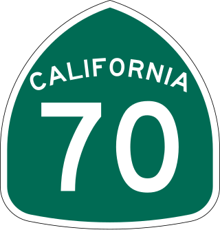
State Route 70 is a state highway in the U.S. state of California, connecting SR 99 north of Sacramento with U.S. Route 395 near Beckwourth Pass via the Feather River Canyon. Through the Feather River Canyon, from SR 149 to US 395, SR 70 is the Feather River Scenic Byway, a Forest Service Byway that parallels the ex-Western Pacific Railroad's Feather River Route.
The Stephens–Townsend–Murphy Party consisted of ten families who migrated from Iowa to California prior to the Mexican–American War and the California Gold Rush. The Stephens Party is significant in California history because they were the first wagon train to cross the Sierra Nevada during the expansion of the American West. In 1844, they pioneered the first route at or near what was later named Donner Pass. The crossing was a year before the third expedition of John C. Fremont, two years before the Donner Party, and five years before the 1848–49 Gold Rush. Three other known European exploration crossings of the Sierra Nevada had previously occurred at points south of this however, including Fremont's second expedition the previous winter, at Carson Pass.
Gold Canyon is located a few miles south of Alleghany, California, on the border between Sierra and Nevada Counties. The middle fork of the Yuba River flows through the canyon. Gold mining began in Gold Canyon in the early 1850s and has continued to present day. Three major gold mines are located here: German Bar Mine, Gold Canõn Mine, and Independent Mine.

The Bridgeport Covered Bridge is located in Bridgeport, Nevada County, California, southwest of French Corral and north of Lake Wildwood. It is used as a pedestrian crossing over the South Yuba River. The bridge was built in 1862 by David John Wood. Its lumber came from Plum Valley in Sierra County, California. The bridge was closed to vehicular traffic in 1972 and pedestrian traffic in 2011 due to deferred maintenance and "structural problems".

Graniteville is a small, unincorporated community and census-designated place (CDP) located in Nevada County, California, United States. The town sits on the San Juan ridge separating the Middle and South Forks of the Yuba River, approximately 26 miles (42 km) northeast of Nevada City. The elevation of Graniteville is 4,977 feet (1,517 m) above sea level.
North Columbia was a California Gold Rush town on the San Juan Ridge in Nevada County, California. Originally known as Columbia, Columbia Hill, or The Hill because of its proximity to Columbia Hill, it started as a gold miners' camp around 1851. When a Post Office was established on May 29, 1860, the word "North" was added in order to differentiate the settlement from Columbia, California, another gold rush town in Tuolumne County, California.

Arthur De Wint Foote (1849–1933) was an American civil engineer and mining engineer who impacted the development of the American West with his innovative engineering works and entrepreneurial ventures. In Northern California in the late 1890s, he designed and built the North Star Mine Powerhouse, the highest capacity impulse-turbine power-plant of the time, and now a California historic landmark; within that plant he designed and installed the then-largest Pelton wheel turbine. Later, he designed and built Foote's Crossing, a high bridge, and Foote's Crossing Road, both now memorialized as California and U.S. landmarks.

The North Bloomfield Mining and Gravel Company of North Bloomfield, California, was established in 1866 and operated a hydraulic gold-mining operation at the Malakoff Mine subsequent to the California Gold Rush. In its day, no other company's operations matched North Bloomfield Mining and Gravel Company in size or expense. The company operated until 1910. In the years prior, its profits and procedures had been reduced due to the landmark ruling of Woodruff v. North Bloomfield Gravel Mining Company.
Woolsey's Flat was a historic mining town located on the San Juan Ridge, located about 17 miles northeast of Nevada City and about 3 miles northeast of North Bloomfield. The town was about 1 mile south of the Middle Yuba at an elevation of about 4200 ft. To the east lay the mining towns of Moore's Flat and Orleans Flat, each about I mile apart. All three were settled in 1851 and their histories frequently intertwine. Collectively, they are sometimes referred to as "The Flats. All three were part of Eureka Township.
Cherokee is a former gold mining community in Nevada County, California. As explained below, it has also been known as Patterson, Melrose and Tyler. It is located on the San Juan Ridge about 4 miles east of North San Juan. Its elevation is 2,516 ft (767 m) above sea level.
Little York is the name of one of the first gold mining towns established in Nevada County, California as well as the name of the township in which it was situated. The town was located on the Lowell Ridge between Steephollow Creek and the Bear River, about 13 miles east of Nevada City, California and about 1 mile southwest of Dutch Flat, California at an elevation of about 2800 feet.
The North Star Mine and Powerhouse are located on Lafayette Hill a short distance south of Grass Valley in the U.S. state of California. It was the second largest producer of gold during California's Gold Rush. In 1898, the largest Pelton wheel for its time was built for the mine. The North Star Mine Company also owned locations on Weimar Hill, adjoining and south of the North Star Mine. It shut down during World War II after its consolidation with the Empire Mine.
Henness Pass, elevation 6,916 ft (2,108 m), is a mountain pass northwest of Reno on the crest of the Sierra Nevada range in Sierra County, California. The pass is traversed by Henness Pass Road, a mostly unpaved road not generally passable by automobiles in winter. Portions of the road are recommended for high clearance vehicles only.


