Fort Stamford Site

Last updated
Fort Stamford Site
StamfordCT FortStamford 2.jpg
View from atop the earthworks
USA Connecticut location map.svg
Red pog.svg
Usa edcp location map.svg
Red pog.svg
Location Westover, Stamford, Connecticut
Coordinates 41°5′6″N73°34′42″W / 41.08500°N 73.57833°W / 41.08500; -73.57833
Area5 acres (2.0 ha)
Built1781
NRHP reference No. 75001920 [1]
Added to NRHPSeptember 10, 1975

The Fort Stamford Site, site of Fort Stamford, is a public park at 900 Westover Road in the Westover neighborhood of Stamford, Connecticut. [2] [3] It was listed on the National Register of Historic Places in 1975. [1] It is the site of the archaeological remnants of a military earthworks erected during the American Revolutionary War. [4] [5] With a clear view of the Mianus River and Long Island Sound, the fort was built as part of a ring of defenses to defend the New England Colonies from attacks by the British garrison in New York City. [6]

Contents

History

American Revolution

During the Revolutionary War, Fort Stamford was built as part of a ring of forts (others at New Castle, New York and White Plains, New York) by George Washington [7] to aid in the defense of Connecticut from loyalist raids. The fort in its current form was designed by the engineer who constructed West Point, Rufus Putnam. General David Waterbury oversaw the construction in 1781. [8] At its peak, the fort was home to 800 soldiers.

Some form of military camp or fortification existed at the site prior to the construction of the current fort. During the February 26, 1779 raid on Greenwich by William Tryon, General Israel Putnam rode to Fort Stamford to rally reinforcements. Tyron crossed the Mianus Bridge on the old Bedford Road (current day Mianus Road/Valley Road), but quickly retreated after seeing the size of the Fort's garrison. [9] Troops from the fort then met Tryon in battle near Palmer's Hill and the Mianus River. [10] A planned flank attack down what is now Westover Road from the Fort never materialized due to misunderstanding of the commanding officer's orders. [9]

On July 2, 1779 during Banastre Tarleton's raid on Pound Ridge, New York, the 2nd Regiment of Light Horse under Colonel Sheldon prevented the fort from being directly attacked. [11]

Later in the war, roughly 300 men manned the fort. When the war ended, the fort was considered no longer necessary, and was promptly sold. [12] In later years, residents of the neighborhood began referring to Fort Stamford as "Fort Nonsense." [13]

As a Private Residence

The area encompassing Fort Stamford was a private residence known as Fortland Farm, owned for some time by the Ogden family. [14]

In 1926, the Stamford Chapter of the Daughters of the American Revolution dedicated a monument at the site. After a reception at Stamford Yacht Club, there a procession of automobiles up Westover Road to the site, where a fife and drum band played as the monument was dedicated. The monument itself was dedicated by Jean Parker Waterbury, a descendant of General David Waterbury who built the fort. [15]

Fort Stamford DAR Dedication.png

In 1928, stockbroker Marcus Goodbody, founder of Goodbody & Co. moved his family to the property. His wife Virginia constructed the Italianate Garden that still stands on the property, now known as the Goodbody Garden. [16]

Fort Stamford Park

The City of Stamford purchased 5-acre property in 1972 from the Goodbody family, and the park features some of their garden structures in the formal Goodbody Garden maintained by the Stamford Garden Club. [17]

In its current state, the Fort's parapets are mostly worn away. The remains of three of the four bastions are still visible. [18]

See also

Related Research Articles

<span class="mw-page-title-main">Fairfield County, Connecticut</span> County in Connecticut, United States

Fairfield County is a county in the southwestern corner of the U.S. state of Connecticut. It is the most populous county in the state and was also its fastest-growing from 2010 to 2020. As of the 2020 census, the county's population was 957,419, representing 26.6% of Connecticut's overall population. The closest to the center of the New York metropolitan area, the county contains four of the state's top 7 largest cities—Bridgeport (1st), Stamford (2nd), Norwalk (6th), and Danbury (7th)—whose combined population of 433,368 is nearly half the county's total population.

<span class="mw-page-title-main">Greenwich, Connecticut</span> Town in Connecticut, United States

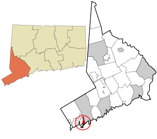
Greenwich is a town in southwestern Fairfield County, Connecticut, United States. At the 2020 census, it had a population of 63,518. Greenwich is a principal community of the Bridgeport–Stamford–Norwalk–Danbury metropolitan statistical area, which comprises all of Fairfield County, and is part of the Western Connecticut Planning Region. The town is the southwesternmost municipality in both the State of Connecticut and the six-state region of New England. The town is named after Greenwich, a royal borough of London in the United Kingdom.

<span class="mw-page-title-main">Bedford (town), New York</span> Town in New York, United States

Bedford is an incorporated town in Westchester County, New York. The population was 17,309 at the 2020 census.

<span class="mw-page-title-main">William Tryon</span> British Army officer and colonial administrator (1729–1788)

Lieutenant-General William Tryon was a British Army officer and colonial administrator who served as governor of North Carolina from 1764 to 1771 and the governor of New York from 1771 to 1777. He also served during the Seven Years' War, the Regulator Movement, and the American War of Independence.

<span class="mw-page-title-main">Cos Cob, Connecticut</span> Census-designated place in Connecticut, United States

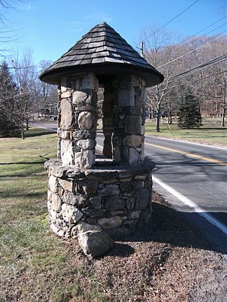
Cos Cob is a neighborhood and census-designated place in the town of Greenwich, Connecticut, United States. It is located on the Connecticut shoreline in southern Fairfield County. It had a population of 6,873 at the 2020 census.

<span class="mw-page-title-main">History of Norwalk, Connecticut</span>

The history of Norwalk, Connecticut ranges from pre-contact cultures and Native Americans to the 21st century.

<span class="mw-page-title-main">History of Greenwich, Connecticut</span>

The history of Greenwich, Connecticut, United States.

<span class="mw-page-title-main">Putnam Cottage</span> United States historic place

Putnam Cottage was also known as Knapp Tavern during the American Revolution. It is located at 243 East Putnam Avenue, on the former route of the Boston Post Road, in Greenwich, Connecticut.

<span class="mw-page-title-main">Riverside, Connecticut</span> Census-designated place in Connecticut, United States

Riverside is a neighborhood/section in the town of Greenwich in Fairfield County, Connecticut, United States. As of the 2020 census, it had a population of 8,843.

<span class="mw-page-title-main">Old Greenwich, Connecticut</span> Census-designated place in Connecticut, United States

Old Greenwich is an affluent coastal village in Fairfield County, Connecticut, United States. As of the 2010 census it had a population of 6,611.

<span class="mw-page-title-main">Fort Nathan Hale</span> United States historic place

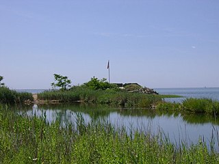
Fort Nathan Hale, also known as Fort Hale Park, Black Rock, is a 20-acre (8.1 ha) city park located on the east shore of New Haven Harbor in New Haven, Connecticut. It includes the site of a 1659 fort, a Revolutionary War-era fort, and a Civil War-era fort. The fort was named after Nathan Hale, Connecticut's official hero. Since 1921, the site has been owned by the state of Connecticut. It has been used as a park and maintained as a historical site by the City of New Haven. Educational programs are given throughout the year to students attending local schools.

The Battle of Ridgefield was a series of American Revolutionary War skirmishes in Danbury, Connecticut and Ridgefield, Connecticut.

<span class="mw-page-title-main">Cos Cob Power Station</span> United States historic place

Cos Cob Power Station was a historic power station near the Metro-North Railroad tracks, the Mianus River and Sound Shore Drive in the Cos Cob area of Greenwich, Connecticut.

Tryon's Raid occurred in July 1779, during the American Revolutionary War, in which 2700 men, led by British Major General William Tryon, raided the Connecticut ports of New Haven, Fairfield, and Norwalk. They destroyed military and public stores, supply houses, and ships as well as private homes, churches, and other public buildings. The raids were ineffectually resisted by militia forces.

<span class="mw-page-title-main">Rippowam River</span> River in Connecticut and New York, US

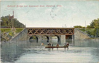
The Rippowam River is a river in Fairfield County, Connecticut and Westchester County, New York. It drains a catchment area of 37.5 square miles (97 km2) and flows for 17 miles (27 km) from Ridgefield to Long Island Sound, which it enters in Stamford's harbor.

<span class="mw-page-title-main">Noroton River</span> River in the United States of America

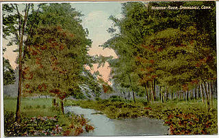
The Noroton River is a 9.4-mile-long (15.1 km) stream which forms most of the border between Stamford and Darien, Connecticut, United States. The river's headwaters are in New Canaan, Connecticut and flow into Holly Pond. It is the largest flowing body of water between the Mill River/Rippowam River to the west and the Fivemile River to the east, although Stony Brook and the Goodwives River in Darien are not much smaller.

<span class="mw-page-title-main">Burning of Fairfield (1779)</span> American Revolutionary War action in CT

The Burning of Fairfield refers to the action of the American Revolutionary War at Fairfield, Connecticut on July 7, 1779 after a British landing force under the command of General William Tryon attacked the town, engaged and dispersed its militia forces, and burned down the vast majority of its buildings. Much of the action took place in areas that are now part of Bridgeport, Southport, and Westport.

<span class="mw-page-title-main">Betts Academy</span> Defunct school in Stamford, Connecticut

Betts Academy was a well-known private academy in Stamford, Connecticut that operated from 1838 to 1908.

<span class="mw-page-title-main">Gold Coast (Connecticut)</span> Affluent part of southwestern Connecticut, US

The Gold Coast, also known as Lower Fairfield County or Southwestern Connecticut not limited to the Connecticut panhandle, is an affluent part of Western Connecticut that includes the entire southern portion of Fairfield County as defined by the U.S. Census Bureau, Super-Public Use Microdata Area (Super-PUMA) Region 09600. The area is about 50 miles (80 km) northeast of New York City, and is home to many wealthy Manhattan business executives. Parts of the region are served by the Western Connecticut Council of Governments.

<span class="mw-page-title-main">Westover, Stamford, Connecticut</span> Neighborhood in Fairfield, Connecticut, United States

Westover is an affluent section of Stamford, Connecticut, United States. With a median household income of $186,607, it is one of the wealthiest neighborhoods in the city, along with Shippan Point and North Stamford. The neighborhood is bordered by Mianus River State Park to the west, the Merritt Parkway to the north, Stillwater Road to the east, and Palmer Hill Road to the south.

References

  1. 1 2 "National Register Information System". National Register of Historic Places . National Park Service. March 13, 2009.
  2. State Commission on Culture & Tourism list
  3. "City of Stamford Park List" (PDF). Archived from the original (PDF) on 2011-07-20. Retrieved 2010-06-25.
  4. Roberts, Robert B. (1988). Encyclopedia of Historic Forts: The Military, Pioneer, and Trading Posts of the United States. New York: Macmillan. pp. 123–124. ISBN   0-02-926880-X.
  5. Fort Stamford at American Forts Network
  6. "Fort Stamford haunted by history, and maybe ghosts". Stamford Advocate. October 30, 2014. Retrieved 5 March 2017.
  7. Sawyer, Joseph Dillaway (April 1927). Washington. New York, NY: The MacMillen Company. p. 628.
  8. "Fort Stamford". Stamford Patch. Retrieved 22 December 2020.
  9. 1 2 Gillespie, Edward T. W. (1892). Picturesque Stamford. Stamford, CT: Gillespie Brothers. p. 77.
  10. Mather, Frederic George (1913). The Refugees of 1776 from Long Island to Connecticut. Berkeley, California: The University of California. pp. 196–197. ISBN   9780806304953.
  11. Gillespie, Edward T.W. (1892). Picturesque Stamford. Stamford, Connecticut: Gillespie Brothers. p. 91.
  12. O'Conner, Kara (August 17, 2011). "Fort Stamford: The city's Revolutionary stronghold". The Stamford Times. Stamford, Connecticut.
  13. Root, Mary Philotheta (1901). Chapter Sketches, Connecticut Daughters of the American Revolution. New Haven, CT: Edward P Judd Co. p. 434.
  14. Summer Social Register. New York, New York: The Social Register Association. 1911. p. 213.
  15. Kramer Haff, Margaret (January 1927). "Work of the Chapters". Daughters of the American Revolution Magazine. National Society Daughters of the American Revolution.
  16. "Fort Stamford's Secret Garden". Stamford Patch. May 5, 2011. Retrieved 5 March 2017.
  17. "Goodbody Family 1928-1970". Stamford Garden Club. Retrieved 22 December 2020.
  18. Gillespie, Edward T. W. (1892). Picturesque Stamford. Stamford, CT: Gillespie Brothers. p. 76.