Franklin Square, New York | |
---|---|
Coordinates: 40°42′6″N73°40′36″W / 40.70167°N 73.67667°W | |
Country | United States |
State | New York |
County | Nassau |
Town | Hempstead |
Area | |
• Total | 2.88 sq mi (7.46 km2) |
• Land | 2.88 sq mi (7.46 km2) |
• Water | 0.00 sq mi (0.00 km2) |
Elevation | 66 ft (20 m) |
Population (2020) | |
• Total | 30,903 |
• Density | 10,730.21/sq mi (4,143.09/km2) |
Time zone | UTC−5 (Eastern (EST)) |
• Summer (DST) | UTC−4 (EDT) |
ZIP Code | 11010 |
Area codes | 516, 363 |
FIPS code | 36-27309 |
GNIS feature ID | 0950629 |
Franklin Square is a hamlet and census-designated place (CDP) in the Town of Hempstead in Nassau County, on Long Island, New York, United States. The population was 30,903 at the time of the 2020 census.
The area was originally known as Trimming Square [2] and then as Washington Square.
What is now Franklin Square was near the center of the Hempstead Plains, and used as grazing land, and later farmland, by the first white settlers. [3] The southern portion included oak and dogwood forests. [3]
In late 1643, Robert Fordham and John Carman made a treaty with members of the Massapequak, Mericoke, Matinecock and Rockaway tribes to buy roughly 100 square miles upon which they intended to start a new settlement. They purchased this tract, including much of what are now the towns of Hempstead and North Hempstead. [3]
In 1790, George Washington passed through the town while touring Long Island. He wrote in his diary that the area was "entirely treeless except for a few scraggly fruit trees." Walt Whitman spent three months in the spring of 1840 as the schoolmaster of the Trimming Square school district, in the area where Franklin Square, Garden City South and West Hempstead intersect. [3]
In 1852, one Louis Schroeher built a hotel near a tollgate (by what is now Arden Boulevard) of the Hempstead-Jamaica Turnpike (toll road). The hotel attracted an increasing number of visitors and immigrants (the latter often German) from New York City to the formerly rural hamlet. [3]
Population grew steadily until the sudden intensified surge of suburbanization into post-World War II Long Island reached the community. By 1952, the farms were all gone, replaced by newly-built houses full of emigrants from nearby New York City. [3]
It is rumored that the original name for the area, Trimming Square, reflected the fact that farms once dominated the area's landscape (as was common for areas all across the Hempstead Plains), and because many sheep were brought to the area by local farmers for separation during the latter parts of the 18th Century. [4] The Trimming Square name was used between the early 19th Century and 1851, when the name was changed to Washington Square after George Washington. [4]
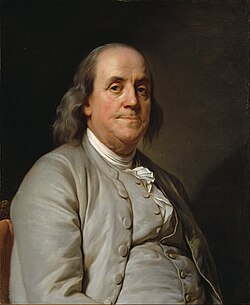
The name of the community was again changed in the 1870s when locals made strides to establish a local U.S. post office. [4] The United States Postal Service would not use the name Washington Square, as they felt that there were too many other places within New York which had Washington in their names. This led to locals again changing the name, and they ultimately chose the name Franklin Square. It is rumored that the name is in honor of Benjamin Franklin. [4]
In February 1929, locals tried incorporating their community as the Incorporated Village of Franklin Square. [4] However, the plans were scrapped that April when the Town of Hempstead denied the petition, due to the fact that too few residents were in favor of incorporation. [4]
According to the United States Census Bureau, the CDP has a total area of 2.9 square miles (7.5 km2), all land. [5]
Franklin Square is bordered on the north by Stewart Manor, northeast by Garden City and Garden City South, southwest by North Valley Stream, east by West Hempstead, and west by Elmont. [6]
Census | Pop. | Note | %± |
---|---|---|---|
2020 | 30,903 | — | |
U.S. Decennial Census [7] |
As of the 2010 United States Census the population was 29,320. The makeup of the population was 75.1% Non-Hispanic White, 3.2% African American, 0.11% Native American, 7.2% Asian, 0.01% Pacific Islander, 1.75% from other races, and 2% from two or more races. Hispanic or Latino of any race were 13.3% of the population. [8]
As of the 2000 United States Census [9] there were 29,342 people, 10,187 households and 7,833 families residing in the CDP. The population density was 10,169.2 inhabitants per square mile (3,926.4/km2). There were 10,364 housing units at an average density of 3,591.9 per square mile (1,386.8/km2). The racial makeup of the CDP was 93.97% White, 0.99% African American, 0.11% Native American, 1.79% Asian, 0.01% Pacific Islander, 1.75% from other races, and 1.38% from two or more races. Hispanic or Latino of any race were 6.89% of the population.
There were 10,187 households, out of which 31.4% had children under the age of 18 living with them, 62.9% were married couples living together, 10.4% had a female householder with no husband present, and 23.1% were non-families. Of all households 19.9% were made up of individuals, and 11.3% had someone living alone who was 65 years of age or older. The average household size was 2.87 and the average family size was 3.30.
In the CDP, the population was spread out, with 22.0% under the age of 18, 7.1% from 18 to 24, 29.6% from 25 to 44, 22.7% from 45 to 64, and 18.6% who were 65 years of age or older. The median age was 39 years. For every 100 females, there were 89.9 males. For every 100 females age 18 and over, there were 86.3 males.
The median income for a household in the CDP was $80,164, and the median income for a family was $87,485 as of a 2007. [10] Males had a median income of $50,805 versus $35,207 for females. The per capita income for the CDP was $24,149. About 3.7% of families and 5.0% of the population were below the poverty line, including 4.8% of those under age 18 and 7.7% of those age 65 or over.
Franklin Square has large Italian-American (40%), Irish-American (16%) and German-American (11%) populations. [11] The growing Jewish population is served by one Conservative and seven Orthodox synagogues. An eruv surrounds most of Franklin Square and adjoining West Hempstead. [12]
Franklin Square was the home of the Franklin National Bank, once the nation's 20th largest bank. Under the leadership of Arthur T. Roth, the Franklin National Bank introduced many banking innovations, such as the bank credit card, the drive up teller window (1950), junior savings accounts (1947), and a no-smoking policy on banking floors (1958). Today, the building is a Chase bank.
On October 8, 1974, the Franklin National Bank was declared insolvent due to mismanagement and fraud, involving losses in foreign currency speculation and poor loan policies. This caused massive losses for its stockholders, resulted in jail and disgrace for its management; Italian financier and CEO Michele Sindona was poisoned in his cell in 1986, [13] while serving a life-sentence for his part in this affair. It was at the time the largest bank failure in the history of the country, and forced US banking policymakers to reexamine and reassess regulation of international banking.
The building was listed on the National Register of Historic Places in 2015. [14]
There is an active Chamber of Commerce [15] and a historical society. The Community League of Garden City South, Inc. Is the first New York State Incorporated Civic of Long Island, established in 1929. As the oldest acting Civic, originally serving all of Nassau County, in 1942, they narrowed their demographics to serve Franklin Square School District #17. The Community League of Garden City South, Inc. Is a direct liaison between the residents/merchants and the State and Local Governments as well as other Organizations. It is their honor to act on behalf of the people to maintain and preserve the quality of life within the district. Franklin Square Civic Association, [16] established in 2016 by a group of residents within the community, serves to maintain and improve the quality of life within the community. The organization sponsors several events to bring the community together. [17] Franklin Square has the Franklin Square Warriors youth football program, [18] Franklin Square Raiders youth soccer program, [19] the Franklin Square Little League, [20] and Franklin Square Seminoles II baseball and softball club. [21]
As part of the Town of Hempstead, Franklin Square is located within the town's 3rd council district, through which it is represented on the Hempstead Town Council by Melissa Miller. [22] Furthermore, as part of New York's 4th congressional district, the hamlet is represented by Anthony D'Esposito. [6]
The Town of Hempstead Department of Parks and Recreation operates and maintains two parks in Franklin Square: Averill Boulevard Park and Rath Park. [6] [23] [24]
The Averill Boulevard Park features a playground, a swimming pool, walking paths & nature trails, and sports facilities. [24]
Rath Park includes a swimming pool, a playground, football & baseball fields, and basketball, handball, & tennis courts. Furthermore, there is a snack commissary and recreational equipment rental facility that operate during the summer, while the pool is operational. [23]
Franklin Square is served by the following: [25]
The Valley Stream Union Free School District 13 covers the four public elementary schools in Franklin Square (Willow Road School is located in Franklin Square under Valley Stream District) and two public high schools (North Valley Stream H.S. is located in Franklin Square under Valley Stream District). The Franklin Square Union Free District 17 covers Washington Street School, John Street Elementary School, H. Frank Carey High School, and Polk Street School. [26] District 16 (Elmont School district), covers the western part, with most students attending Covert Ave School and Sewanhaka High School.
Below are the schools in Franklin Square, and their respective grade levels and districts.
School | Grades | District | Funding |
---|---|---|---|
Polk Street School | K–6 | Franklin Square Union Free School District | Public |
Willow Road School | K–6 | Valley Stream 13 Union Free School District | Public |
John Street School | K–6 | Franklin Square Union Free School District | Public |
Washington Street School | K–6 | Franklin Square Union Free School District | Public |
Valley Stream North High School | 7–12 | Valley Stream Central High School District | Public |
H. Frank Carey Junior-Senior High School | 7–12 | Sewanhaka Central High School District | Public |
The private St. Catherine of Sienna Elementary School was once located within the hamlet. It closed in June 2012. [27]
Franklin Square residents are served by two public libraries: the Elmont Library District (served by the Elmont Public Library) and the Franklin Square Library District (served by the Franklin Square Public Library). [6] [28] [29]
Franklin Square had a print weekly newspaper, the Franklin Square Bulletin, [30] and is covered by another local print and online newspaper, the Three Village Times. [31]
Franklin Square has a volunteer fire department and is served by the Nassau County Police Department's Fifth Precinct. [6] [32] [33]
Sanitation and recycling services are provided by Town of Hempstead District 6. [6]
Nassau County is a suburban county located on Long Island, immediately to the east of New York City, bordering the Long Island Sound on the north and the open Atlantic Ocean to the south. As of the 2020 United States census, Nassau County's population was 1,395,774, making it the sixth-most populous county in the State of New York, and reflecting an increase of 56,242 (+4.2%) from the 1,339,532 residents enumerated at the 2010 census. Its county seat is Mineola, while the county's largest and most populous town is Hempstead.
Albertson is a hamlet and census-designated place (CDP) in the Town of North Hempstead in Nassau County, on Long Island, in New York, United States. The population was 5,220 at the time of the 2020 census.
Bellerose Terrace is a hamlet and census-designated place (CDP) in the Town of Hempstead in Nassau County, on Long Island, in New York, United States. The population was 2,329 at the 2020 census.
Elmont is an unincorporated hamlet and census-designated place (CDP) located in northwestern Hempstead in Nassau County, New York, United States, along its border with the borough of Queens in New York City. The population was 35,265 as of the 2020 census.
Greenvale is a hamlet and census-designated place (CDP) in the towns of North Hempstead and Oyster Bay in Nassau County, on the North Shore of Long Island, in New York, United States. It is considered part of the Greater Roslyn area, which is anchored by the Incorporated Village of Roslyn. The population was 1,069 at the time of the 2020 census.
Harbor Hills is a hamlet and census-designated place (CDP) located on the Great Neck Peninsula within the Town of North Hempstead in Nassau County, on the North Shore of Long Island, in New York, United States. The population was 562 at the time of the 2020 census.
Herricks is a hamlet and census-designated place (CDP) in Nassau County, on Long Island, in New York, United States. The population was 4,398 at the 2020 census.
Hewlett is a hamlet and census-designated place (CDP) in the Town of Hempstead in Nassau County, on Long Island, in New York, United States. The population was 6,819 at the 2010 census.
Inwood is a hamlet and census-designated place (CDP) in Nassau County, on Long Island, in New York, United States. The population was 11,340 at the time of the 2020 census. It is considered part of Long Island's Five Towns area and is located within the Town of Hempstead.
Manhasset is a hamlet and census-designated place (CDP) in Nassau County, on the North Shore of Long Island, in New York, United States. It is considered the anchor community of the Greater Manhasset area. The population was 8,176 at the 2020 census.
Manhasset Hills is a hamlet and census-designated place (CDP) in the Town of North Hempstead in Nassau County, on Long Island, in New York, United States. The population was 3,649 at the time of the 2020 census. Neighboring communities include Herricks, North Hills, North New Hyde Park, and Lake Success.
New Hyde Park is a village in the Towns of Hempstead and North Hempstead in Nassau County, on Long Island, in New York, United States. It is the anchor community of the Greater New Hyde Park area. The population was 10,257 at the time of the 2020 census.
North Valley Stream is a hamlet and census-designated place (CDP) in the Town of Hempstead in Nassau County, on Long Island, in New York, United States. The population was 18,197 at the time of the 2020 census.
Saddle Rock Estates is a hamlet and census-designated place (CDP) located on the Great Neck Peninsula within the Town of North Hempstead in Nassau County, on the North Shore of Long Island, in New York, United States. The population was 428 at the time of the 2020 census.
Searingtown is a hamlet and census-designated place (CDP) in the Town of North Hempstead in Nassau County, on Long Island, in New York, United States. It is considered part of the Greater Roslyn area, which is anchored by the Village of Roslyn. The population was 4,915 at the 2010 census.
South Valley Stream is an unincorporated hamlet and census-designated place (CDP) in the Town of Hempstead in Nassau County, on Long Island, in New York, United States. The population was 6,386 at the time of the 2020 census.
Stewart Manor is a village in the Town of Hempstead in Nassau County, on Long Island, in New York, United States. The population was 1,992 at the time of the 2020 census.
University Gardens is a hamlet and a census-designated place (CDP) in Nassau County, on the North Shore of Long Island, in New York, United States. It is located within the Town of North Hempstead and is part of the Greater Great Neck area. The population was 4,358 at the time of the 2020 census.
West Hempstead is a hamlet and census-designated place (CDP) in the Town of Hempstead in Nassau County, on Long Island, in New York, United States. The population was 19,835 at the time of the 2020 census. It is an unincorporated area in the Town of Hempstead and is represented by Councilman Edward Ambrosino.
The Town of Hempstead is the largest of the three towns in Nassau County on Long Island, in New York, United States. The town's combined population was 793,409 at the 2020 census, which is the majority of Nassau County's population. It's the largest populated town in the United States.