
Capitol Reef National Park is an American national park in south-central Utah. The park is approximately 60 miles (97 km) long on its north–south axis and just 6 miles (9.7 km) wide on average. The park was established in 1971 to preserve 241,904 acres of desert landscape and is open all year, with May through September being the highest visitation months.
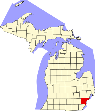
This is a list of the National Register of Historic Places listings in Wayne County, Michigan.
Fruita is the best-known settlement in Capitol Reef National Park in Wayne County, Utah, United States. It is located at the confluence of Fremont River and Sulphur Creek. Despite its status as ghost town, it is the location of the National Park Service's employee residences.

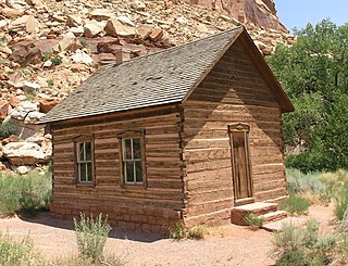
The Fruita Schoolhouse is a historic school building located in Fruita, Utah, United States.

The Swiftcurrent Ranger Station is an example of the Swiss Chalet style that prevailed in the early years of Glacier National Park, before the establishment of the similar National Park Service Rustic style. The station was designed by Edward A. Nickel and built by Ole Norden and S. M. Askevold. It replaced a previous ranger station, destroyed in a 1936 forest fire. All structures in the district were built within a single year and are consistent in design and materials.

The Belly River Ranger Station Historic District in Glacier National Park includes several historic structures, including the original ranger station, now used as a barn. The rustic log structures were built beginning in 1912. Other buildings include a woodshed, built in 1927 to standard National Park Service plans and a cabin used as a fire cache.

The Saddlehorn Comfort Station is one of a group of related structures listed on the National Register of Historic Places in Colorado National Monument. The comfort station and the nearby caretaker's house, garage and the Saddlehorn Utility Area Historic District feature a consistent interpretation of the National Park Service Rustic style, featuring coursed ashlar sandstone masonry and log-supported roof structure. The comfort station was designed in 1936 by W.G. Carney of the National Park Service Branch of Plans and Designs, and built by labor from the Works Progress Administration and the Civilian Conservation Corps. Plans specified not only the general layout of the house and garage, but the specific dimensions of each stone and its location, using a technique of "built by detail".
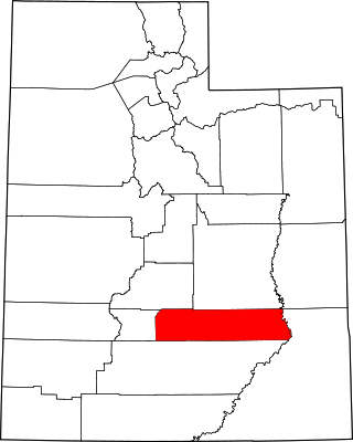
This is a list of the National Register of Historic Places listings in Wayne County, Utah.

The historical buildings and structures of Zion National Park represent a variety of buildings, interpretive structures, signs and infrastructure associated with the National Park Service's operations in Zion National Park, Utah. Structures vary in size and scale from the Zion Lodge to road culverts and curbs, nearly all of which were designed using native materials and regional construction techniques in an adapted version of the National Park Service Rustic style. A number of the larger structures were designed by Gilbert Stanley Underwood, while many of the smaller structures were designed or coordinated with the National Park Service Branch of Plans and Designs. The bulk of the historic structures date to the 1920s and 1930s. Most of the structures of the 1930s were built using Civilian Conservation Corps labor.
Grover is an unincorporated community in southwestern Wayne County, Utah, United States. Originally known as Carcass Creek, Grover is a small ranching community off the county's main recreational corridor.

State Route 24 (SR-24) is a state highway in south central Utah which runs south from Salina through Sevier County then east through Wayne County and north east through Emery County. At a total of 163.294 miles, it is the longest contiguous state route in Utah. A portion of the highway has been designated the Capitol Reef Scenic Byway as part of the Utah Scenic Byways program.
This is a list of the National Register of Historic Places listings in Capitol Reef National Park.

The Elijah Cutler Behunin Cabin was built to house Elijah Cutler Behunin's family in 1883–84 in what is now Capitol Reef National Park in Wayne County, Utah, United States.

The Civilian Conservation Corps Powder Magazine in Capitol Reef National Park, Utah, was used in the 1930s to store explosives for use by Civilian Conservation Corps laborers in the construction of improvements to the park. Much of the CCC's work in the park involved the quarrying of sandstone blocks and slabs, which required explosives. The magazine was built about 1938 in association with CCC Camp NM-2, later called NP-6, located to the west of Fruita at Chimney Rock. The Fruita ranger station and the powder magazine are the only structures remaining from the CCC tenure in the park.
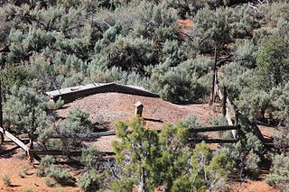
The Hanks' Dugouts are a series of pioneer dwellings in southern Utah, in what is now Capitol Reef National Park. The dugouts were constructed as temporary housing for the Ephraim K. Hanks family, Mormon pioneers who established the now-vanished Floral Ranch on Pleasant Creek in April 1883. The remains of three dugouts and one other structure remain at the site. All above-ground construction has collapsed. The dugouts were abandoned in 1888 when the Hankses built a four-room frame house, although the homestead claim of Hanks' widow claims that a one-room log house was built at the time of settlement. The site includes debris such as ceramic and glass, and pieces of a wagon. The settlement reflects a typical early Mormon homestead of the time.
The Stockmore Ranger Station, is a ranger station in Ashley National Forest in Duchesne County, Utah, United States, near Tabiona, that is listed on the National Register of Historic Places (NRHP).
The Indian Canyon Ranger Station in the Duchesne Ranger District, Ashley National Forest in Duchesne County, Utah near Duchesne was built in 1914. It was a work of the U.S. Forest Service and is a wood-framed guard station. It was listed on the National Register of Historic Places (NRHP) in 1999; the listing included two contributing buildings and two contributing structures.

The Tony Grove Ranger Station Historic District, in Cache County, Utah near Logan, Utah, was listed as a historic district on the National Register of Historic Places in 1992. The listing included three contributing buildings and a contributing site on 13.7 acres (5.5 ha).
The Raritan–Readington South Branch Historic District is a 556-acre (225 ha) historic district along River Road from New Jersey Route 31 to U.S. Route 202 near Flemington in Hunterdon County, New Jersey. It is primarily on the western side of the South Branch Raritan River in Raritan Township. It extends onto the eastern side of the river in Readington Township. County Route 523 and County Route 612 pass through the district to the north. The district encompasses the small settlements of Holcomb Mills, Flemington Junction, and Rockefellows Mills. It was added to the National Register of Historic Places on January 26, 1990, for its significance in architecture, politics, transportation, and exploration/settlement. The district includes 36 contributing buildings, four contributing structures, and three contributing sites. It also includes the John Reading Farmstead, previously listed on the NRHP individually.


