
Minganie is a regional county municipality on the north shore of the Gulf of St. Lawrence, in Côte-Nord region, Quebec, Canada, its territory includes Anticosti Island.
Bonaventure Island is a Canadian island in the Gulf of St. Lawrence located 3.5 km (2.2 mi) off the southern coast of Quebec's Gaspé Peninsula, 5 km (3.1 mi) southeast of the village of Percé. Roughly circular in shape, it has an area measuring 4.16 km2 (1.61 sq mi).

North Kent Island is one of the uninhabited Queen Elizabeth Islands in the Canadian arctic islands in the Qikiqtaaluk Region of Nunavut, Canada. It is located in the Cardigan Strait between Devon Island's Colin Archer Peninsula and Ellesmere Island's Simmons Peninsula.

Waswanipi is a Cree community in the Eeyou Istchee territory of central Quebec, Canada, located along Route 113 and near the confluence of the Chibougamau and Waswanipi Rivers. It has a population of 459 people. Waswanipi is a compound word composed of wâswân and -pî (lake), meaning "torch-fishing lake" but colloquially translated as "light over the water" referring to the traditional night-time fishing method of luring fish to light by using torches.
Greenly Island is an island in Blanc-Sablon, Quebec, Canada, near the border of Newfoundland and Labrador, in the Gulf of Saint Lawrence at the southwestern end of Strait of Belle Isle. The rocky surface of Greenly Island has a thin cover of herbaceous vegetation. A fishing settlement and lighthouse are on the island.

Coburg Island is an uninhabited island in Qikiqtaaluk, Nunavut, Canada. It is one of the members of Queen Elizabeth Islands located in Baffin Bay's Lady Ann Strait. It is separated from Ellesmere Island by Glacier Strait; Devon Island is to the south.

Gull Glacier is a glacier in the Osborn Range of north-central Ellesmere Island, Nunavut, Canada. It lies in the Tanquary Fiord in Quttinirpaaq National Park.
The Twin Islands are similarly shaped Arctic islands in the Qikiqtaaluk Region of Nunavut, Canada. They are located in central James Bay, 56 km (35 mi) north east of Akimiski Island, and 58 km (36 mi) west of Quebec. The group includes North Twin and South Twin islands.
The Finlayson Islands are a string of Canadian arctic islands in Nunavut, Canada. The group lies in Dease Strait, approximately 12 mi (19 km) from Cape Alexander, south of Victoria Island and north of the mainland's Kent Peninsula. The community of Cambridge Bay is approximately 23 mi (37 km) to the east.
Philpots Island is a member of the Queen Elizabeth Islands and the Arctic Archipelago in the territory of Nunavut. It is the largest of Devon Island's offshore islands, located at Devon's eastern end. It lies in Baffin Bay, with Hyde Inlet to the north, and the Parry Channel to the south.
Digges Sound is a Canadian Arctic waterway in Qikiqtaaluk, Nunavut, Canada. The sound is located at the juncture where the Hudson Strait meets northeastern Hudson Bay close to the northern tip of the Ungava Peninsula, between Digges Islands and Cape Wolstenholme. Ivujivik, Quebec, the northernmost settlement in any Canadian province, is located on the south coast of the sound.
Grey Goose Island is one of several, larger, uninhabited Canadian arctic islands in Nunavut, Canada located within the midsection of James Bay. Other comparable islands in the area include the Bear Islands, North and South Twin Islands, Spencer Island, Sunday Island, and Walter Island. La Grande River and the Cree village of Chisasibi, Quebec are 65 km (40 mi) to the southeast.
The uninhabited Cheyne Islands are members of the Queen Elizabeth Islands and the Arctic Archipelago in the Qikiqtaaluk Region of Nunavut, Canada. The group is made up of three islands known as North Island, Middle Island, and South Island. Located approximately 5 km (3.1 mi) off eastern Bathurst Island, they are situated near Reindeer Bay within western Penny Strait.
The Salikuit Islands are an uninhabited island group in the Qikiqtaaluk Region of Nunavut, Canada. The 103 island archipelago is located in eastern Hudson Bay between the Belcher Islands and the western coast of Quebec. The closest communities are the Inuit hamlets of Umiujaq, Quebec, 60 km to the east on the coast of Hudson Bay, and Sanikiluaq, 75 km (47 mi) to the west on Flaherty Island.
Pilattuaq formerly Scott Island is an uninhabited island in the Qikiqtaaluk Region of Nunavut, Canada. It is located in Baffin Bay, off the eastern coast of Baffin Island, in the middle of Scott Inlet, north of the confluence of Clark Fiord and Gibbs Fiord which embrace Qikiqtaaluk.
Seymour Island is an uninhabited island in the Qikiqtaaluk Region of northern Canada's territory of Nunavut. A member of the Berkeley Islands group, it is located approximately 30 mi (48 km) north of northern Bathurst Island. Between Seymour Island and Bathurst Island lies Helena Island. Penny Strait lies about 90 km (56 mi) to the east where open water polynyas occur.

The Grand Council of the Crees or the GCC(EI), is the political body that represents the approximately 18,000 Cree people of the territory called Eeyou Istchee in the James Bay and Nunavik regions of Northern Quebec, in The Grand Council has twenty members: a Grand Chief and Deputy-Grand Chief elected at large by the Cree people, the Chiefs elected by each of the ten communities, and one other representative from each community.

Solander Island Ecological Reserve is a 7.7 ha protected area on an island 1.5 km (0.9 mi) west of Brooks Peninsula Provincial Park off the northwest coast of Vancouver Island in British Columbia, Canada. It was established in 1971. The reserve is closed to the public to protect the habitat of nesting seabirds.

The Lac au Goéland is a freshwater body of water crossed by the Waswanipi River and is located within Eeyou Istchee James Bay (municipality), within the administrative region of Nord-du-Québec, in the province of Quebec, in Canada.

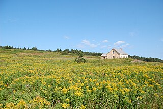
The Sept Îles Archipelago Regional Park is a proposed protected area in the Côte-Nord region of Quebec, Canada. The islands are important to migratory sea birds, and are also of interest to tourists. The management plan was prepared in 2008.

