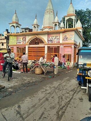
Piploda is a town and a Nagar Parishad in Ratlam district in the Indian state of Madhya Pradesh.
Bajna is a town and a nagar panchayat in Mathura district in the state of Uttar Pradesh, India.
Chourai is a town and a nagar panchayat in Chhindwara district in the state of Madhya Pradesh, India.
Dhilwan is a town and a nagar panchayat in Kapurthala district in the state of Punjab, India.

Dineshpur is a town and a nagar panchayat in Udham Singh Nagar district in the state of Uttarakhand, India.
Iltifatganj Bazar is a town and a nagar panchayat in Ambedaker Nagar district in the Indian state of Uttar Pradesh. Situated at the bank of Ghaghra River. It is near 4 km to Tanda NTPC township.
Khutar is a town and a nagar panchayat in Shahjahanpur district in the Indian state of Uttar Pradesh.
Kiraoli is a town and a nagar panchayat in Agra district in the Indian state of Uttar Pradesh.
Lahar is a city and a Nagar Palika in Bhind district in the Indian state of Madhya Pradesh.
Loharda is a town and a nagar panchayat in Dewas district in the Indian state of Madhya Pradesh.
Mhowgaon is a Nagar Panchayat under Sub Division Dr. Ambedkar Nagar (Mhow) in Indore district in the Indian state of Madhya Pradesh. The total geographical area of Mhowgaon nagar panchayat is 13.5 km2 and it is the smallest city by area in the sub district. The population density of the city is 2309 persons per km2. Mhowgaon is divided into 15 wards for which elections are held every 5 years. Among them, Mhowgaon Ward No. 2 is the most populous ward with a population of 3440 and Mhowgaon Ward No. 15 is the least populous ward with a population of 957. Mhowgaon Nagar Panchayat has total administration over 6,373 houses to which it supplies basic amenities like water and sewerage. It is also authorized to build roads within Nagar Panchayat limits and impose taxes on properties coming under its jurisdiction.
Saraswati Nagar is a Town in Yamunanagar District in the Indian state of Haryana.
Narasimhanaickenpalayam is a part of Coimbatore city. It is about 14 km from Coimbatore city junction in the northern direction. Narasimhanaickenpalayam is on the stretch of National Highway NH 67 Extn (NH-181) Mettupalayam Road, one of the arterial roads of Coimbatore city. Neighbouring places are Thudiyalur, NGGO Colony, and Periyanaickenpalayam
Pinahat is a town and a nagar panchayat in Agra district in the Indian state of Uttar Pradesh and situated on the Bank of Chambal River. It is about 55 km from Agra. The distance between Pinahat and Chambal is only 2 km.
Piplia Mandi is a town and a Nagar Parishad in Mandsaur district in the Indian state of Madhya Pradesh. It is15 km away from the city of Mandsaur on state highway 31.

Vijayraghavgarh is a town, tehsil headquarters, and a nagar panchayat located in Katni district in the Indian state of Madhya Pradesh. It belongs to Jabalpur division and is 34 km (21 mi) east of district headquarters Katni.

Shahpur is a town and a notified area in Bhojpur district in the Indian state of Bihar.
Banga is a town and Municipal council in the Shaheed Bhagat Singh Nagar district of Punjab, India. Banga is also one of the sub-division (tehsil) headquarters of the district. Banga is located on Phagwara-Rupnagar section of National Highway 344A. It is currently estimated to have a population of about 23,000 and is classified as a class 2 Municipality. The town also incorporates the former village of Jindowal apart from Banga town.
Kothi is a town and a nagar panchayat in Satna district in the Indian state of Madhya Pradesh.


