Hinsdale, New York

Last updated
Hinsdal, New York
CR 26 in Hinsdale.jpg
The hamlet of Hinsdale along County Route 26.
USA New York location map.svg
Red pog.svg
Hinsdale
Location within the state of New York
Coordinates: 42°10′1″N78°23′16″W / 42.16694°N 78.38778°W / 42.16694; -78.38778 Coordinates: 42°10′1″N78°23′16″W / 42.16694°N 78.38778°W / 42.16694; -78.38778
Country United States
State New York
County Cattaraugus
Government
  Type Town Council
   Town Supervisor Monroe B. Bishop (R)
   Town Council
Members' List
Area
[1]
  Total38.77 sq mi (100.42 km2)
  Land38.73 sq mi (100.31 km2)
  Water0.04 sq mi (0.11 km2)
Elevation
1,499 ft (457 m)
Population
 (2020) [2]
  Total2,119
  Estimate 
(2021) [2]
2,110
  Density53.94/sq mi (20.82/km2)
Time zone UTC-5 (Eastern (EST))
  Summer (DST) UTC-4 (EDT)
ZIP code
14743
Area code(s) 716
FIPS code 36-009-34946
GNIS feature ID0979069
Website hinsdaleny.org

Hinsdale is a town in Cattaraugus County, New York, United States. The population was 2,119 at the 2020 census [2] . The town was named after Hinsdale in New Hampshire.

Contents

Hinsdale is at the eastern border of Cattaraugus County, north-northeast of Olean.

History

Hinsdale was formed in 1820 from the town of Olean. It was named for Hinsdale, New Hampshire. [3] The town of Ischua was created in 1846, from part of Hinsdale.

Geography

According to the United States Census Bureau, the town has a total area of 38.8 square miles (100.4 km2), of which 38.7 square miles (100.3 km2) is land and 0.04 square miles (0.1 km2), or 0.11%, is water. [4]

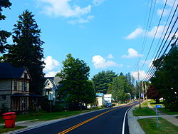
The Southern Tier Expressway (Interstate 86 and New York State Route 17) passes across the town. New York State Route 16 is a major trunk road in the town and partially follows the same path as the Expressway. New York State Route 446 crosses the northeast part of the town and has its western terminus in the community of Maplehurst.

The eastern town line is the border of Allegany County.

Adjacent towns and areas

Hinsdale is south of the town of Ischua and north of the towns of Olean and Portville. The west border is formed by the towns of Humphrey and Allegany. The east border is formed by the towns of Cuba and Clarksville in Allegany County.

Demographics

Historical population
CensusPop.
1830 919
1840 1,937110.8%
1850 1,302−32.8%
1860 1,70831.2%
1870 1,491−12.7%
1880 1,5946.9%
1890 1,312−17.7%
1900 1,218−7.2%
1910 1,125−7.6%
1920 972−13.6%
1930 969−0.3%
1940 1,07911.4%
1950 1,24014.9%
1960 1,53824.0%
1970 1,78115.8%
1980 2,18222.5%
1990 2,095−4.0%
2000 2,2708.4%
2010 2,168−4.5%
2020 2,119−2.3%
2021 (est.)2,110 [2] −0.4%
U.S. Decennial Census [5]

As of the census [6] of 2000, there were 2,270 people, 861 households, and 625 families residing in the town. The population density was 58.6 people per square mile (22.6/km2). There were 1,134 housing units at an average density of 29.3 per square mile (11.3/km2). The racial makeup of the town was 97.05% White, 0.57% African American, 0.44% Native American, 0.22% Asian, 0.18% from other races, and 1.54% from two or more races. Hispanic or Latino of any race were 0.79% of the population.

There were 861 households, out of which 34.0% had children under the age of 18 living with them, 58.3% were married couples living together, 9.4% had a female householder with no husband present, and 27.3% were non-families. 20.6% of all households were made up of individuals, and 8.2% had someone living alone who was 65 years of age or older. The average household size was 2.59 and the average family size was 3.00.

In the town, the population was spread out, with 26.7% under the age of 18, 6.9% from 18 to 24, 27.5% from 25 to 44, 25.9% from 45 to 64, and 13.1% who were 65 years of age or older. The median age was 39 years. For every 100 females, there were 96.5 males. For every 100 females age 18 and over, there were 96.6 males.

The median income for a household in the town was $33,110, and the median income for a family was $36,949. Males had a median income of $27,008 versus $20,645 for females. The per capita income for the town was $14,985. About 9.6% of families and 14.9% of the population were below the poverty line, including 18.7% of those under age 18 and 10.8% of those age 65 or over.

Communities and locations in Hinsdale

Related Research Articles

Cattaraugus County, New York County in New York, United States

Cattaraugus County is a county in western New York, with one side bordering Pennsylvania. As of the United States 2020 census, the population was 77,042. The county seat is Little Valley. The county was created in 1808 and later organized in 1817.

Clarksville, Allegany County, New York Town in New York, United States

Clarksville is a town located in Allegany County, New York, United States. As of the 2010 census, the town had a total population of 1,161. The town is named after S.N. Clark, an agent of the Holland Land Company.

Genesee is a town in Allegany County, New York, United States. The population was 1,693 at the 2010 census. Genesee is in the southwestern corner of the county, southeast of Olean.

New Hudson is a town in Allegany County, New York, United States. The population was 781 at the 2010 census. The town is on the west border of the county, northeast of Olean.

Rushford, New York Town in New York, United States

Rushford is a town in Allegany County, New York, United States. The population was 1,150 at the 2010 census. Rushford is in the northwest part of Allegany County and is northeast of Olean.

Carrollton, New York Town in New York, United States

Carrollton is a town in Cattaraugus County, New York, United States. The population was 1,214 at the 2020 census. The town was named after Guy Carrollton Irvine, an early settler of the region.

Farmersville is a town located in the eastern border of Cattaraugus County, New York, United States. The population was 1,081 at the 2020 census.

Freedom is a town in Cattaraugus County, New York, United States. The population was 2,267 at the 2020 census. The town is in the northeast corner of Cattaraugus County.

Humphrey is a town in Cattaraugus County, New York, United States. The population was 701 at the 2020 census. The town is named after Charles Humphrey, who at the time of the town's founding was Speaker of the New York State Assembly.

Ischua, New York Town in New York, United States

IschuaISH-way is a town in Cattaraugus County, New York, United States. The population was 734 at the 2020 census. Ischua is also the name of a hamlet in the town. The town is on the eastern border of the county, north of Olean.

Limestone is a hamlet in Cattaraugus County, New York, United States. The population was 389 at the 2010 census.

Lyndon is a town in Cattaraugus County, New York, United States. The population was 686 at the 2020 census. The town is on the east border of the county and is north of Olean.

St. Bonaventure is a hamlet and census-designated place (CDP) in the town of Allegany in Cattaraugus County, New York, United States. The population was 1,963 at the 2020 census.

Bolivar, New York Town in New York, United States

Bolivar is a town in Allegany County, New York, United States. The population was 2,189 at the 2010 census. The town is named after Simón Bolívar.

Cuba, New York Town in New York, United States

Cuba is a town on the western border of Allegany County, New York, United States. The village of Cuba lies within its borders. The federally recognized tribe of Seneca Native Americans has a reservation on the western town line. As of the 2010 Census, the total population was 3,243.

Allegany is a village in Cattaraugus County, New York, United States. The population was 1,596 at the 2020 census. The village is in the eastern part of the town of Allegany, west of the city of Olean.

Allegany is a town in Cattaraugus County, New York, United States. The population was 7,493 at the 2020 census.

Olean is a town in Cattaraugus County, New York, United States. The population was 1,890 at the 2020 census. The name is derived from the Latin word "oleum" due to the discovery of crude oil in nearby Ischua.

Perrysburg is a town in Cattaraugus County, New York, United States. The population was 1,515 at the 2020 census. The town is named after Commodore Oliver Hazard Perry and is located in the northwest corner of the county. The town contains the census-designated place also named Perrysburg, formerly an incorporated village.

Portville, New York Town in New York, United States

Portville is a town in Cattaraugus County, New York, United States. The population was 3,504 at the 2020 census. The name is derived from the town's early role in shipping lumber and other items down the Allegheny River. It was formed in 1837 from the town of Olean.

References

  1. "2016 U.S. Gazetteer Files". United States Census Bureau. Retrieved Jul 4, 2017.
  2. 1 2 3 4 Bureau, US Census. "City and Town Population Totals: 2020-2021". Census.gov. US Census Bureau. Retrieved 5 July 2022.
  3. "Profile for Hinsdale, New York". ePodunk . Retrieved 2010-05-23.
  4. "Geographic Identifiers: 2010 Demographic Profile Data (G001): Hinsdale town, Cattaraugus County, New York". U.S. Census Bureau, American Factfinder. Archived from the original on February 12, 2020. Retrieved October 24, 2014.
  5. "Census of Population and Housing". Census.gov. Retrieved June 4, 2015.
  6. "U.S. Census website". United States Census Bureau . Retrieved 2008-01-31.